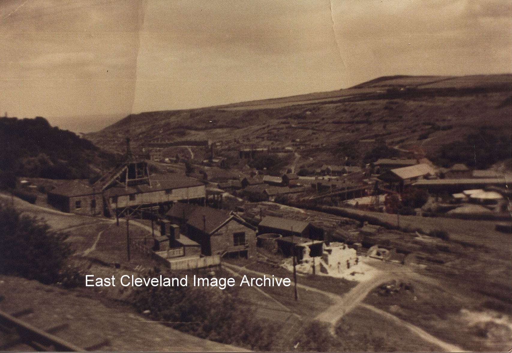
Taken from the railway lines above, the picture clearly shows Duckhole in the foreground with Skinningrove or Loftus pit farther down in the valley.
Image courtesy of Carlin How Community Centre and the Pem Holliday collection.
|
|
||
|
Taken from the railway lines above, the picture clearly shows Duckhole in the foreground with Skinningrove or Loftus pit farther down in the valley. Image courtesy of Carlin How Community Centre and the Pem Holliday collection. 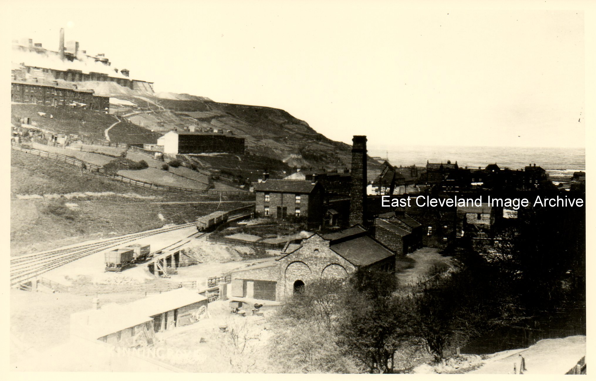 It’s a pretty poor title and time hasn’t been kind to the image either! Some nice architecture on display here, would that be the gas works in the foreground? Derick Pearson confirmed this fact, also advising: “If you look at the left side of the photograph you can just make out the tunnel that went under the railway. We used to walk under this on our way home from school. When it was wet weather it was often flooded. Traffic used to have to go through it in single file.” Image courtesy of the Pem Holliday Collection and others, thanks to Derick Pearson for that update. 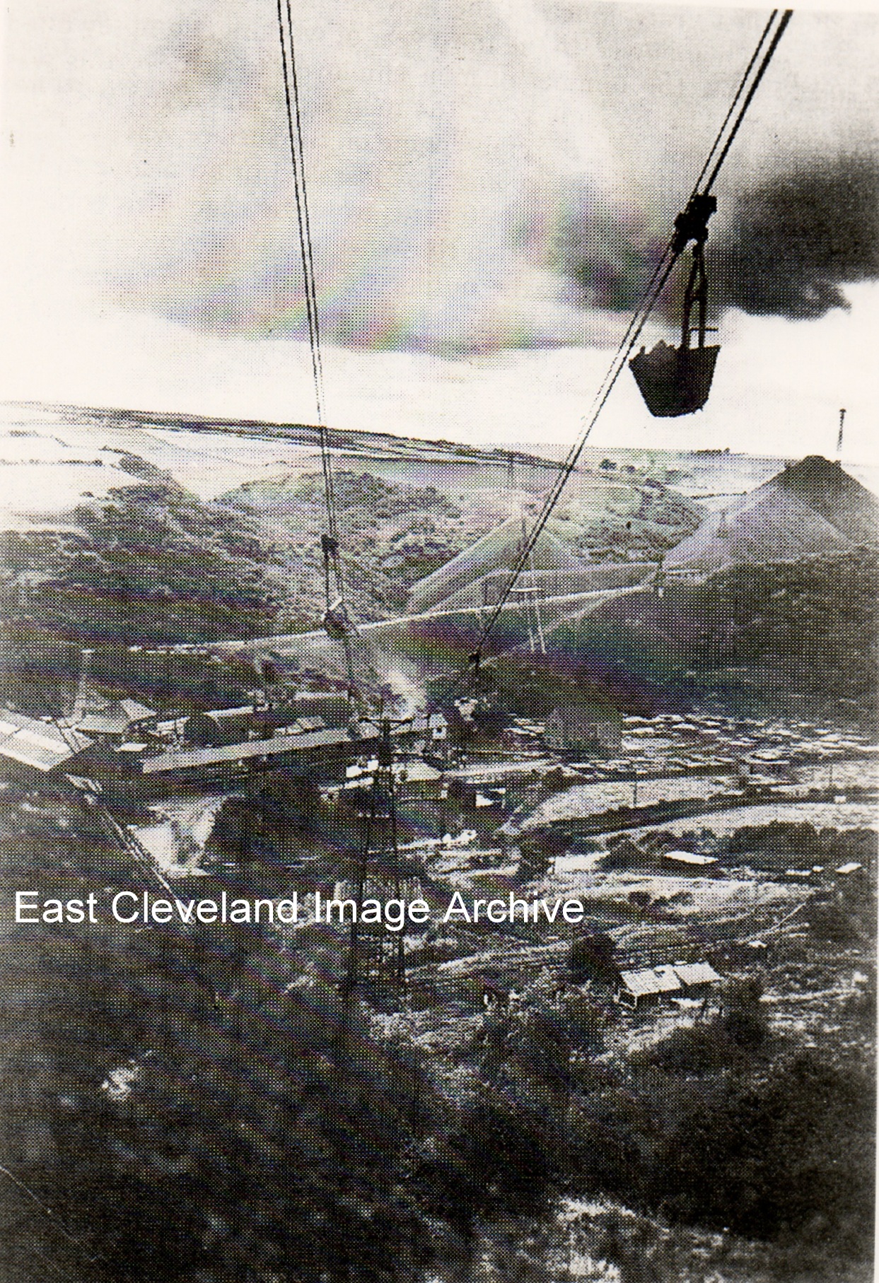 A working photograph of the aerial ropeway, locally known as ’the buckets’. We can see a full bucket of ironstone being taken up to the iron and steel works, with the mine in the distance at the bottom of the picture. Simon Chapman advised: “Loftus mines ironstone was transported up to Skinningrove Works from 1895 by connection into the abandoned workings of the North Loftus mine to avoid paying haulage charges to the N.E.R. By 1932 the North Loftus shaft steam winding equipment was thoroughly antiquated so the aerial ropeway was built to avoid using the shaft which was later filled in.” Image courtesy of the Pem Holliday Collection and others; thanks to Simon Chapman for information in the last paragraph. 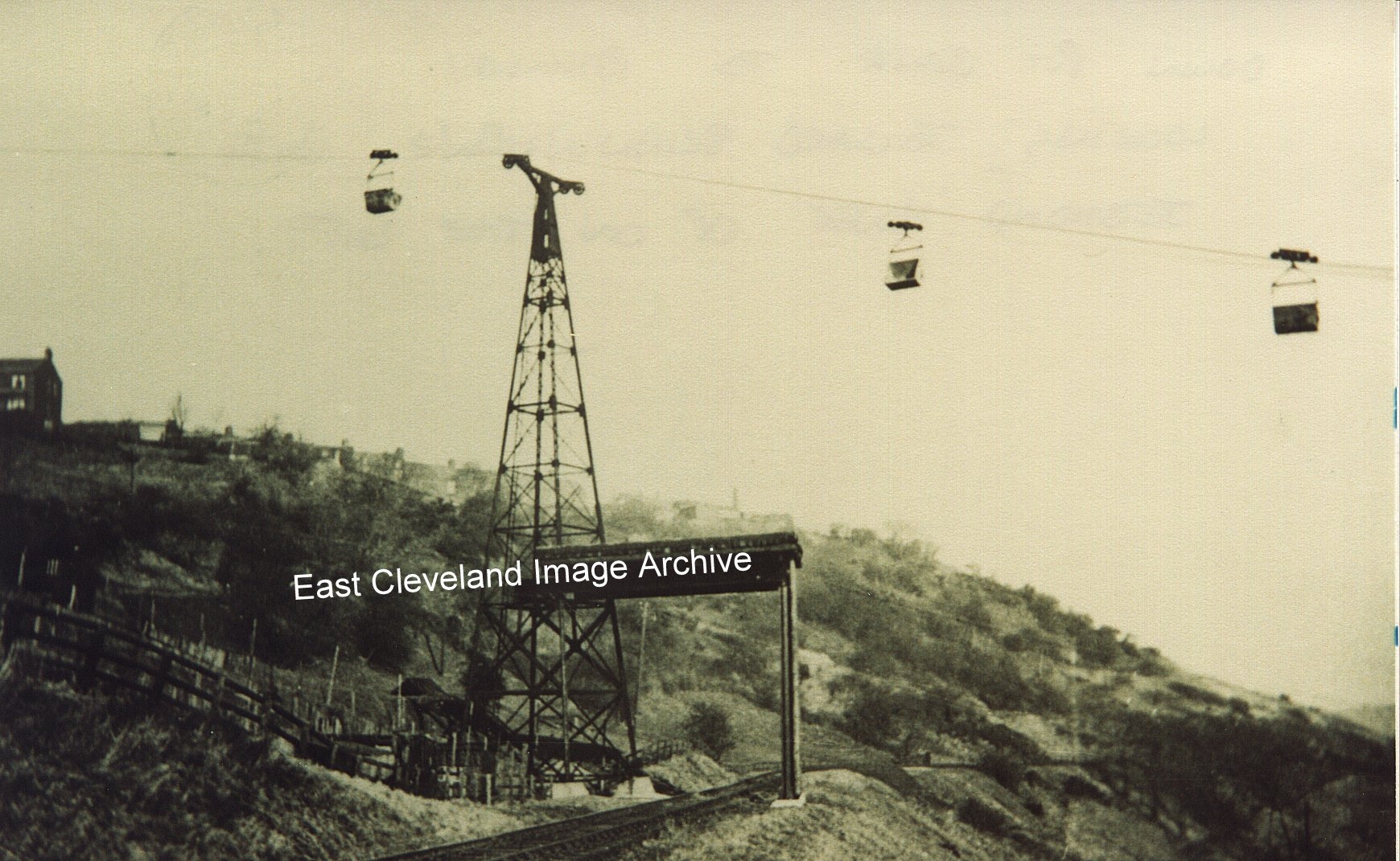 Loftus mines ironstone was transported originally transported from the Loftus (Skinningrove) mine up to Skinningrove Works via the zig-zag railway system along the valley side. From 1895 this transportation occurred via a connection into the abandoned workings of the North Loftus mine to avoid paying haulage charges to the N.E.R. By 1932 the North Loftus shaft steam winding equipment was thoroughly antiquated so the aerial ropeway was built to avoid using the shaft which was later filled in. An aerial ropeway (known locally as ”the buckets”) was constructed to take the stone from the valley floor up to Skinningrove Ironworks on the cliff top. This is the middle stanchion, the roofed structure over the zig-zag railway was to catch any falling stone jerked out of the buckets as a result of passing over the stanchion pulleys. This system was in use until local stone was superseded by cheaper foreign ores. (The topmost stanchion was still in place at the top gates of Skinningrove Iron and Steel Works when I worked there, adapted as a floodlight tower!). Image courtesy of the Pem Holliday Collection and others, thanks to Simon Chapman for the details of these changes in transportation. 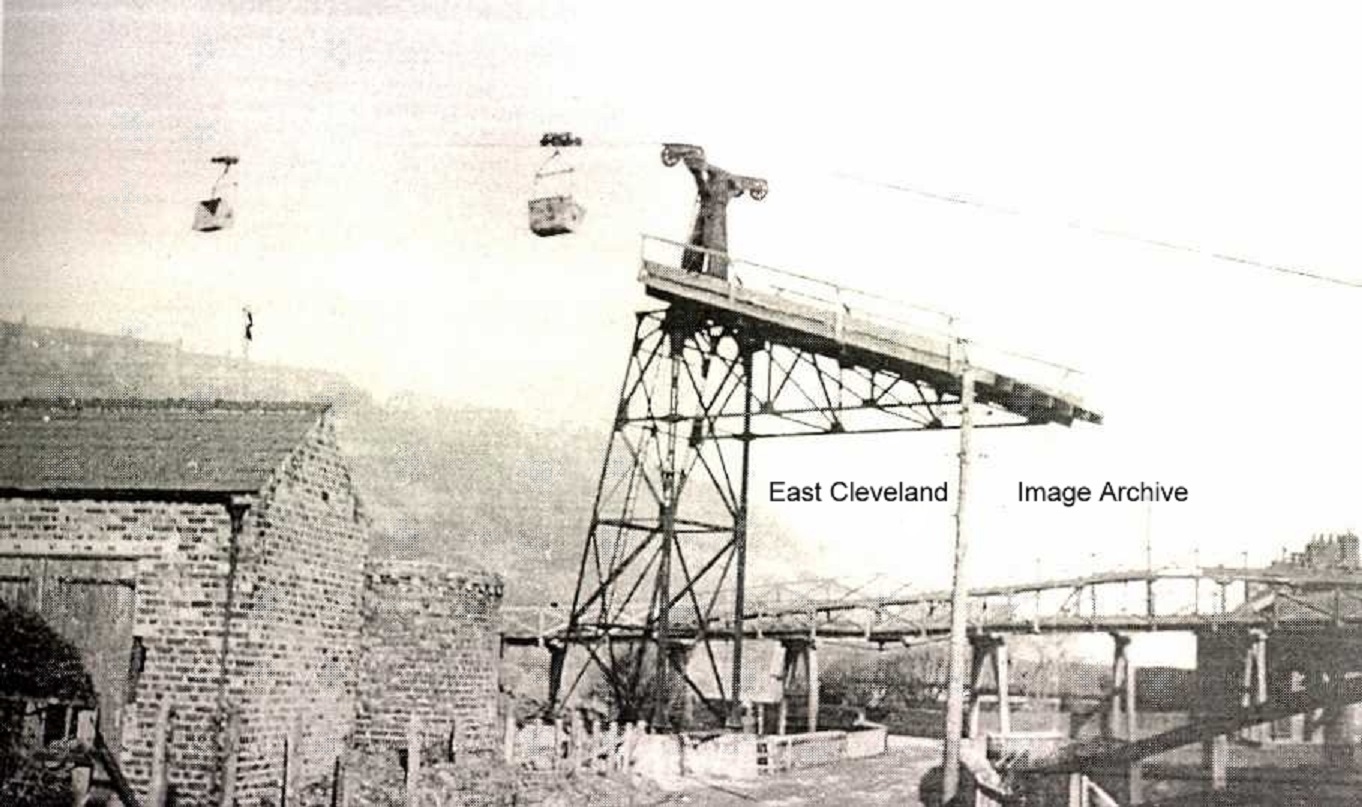 This is the sight you would have seen entering Skinningrove, from the Carlin How to Loftus road, dating from about 1937; Loftus mine was to the right and the ropeway took ironstone from the mine to the steel works on the top of the hill, on it’s return it brought shale which was tipped at the back of the mine. This ropeway was known locally as ’the buckets’. This is a view of the bottom pylon of ’The Buckets’ complete with protective screen above the road. Just to the left of the pylon can be seen the air shaft for the mine. This airshaft still can be seen today, beside the entrance to the footpath up to Carlin How. The row of houses on the extreme right of this image is that of Overman’s Cottages, colloquially known as ‘Hoss Muck Terrace”; owing to the proximity to the surface stables for the mine. Image courtesy of the Pem Holliday Collection, the David Linton Collection and others. 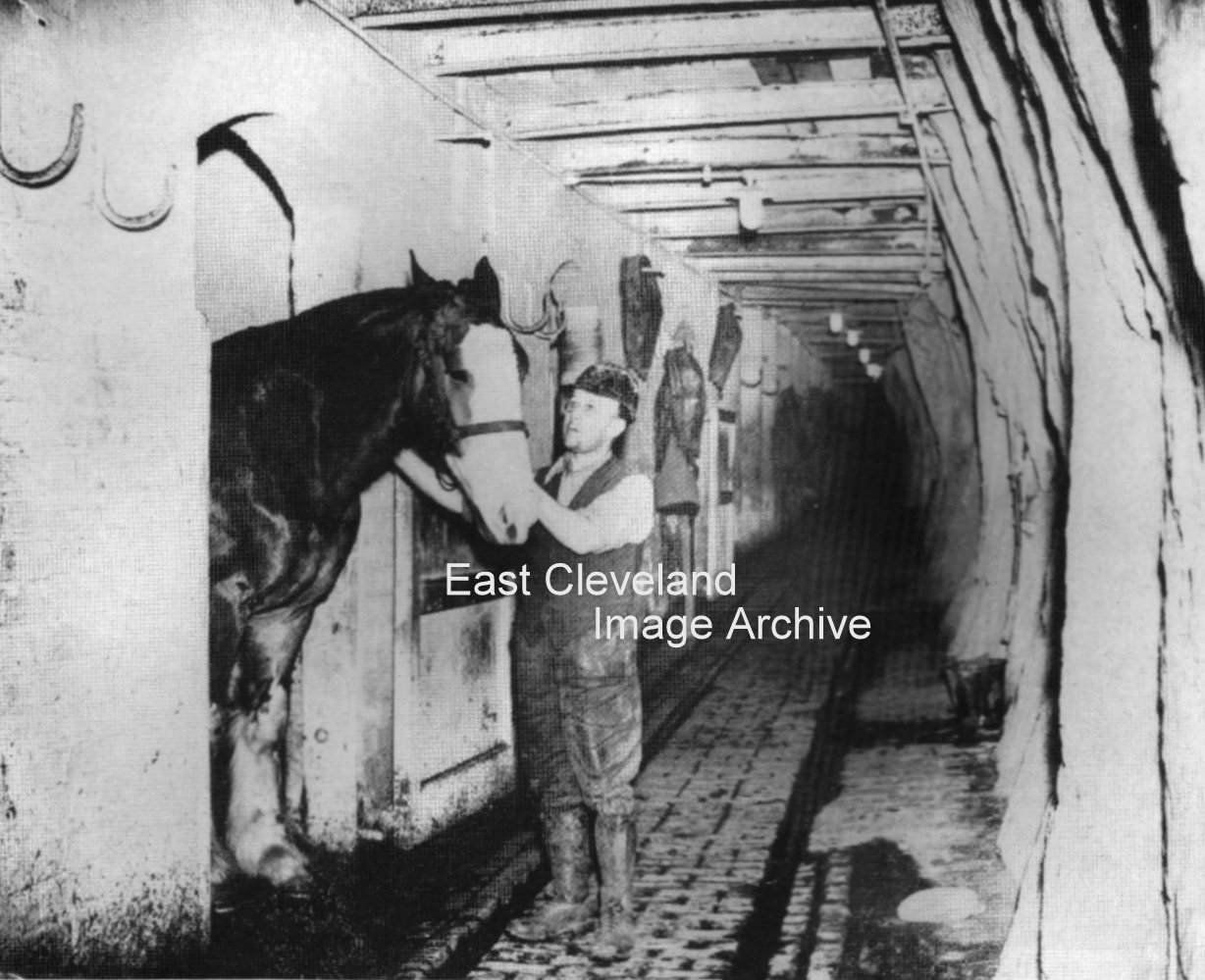 A newspaper cutting from about 1930-1940, showing the underground stables at ”Duckhole” pit (so named because it was one of the wettest pits in the Cleveland System). This pit was eventually worked from Lumpsey mine at Brotton. Simon Chapman advised the Archive: “The horse keeper was Bob Robinson, who has specially put on his helmet for the picture. That round object at the bottom right of the picture is his cap! Although the cutting refers to it as Carlin How pit and the other mine in the valley was known as Loftus mine, both were actually in Skinningrove Valley! Loftus mine was more popularly known as Skinningrove and is now the basis of the Cleveland Ironstone Mining Museum. The horse stables for Loftus mine were believed to be situated under Loftus town Hall, we will check this out. Image courtesy of various sources, including Cleveland ironstone Mining Museum, the Pem Holliday Collection, etc., thanks to Simon Chapman for the update. 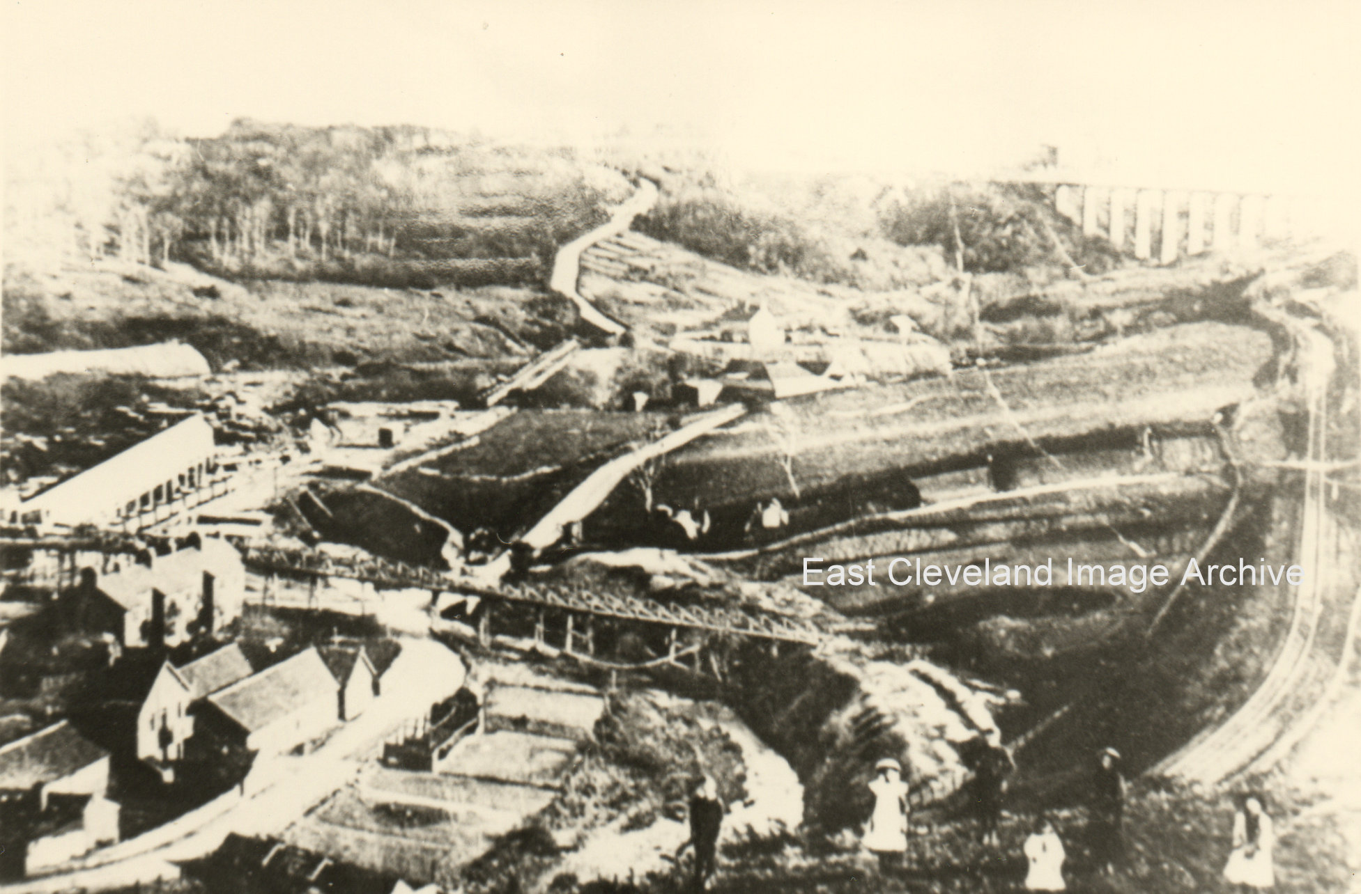 To the bottom left are the stables, then comes Overman’s Cottages (hoss muck terrace, as it was known by the locals) then what looks like a bridge is where the stone from Loftus mine was taken to Duck Hole and up the shaft to the works at the top of the bank. This happened when the railway put up the charge for the mine using the zig zag line. Kilton viaduct can just be seen and Mill Bank snakes it’s way to the top of the photo. We must not forget the children posing in the front of the photo, it was wonderful how the word got round when the photographer was coming. 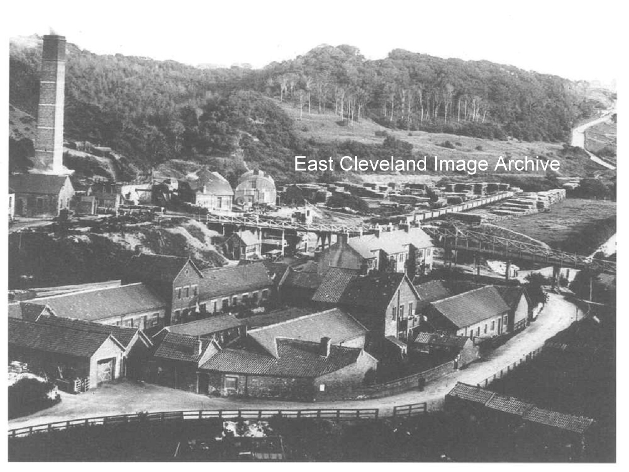 Loftus Mine at full production in about 1900. More popularly known as Skinningrove mine, in the picture it is possible to see at the right hand side is what was known as the wood yard where the wood for the pit props was stored. Mill Bank is just visible at the far right and in the foreground are the stables. These are the surface stables, access inbye to the mine was via the Horse Drift. The underground stables were situated underneath Loftus Town Hall, there were stalls for 16 horses; with provisions for fodder and water, etc. Harold Found, an ex-miner tells us: ”The stables were kept immaculate.” As a new miner he spent time at the blacksmiths next door, assisting the blacksmith with shoeing horses, etc. Image courtesy of the Pem Holliday Collection and others, thanks to Harold Found for this update. 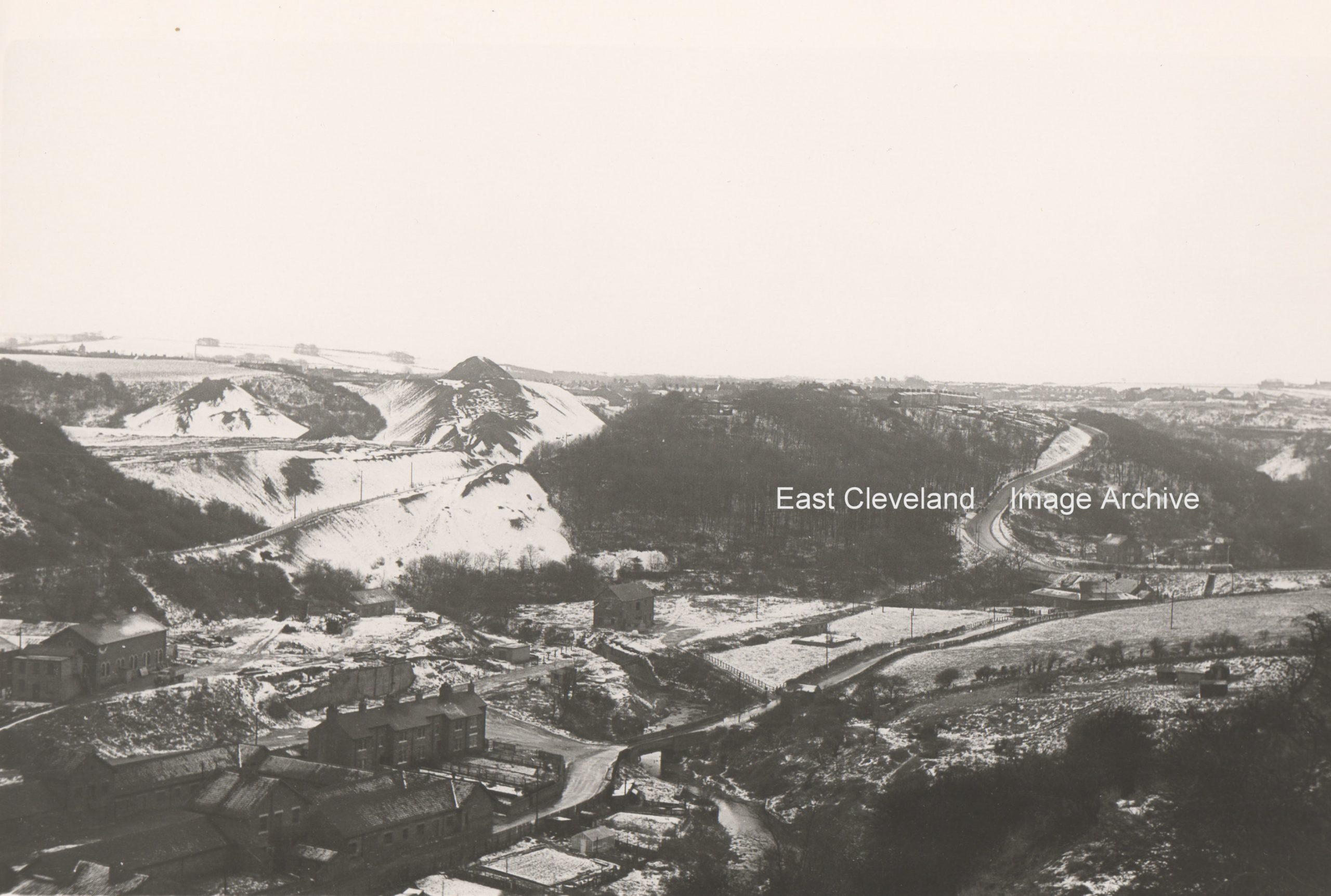 A serene snow-covered image taken from Carlin How, probably from near the entrance to Skinningrove Iron and Steel Works, belying the gritty industrialised nature of the area. A light dusting of snow, but you can still make out Overman’s Cottages, with the mine to the rear and Mill Bank snaking it’s way to Loftus. The shale heaps look almost like mountains with their covering of snow. Image courtesy of Ted Morgan (via Eric Johnson). 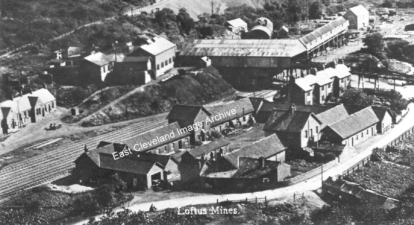 Skinningrove Mine, from Carlin How once again (this time captioned ”Loftus Mines”) the stables are centre foreground with Overmen’s Cottages behind them (lovingly named ”Hoss Muck Row” by the locals, for obvious reasons); behind that the picking belt and heapstead. Dating from c.1903 this view is much changed, in more recent times part of the remaining buildings have been converted to living accommodation and the renowned ‘Kaskane/Covell’s Bar’. |
||
Recent Comments