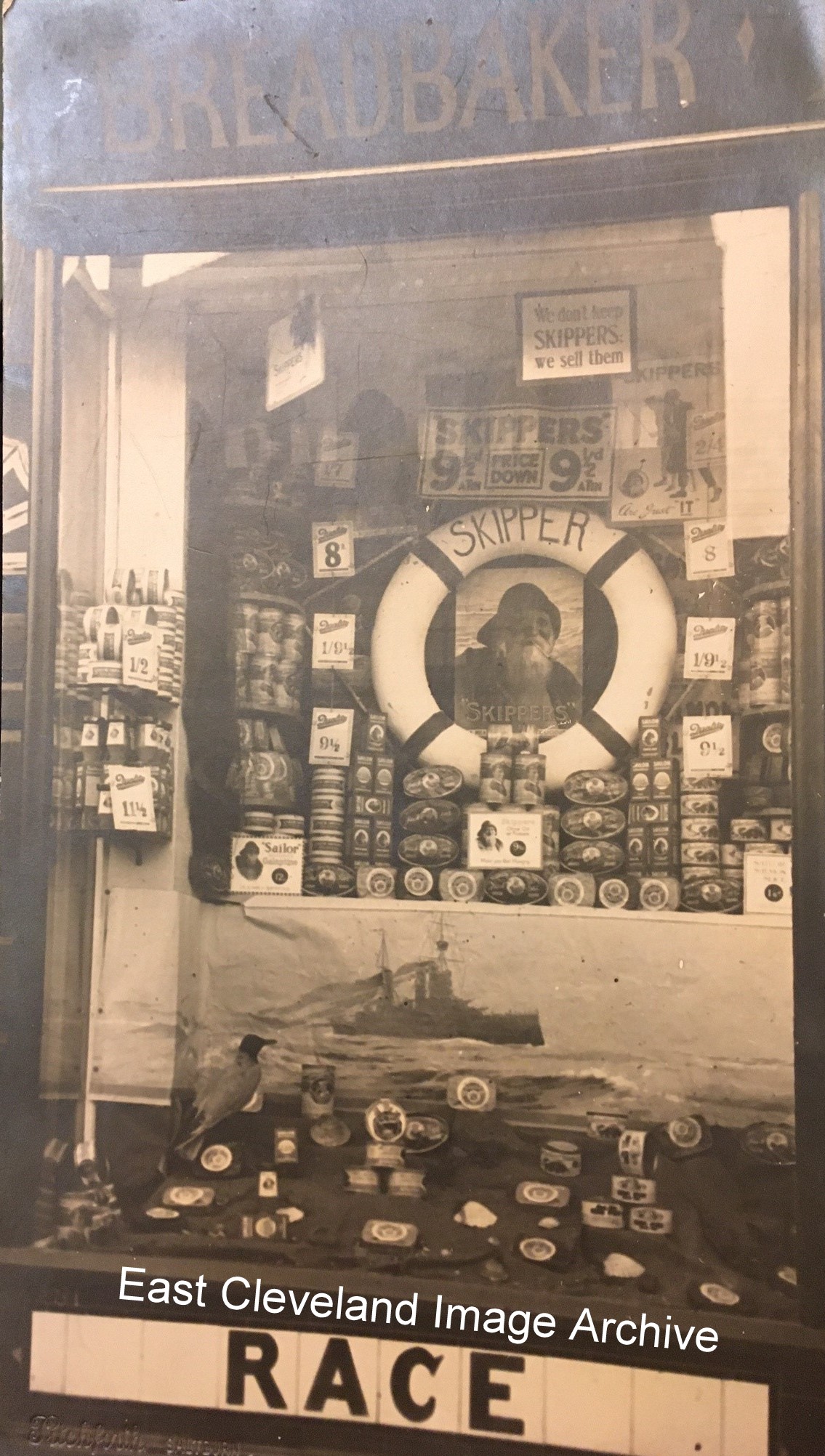
A display advertising Skipper – tinned fish products – a part of one of Race’s regular changing window displays.William Race’s shop was listed in Kelly’s Directory in 1913 as ‘Confectioners and Pastry Cooks’; William gave his trade as Grocer and Baker in the Census of 1891.Can you remember Skippers Sardines?
Image courtesy of Mervyn Sherwood Brown (via Dean Gibson).
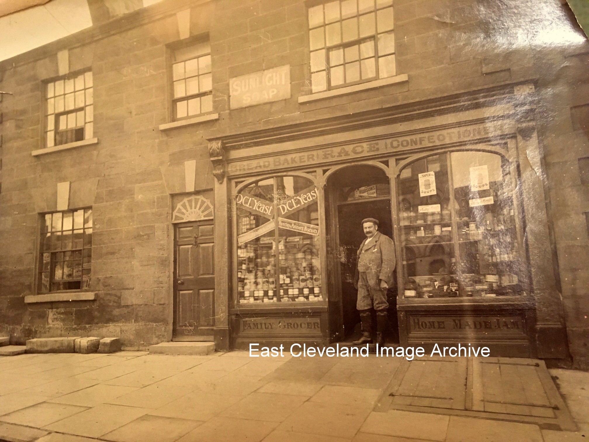
WilliamMaxwell Race, in the doorway of his shop in the Market Place; the original ‘Race’ of the story about “a race between a camel and a lion, overlooked by an angel. In reality Cammell – the name of the next shop in the Market Place) and the Lion (being the Golden Lion which is to the right in this image. The ‘angel’ was the Angel Inn on the opposite side of the Market Place; now closed. Dating the image places it well before 1923 (William’s death) and is probably about 1900. William Maxwell Race was the uncle of Mervyn Sherwood Brown who sent the Archive this series of images.
Image courtesy of Mervyn Sherwood Brown (via Dean Gibson).
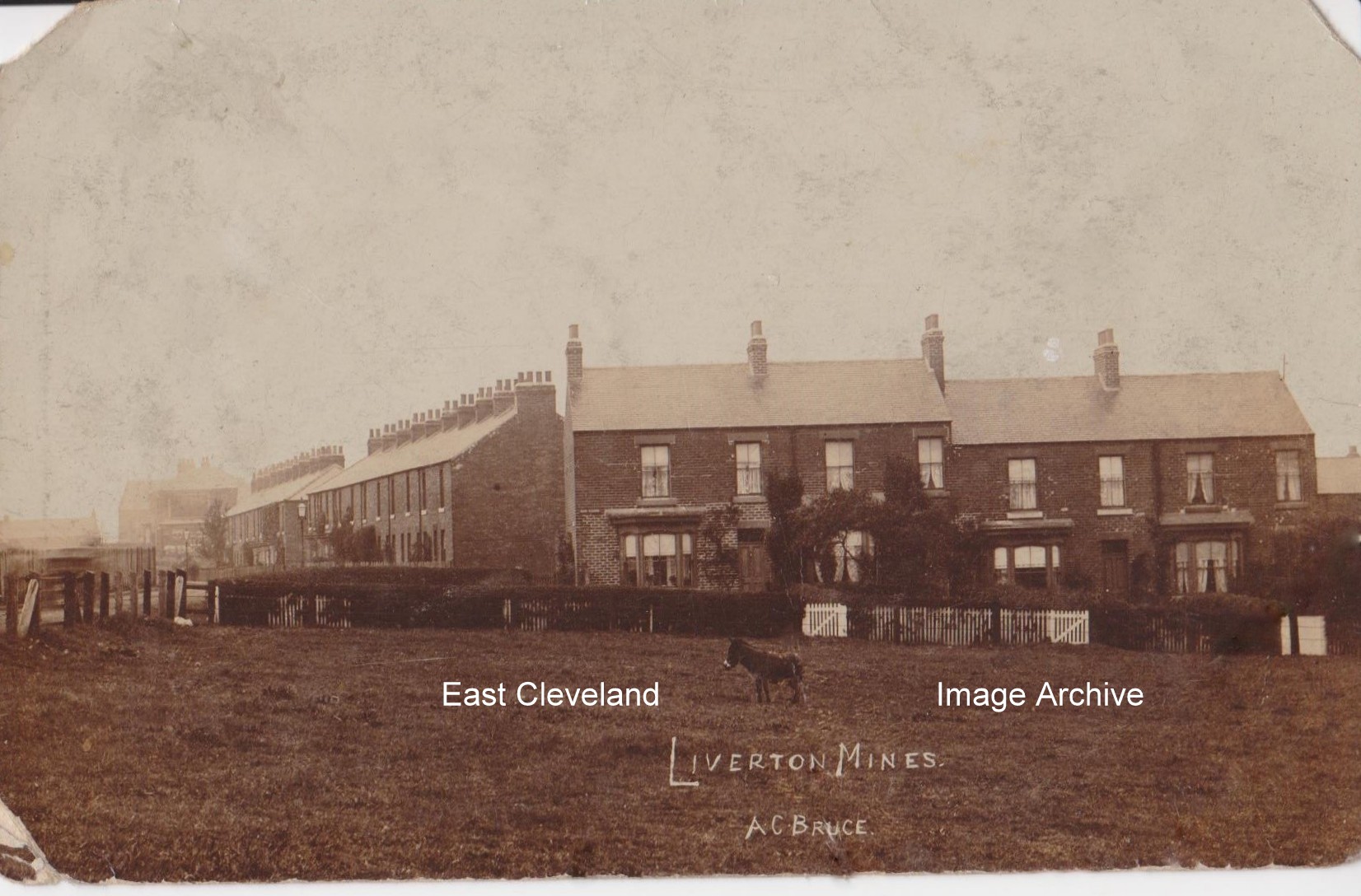
Cliffe Terrace, Liverton Mines in 1930; Mervyn Brown (who kindly sent the following images) lived at 3 Cliffe Terrace overlooking these fields and can remember the donkey! Mervyn moved away in 1942 when his father (who was a foreman electrician in the steel works) sought new employment in County Durham.
Image and information courtesy of Mervyn Brown (via DeanGibson).
This postcard view of South Loftus from Dam end with the old railway bridge and land free of trees, includes Haugh Bridge, complete with three who children managed to get into the frame! It was produced by J. E. Harrison of High Street Loftus, posted in the 1930s from Loftus to Lealholm.
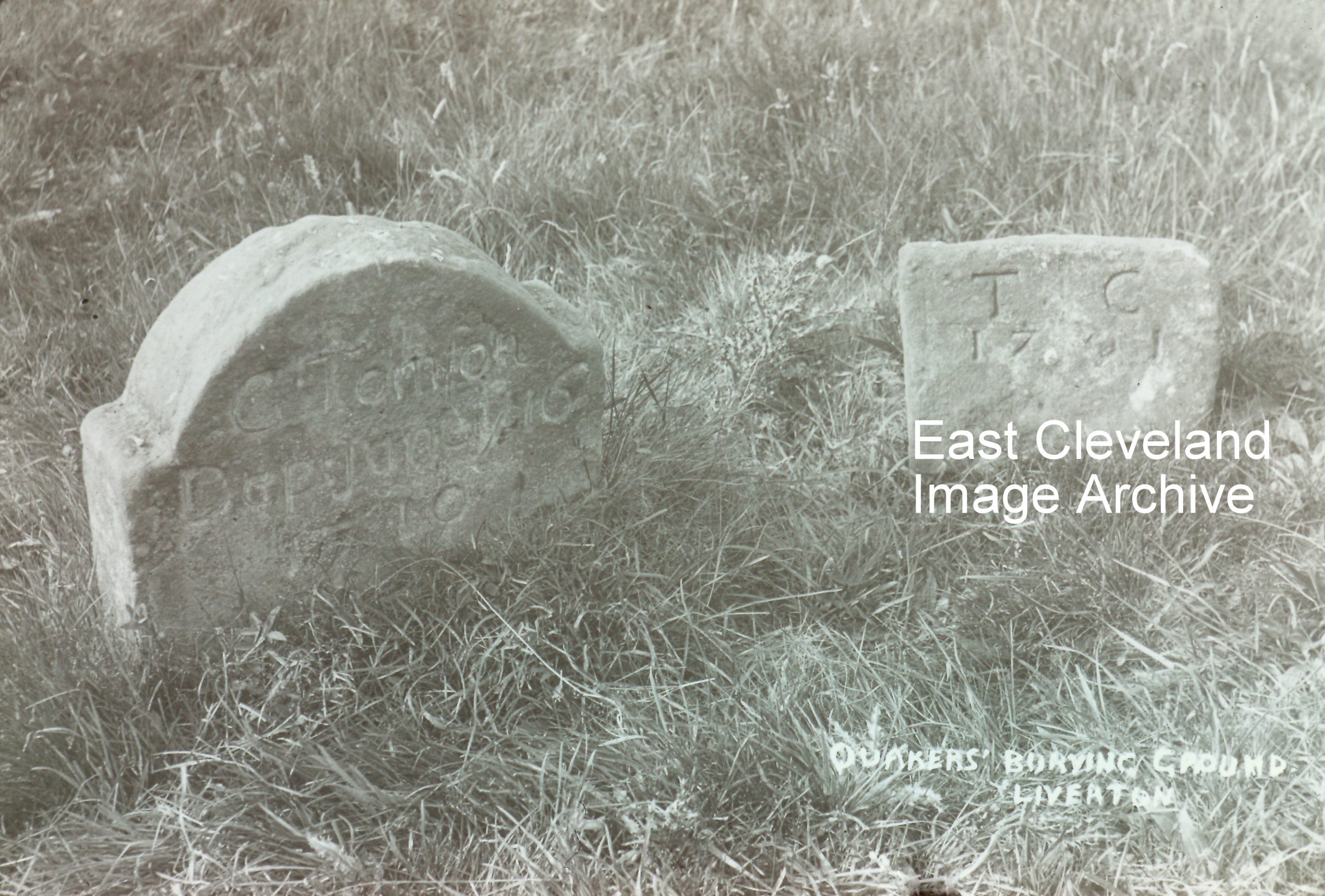
Another gravestone from the Quaker burial ground at Liverton, these two stones are dated by the Quaker variation of the Julien calendar. The stone on the left is of George Thompson of Moorsholm who died on 16th June 1710; the stone on the right is of Thomas Carlill who died on the 26th October 1701. “The Quaker burial ground at Liverton is located at Red House farm. Dating from about 1669 to the early 1800’s, it is believed that up to 50 persons are interred there. Little is known about the Society of Friends in the area, But may have started after the visit by the founder George Fox preaching in Cleveland around 1654.”Ann Jackson comments: “While researching my family tree in Moorsholm I have had quite a few posts from families in America looking for Quaker relations who lived in Moorsholm. I know of . 1 family who lived at Ness Hagg which is in the wood called Hagg Wood nearer the Liverton area. It’s a ruin now. I got the information from Mrs Shaw whose family own Ness Hagg farm off the Moorsholm Liverton Road . Another family called Hoopes we’re looking for connections to Moorsholm.”
Peter Appleton advises: “I cannot speak about Quakers in the Liverton area. However, I can add information about the Hoopes family of Quakers. The Quaker burial ground near Skelton, at the side of the road from New Skelton to Lingdale and marked by four old oak trees, was also known as Tobias Hoopes’ burial ground. In their day the Hoopes family were owners of a large swathe of east Cleveland. They owned Stank House farm near Kilton and everything west to the Claphow road. I have twice shown American descendants of the Hoopes family around the area. As well as taking them to Stank House, we also visited Tidkinhow farm near Aysdalegate, which had been a family home for their ancestors. In both cases, the American family was descended from Joshua Hoopes. He had emigrated, from Scarborough, on the last vessel to be financed by William Penn, founder of Pennsylvania. He and his sons converted to Mormonism and became leading figures in that faith. Hope your readers find this of interest.”
Image courtesy of a friend of the Archive, additional information courtesy of Dr Alastair Laurence ’History of Liverton’.Thanks to Ann Jackson, Peter Appleton and Alan Jones (who has researched the Liverton Quaker burials) for the updates.Thanks also to John Hoopes for his query; for which the Archive has supplied a OS grid reference.
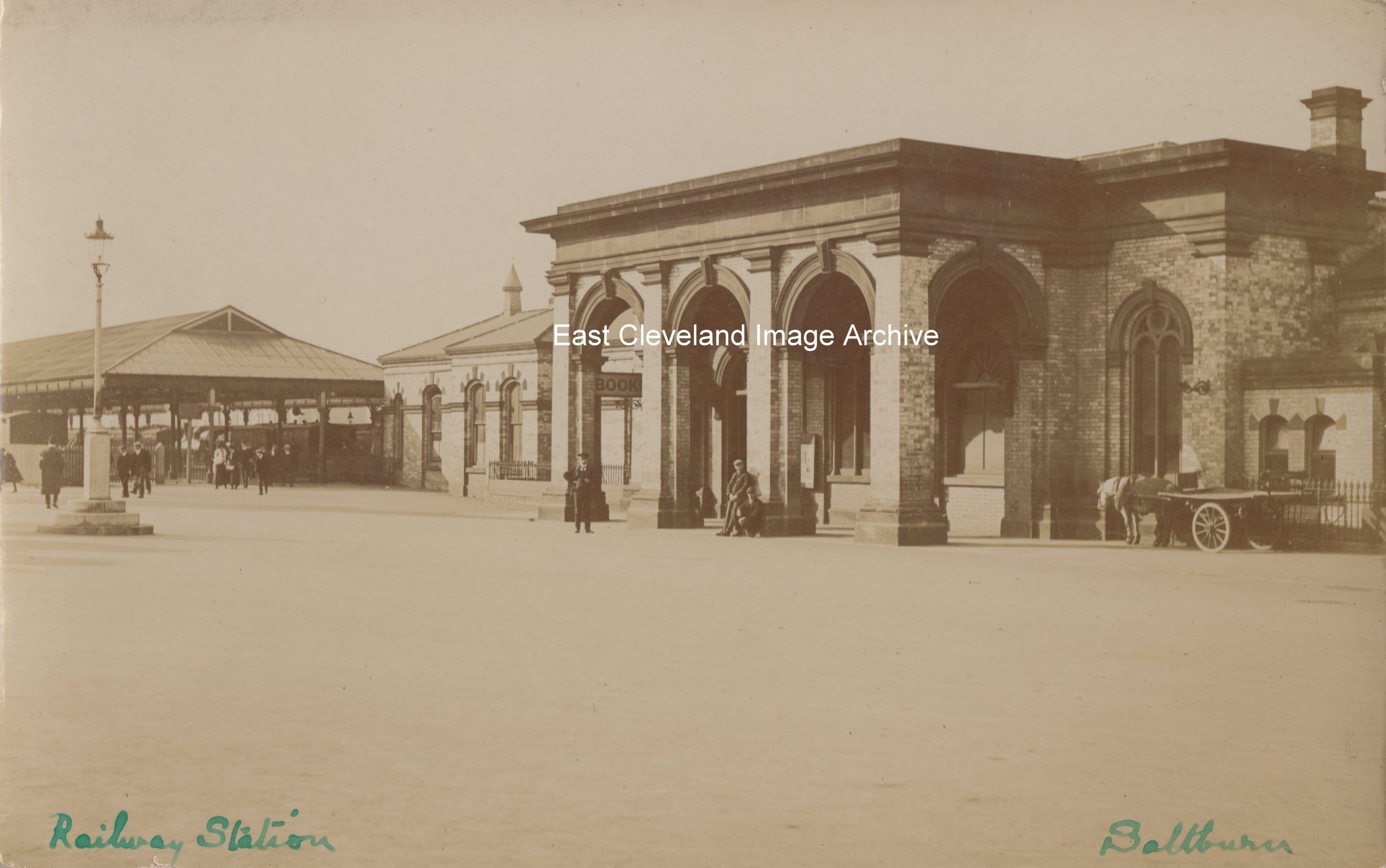
A Thirkell’s (of Saltburn) postcard view of the Station, obviously at least one of the railway staff knew of the event; the Stationmaster is standing on what is today the road! Traffic must have been very light; the date of this photograph is believed to be post 1899.
Image courtesy of Julie Tyrka, thanks to Tony Lynn for the update.
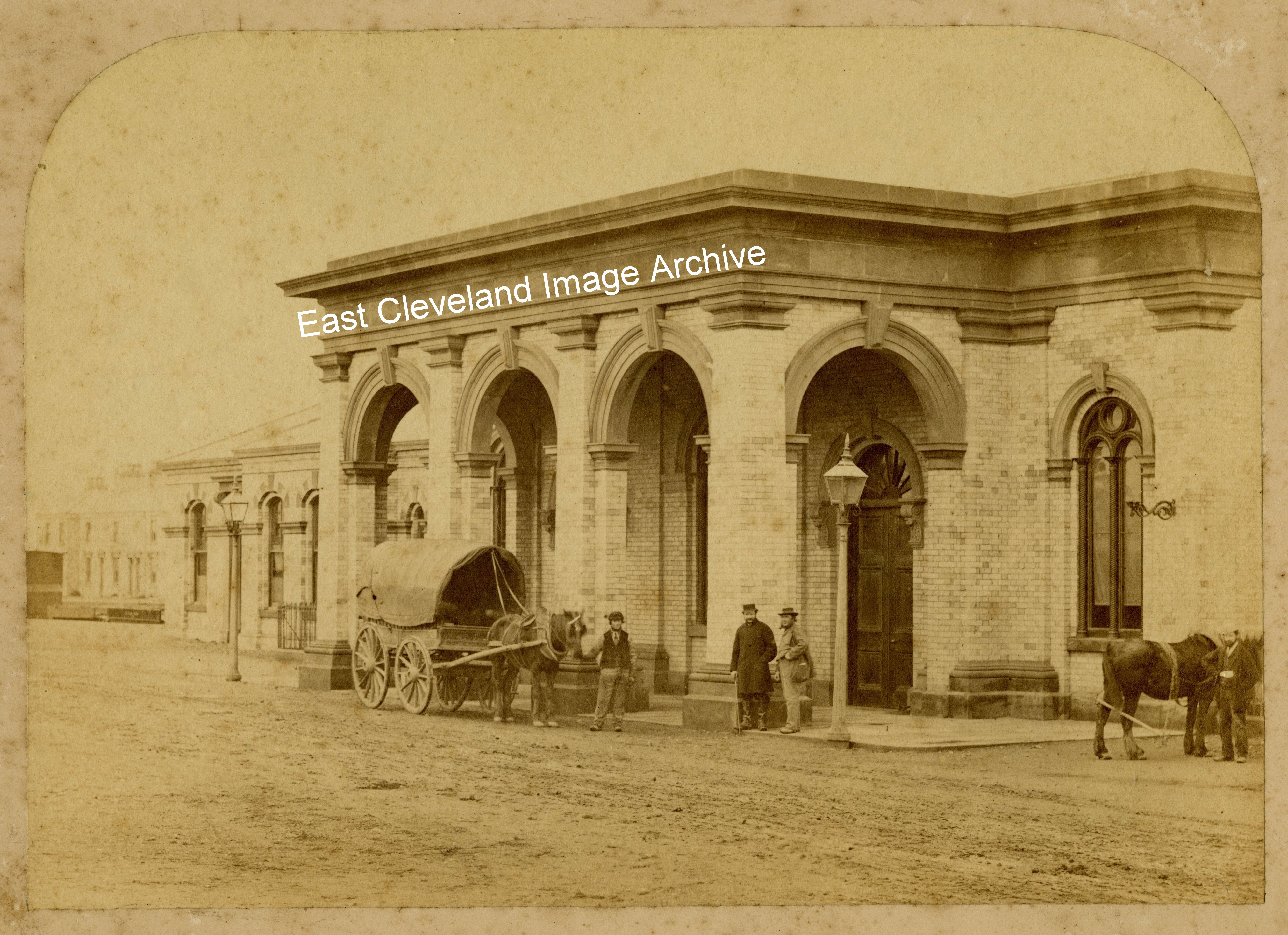
Known to date from 1869 (a newspaper clipping located behind this photograph was dated 20th November 1869), this view of the portico of the station appears to show Alpha Place on the extreme left. The photographer is unknown, but could it have been a local ‘snapper’?
The original ‘Golf Balls’ at Fylingdales in the 1960s, now replaced by a pyramid object; the original ‘Golf Balls’ could be seen for miles across the moors, particularly from the north and west and often best viewed from the Guisborough to Whitby ‘moor’ road.
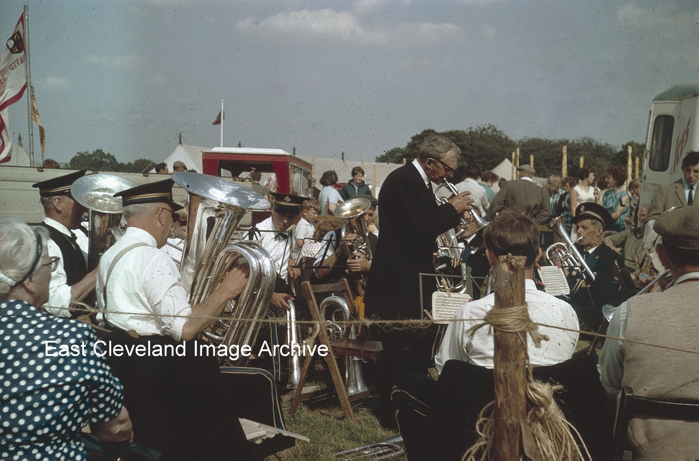
Stape Silver Band playing in the sunshine at Egton Show in the 1960s, one of the many attractions of the show; popular with all ages and weather permitting a fantastic day out for all ages.I would imagine the band would be feeling the sun’s rays later in the day!
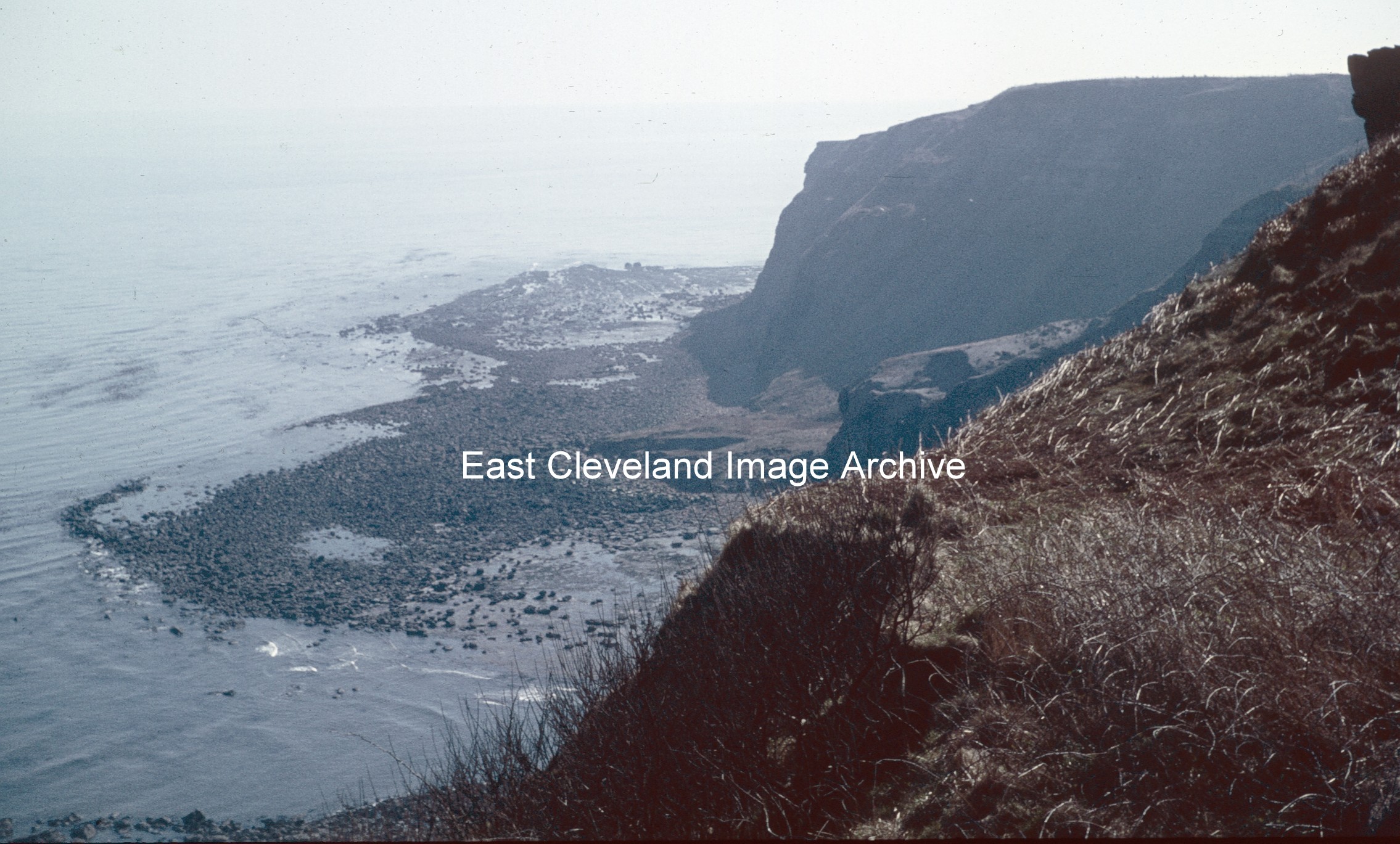
Now known to be Keldhowe Point and not Kettleness Point; as David Richardson advised: “It was taken on Ovalgate Cliffs and is looking east across Loop Wyke towards Tellgreen Hill and Keldhowe Point.” Peter Appleton commented: “This is an interesting view. Note the enormous debris field of boulders behind the words “East Cleveland”. These boulders are the legacy of the massive landslide of 17th December 1829 which destroyed the village of Kettleness and the alum works. Mercifully, it took the form of a “rotational slump” and nobody was killed or seriously injured. By mid-summer 1831, the alum works had been rebuilt at a higher level in the quarries and production had been resumed. The works would continue in operation until 1871, being one of the last two north-east Yorkshire works to close.”
Image courtesy of Robert Goundry; thanks to David Richardson and Peter Appleton for the updates.
Recent Comments