|
|
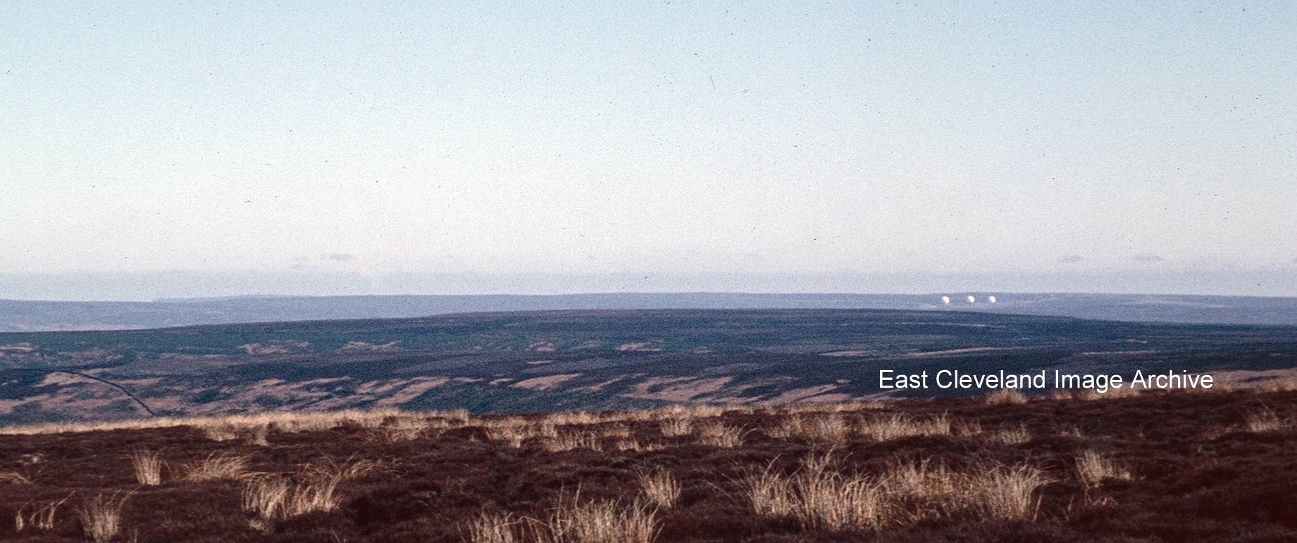
The original ‘Golf Balls’ at Fylingdales in the 1960s, now replaced by a pyramid object; the original ‘Golf Balls’ could be seen for miles across the moors, particularly from the north and west and often best viewed from the Guisborough to Whitby ‘moor’ road.
Image courtesy of Robert Goundry.
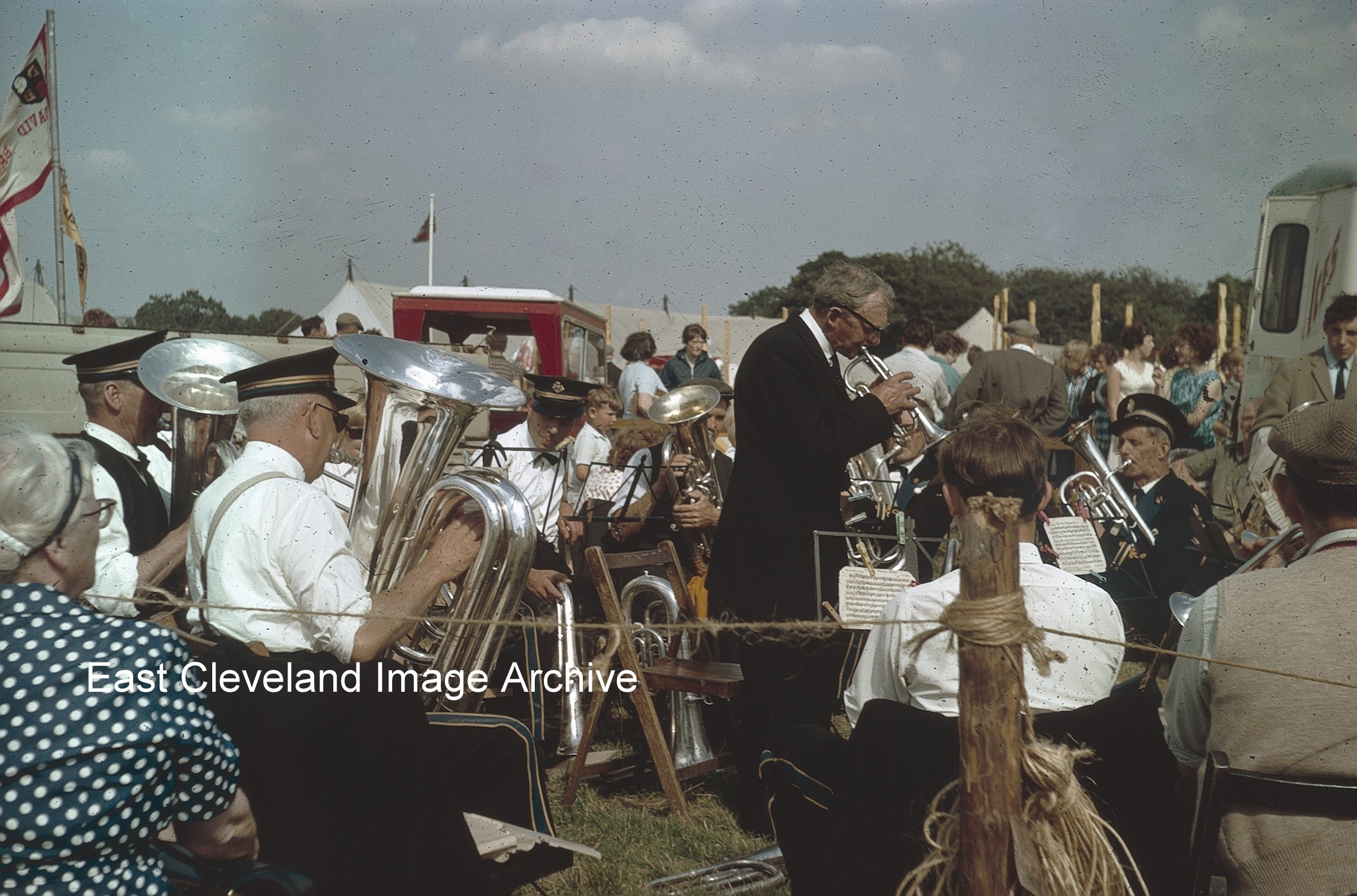
Stape Silver Band playing in the sunshine at Egton Show in the 1960s, one of the many attractions of the show; popular with all ages and weather permitting a fantastic day out for all ages. I would imagine the band would be feeling the sun’s rays later in the day!
Image courtesy of Robert Goundry.
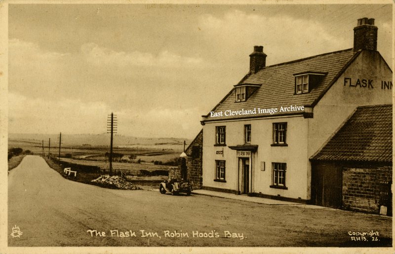
The Flask Inn, 7 miles from Whitby on the road to Scarborough is a former 18th century coaching inn . Now much altered with development and lying away from the realigned road. The opened topped sports car stands at the lone petrol pump, can any one identify the make of the car?
Image courtesy of Iris Place.
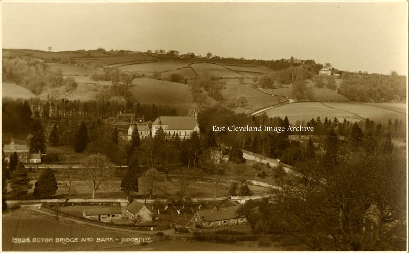
A further Judges postcard view of Egton Bridge, St Hedda’s RC church and the bank (entitled Egton Cliff on maps!) which descends from Egton, at the top of the hill. The view, dating from the 1950s; was probably taken from the road which having crossed the River Esk splits and then leads to Goathland or over the moor to Rosedale.
Image courtesy of Iris Place.
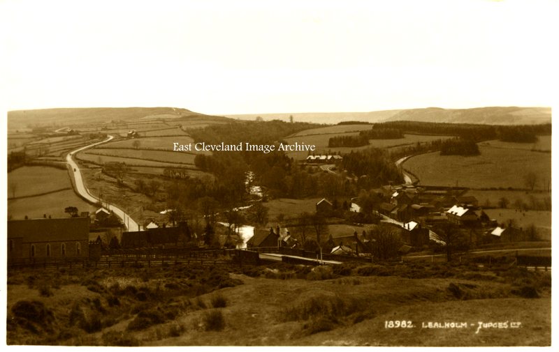
A Judges postcard view of Lealholm, dating from the 1950s. Sited at a crossing point on the River Esk, Lealholm has an long history and is recorded in the Domesday Book. It was recently described by the Sunday Times “as the prettiest village in Yorkshire”; a title it well deserves, being a popular destination for many visitors to Eskdale.
Image courtesy of Iris Place.
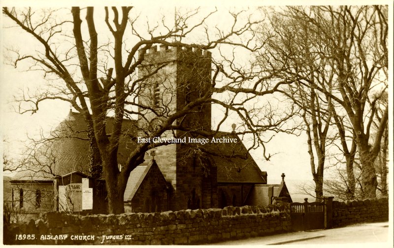
Dating from the 1950s this Judges postcard shows Aislaby church, it stands at the western end of the village; dedicated to St Margaret built in 1897 as a replacement a chapel (dating from 1732) which still stands further to the east.
Image courtesy of Iris Place.
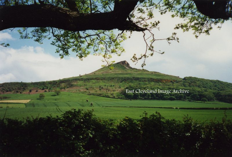
A familiar view to all who visit the area is this more modern image of Roseberry Topping; viewed from the lay-by/car parking are as one approaches Newton under Roseberry. At 1,049 feet (320 m), Roseberry Topping was traditionally thought to be the highest hill on the North York Moors however, the nearby Urra Moor is higher, at 1,490 feet (450 m). The top offers views of Captain Cook’s Monument on Easby Moor and the monument on Eston Nab. We are informed: “Until 1912 the summit resembled a sugarloaf, but a geological fault and possibly nearby alum and ironstone mining caused its collapse.”
Image courtesy of Iris Place.
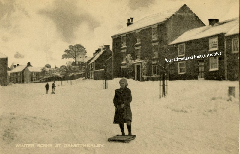
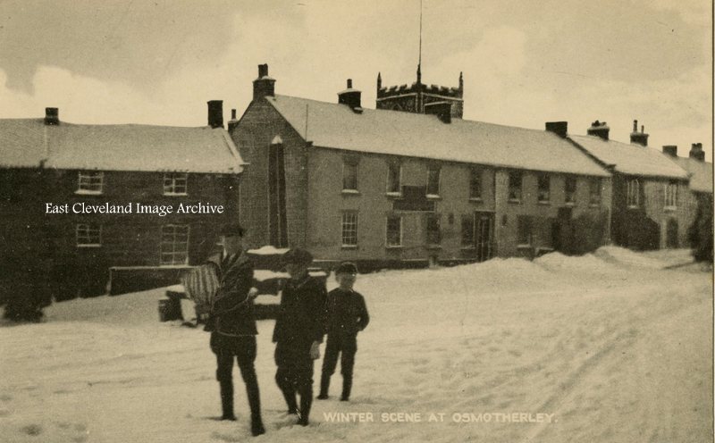
A further view (again a modern reproduction of a 1950s postcard) of snow at Osmotherly. The newspaper delivery must get through; judging by the banked up roadsides there had been snow previously. I can remember similar winter scenes and life seemed to just go on. Memories of taking newspapers out: despite the delivery vans having difficulty in getting from Darlington, we were expected to be ready to deliver. And there was trouble if you were late collecting your delivery bag! Ann Jackson advises : “Queen Catherine public house in the background.”
Image courtesy of Iris Place and thanks to Ann for that update.
Despite being a modern reproduction (of a 1950s) postcard view this is how we used to have snow! This on the main street in Osmpotherly does not deter our young sledgers from enjoying an opportunity to make use of the snow.
Image courtesy of Iris Place.
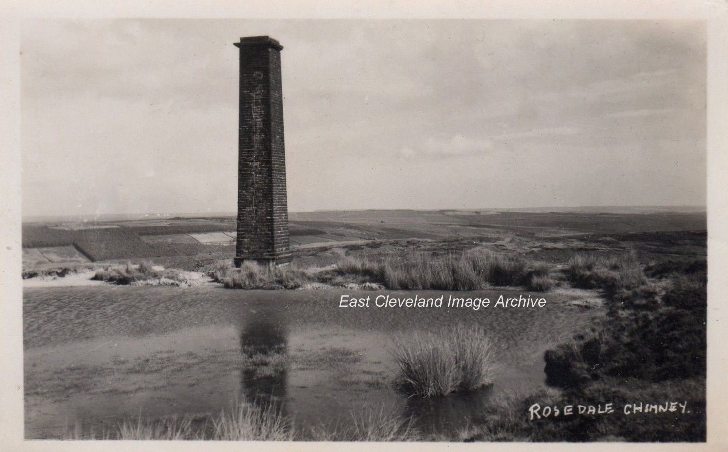
Once a very familiar sight to all who traversed Blakey Ridge, whilst crossing the North York Moors, Bank Top chimney remained standing long after the Rosedale ironstone mines had closed, only being taken down in 1972. It was for many years a familiar landmark and indicator for the route of the Lyke Wake Walk. Martin Aconley advises: “I worked at a local builders our company lead the stone away to various sites near Hutton le hole where we used the stone to build houses the black surface on the stone can still be seen on the houses.”
Image courtesy of John G. Hannah, many thanks to Martin Aconley for the update.
Page 1 of 912345...»Last »
|
|
Recent Comments