|
|
Looking towards the east at Saltburn Station, originally it was believed that the photograph dated from 1960; however Russ Pigott advised us: ”This picture is later than 1960 I would say about 1971-1973 The track into the trainshed was closed in 1970 and the sleepers are still present. Also the poster has a mark 2 Inter-City coach on it which were not introduced until 1966.” It was a lovely station as most of them were, what a pity such a lot of them were demolished.
Image courtesy of several sources and thanks to Russ Pigott for the update.
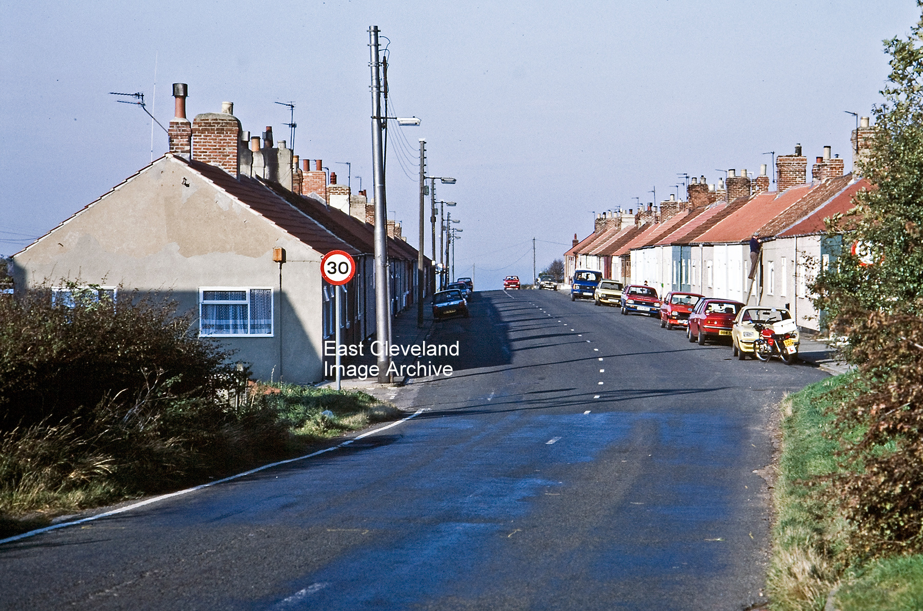
Raymond Brown advised: “These dwellings were originally Upper Cleveland Street and have survived at least 2 condemnations to my knowledge; Lower Cleveland Street (except for numbers 1 and 2, looking very much like semi-detached bungalows still standing) was demolished many many years ago.
(image courtesy of Raymond Brown, thanks to Angela Vincent and Miss Ward for the updates.
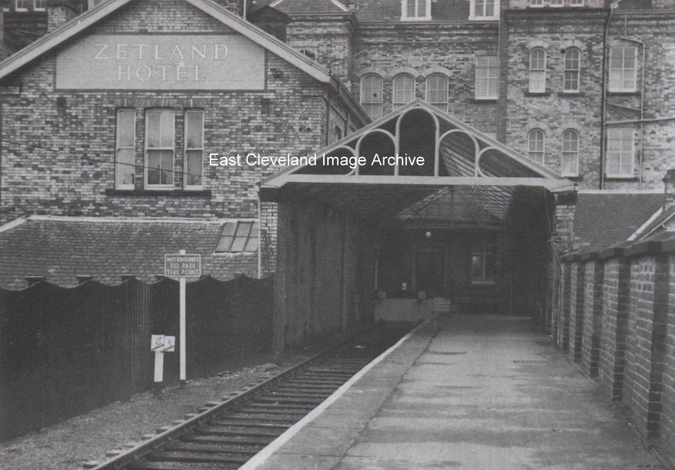
Yes another photograph of Saltburn station; this time looking towards the Zetland Hotel where the trains could pull right into the hotel. This was the ‘private entrance’ to the Hotel, originally personal guests of the Pease family and later celebrities could enter the hotel without being seen by the public.
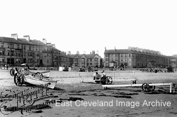
An early postcard photograph of Redcar beach; one in the Frith series.
Image courtesy of Mike Holliday.
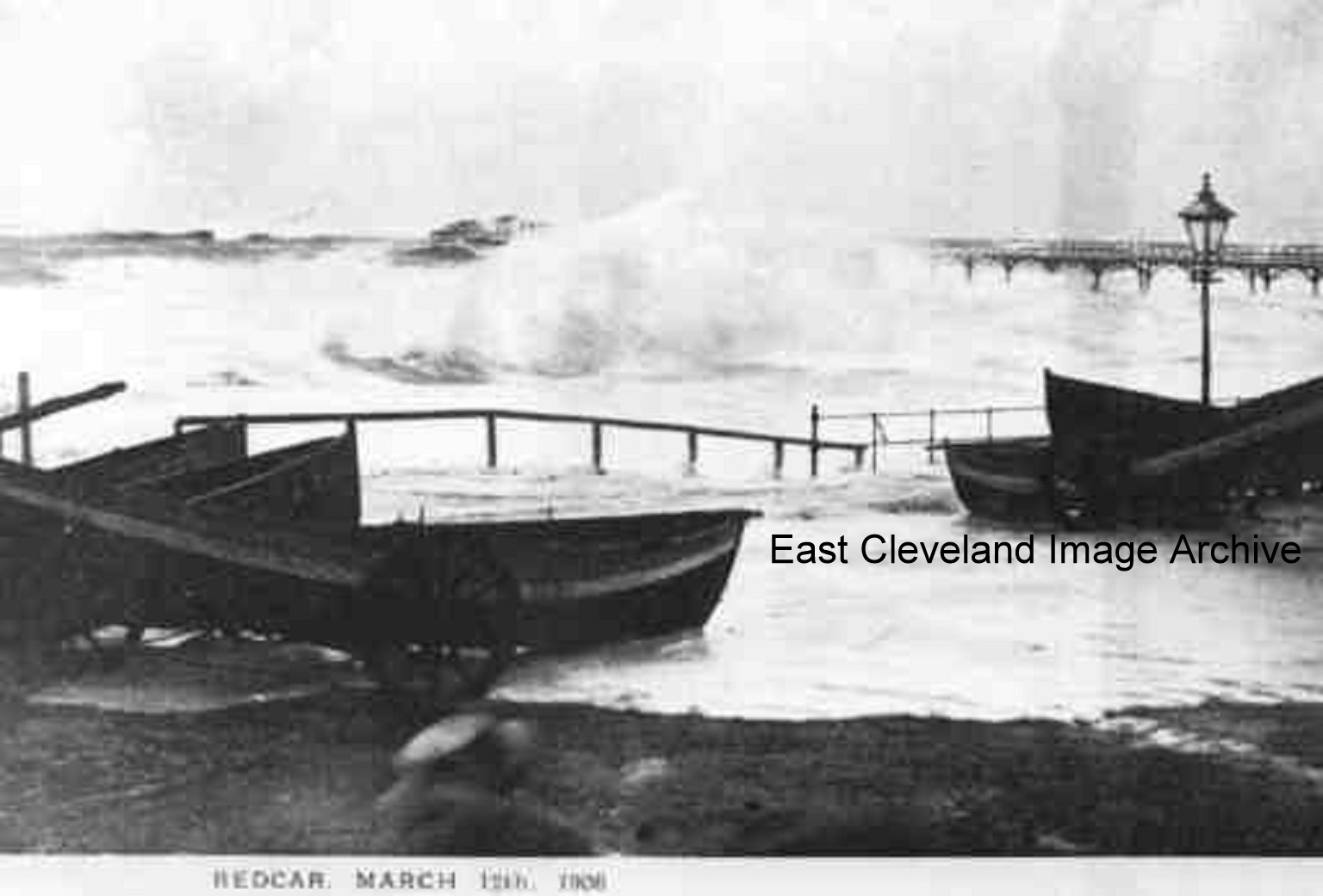
Not a day to be strolling long the promenade at Redcar; obviously 12th March 1908 must have had some significance to the photographer, the image is from a postcard by an unknown producer.
Image courtesy of Mike Holliday.
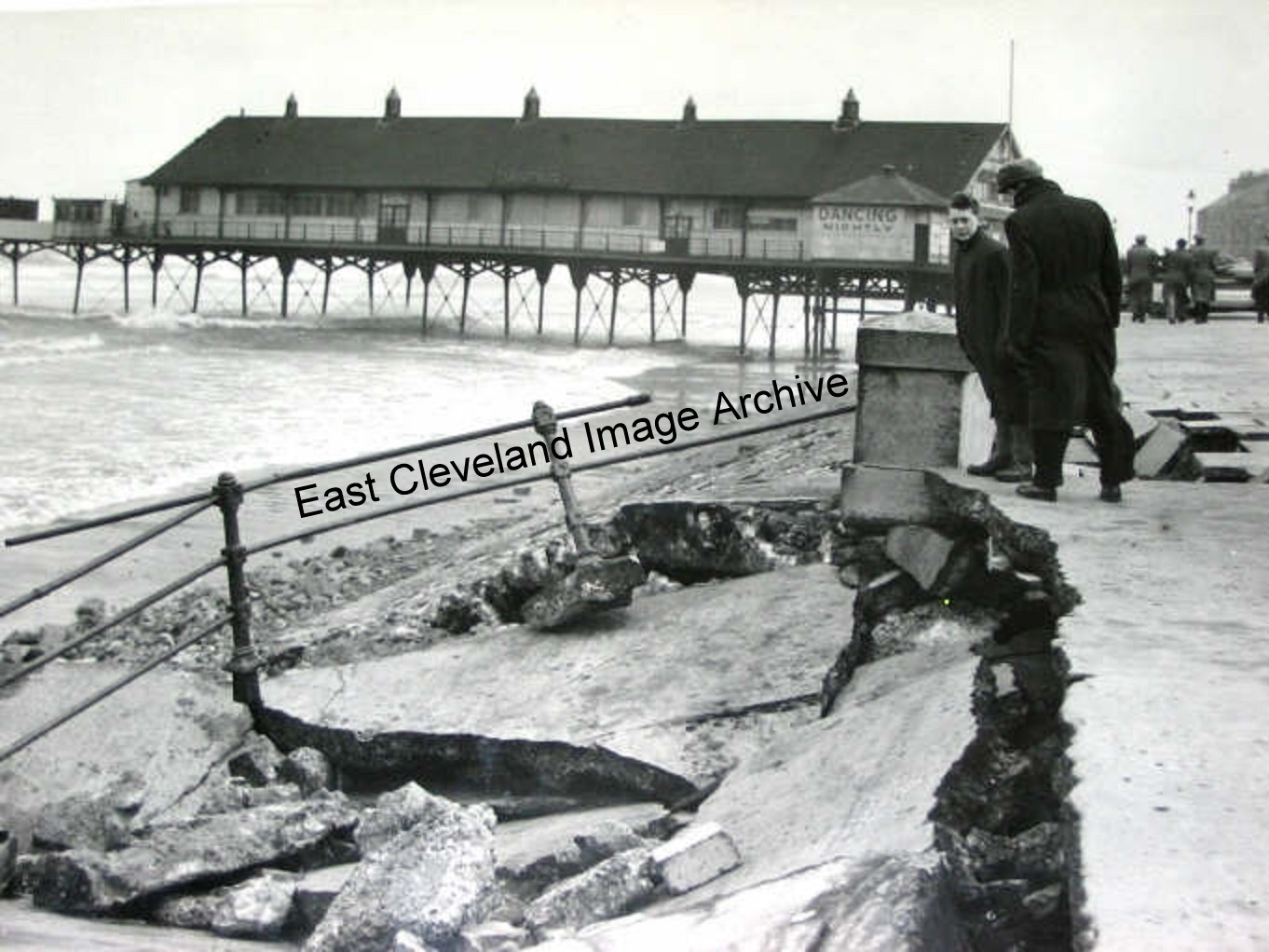
The pier is in the background but look what the high rough seas had done to the promenade. Alan Etherington advised the Archive: “This was the result of the major storm that passed down the North Sea at the end of January 1953 creating massive damage all along the East coast. Holland and Canvey Island seemed to have suffered many deaths because of it.”
Image courtesy of Mike Holliday, thanks to Alan Etherington for the update.
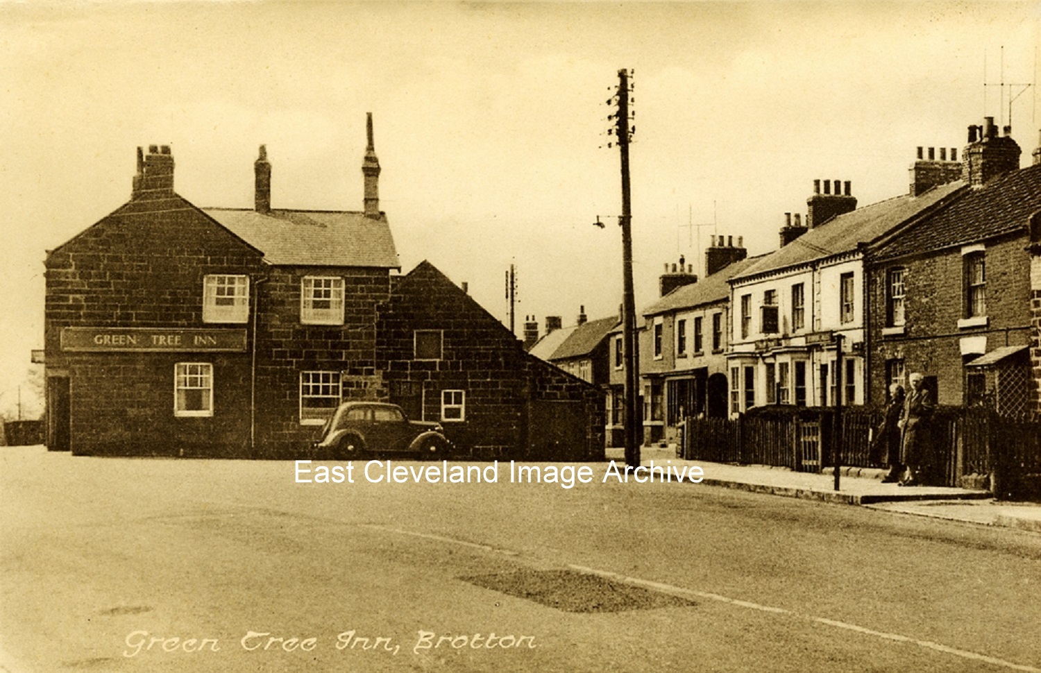
The Green Tree at Brotton, believed to be from the 1950’s. Pamela Mcvay tells us: ”We used to live on Lorne Terrace (out of shot here,) I remember the shops behind the Green Tree and at the end of Lorne Terrace was a dairy selling milk and orange juice in bottles. Not sure if this might be very early 1950s”. Gary Wilson also tells us: ”I can also remember the shops behind the Green Tree; the Coop and Ruddock’s butchers on the corner and Ada Bell in the dairy.” Whilst Patsy Gallon has memories: “I remember going to Ada’s when we visited my gran, Elsie Rogerson. She lived on the High Street. My mum had the hairdressers in approximately late 1940’s – 1950’s. I believe it is still a hairdressers today.” Alison Yarushin enquires: “Can anyone tell me which modern day building is the site of where Ruddock’s Butchers shop was? I am related to the Ruddock’s who owned the shop, and have some photograph from the 1930s of people standing on the doorstep of the shop.”
Image courtesy of Ray Brown; thanks to Pamela McVay, Gary Wilson, Patsy Gallon and Alison Yarushin for the updates.
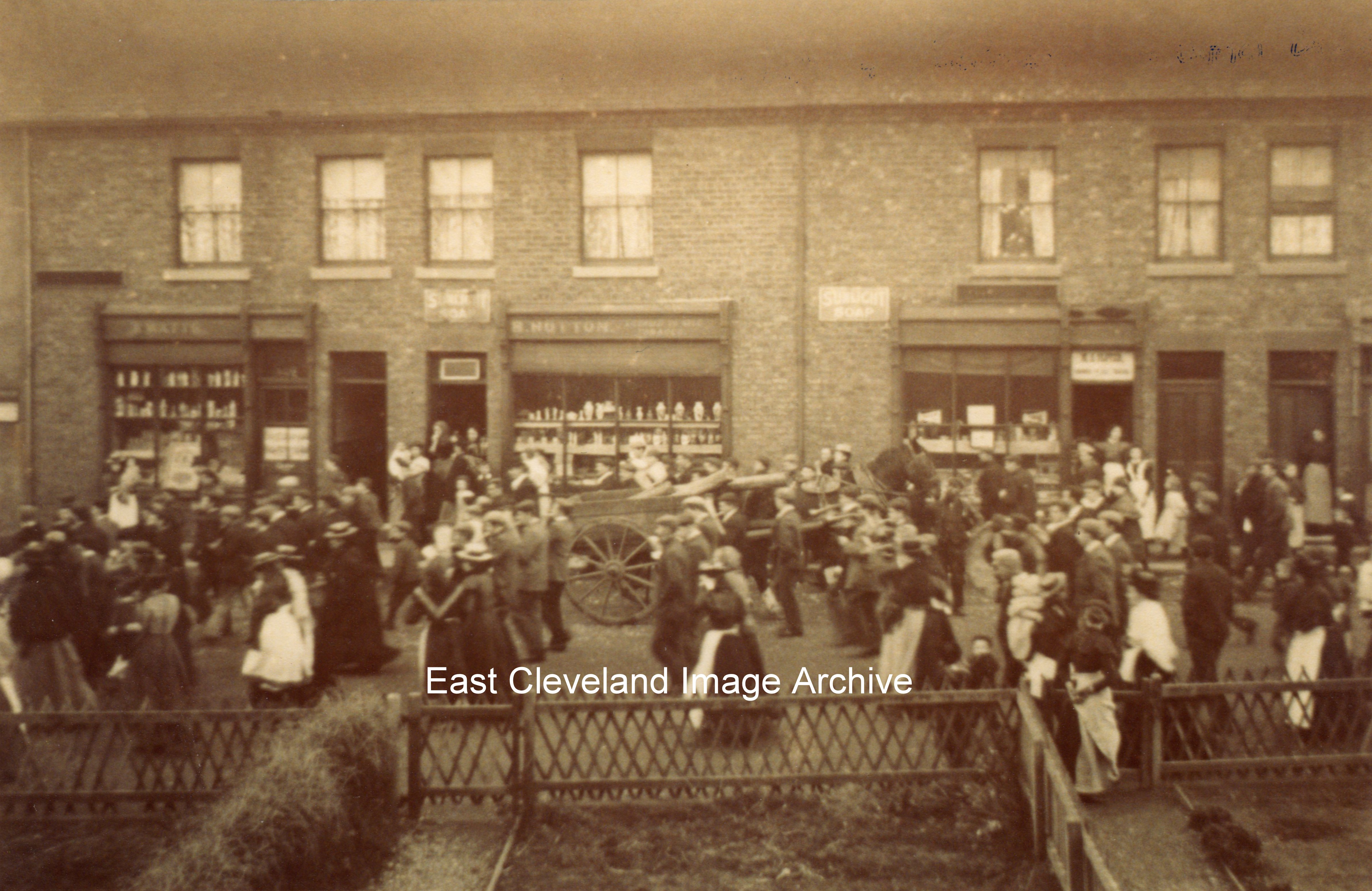
When first posted on the Archive the question was: “Wonder what has brought all these people out int the square?” Finley Butler advised: “It says in a book of my grandmothers called ‘Carlin How – Times Past ‘ that this image is of ”Volunteers leaving for Boer war, 1900”. Derick Pearson advised it was part of a disc compilation of images he produced in 1983 for a Village Arts initiative led by Doff Pollard in the Jubilee Hall. Further researches aided by Carlin How Community Centre has allowed an improved image to be presented.
Image courtesy of Stan Ward, Carlin How Community Centre and Cleveland Ironstone Mining Museum, thanks also to Finley Butler and Derick Pearson for the updates.
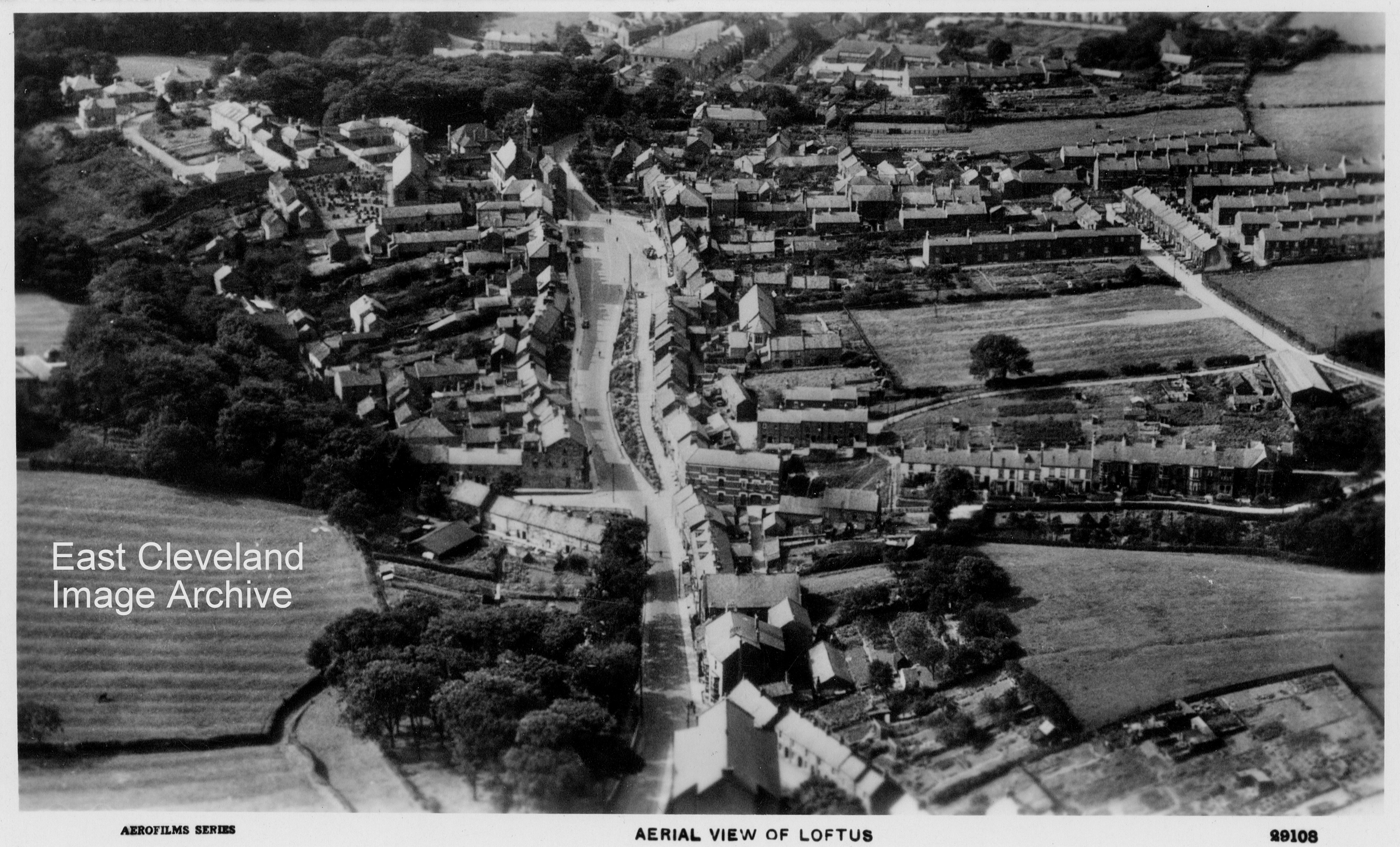
Taken from the east, in the foreground is the roof of the Chapel then along Arlington Street, we see on the right the road to Spring Head and on the left Dam End, the road widens at the Market Place. The road on the right of the photo is the road that leads up to Micklow lane. A lovely clear postcard view believed to have been sold by Ford’s in the early 1960’s, although unsure of date of production. However Norman Patton points out: ”I suspect that the church in the foreground is the Newton Memorial Chapel which was damaged beyond repair in the bombing of 1941 and demolished. It also appears that the beautiful and large Methodist Chapel near to the Arlington Hotel had not been built when this photograph was taken and yet I remember attending in my earliest days (early 40s)!! There is an obelisk at the east end of the market square which I don’t remember seeing in my life and I am not convinced that the War Memorial is in the picture. I don’t know how many of these observations are accurate but given the number of what appear to be motor vehicles on the road, I am guessing about 1920………don’t forget the aeroplane!?” Richard Watson comments: ”Would concur with Norman’s observations — the houses now opposite the recreation ground on Micklow Lane also are absent — the 20′s would seem a good guess.”
Image courtesy of John G. Hannah and thanks to Norman & Richard for the updates.
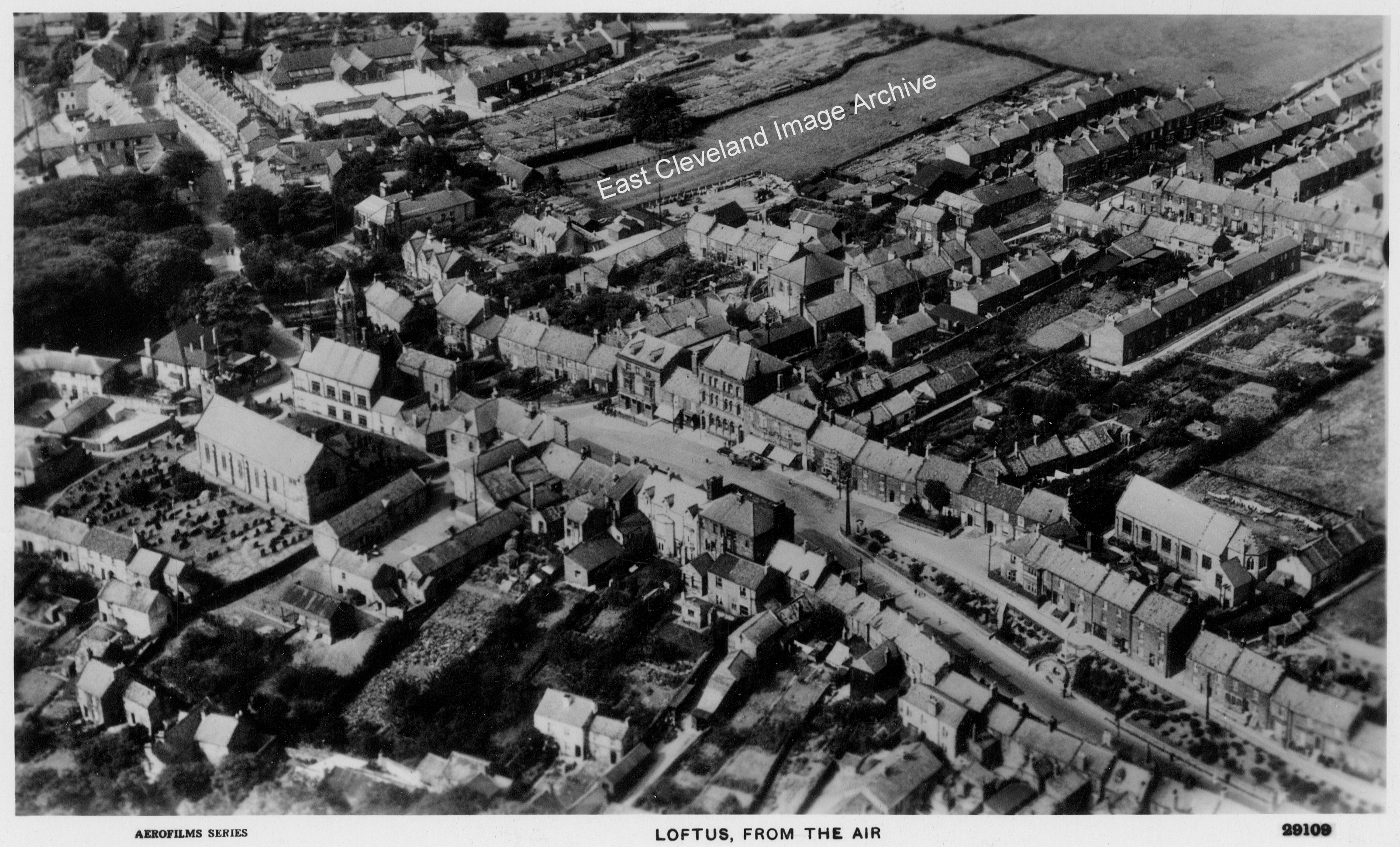
Another lovely aerial view showing a different part of Loftus, any places you recognise?
Image courtesy of John G. Hannah and Cleveland Ironstone Mining Museum.
Page 6 of 12« First«...45678...»Last »
|
|
Recent Comments