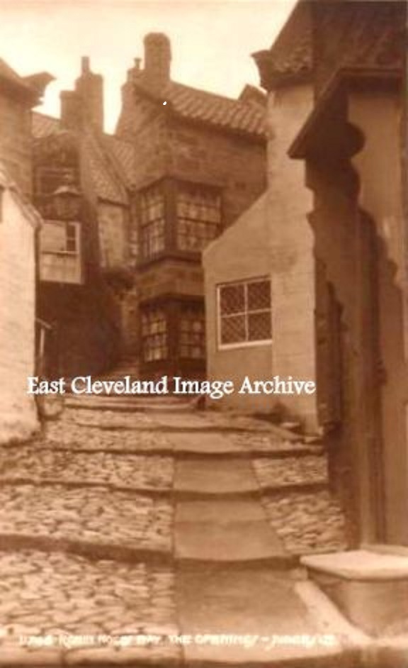
A view of one of the quaint corners of Robin Hoods Bay, the old cottages built with no particular plan in mind. The cobbled path made with beach stone, and the porch of the doorway on the right with the carved portals probably made with timbers salvaged from one of the many wrecks on this coast.
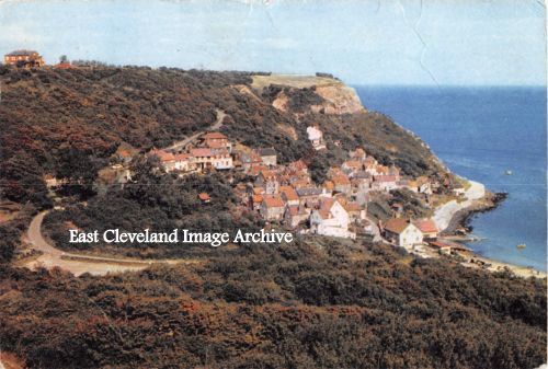
This postcard view of Runswick, clearly shows the original road as it curled down the hillside and down to the original drying greens. How blue the sea looks, almost Mediterranean.
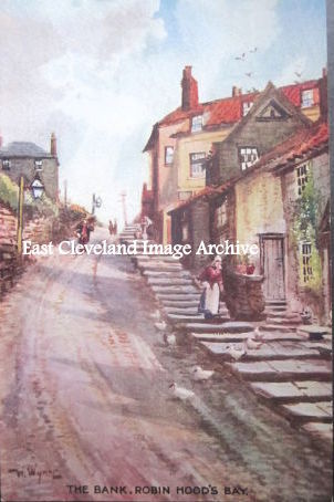
The steps at the side of the road in this postcard view of Robin Hood’s Bay bank are still in situ today and are a useful refuge from that traffic that attempts to negotiate this very steep hill.And this despite the numerous signs at bank top and available car parks!
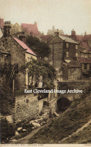
The view today of this image is slightly more vegetated! There are more trees and vegetation surrounding the bridge which carries the road down to the shore in Bay. King’s Beck is the small stream which runs down through the village.
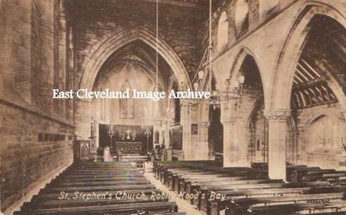
This interior view of St Stephen’s church at Robin Hoods Bay shows another large church for what was a fishing village. A building often used in the more trying times in the past.
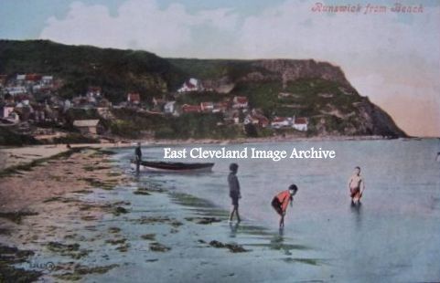
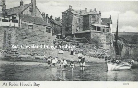
“Splodging at Bay” would best describe this scene from the last century. Today if the tide is down even cars seem to drive onto the beach. In our view the height of the tide would preclude such frivolous activities!
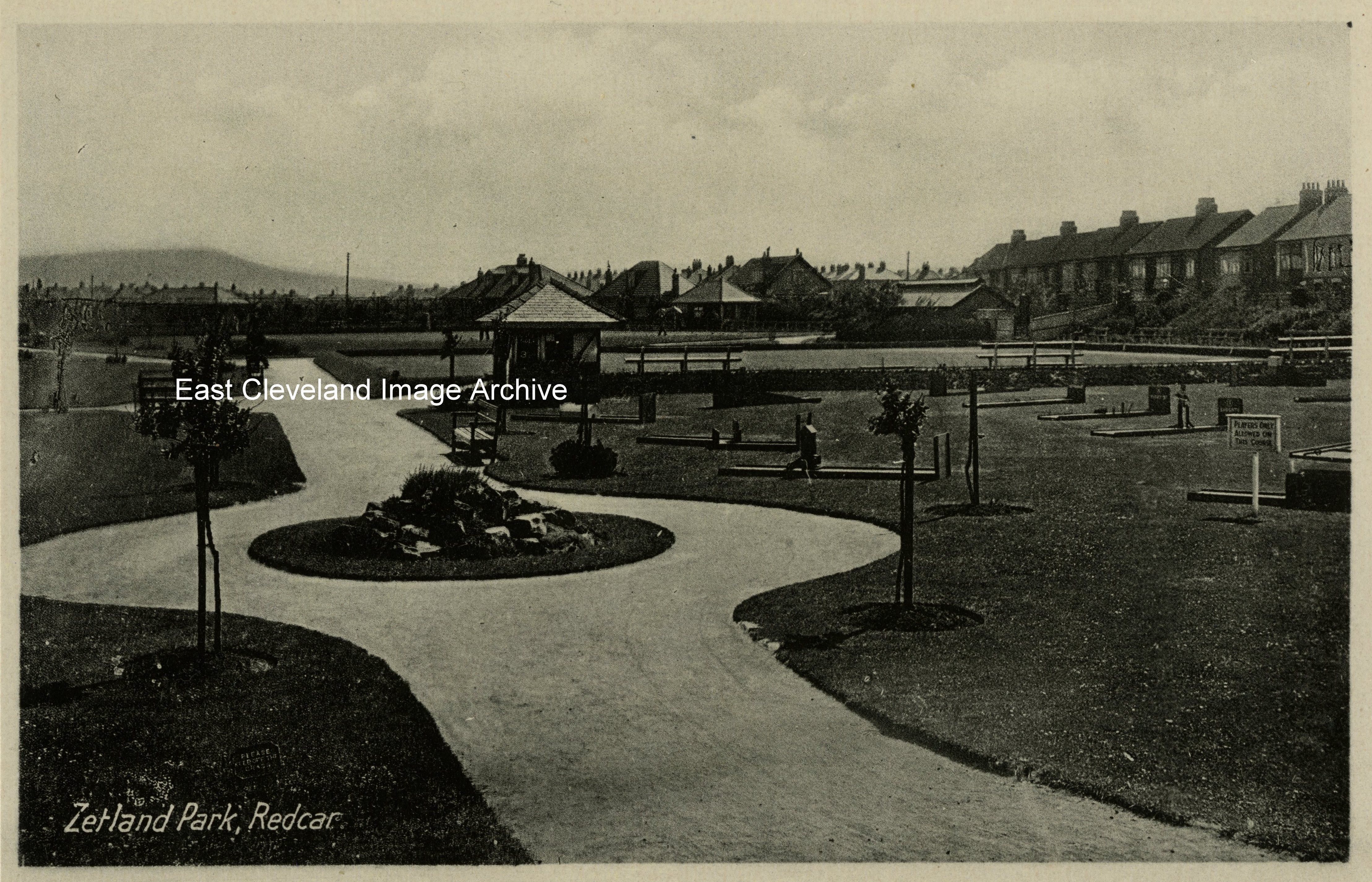
At the end of The Stray, Zetland Park is the smallest of the parks in Redcar. Today it even has its own website for Friends of Zetland Park; another example of the power of the local community in wanting to maintain their own amenities.
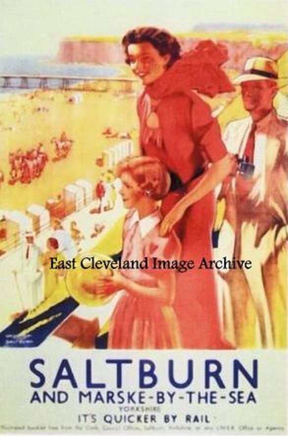
One of a series of posters produced by LNER 1923 – 47 promoting tourist resorts and possible places of interest. Reproductions of many of these posters (some as postcards) can be purchased today via the National Railway Museum and tourist information centres.
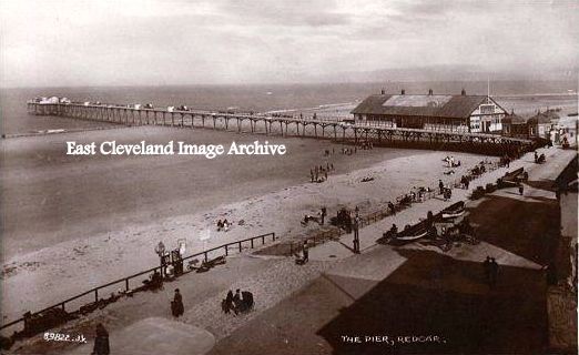
A view looking eastwards along the front at Redcar, with the pier dominating the scene. Redcar Pier Company was formed in 1866 but work did not begin until August 1871. The 1300 foot structure opened on 2nd June 1873 to the public, The 1300 foot structure opened on 2nd June 1873 to the design of J.E. & A.Dowson. Facilities included a 700-seat bandstand and separate landing stage; this was one of two piers at this point on the coast; the other was at Coatham. The pier was demolished finally in 1981 having become unstable. Julie Matthews believes: ”I may be wrong but I think it was demolished later than 1981. I worked in the front part which was a restaurant as a Saturday girl waitress around 1977 to 1979, whilst I was still at school.” Craig White has assisted with: ”It was taken down in the winter of 1980 / 1981. The restaurant was open till quite near the end, often a Police van was parked outside picking up meals for prisoners in Redcar nick! If it had survived a few more years it may have made it into the preservation era as opposed to the demolish everything old era that prevailed in the 1960’s and 1970’s.”
Image courtesy of a supporter of the Archive, historical information courtesy of National Piers Society and thanks to Julie Matthews and Craig White for the updates.
Recent Comments