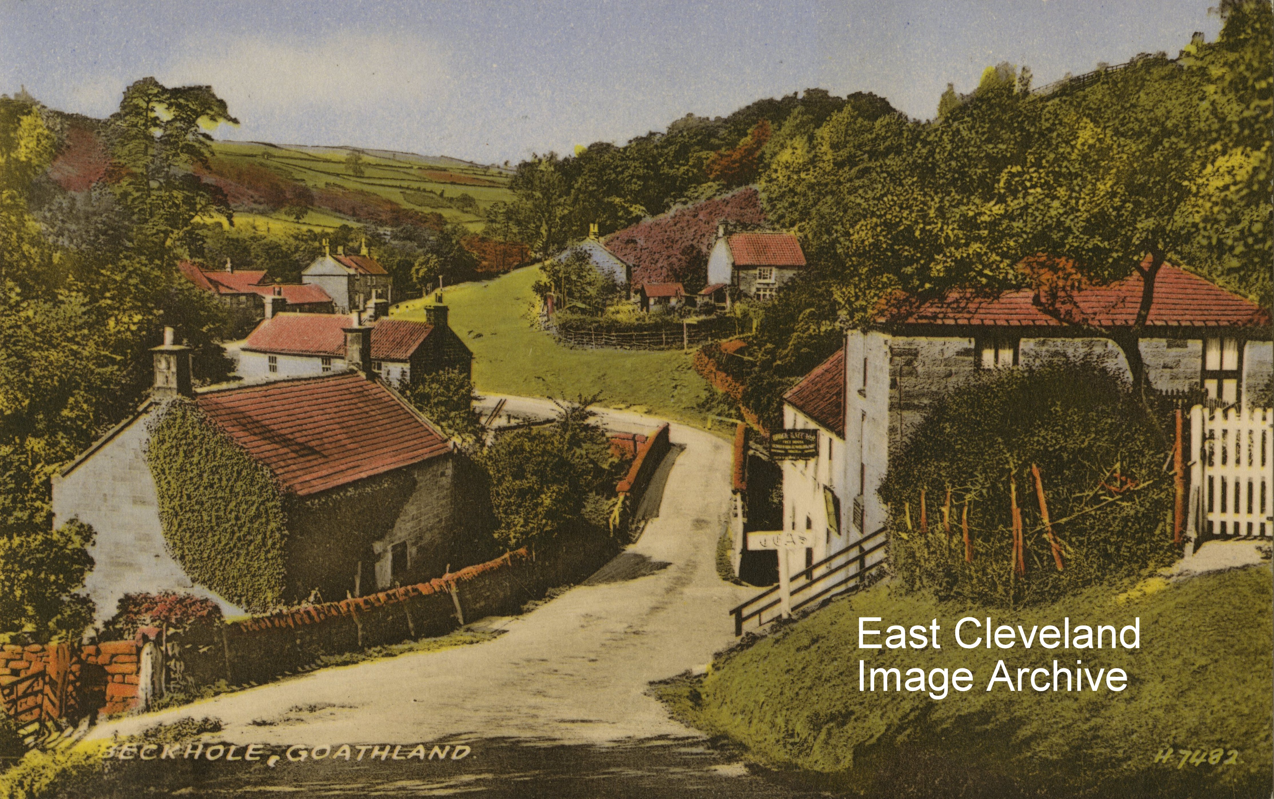
This postcard view of Beckhole – which grew up round an old fording point of the Murk Esk – in Victorian times was much visited having extensive orchards with visitors enjoying the many walks and waterfalls; as well as taking tea beneath the apple trees. Image courtesy of John G Hannah.
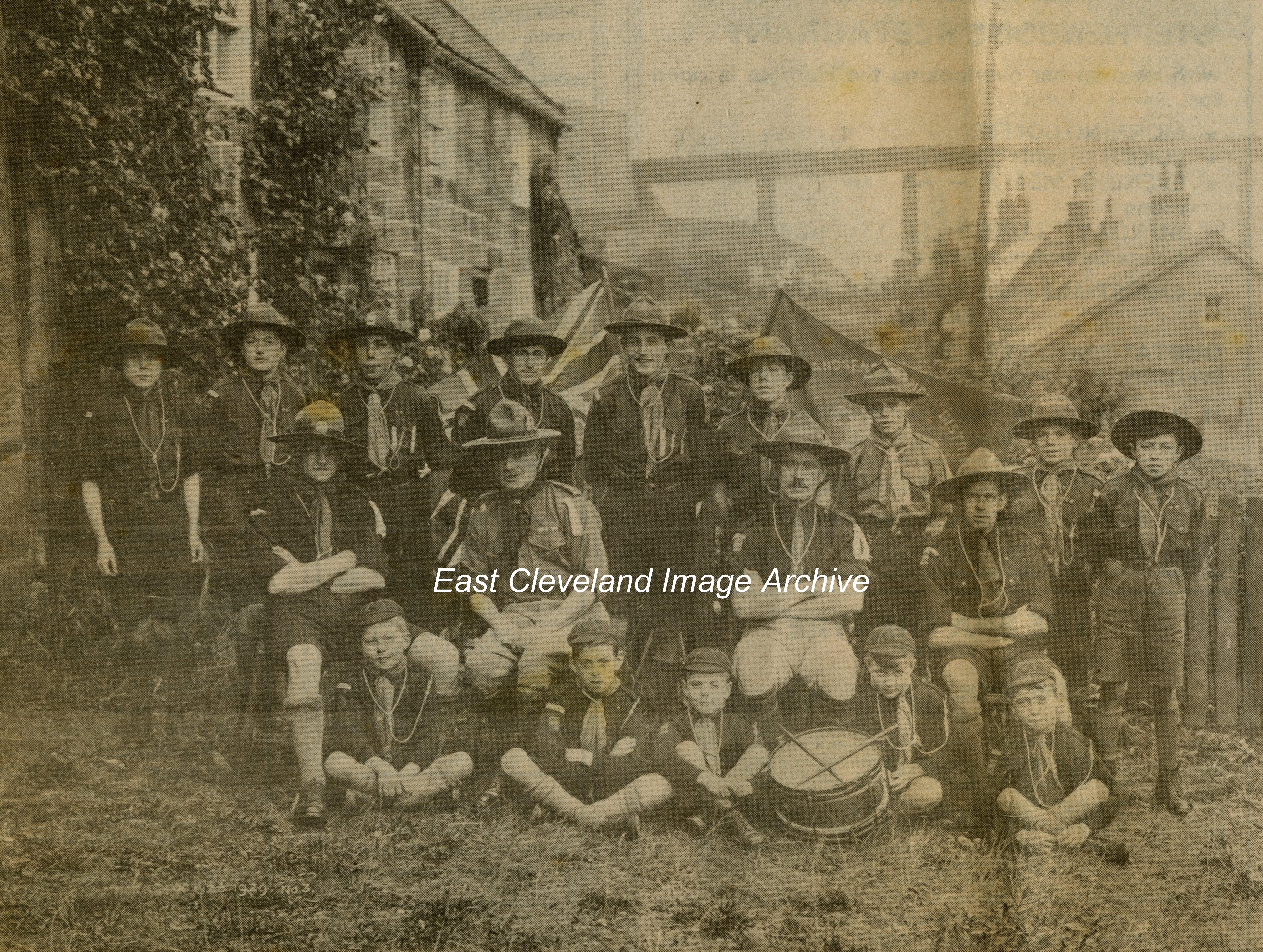
Pictured at Sandsend with the railway viaduct in the background; the Cubs and Scouts of Sandsend had assembled. Back row (left to right): D. MacLean, R. Sleightholme, John Young, G. Crosby, H. Crosby, H. Foster, W. Mead, T. Waller, W. Stamp, C. Thomas. Middle row: J. Robson (Cub Master), Dr. Tinley (District Commissioner), T. Walker (Scout Master), W. Braithwaite (Assistant Scout Master). Front row: F. Stonehouse, S. Sparks, B. Waller, T. Pybus, Reg. Carass . Image courtesy of John G Hannah (originally from Whitby Gazette “Down Memory Lane” 1980).
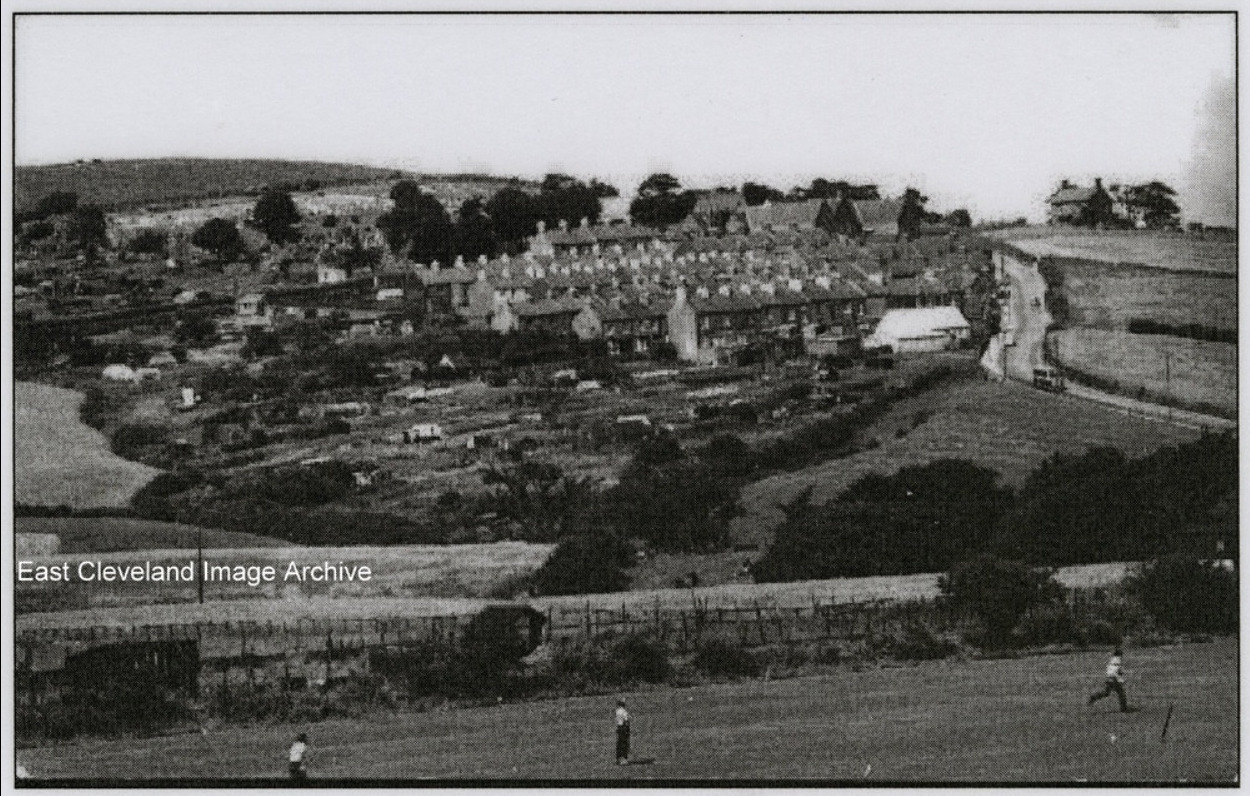
A view of New Skelton from North Skelton (apparently from the shale heap). This in the days of Stanghow Lane Secondary School, now sadly demolished and the chapel sited opposite what is now Byland Road. Dating is unsure so we welcome a suggestion. Peter Appleton has assisted with: “There is a bus going up the road. It looks to be one of those from the 1960s that had a flat front, flat back and rounded corners to the coachwork. All three boys in the foreground are wearing long trousers. Are they still in school uniform? When did long trousers become the normal uniform for lads of this age? The cemetery looks to be fairly full. When was the next extension added?” Can anybody advise on that date?
Image courtesy of John G Hannah, thanks to Peter Appleton for the update..
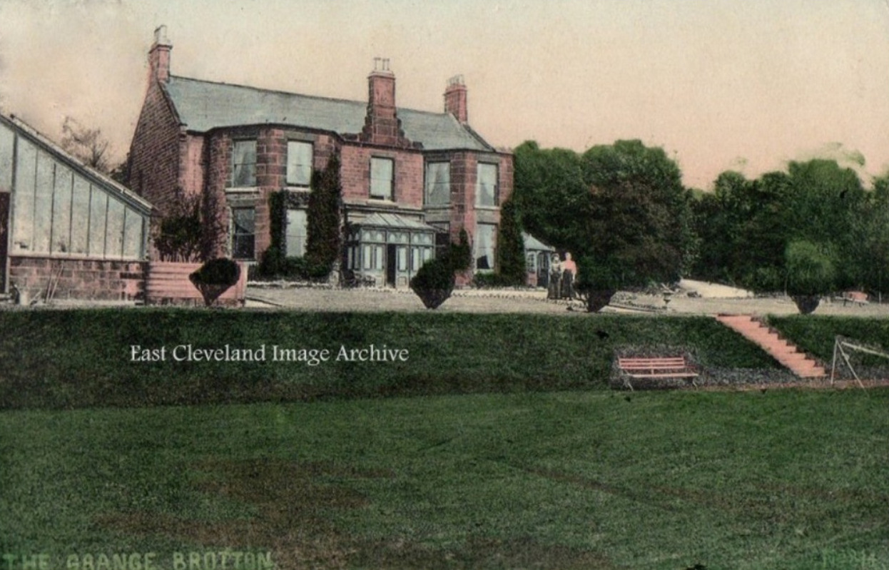
The Grange, Brotton standing on Coach Road was originally the home of Robert Morrison. He started the ironstone mine (Morrison’s Pit) close to his home, from 1881 the house was occupied by Joseph Taylor. Listed in the Census of 1901 as Accountant and Secretary of Brotton Gaslight and Coke Company. The two figures in the postcard image could be Margaret Taylor (wife) or Margaret (daughter) or possibly Beatrice Rush (maid). Roger Hardcastle tells the Archive: ” My great grandfather was a doctor; Thomas Taylor. He had five children and one of them was George, born in 1885 who was my grandfather. It was our branch of the Taylor family that lived in the Grange at Brotton. Going through old photo albums there is a photograph of the Grange”. Charles Taylor advises: “George Taylor was (I believe) the brother of Tom Hugh Taylor who was my grandfather and I have a couple of pictures of gatherings in the Grange garden in which the whole family is shown. Roger Hardcastle is related; as we share the same great grandfather and our grandfathers were siblings”. Image courtesy of John G Hannah and thanks to Roger Hardcastle and Charles Taylor for the updates.
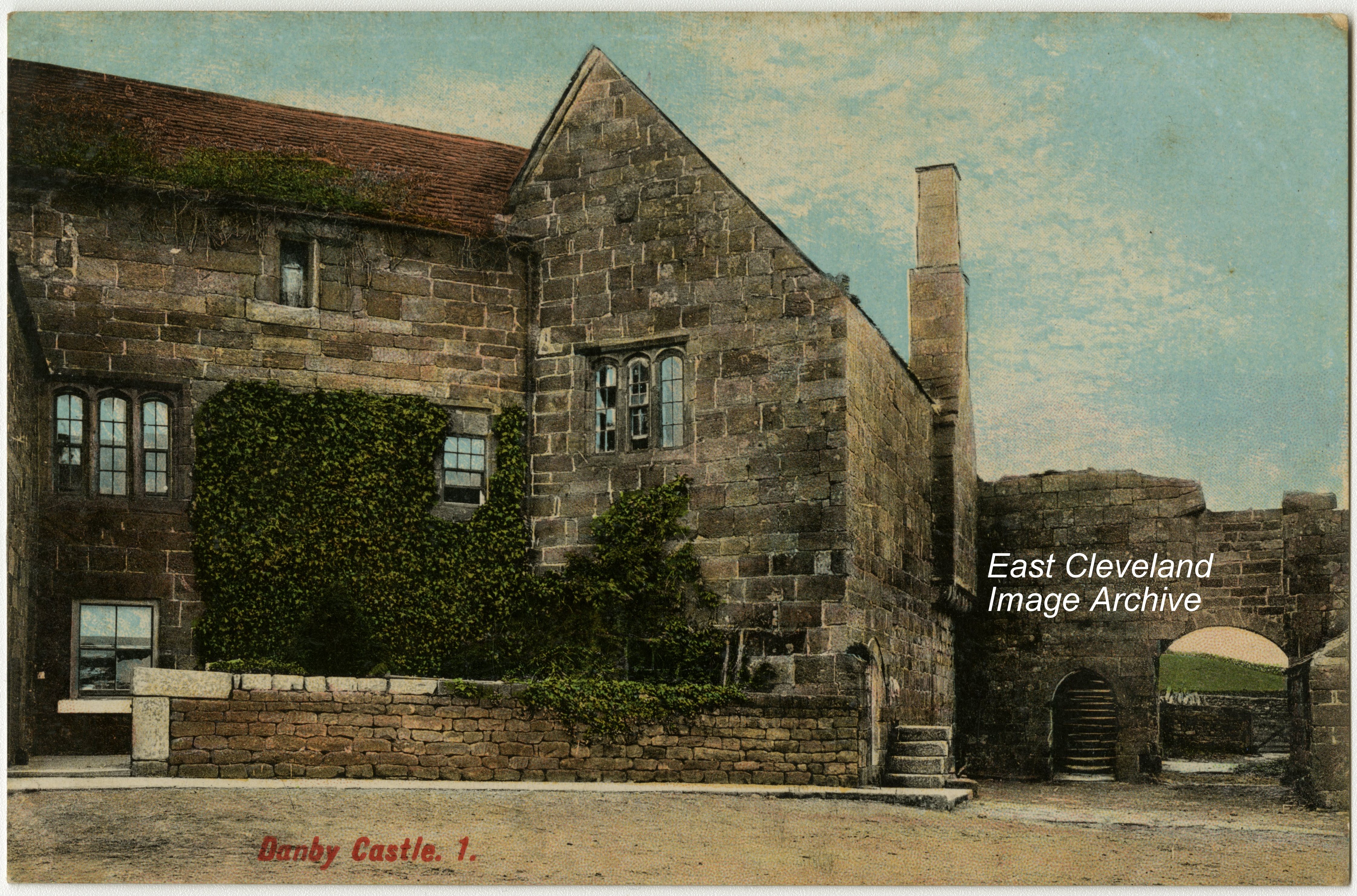
A hand tinted postcard view of Danby Castle by Tom Watson of Lythe; although when viewed from the road more resembles a fortified farmhouse! It dates from the early 14th century and was built by Baron le Latimer. It was visited by King Edward II in 1323, Danby Castle; it was and still is a popular postcard theme.
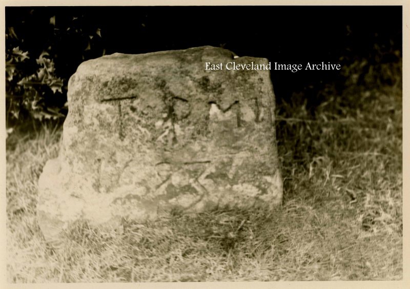
Old Liverton, stone dated 1693; it is now known that the grave is that of Thomas Porritt of Liverton, who died on 1st March 1693. The Quaker burial ground at Liverton is located at Red House farm. Dating from about 1669 to the early 1800’s, it is believed that up to 50 persons are interred there. Little is known about the Society of Friends in the area, But may have started after the visit by the founder George Fox preaching in Cleveland around 1654.
Image courtesy of The Pem Holliday Collection, additional information courtesy of Dr Alastair Laurence ’History of Liverton’ and thanks to Alan Jones (who has researched the Liverton Quaker burials) for the headstone information.
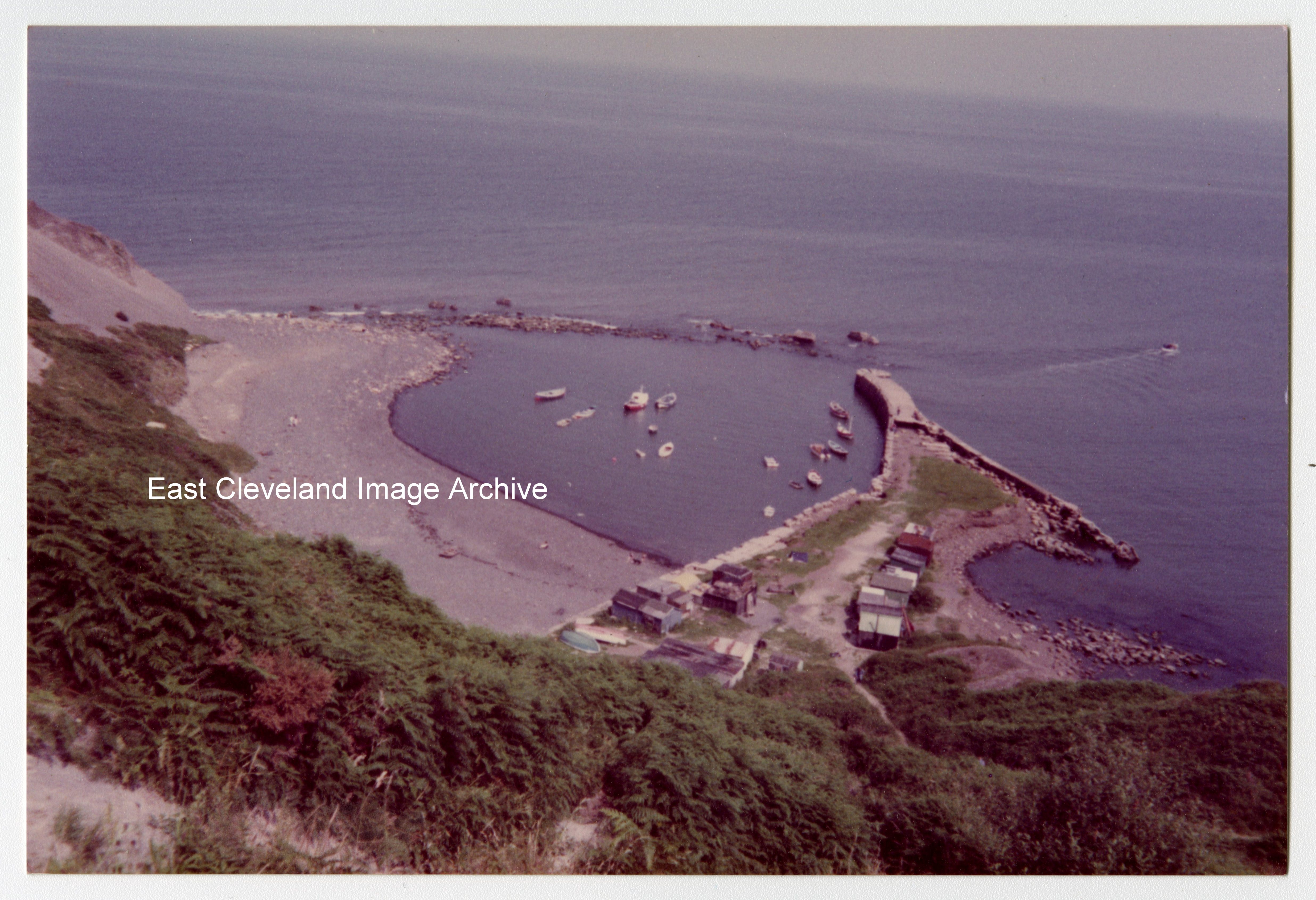
Originally a fishing port, the harbour at Port Mulgrave was used as the only feasible transportation point for iron stone quarried from the Grinkle Mine. In use from the late 1870s till 1917; the machinery on the jetty was being dismantled in 1934 when the wooden gantry accidentally caught fire. The Royal Engineers subsequently destroyed the breakwater on the seaward side to prevent German invasion, even less remains that that shown in this 1982 image.
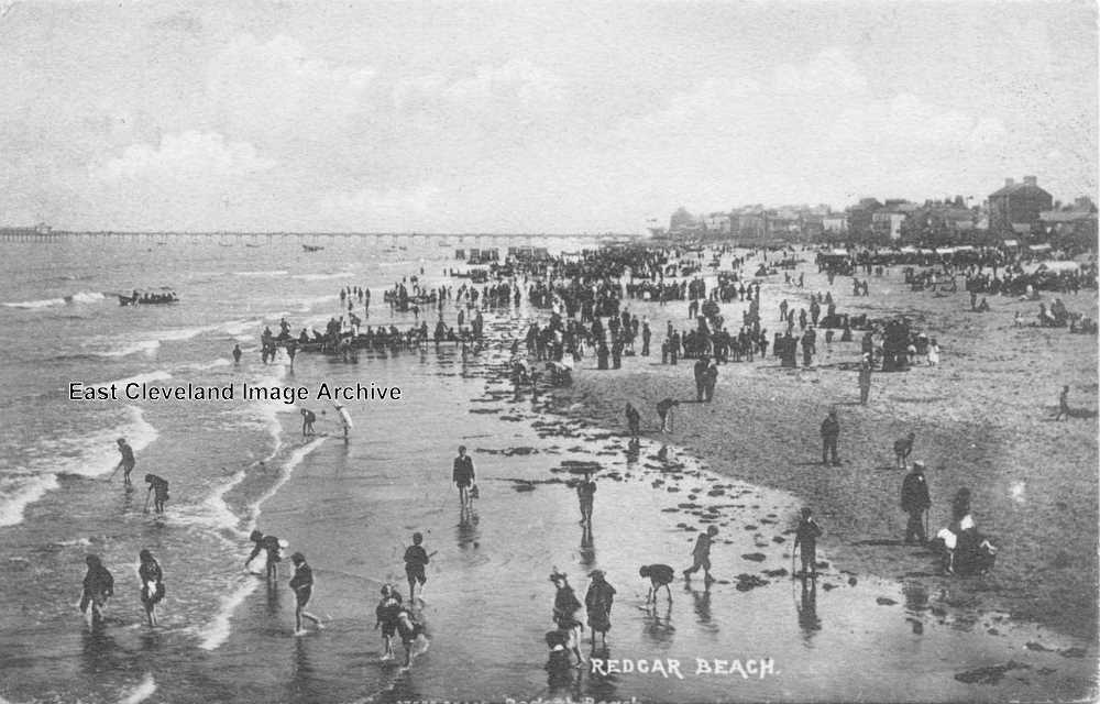
With trousers rolled up and skirts modestly raised, trippers venture into the briny, but a distinct lack of swimmers is evident in this postcard view of the beach at Redcar. Peter Appleton has pointed out: “If you cover up the bottom half, the rest of the scene is not dissimilar to that created by the film crew for “Atonement”: equipment drawn up at the head of the beach and lines of people leading down to the water’s edge.”
Image courtesy of Maurice Grayson, thanks to Peter Appleton for the update on similarities.
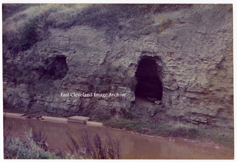
The caves at Skinningrove beside Kilton Beck were used as air raid shelters for the staff and patients of Skinningrove Hospital during the Zepplin raids of World War I. Brian Sawdon confirms this with: “These caves were also used in World War II; my mother took shelter there”.
Image courtesy of the Pem Holliday Collection and thanks to Brian Sawdon for the update.
Recent Comments