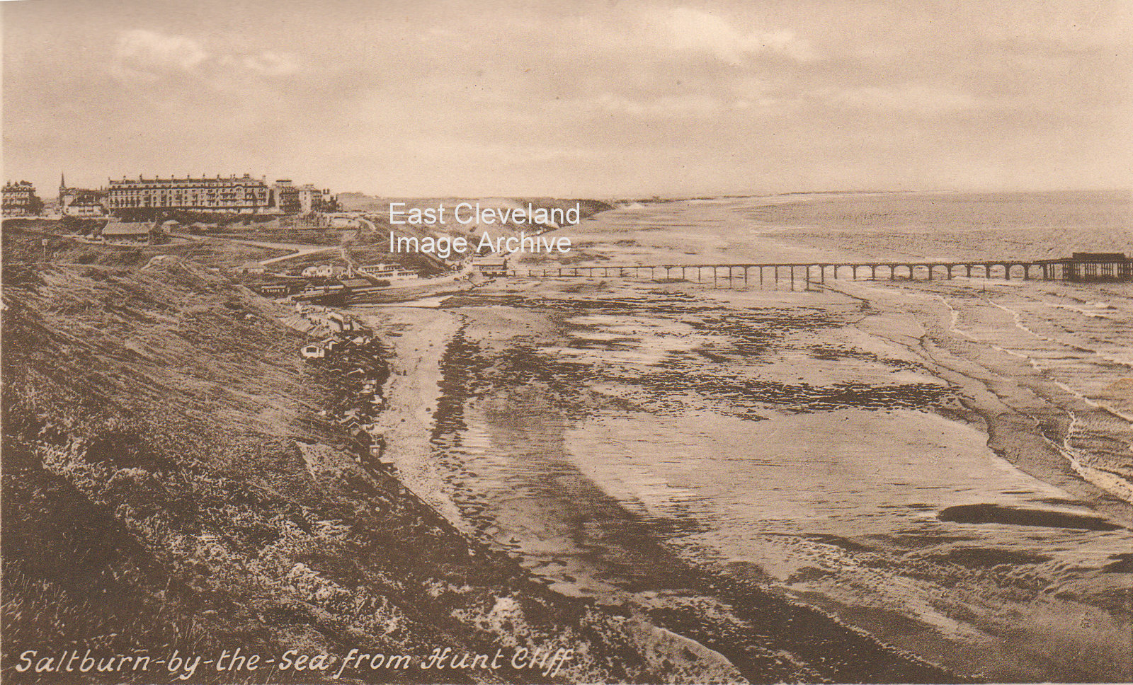
A photograph often taken today, although now the skyline is much busier with the heavy industry at Teesmouth and the huge blast furnace. The image was taken from a booklet of picture postcards, showing the original pier. Callum Duff tells us: ”The picture above shows the pier after it was shortened in 1874 after a motor launch destroyed the landing stage and the pierhead. The original length of the pier was 1500 ft and it was shortened to the pictured length of 1250 ft. This length continued until the pierhead was destroyed by heavy seas in 1974 and the pier shortened to it’s present length. I suggest that this photograph was taken sometime between 1924 & 1939. Andy Gibson also advises: ”The latest date I can’t comment on, but I happen to know that the twin houses at the East end of Marine Parade were built in 1928, so the date range must start then, at the earliest.” Callum further adds: ”Looking at this postcard again, the pier has been repaired after the SS Ovenbeg breach so it must be after 1933 and The Spa Pavilion has yet to gain its concrete apron of windows on the east side of the building which were added in 1935. Therefore this card can be dated between 1933 and 1935.”
Thanks to Andy Gibson and Callum Duff for all the updates.
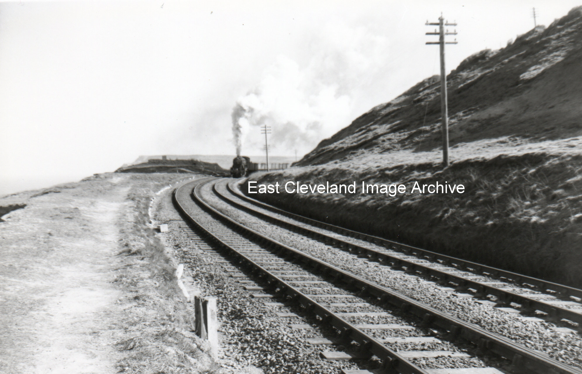
We wondered where the train was and Mark tells us: ” That’s a War Department locomotive on a train from Skinningrove at Huntcliff, roughly where the ring shaped sculpture is, making a racket no doubt, it looks windy but the exhaust is been blasted skywards.” Eric Lindsay asked: “Was the line Saltburn to Whitby all dual tech or only part ? Sandsend viaduct appears to be single track.” Terry Robinson answered the query: “The track was dual as far as Crag Hall, then was single line with passing loops at stations along the route, all the viaducts and tunnels were single line.”
Image courtesy of Ted Morgan, via Eric Johnson; thanks to Mark for the update; also to Eric Lindsay and Terry Robinson for the update on dual tracking.
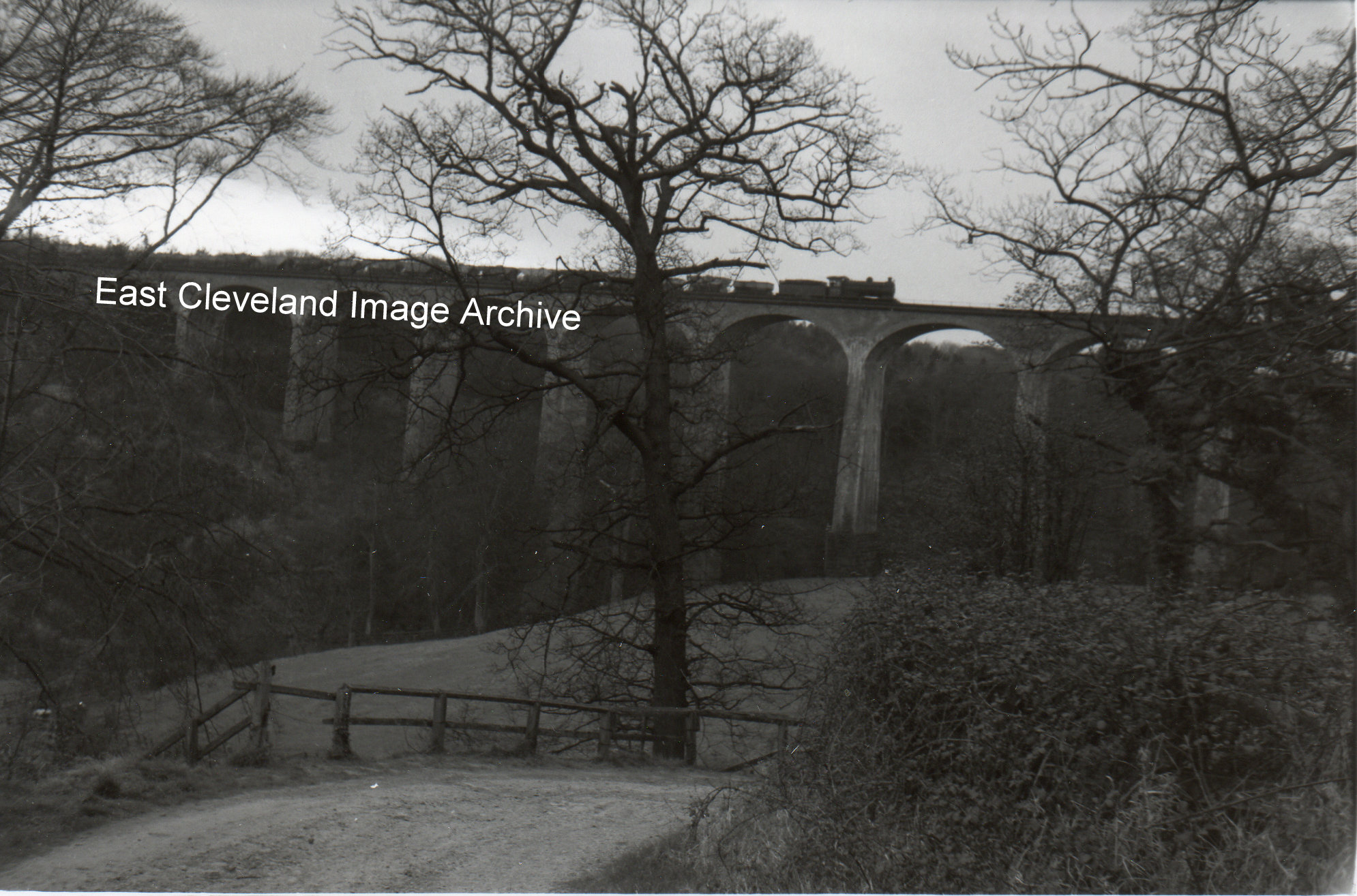
Saltburn viaduct and a steam train with a rake wagons filled with ironstone passing over.The viaduct today carries trains from Boulby Potash mine and service as necessary the works at Skinningrove.
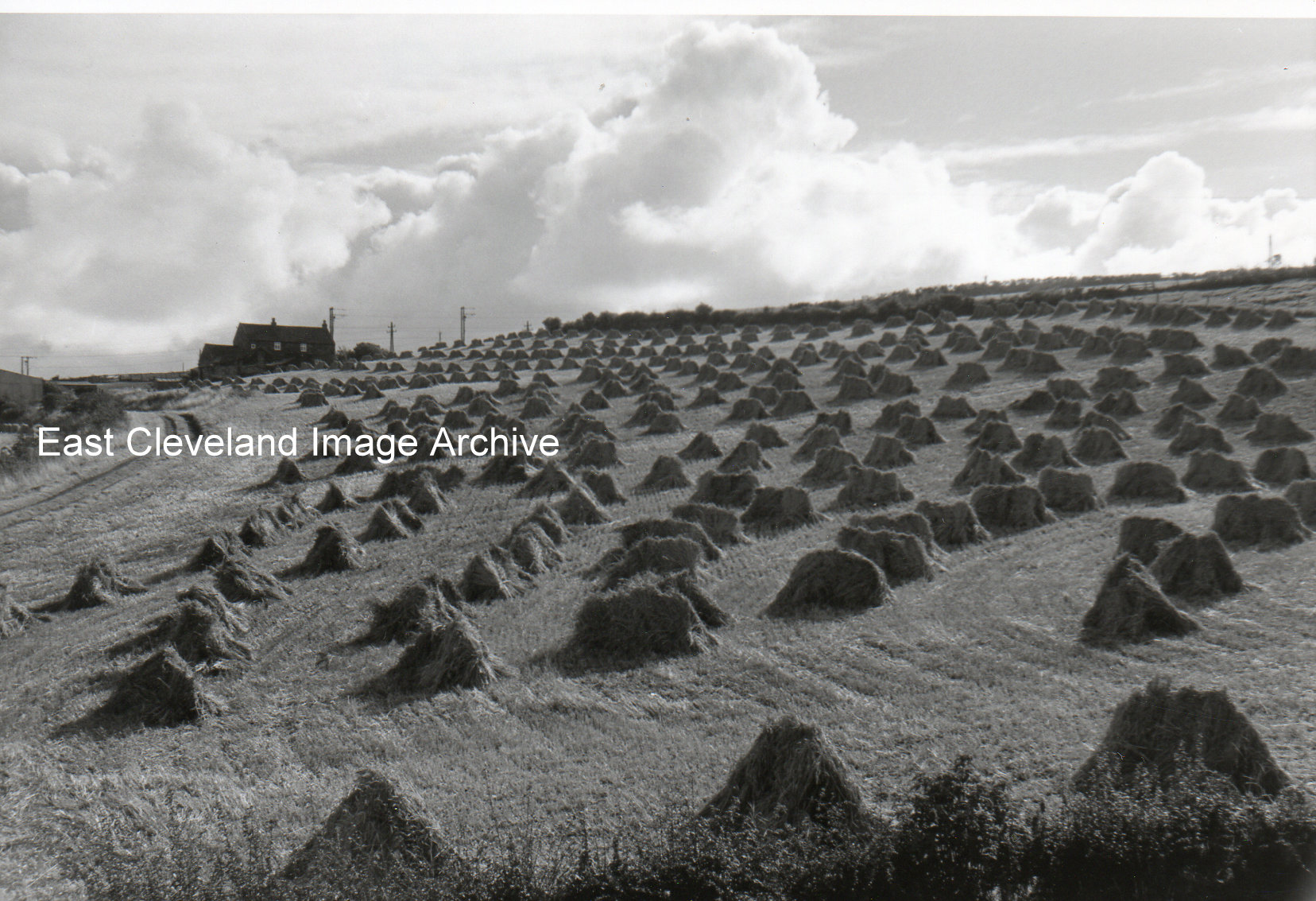
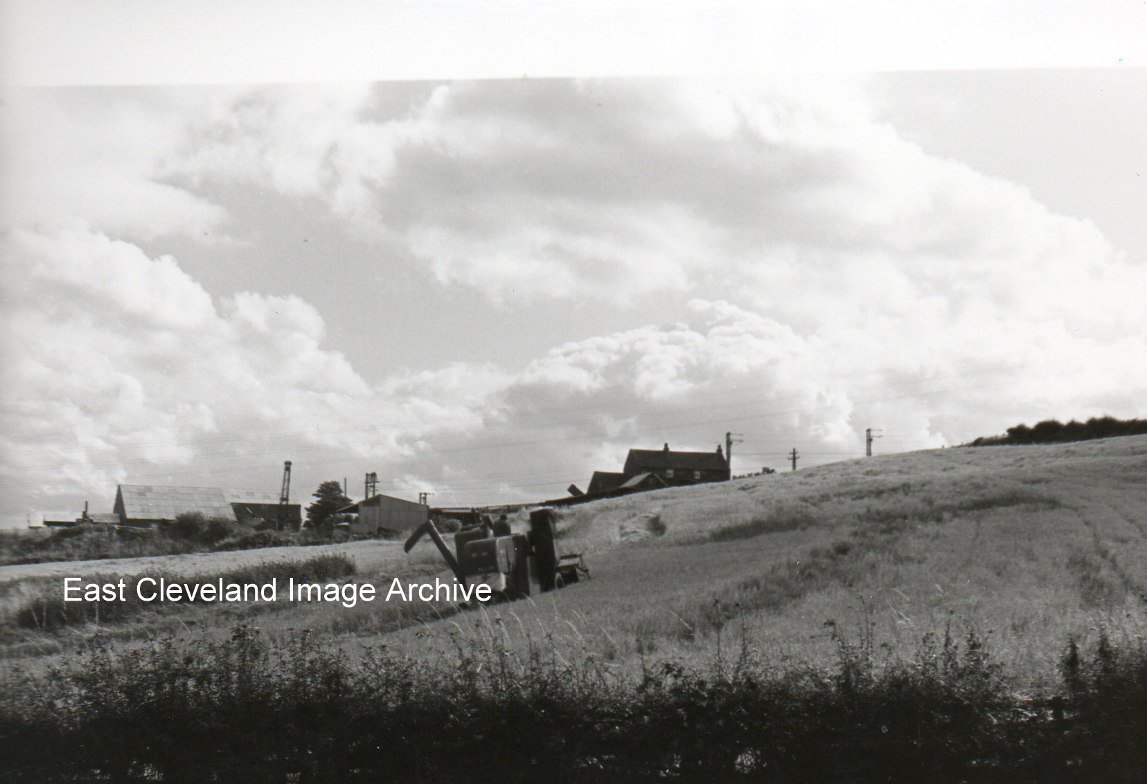
It was hard work stooking those sheaves and there was a skill to get them to stop where they were put without them falling down. Low Cragg Hall Farm (then the farm of Robert Hoggarth and presently Mick Bulmer), features in the background.
Image courtesy of Eric Johnson and thanks to Mick Bulmer for identifying the farm.
A different farm this is Low Cragg Hall Farm (Robert Hoggarth’s), notice the combined harvester a little different to what we see today. At the left of the view is the high roof of Atkinson and Thompson’s welding shop, later Widowhood woodworking and now is the housing estate of Carlin Park.
Image and information courtesy of Eric Johnson, thanks to Derick Pearson for the update.
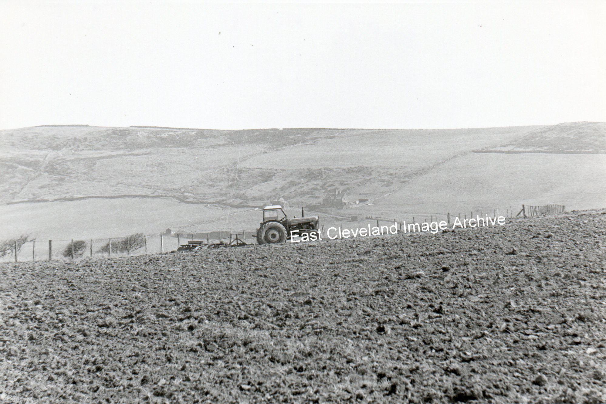
What a lovely picture, a farmer working hard cultivating ready for a crop. What a view with the cliffs in the background; also visible beyond the tractor are the buildings of Warren Cottage, a perfect setting. Alan Wood advised the Archive: “Tom Hart of Hummersea Farm.” Karen Lyons adds: “My father and grandparents used to spend their annual holiday camping on this farm in the 1930s. The Harts were very hospitable.”
Image courtesy of Eric Johnson, thanks to Alan Wood for the name of the farmer. Also to Karen Lyons for the update.
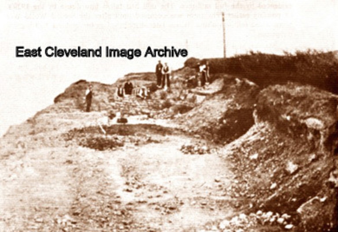
A lovely sepia photo of Huntcliff, now known to be from ”Skelton in Cleveland Website” produced by Bill Danby. The scene is an exploratory dig at the Roman look out station on Huntcliff [the site has now disappeared by erosion]. From Bill’s website we are informed that at the excavation ”25 coins were found there, the earliest showing Emperor Constantius 337 – 361 and the latest dated to 395 – 408. The fort-like station was square with thick stone walls and a 20ft ditch. Excavations revealed a well, 14 feet deep and 6 feet wide, in which were 14 skeletons, leading to suppositions of a successful attack by the Anglo-Saxons. Roman pottery, an iron axe, a bronze vessel and a jet finger ring were also found.” Simon Wedgewood advises: “It is indeed the 1912 excavation. The picture appeared in a book of old photographs Saltburn published by Sotheran’s of Redcar. The finds are stored at the Dorman Museum and can be inspected on application.”
Image and details courtesy of Bill Danby’s Skelton in Cleveland Website, thanks also to Mark T., Eric Johnson and Simon Wedgewood for the updates.
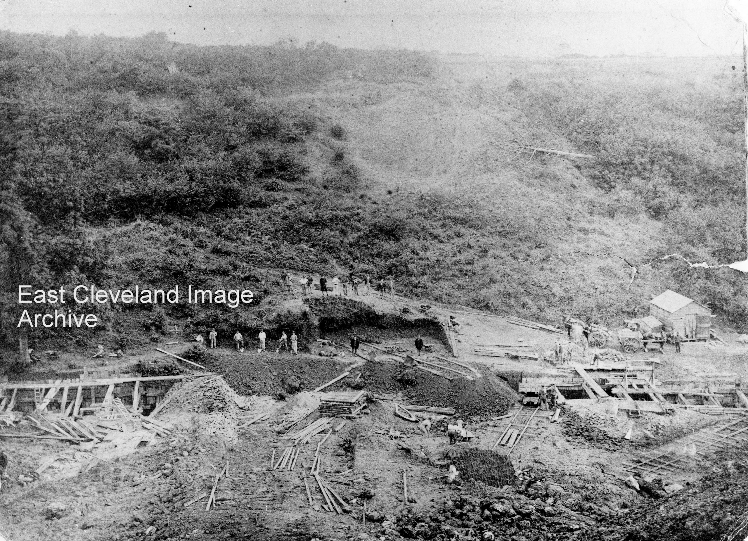
When first posted, the Archive was aware it was a culvert being dug out; however David Richardson came to the rescue with: “Yes it is Twizziegill Culvert during its construction.” As the Teesside to Whitby via the coast line opened in December 1883, creation of the culvert must have been prior to this date. Visible are a lot of workmen, but not doing any work; obviously the photographer was expected.
Image courtesy of Cleveland Ironstone Mining Museum and thanks to David Richardson for the confirmation.
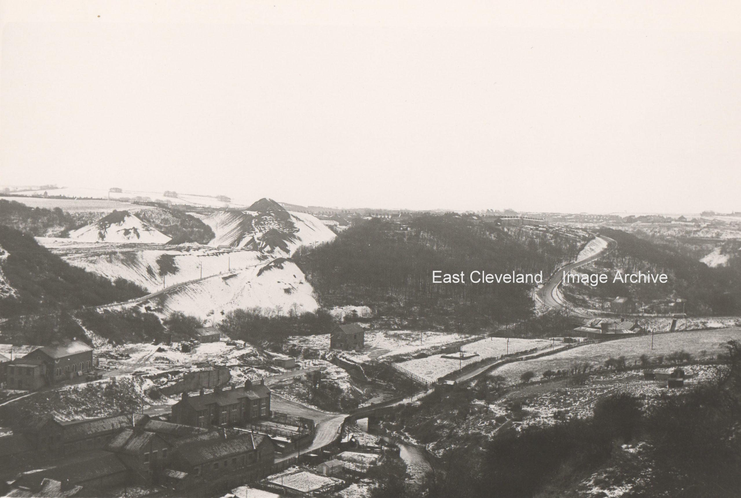
A serene snow-covered image taken from Carlin How, probably from near the entrance to Skinningrove Iron and Steel Works, belying the gritty industrialised nature of the area. A light dusting of snow, but you can still make out Overman’s Cottages, with the mine to the rear and Mill Bank snaking it’s way to Loftus. The shale heaps look almost like mountains with their covering of snow.
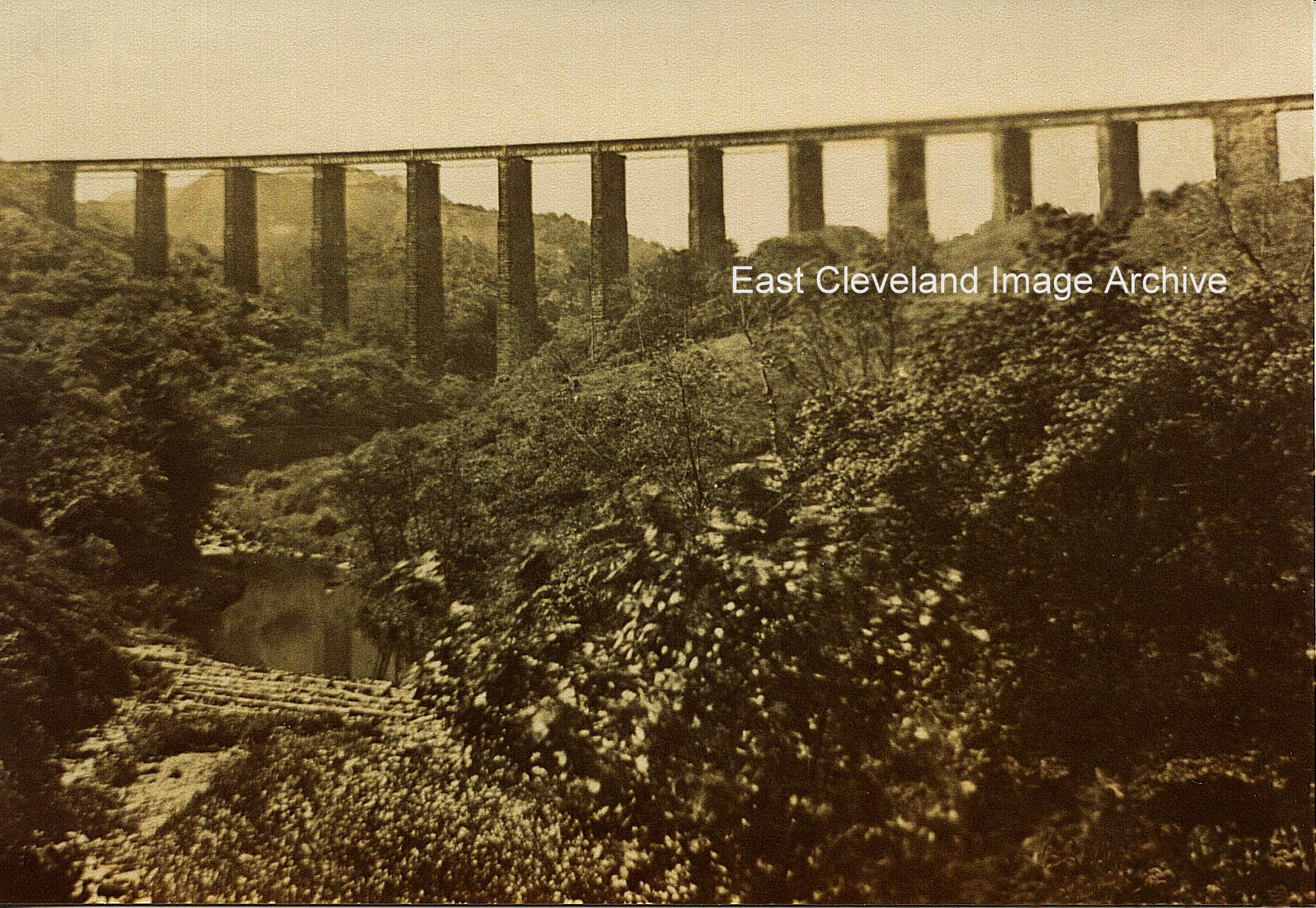
You can see from this much earlier image how light and open the valley was originally. I wonder if the viaduct had been built with arched spans whether the problem would still have manifested itself. I’d need an engineer to tell me – is there an engineer in the house? Simon Chapman advises: ”Kilton Viaduct opened for traffic in 1867 and was later filled in with shale to create a massive embankment so that mining could take place beneath it. During this work which took years, one of the pillars showed signs of stress possibly because of uneven tipping, so traffic over was stopped for a fortnight until the problem was remedied. So if the viaduct had been built with arches it would still have ended up as we see it today.”
Image courtesy of the Pem Holliday Collection and others, thanks to Simon Chapman for the update.
Recent Comments