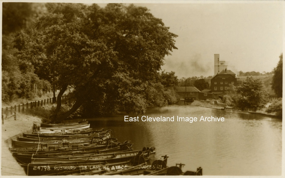
A Judges’ postcard view of the boats drawn up at Ruswarp. As an unused card, date is unknown. Assistance would be welcomed in this situation?
Image courtesy of John G. Hannah.
|
|
||
|
A Judges’ postcard view of the boats drawn up at Ruswarp. As an unused card, date is unknown. Assistance would be welcomed in this situation? Image courtesy of John G. Hannah.
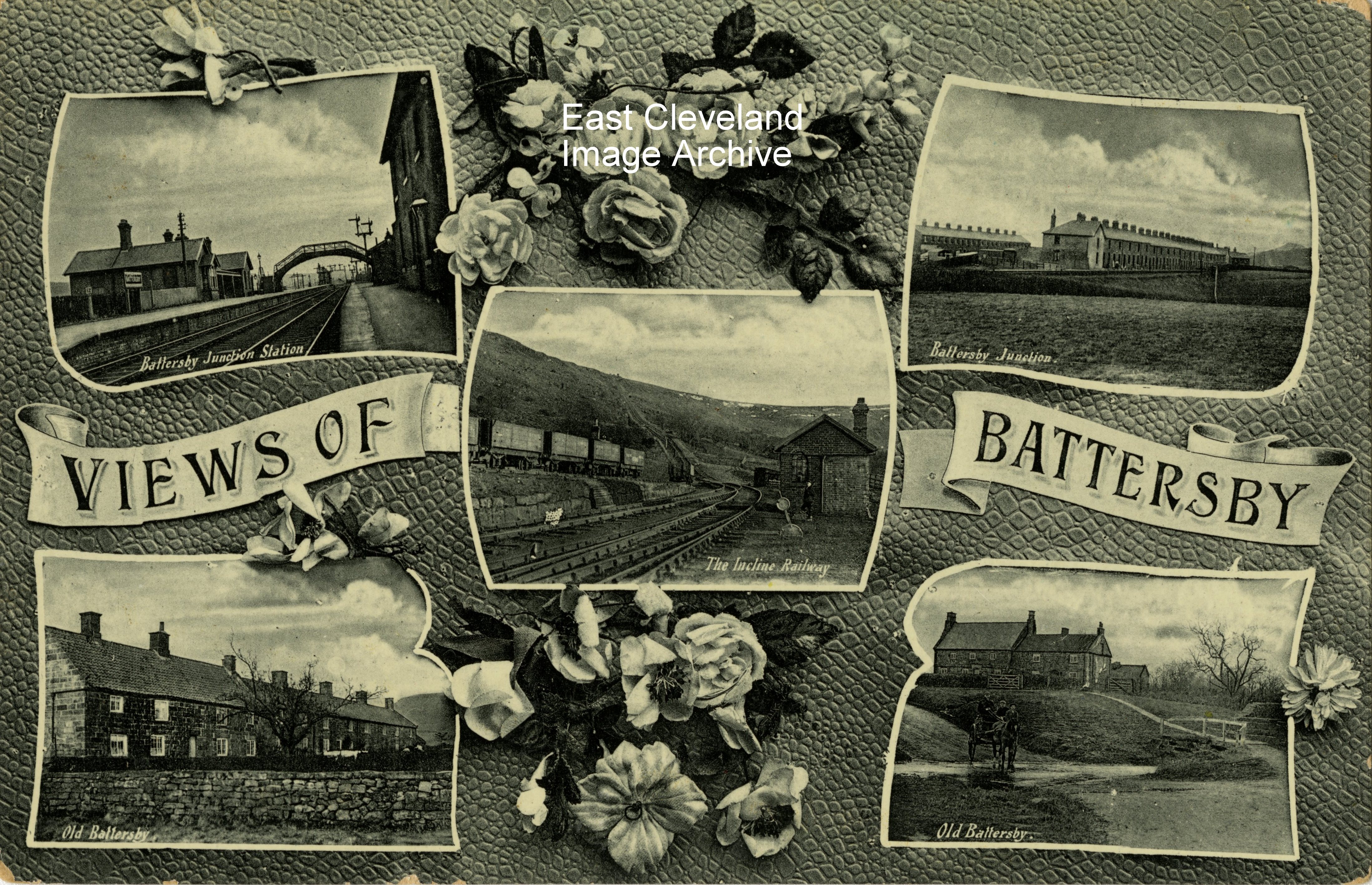
William Richardson (of Loftus) Cleveland Series postcard, shows views of Battersby, including the Incline; the now infamous walking path up to the top of the moors. Unused we believe it dates from the same period as the Bilsdale views.
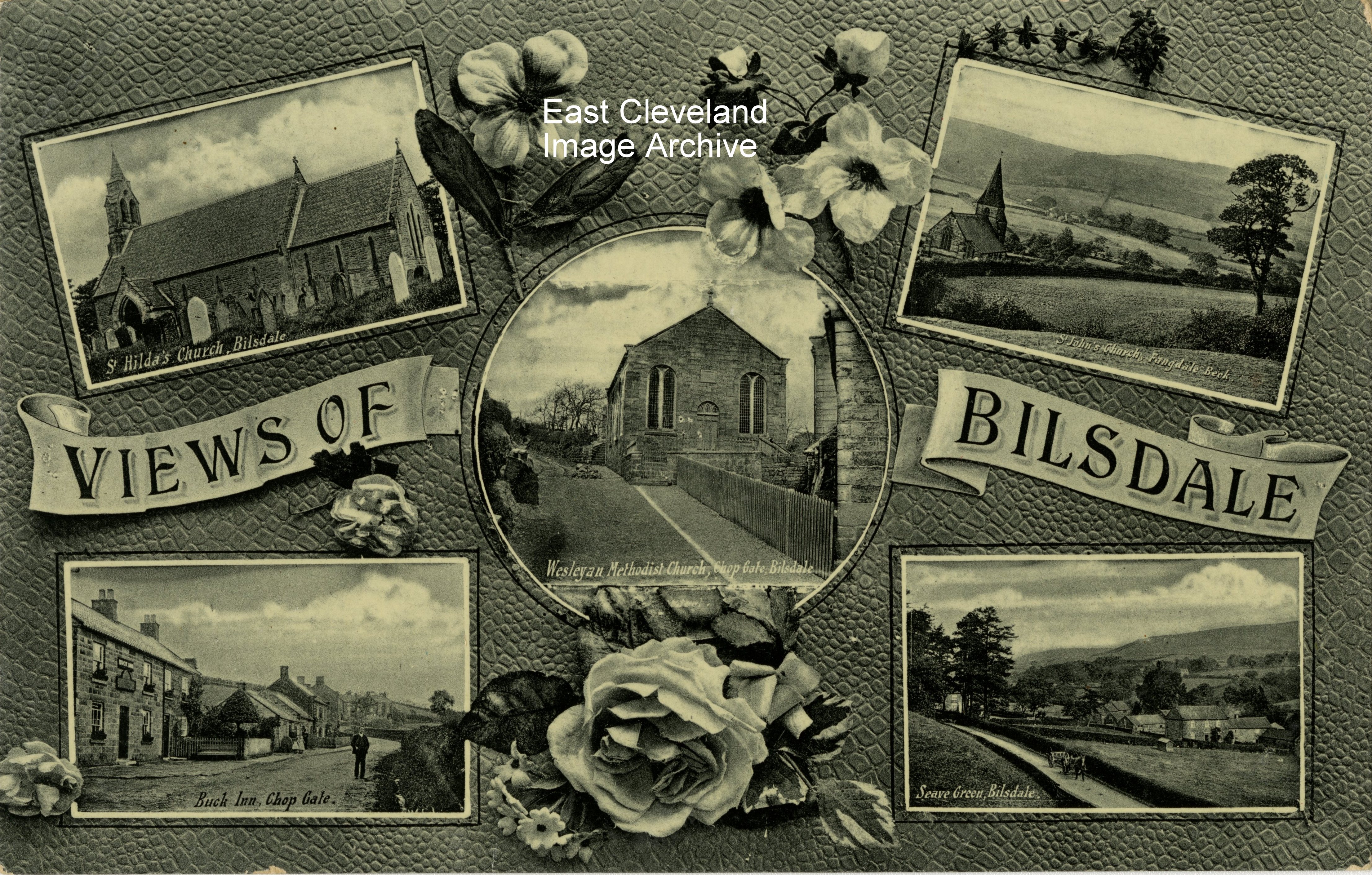
A William Richardson (of Loftus) Cleveland Series postcard, showing views of Bilsdale including the post office (bottom left corner); it is believed that the group includes Agnes Leckonby, who is till a resident of Bilsdale. Although unused it bears a note ’Visited here July 31st 1915’, which implies a personal memoir collection and possibly collected at a later date? 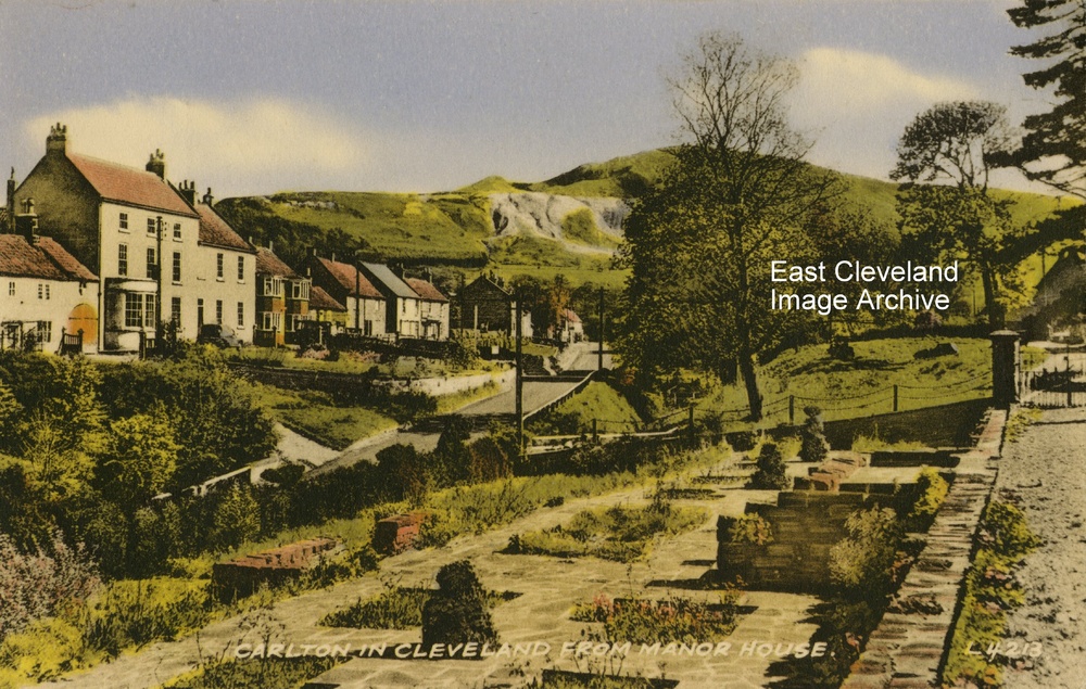 A view from the Manor House at Carlton of Carlton Bank, better known now for the gliders and Lord Stones café at the crest of the hill. This view from a postcard produced by Valentine’s and is post marked 17th June 1956. Image courtesy of John G> Hannah. 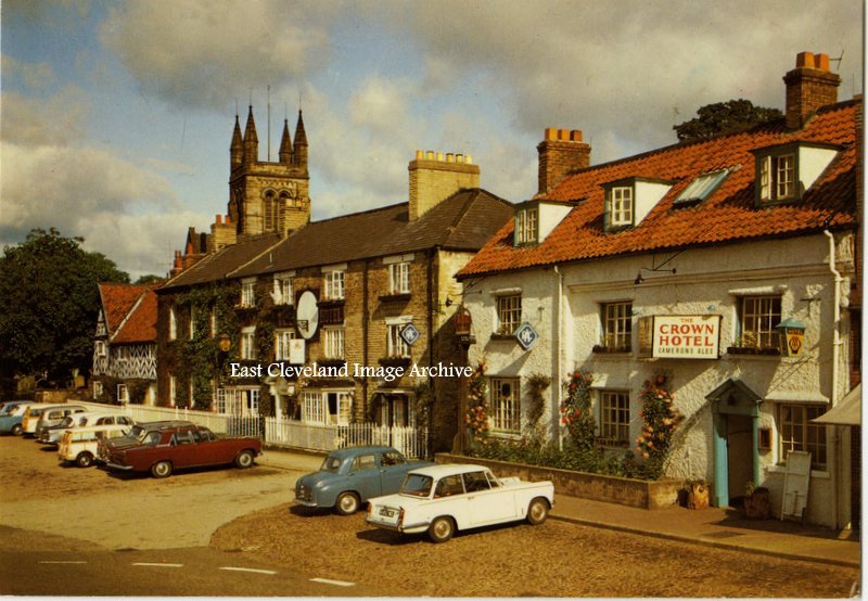 An Arthur Dixon coloured postcard from the 1960’s showing Helmsley on a quiet but very sunny afternoon. No squabbling over parking spaces then; there were plenty for all those affluent enough to possess a vehicle. Image courtesy of a friend of the ECIA. 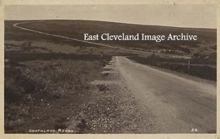 And a desolate piece of moor it is, even today this area has a reputation for bad weather; particularly in the winter. This view is of the road having past the present Fylingdales “pyramid” and heading towards Sleights. Image courtesy of a supporter of the Archive. 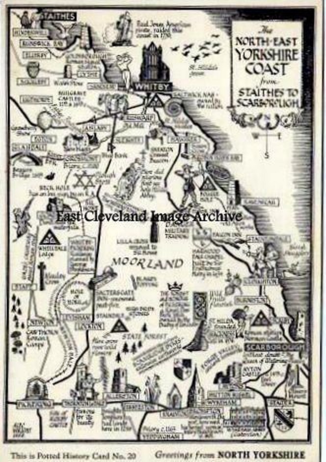 A delightful postcard view is presented as a line drawing map of the many places to visit on the North York Moors. It only portrays a fraction of the wonderful places and views that are available in our local vicinity. Image courtesy of a supporter of the Archive. 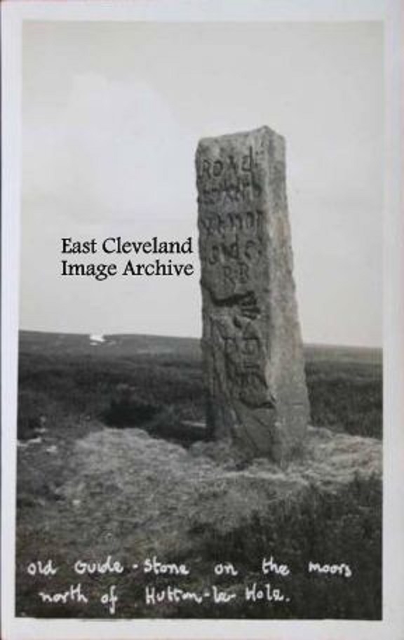 Standing above Hutton le Hole this is one of the many ancient stones on the North York Moors. This stone bears four way inscriptions, each side has a “Road to …” and then a hand symbol. Their dating continues to be a mystery. Image courtesy of a supporter of the Archive. 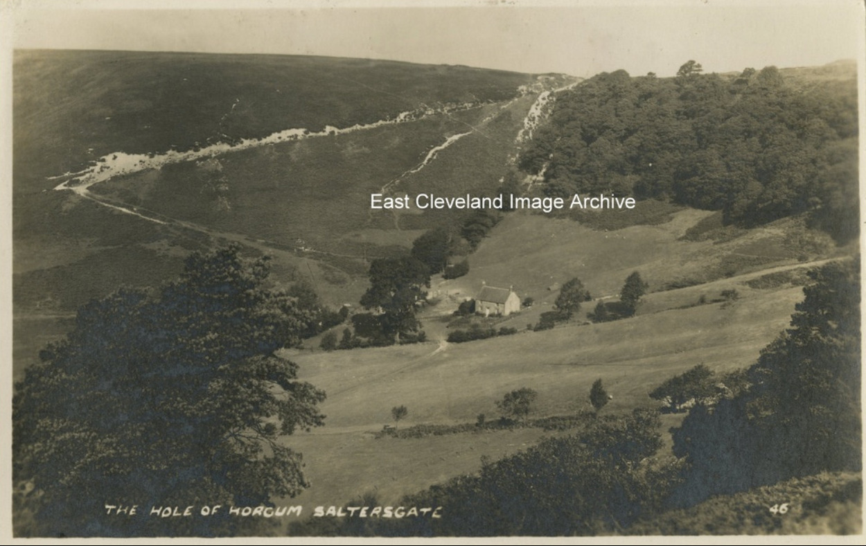 The Hole of Horcum is a hollow in the valley of Levisham Beck, the hollow is 400 feet deep and stretches 3/4 of a mile across; local legend has it that the amphitheatre was formed when Wade the Giant scooped up a handful of earth to throw at his wife during an argument. This postcard view gives a true impression of the enormity of this hollow. Close to the road between Sleights and Pickering features an impressive incline feared by many drivers. Image courtesy of John G Hannah. 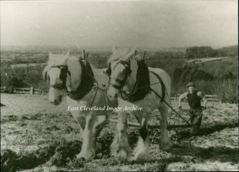 The Archive believed this to be possibly in the Esk Valley, but welcomed further details. Did you know the ploughman? William Castle has told us: ”In Gordon Clitheroe’s book ‘Ryedale’ he has this picture as Edgar Dowson ploughing near Hutton-le -Hole, probably just before the II World War. The Beck Isle Museum in Pickering (where Mr Clitheroe is Curator) also has this picture, possibly the original. Colin Grice has a further update: ”It is very likely just east of the road between Hutton-le-Hole and Keldholme – looking towards Kirkbymoorside (hidden). The Dowsons lived at Halfway House just up the road.” Image courtesy of Joyce Dobson and Keith Bowers, thanks also to William Castle and Colin Grice for the updates. |
||
Recent Comments