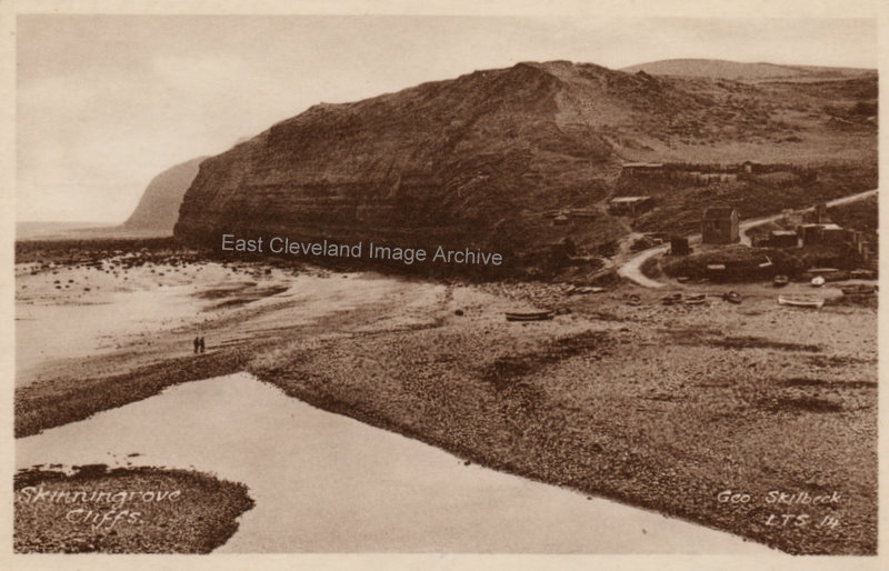
A lovely Skilbeck postcard of Skinningrove; our questions about the buildings have been answered by: Harold Richards tells us: ”I have many happy memories of Skinningrove, I was born there in 1944, and lived with my Gran and Grandad in Chapel Street. As a kid of 12 or 14 years I used to knock around with Arthur Breckon, also of Chapel Street; his dad Teddy Breckon was in the Coastguards in the mid 1950’s. I was told more than once by Teddy Breckon, the large brick building on the right of the photograph beside the road going up to Dickie Bothroyd’s farm, was a mortuary. This was used if anyone had been washed up on the sands who had drowned. I remember this building well made of old red bricks and a large wooden door. My Grandad was Jack Richards (an image of him is on the Website – in the pit with a rat on his knee). My Gran, Amy Richards was a member of the Skinningrove Women’s Institute for many years. I left Skinningrove in 1980, when the heart was ripped out of the village as the houses in Chapel Street and the High Street were demolished; as well as Cliff Street, etc. To me this was very sad, as the houses would still have been stood now.” Colin Hart can tell us: ”The boatmen’s hut was and still is situated just before the bridge onto the beach, it was used for social events, later used by the Gala Association and is now used by the pigeon men.” Terry Baker adds: “It really is sad when your fondest memories of a place – the buildings and the houses and the lanscape are all bulldozed. But it’s nice when you can reminisce the old times, or when someone helps you explain things in a photograph, like you have done here. It has been a real pleasure reading this post, with the lovely description of the contents of the photograph. It makes me want to revisit my childhood and try and remember my own photographs from then.”
Image courtesy of Mrs Lilian Waton; thanks to Harold Richards, Colin Hart and Terry Baker for these updates.
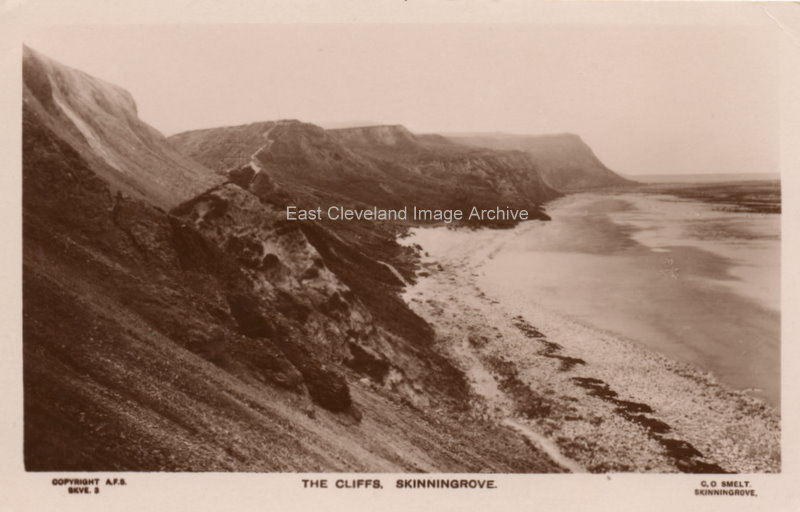
A lovely shot of Cattersty sands and the cliffs, an A.F.S. postcard distributed by C.O. Smelt who used to have Skinningrove post office. The postcard is believed to date from 1931.
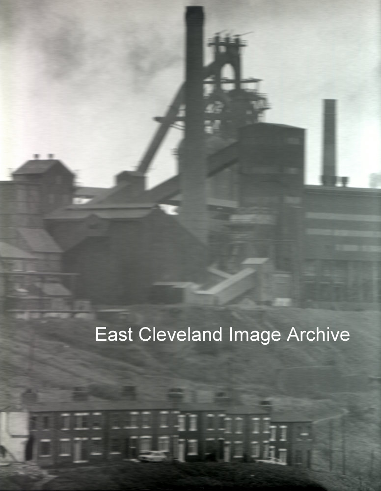
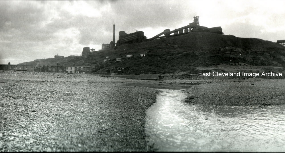
It is rather a cloudy dark moody photograph loaned to us by Eric Johnson; but a lovely image never the less. Taken from an unusual position shows the works off very well.
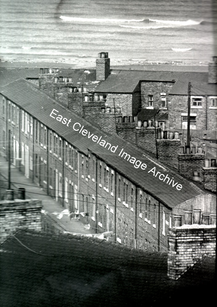
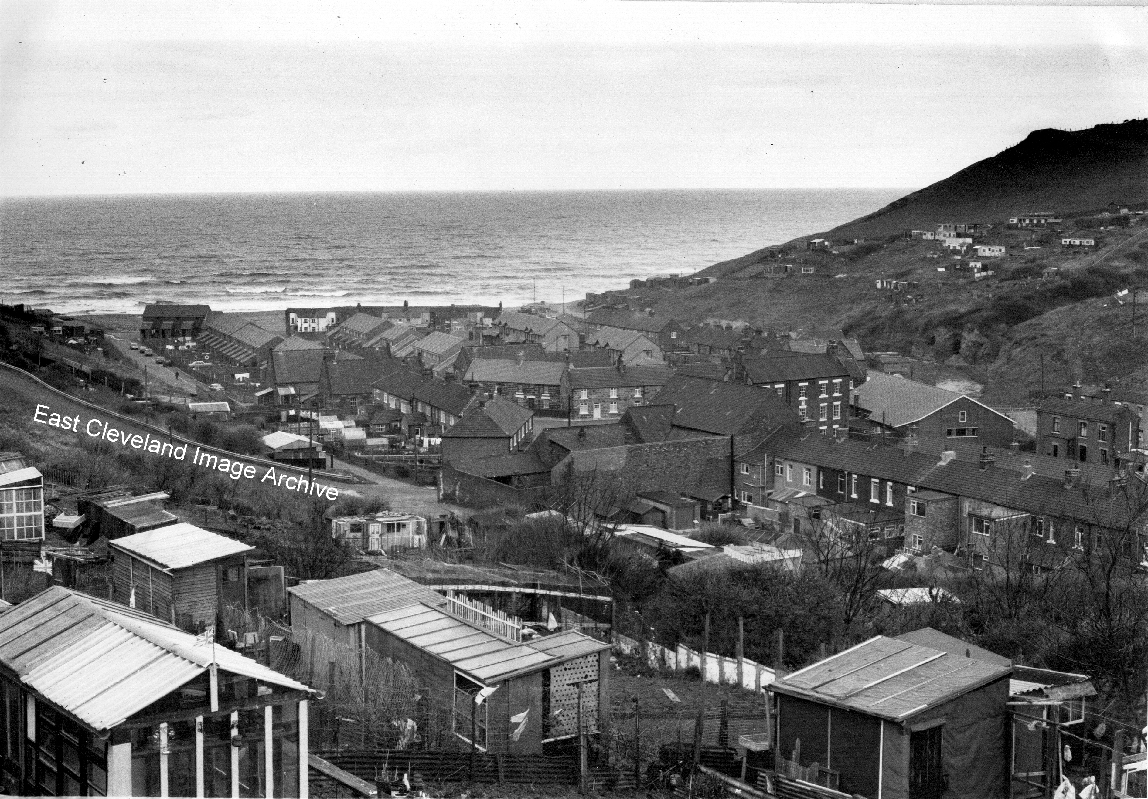
How things change! This view from Grove Road over the allotments gives a view of the back of the Co-operative building (now finally gone!), Hutton Street shops are no more, today even the allotments are gone. But the new houses on the High Street are clearly visible, can any one assist with a date?
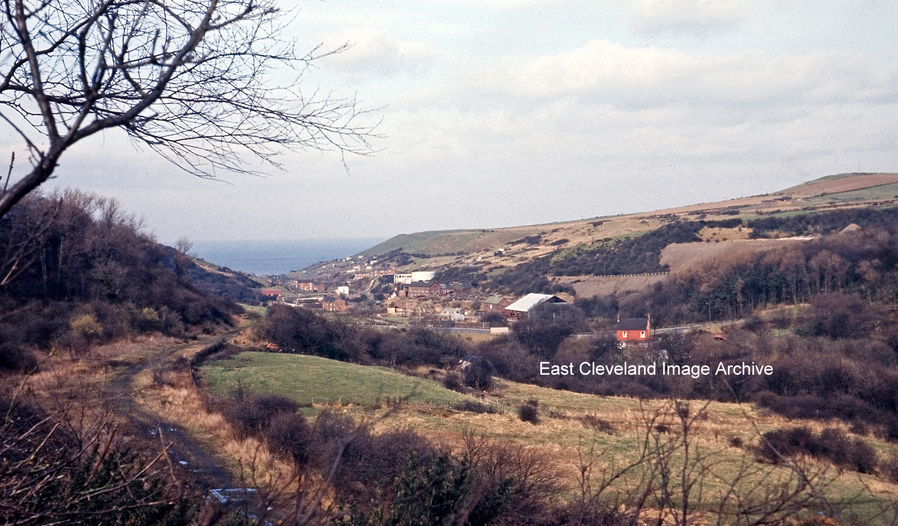
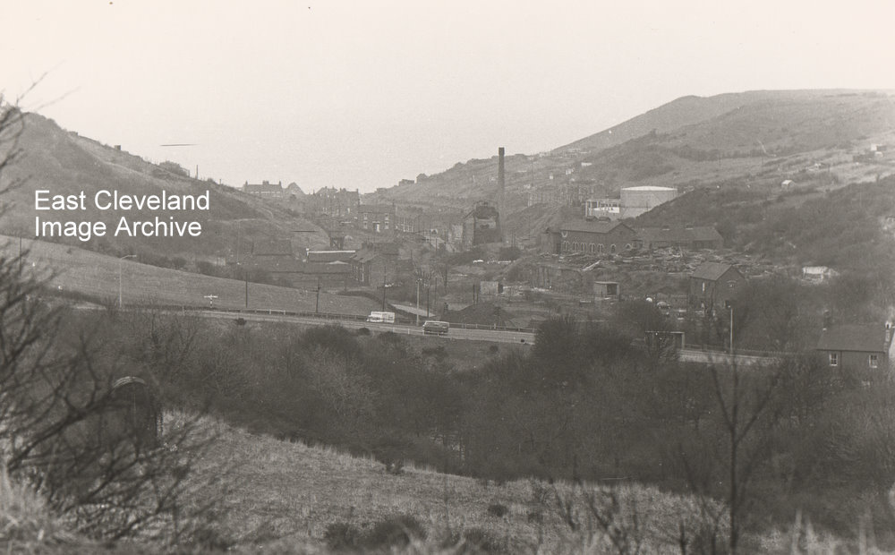
Raymond Brown tells us: ”This one is of Skinningrove Valley circa 1963. The old track bed of the line to Loftus/Whitby can be clearly seen with the track lifted from the BR closure (well before it was re-laid for CPL) and in the distance the pair of old Gas holders at Skinningrove. Note the lack of trees that now obscure this view.” The consensus of opinion is that this is the first junction of the zig-zag, with the ’tail’ of the first section coming off the photo at the bottom (originally to run under the viaduct, but after the viaduct was in-filled, stopping short just before the new embankment).
Image courtesy of Raymond Brown and thanks go to Colin Hart and Russ Pigott for the updates.
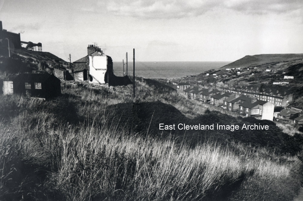
This photograph; taken from the former zig zag line against the railway embankment across the valley shows how Skinningrove was built in the valley with the gas works, gasometers and the mine buildings showing on the right hand side.
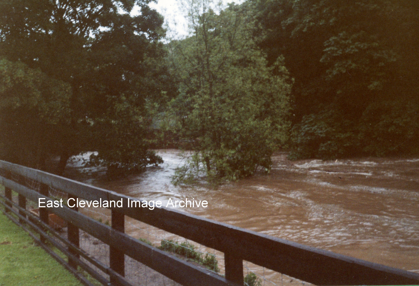
Torrential rain fell in the area on the morning of the 2nd July, 2000, half the month’s usual rain in just six hours. The cloudburst caused flash floods and the water swept down the valleys into Kilton Beck, carrying fallen trees and branches along with it. The photograph shows the old bridge, between the trees, just below Kilton Mill. The logs and debris jammed against the bridge and blocked the beck.
This sequence of images of the flooding in July 2000 was submitted by Kathleen Hicks; she took all the photographs and suppled the commentary.
Recent Comments