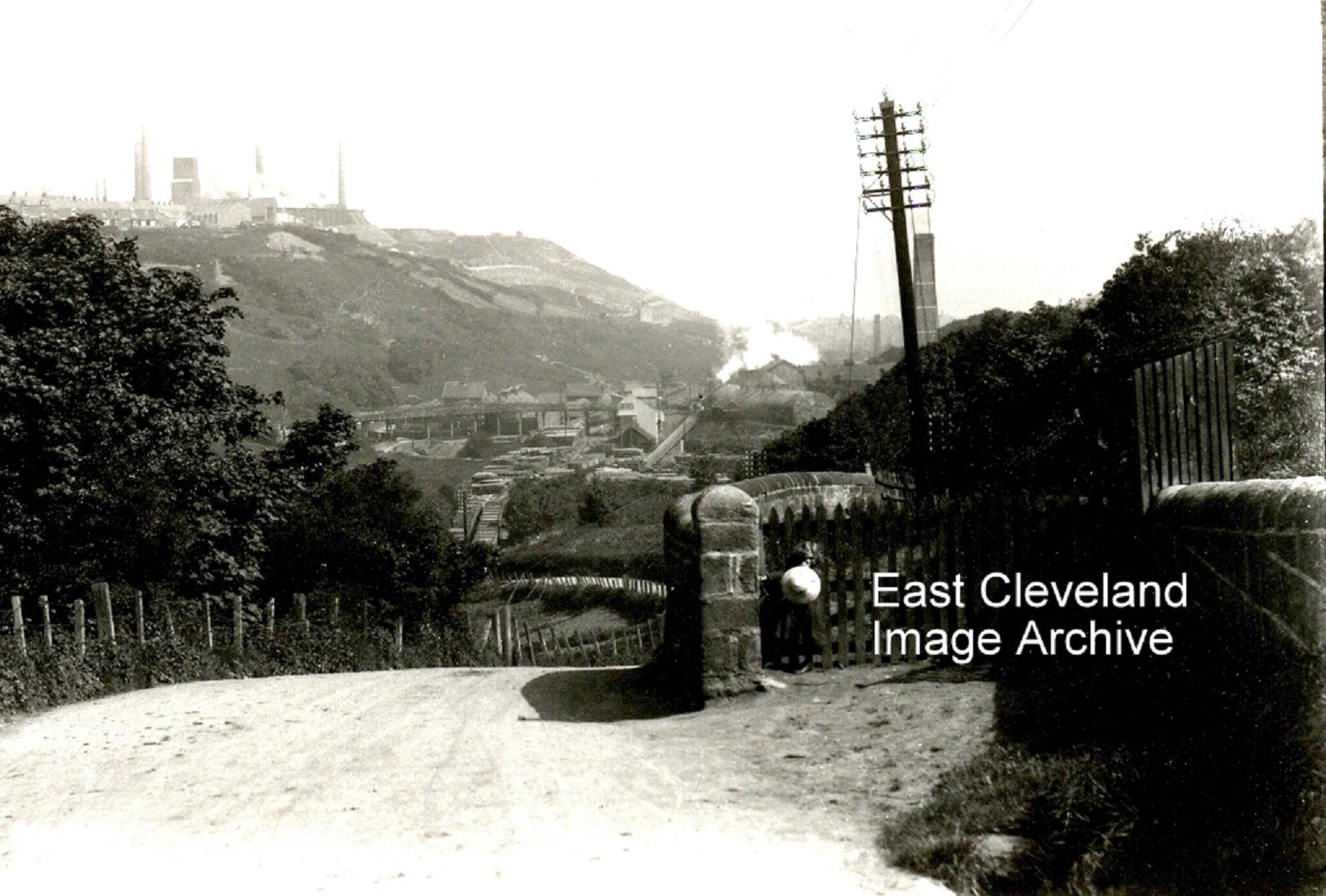
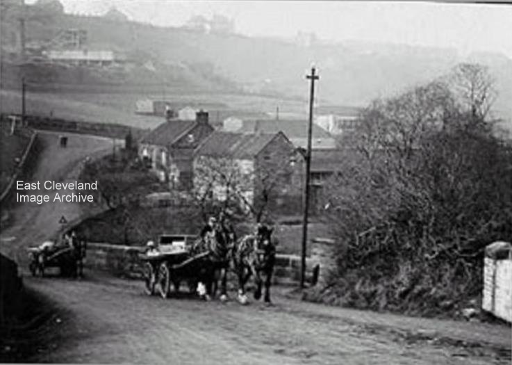
I want to know who the little girl is with the big hat! An image before the iron horse this one, no metalled roads. Derick Pearson tells us: ”It is actually taken two thirds of the way up Loftus bank from Kilton Mill. The pit and the works are a giveaway. I was informed many years ago that the wall on the photograph led to two paths that cut through to the gardens to the right of (High Row) and to a place called The Old Man’s park on the path directly behind the little girl. The old men would have a nice view from here overlooking both pits and the Mill as the trees in those days did not go all the way down.” Norman Patton adds: ”I recall not only the two pathways but three! On the high side, it was possible to walk along the bottom of the furthest “allotments” in front of St Hilda’s Terrace/Short Row. The central path led into the park where there were Swings, Roundabouts, a SeeSaw and several seats. This recreation area was revitalised during the 1950s but again fell into dis-use. The third path was just below the Park and would have been wide enough for carts and possibly vehicles. This path might have lead to Loftus Pit and possibly Skinningrove before the Pit was opened?”
Image courtesy of the Pem Holliday Collection and thanks to Derick Pearson and Norman Patton for the updates.
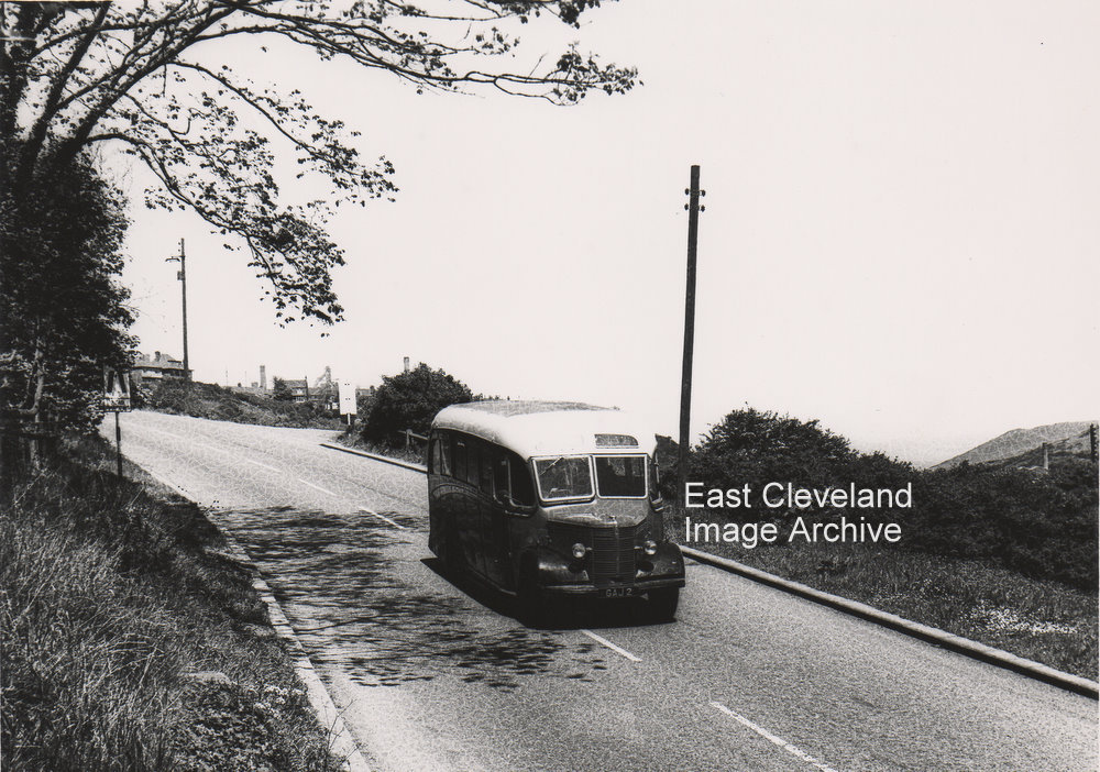
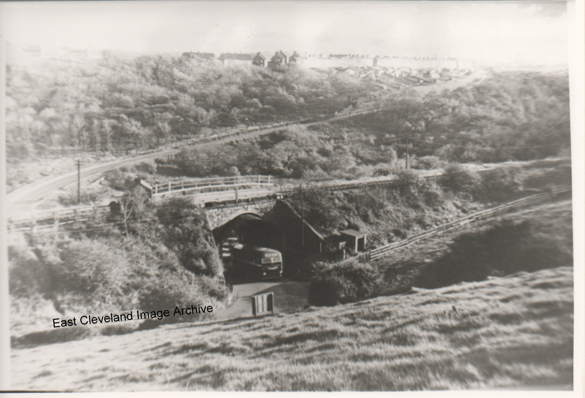
Classic photograph – of a Bedford Duple and that it is the 1950’s. Alan Chilton advises us that this was part of the Saltburn Motor Services (Kelly Watsons) fleet operating from Loftus to Saltburn via Liverton Mines. That number plate would be worth a fortune!
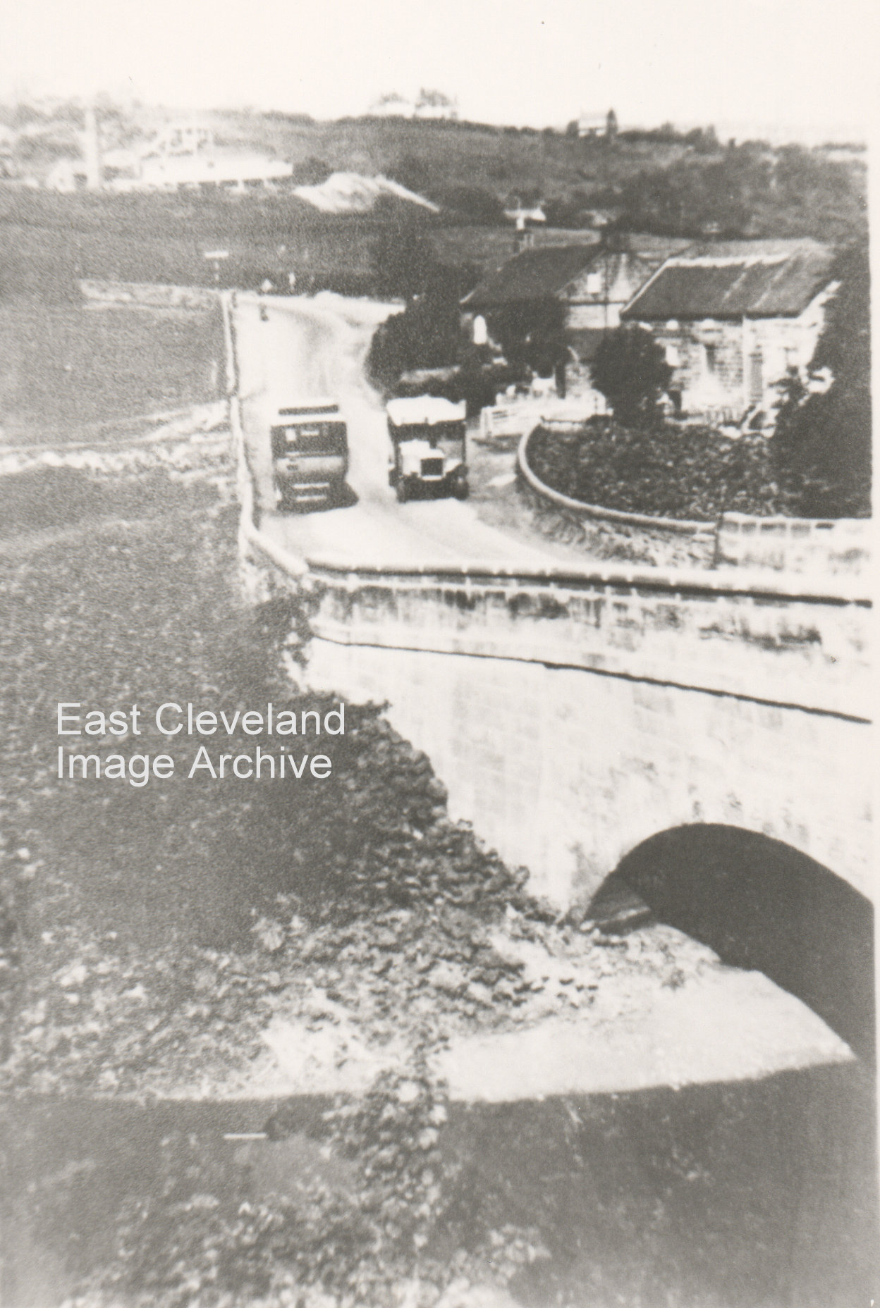
This must be one of our earliest photos of Mill Bank (correct me if I am wrong) but it is the only one I have seen of the bank with horses and carts going up it. Looking closely the road doesn’t seem to be made up, is it? Duck Hole pit that can be seen on the left and through the haze top right Mount Pleasant? The huts in the field were used to house the Australian Army in World War I.
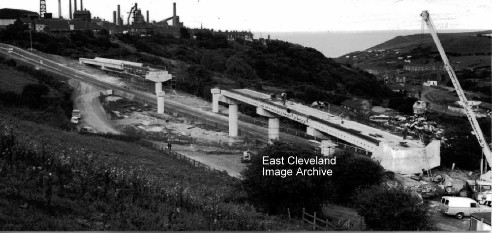
Looking down the bank from Carlin How, this is before the bank was altered it was a tight corner under that bridge, we can see where the railway went over and the bank going up to Loftus. Derick Pearson tells us: ” This was a difficult bend to negotiate and if two buses came from opposite directions one had to back off to let the other pass. Under the bridge itself were some very large timbers in an A frame construction supporting the sides. I remember when only in my teens there was a motor bike accident in which a bike crashed into a Saltburn Motor Service bus, possibly the late 1950s or early 1960s, this was a not infrequent incident under this bridge.” When was the bank altered?
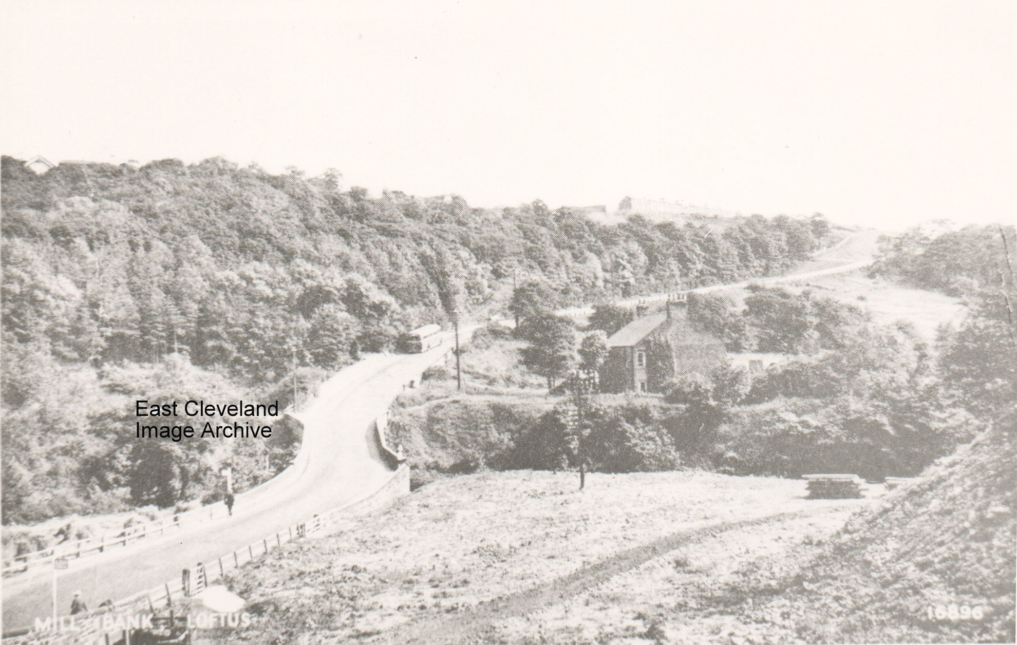
A bus half way up the bank and the entrance to Glover’s Path on the right; a pile of logs in the field (or are they pit props?). On the skyline on the left you can just make out St Hilda’s Terrace.
Recent Comments