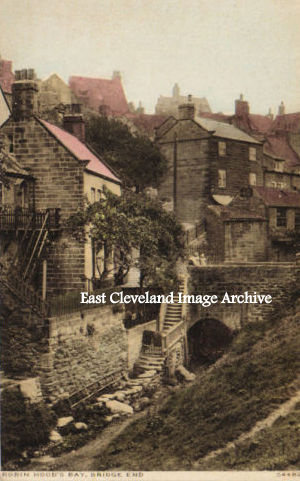
The view today of this image is slightly more vegetated! There are more trees and vegetation surrounding the bridge which carries the road down to the shore in Bay. King’s Beck is the small stream which runs down through the village.
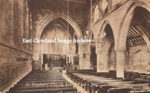
This interior view of St Stephen’s church at Robin Hoods Bay shows another large church for what was a fishing village. A building often used in the more trying times in the past.
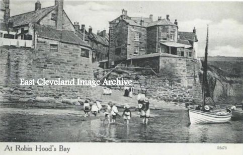
“Splodging at Bay” would best describe this scene from the last century. Today if the tide is down even cars seem to drive onto the beach. In our view the height of the tide would preclude such frivolous activities!
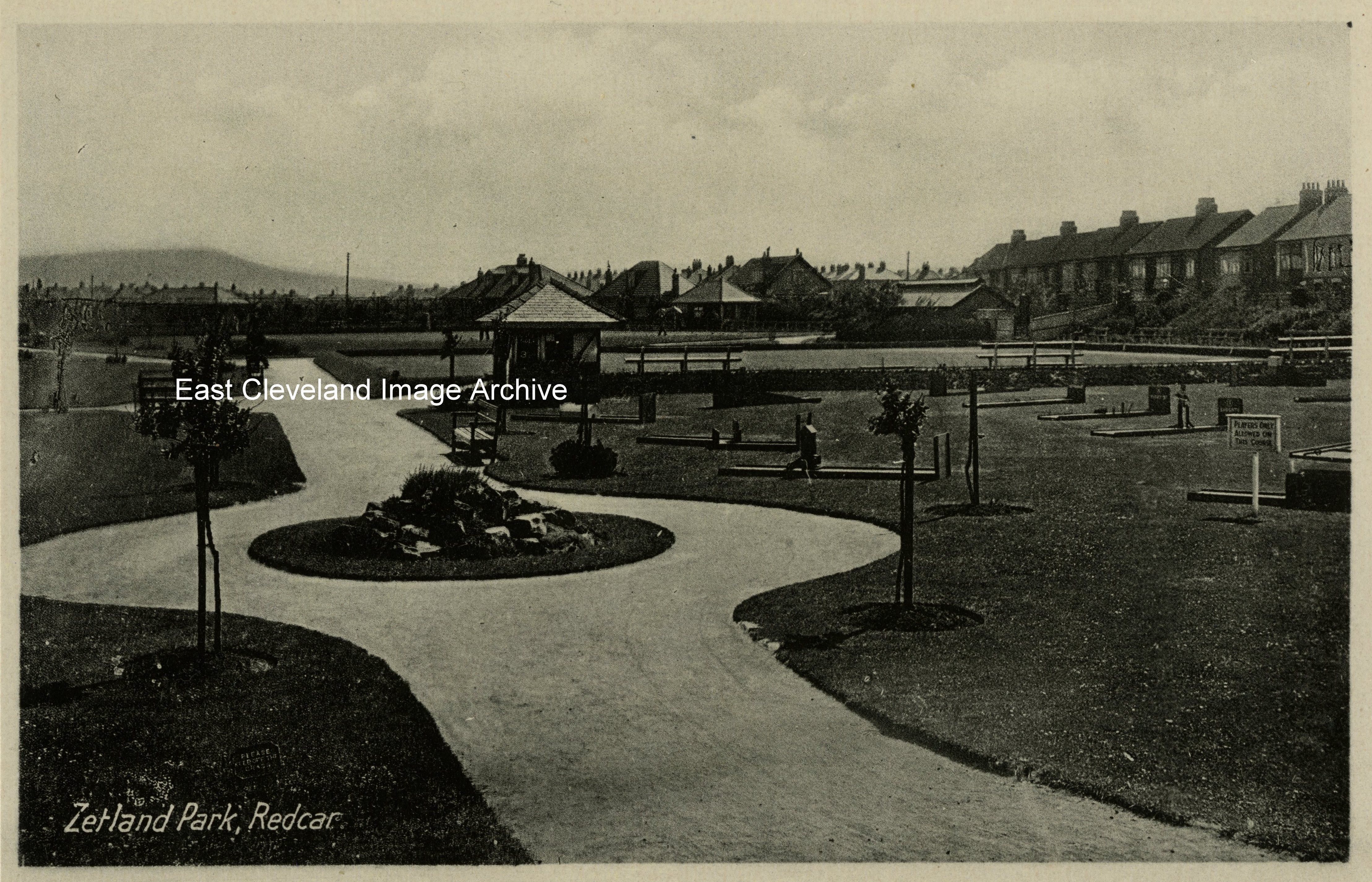
At the end of The Stray, Zetland Park is the smallest of the parks in Redcar. Today it even has its own website for Friends of Zetland Park; another example of the power of the local community in wanting to maintain their own amenities.
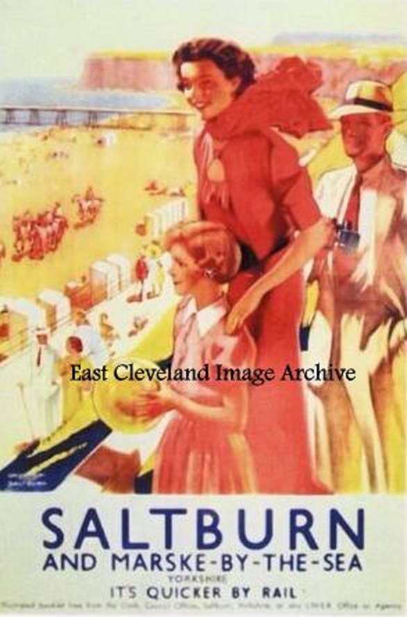
One of a series of posters produced by LNER 1923 – 47 promoting tourist resorts and possible places of interest. Reproductions of many of these posters (some as postcards) can be purchased today via the National Railway Museum and tourist information centres.
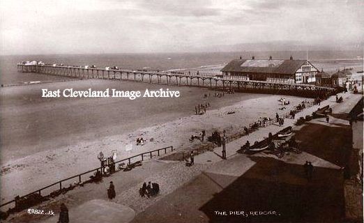
A view looking eastwards along the front at Redcar, with the pier dominating the scene. Redcar Pier Company was formed in 1866 but work did not begin until August 1871. The 1300 foot structure opened on 2nd June 1873 to the public, The 1300 foot structure opened on 2nd June 1873 to the design of J.E. & A.Dowson. Facilities included a 700-seat bandstand and separate landing stage; this was one of two piers at this point on the coast; the other was at Coatham. The pier was demolished finally in 1981 having become unstable. Julie Matthews believes: ”I may be wrong but I think it was demolished later than 1981. I worked in the front part which was a restaurant as a Saturday girl waitress around 1977 to 1979, whilst I was still at school.” Craig White has assisted with: ”It was taken down in the winter of 1980 / 1981. The restaurant was open till quite near the end, often a Police van was parked outside picking up meals for prisoners in Redcar nick! If it had survived a few more years it may have made it into the preservation era as opposed to the demolish everything old era that prevailed in the 1960’s and 1970’s.”
Image courtesy of a supporter of the Archive, historical information courtesy of National Piers Society and thanks to Julie Matthews and Craig White for the updates.
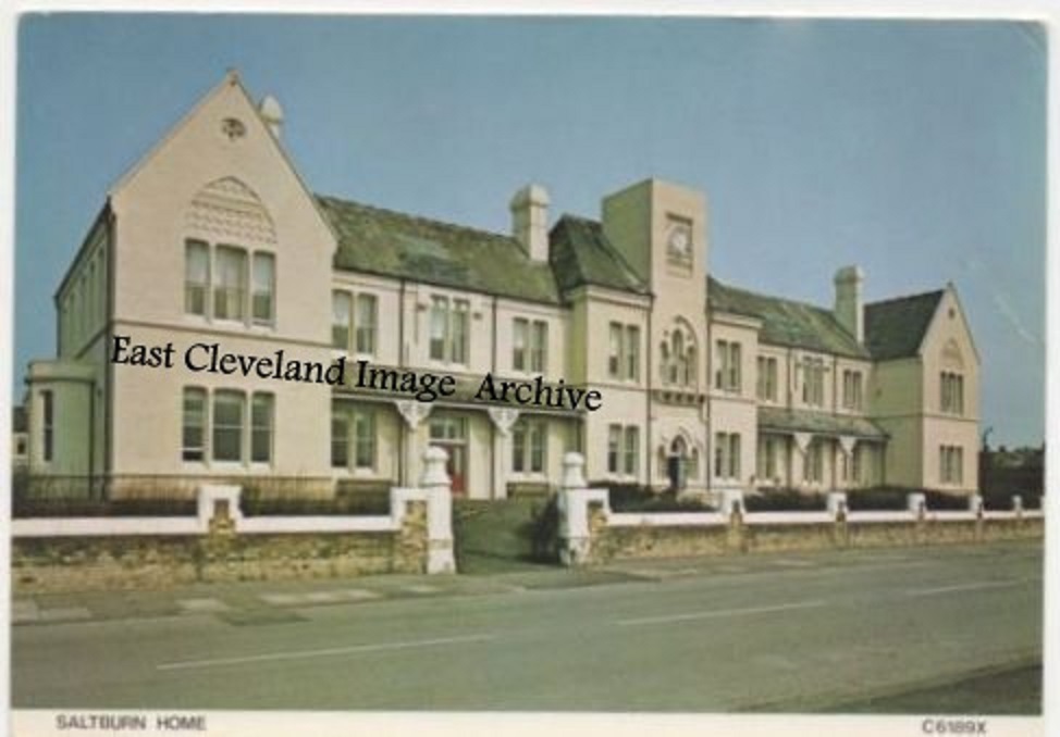
Saltburn House as it is now known was opened in 1872 at a cost of £12,000 by Messrs Pease as a Convalescent Home for their workers. The home became a temporary base for Silcoates School in Wakefield after it burnt down in 1904. The rebuilt school, still open at the time of writing, offers assisted aid to pupils with what is known as the ’Saltburn Bursary’ in memory of the link with the town. The house was later sold to the Working Men’s Club and Institute Union (CIU), which converted it into a convalescent home for club members, one of several around the country. Its ”residents” usually came, from all the major working-class areas of the UK, for subsidised two-week breaks. They were easy to recognise from the yellow button badges they were issued by the ”Superintendent” on arrival. Subsequently bought by Hayes Working Men’s Club it has since been renamed ”Saltburn House” in 2014. Joanne Moylan advised: “I have a copy of a photo of a group of older men (arranged in rows) in front of a conservatory style building, with the Photographers name(hard to read) and the address, Milton Street, Saltburn. My G.G Grandfather( died 1922), is one of the men in the photograph. Could it have been taken at Saltburn House?” Martin Grundy adds: “I have seen a photograph similar to that described by Joanne Moylan and was taken in 1937. However, the gentleman standing seventh from the left in the back row looks very much like my GreatGreatGrandfather, John Grundy, who died in 1932. Joanne’s GGGrandfather died in 1922, which further brings into question the date of the photograph.” Terry Kenny comments: “I have a photograph [it is the picture side of a postcard] of four rows of men and one woman with a sign at the front saying ‘Club Union Convalescent Home Saltburn by the Sea’. It looks as though it has been taken in a conservatory judging by the plants. There is no date but my grandfather is seated far right at the end of the 2nd row up. The woman’s dress looks pre-twenties. I wondered if my grandfather might have gone to convalesce there after the 1st World War. I assumed that it was post World War I [he served in the war when he was 38/39 and was gassed, I thought it might he might have been there convalescing for that reason] but it could be pre-war as the lady’s dress is definitely Edwardian/early Georgian [V]. As a mill worker would it have been used for people in his position if they needed convalescent? On the reverse of the postcard is the information ‘Published by W. Payne, The Bazaar, Saltburn by the Sea.The noted shop for Tobacco, Cigars & Fancy Goods. Dealer in Talking Machines and Records. Can anyone enlighten me?” Callum Duff assists with: “I run a Facebook page called ‘Saltburn OneFifty Plus’ which has an album of of photographs showing Saltburn Convalescent Home in different stages of its life. As for Terry’s postcard, the conservatory-type building shown was the Convalescent home’s ‘Winter Garden’ which is sadly no longer part of the current structure. As for the location of ‘The Bazaar’, this was a populist phrase used the early C20th for shops selling a variety of items where the customer could browse rather than shops selling one thing and being served directly. A Trade Directory of 1910 lists a Walter Payne, Fancy Repository, 7 Dundas Street. This current address is a small terraced house built in the last 25 years so depending on the date of your card, we can determine the original location of the shop.” Callum also advises Joanne: “The photographer might be Pitchforth. He had a studio on Milton Street and many of his photographs still appear for sale on eBay today.” Kath Cheadle advises of seeing similar images, whilst Warren Dougherty finalises with: “I had the pleasure of actually growing up within the home itself, spent 12 fantastic years in it. Most of mates always say we had so many adventures within those walls.”
Image courtesy of a supporter of the Archive (from a postcard view), thanks to Joanne Moylan, Kath Cheadle, Martin Grundy, Terry Kenny, Warren Dougherty and particularly Callum Duff for the updates.
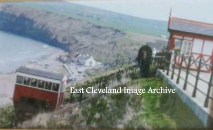
The cliff lift is one of the world’s oldest water-powered cliff lifts (the oldest being the Bom Jesus funicular in Braga, Portugal). The Saltburn tramway, as it is known, replaced a vertical lift, which was closed on safety grounds in 1883. The cliff tramway opened a year later and provided transport between the pier and the town. The railway is water-balanced and since 1924 the water pump has been electrically operated. The first major maintenance was carried out in 1998, when the main winding wheel was replaced and a new braking system installed. In more recent times there have been problems which hopefully are now overcome.
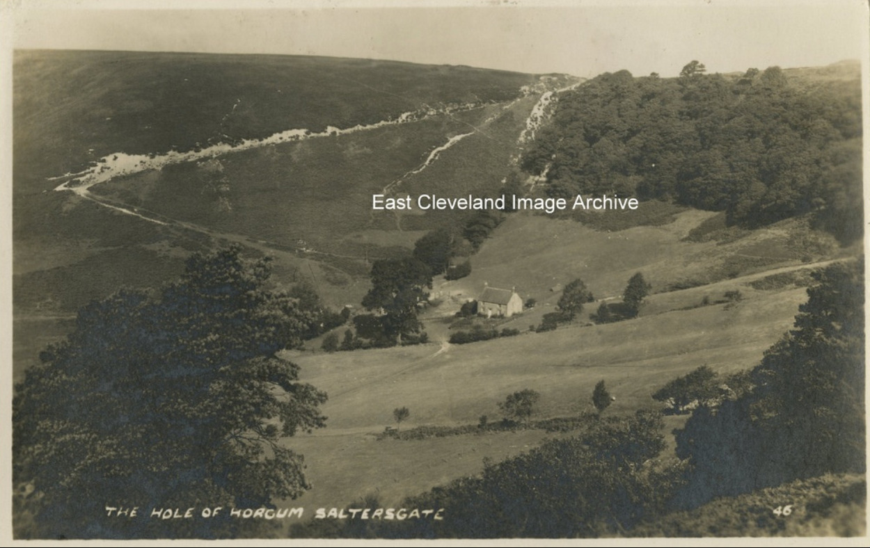
The Hole of Horcum is a hollow in the valley of Levisham Beck, the hollow is 400 feet deep and stretches 3/4 of a mile across; local legend has it that the amphitheatre was formed when Wade the Giant scooped up a handful of earth to throw at his wife during an argument. This postcard view gives a true impression of the enormity of this hollow. Close to the road between Sleights and Pickering features an impressive incline feared by many drivers.
Recent Comments