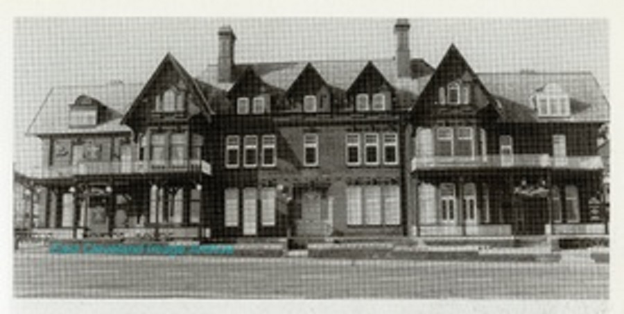
Marine Parade has wonderful views of the sea which were part of the original attraction of the development of Saltburn. This block of properties; Marine Hotel on the left, Masonic Hall in the centre and Red Gables on the right. The Marine Hotel was formerly Dr Burnett’s private house with his surgery at the rear. The Masonic Hall’s basement (after strengthening) was the headquarters of the ARP – air raid wardens – during World War II. Red Lodge was for many years used by Saltburn High School for Girls and is now a block of flats or apartments. Janet Courage (nee Thurlow) tells us: ”I attended Red Lodge in 1952, my first year of High School before moving to Cleveland Grammar School. I remember going down to the beach for P.E., those treks back and forth to Saltburn High School. I have lived in Vancouver, Canada since 1957 and just decided to find out what happened to Red Lodge.” Jenny Traveller responds with: “Thank you Janet! My mother ( born 1932) went to Saltburn High School and mentioned Red lodge and Pearl Hall as former school buildings to me before my very recent visit to Saltburn. I found the main school building, now used as the Earthbeat centre,and took photographs to show my Mum, but could not find Red Lodge or Pearl Hall. I did find Pearl Street, but found no trace of Pearl Hall. I walked past the Marine Hotel and Masonic Lodge without realising that Red Lodge was part of the same row. So thank you!”
Image courtesy of a friend of the ECIA, many thanks to Janet Courage and Jenny Traveller for the updates.
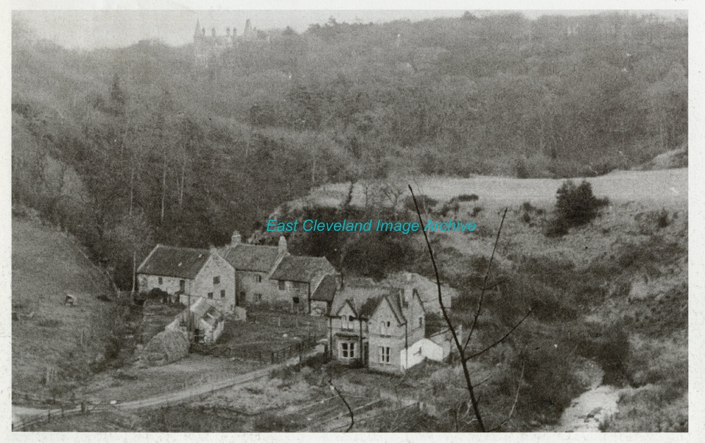
Another view of Marske Mill taken from the railway viaduct, we believe this is view is from the late 19th century. The house was built by the North Eastern Railway during the erection of the viaduct as the Superintendent or custodian’s of the viaduct. The house looks remarkably clean, no ivy or closely growing trees. But we await a definite date.
Marske Mill House was part of the collection of buildings gathered round Marske Mill, which sheltered beside Saltburn railway viaduct. The house on the left of this image was not the original miller’s house; being built for the erection of the railway viaductg. Alas the mill is no more, it was a long way from Marske; that village having no water sources suitable to power a water mill. Saltburn Mill house can still be seen further down the same valley, nestled beside Cat Nab and below the road to Brotton. We believe the image dates from the 1930’s as it appears to be operating more as a farm (judging by the haystacks, etc.), although we welcome any updates upon this. Geoffrey Wilson comments: “This photograph of Marske mill; never heard it called mill house. I lived down there as a young boy. My grandfather farmed it until his death. I know a little about the Mill near Catnab, l believe it was in Smith’s Wood.
Image courtesy of the Pem Holliday Collection, thanks to Geoffrey Wilson for the update.
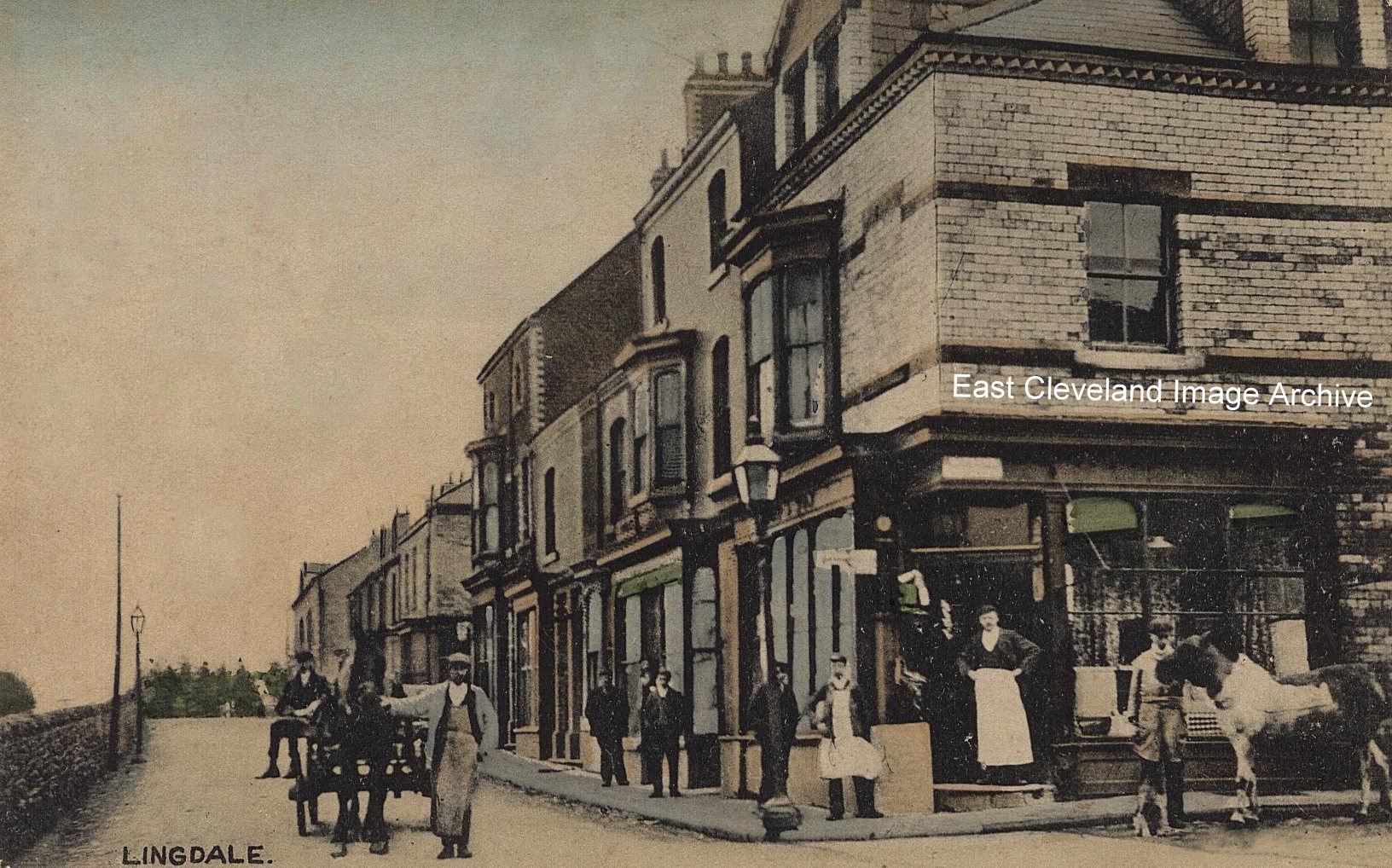
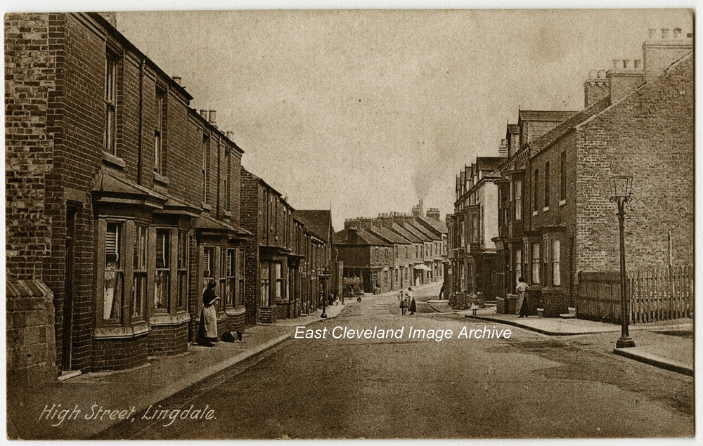
The reverse of this unused Brittain and Wright postcard entitled ”Lingdale” bore penciled note: ’The Co-operative Stores corner’, hence our use in the title. Also in the back ground can be seen the trees of Nova Scotia Plantation, this was to the south of the mine in Lingdale; whilst the woodland (not visible in this image) to the north of Lingdale mine was known as Nova Scotia wood. The mine occupied the area now given over to the light industrial estate and several motor vehicle sales outlets. The wall on the left of the image faced an area of open ground now occupied by Meadow Dale Court and Lingdale village hall. Ann Jackson asked: “Did the Co-op shop become Ditchburns Newsagents?” Derek Dobson replied with: “No, Ditchies was on corner next to park. Remember running down on Saturday nights at 6.00pm, to buy Sports Gazette. My grandad shared a passion of horse racing with Tom and would spruce himself up, leave pigs and have day at races together, riding in Tom’s car, he really looked forward to outings.” Derek Dobson commented further: “I remember as a small child the inside of the Co-op store seemed massive, they used to donate to the top end bonfire collectuons. Now some 50 plus years later I return to my village. The old Co-op is now a convenience store/off license packed floor to ceiling with produce to tempt the residents of what has remained a close community.”
Image and title courtesy of Jean Carass, additional information courtesy of Lingdale History, ECOL Archives sites and historical map sites; thanks to Ann Jackson and Derek Dobson for the updates.
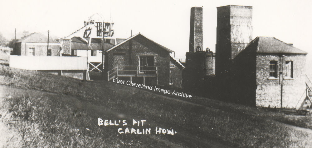
Bell’s pit as it was known; due to its ownership by Bell Brothers, at Carlin How. Bell Brothers were the creators of Bell’s Huts. The mine more popularly known as ”Duck Hole” (because of the very wet working conditions) was towards the end of its working life known as North Loftus Mine. Connections were made underground to Lumpsey and North Loftus Mines.
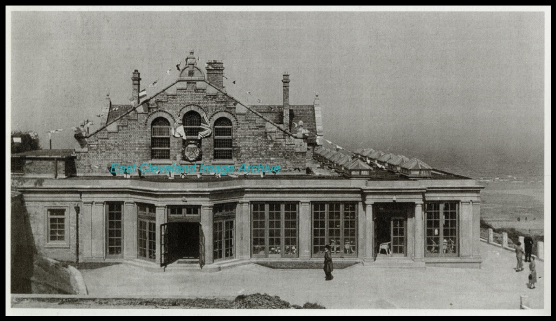
Built in 1884 as the Assembly Rooms and becoming known as the Spa Pavilion and familiar to all who travel up and down Saltburn Bank, originally known as ‘Cart Bank’. The original Assembly Rooms were to have been built on the corner of Britannia Terrace and Milton Street, but lack of funding was a problem. The Spa catered for many social events for the town; concerts, dances, school presentations, ice & roller skating. I can remember seeing Paul Daniels as part of a dance and theatrical event, many years ago; probably about 1960. The building is of course now the Spa Hotel, wedding venue, as well as providing accommodation and meals for visitors to the town. Anthony Simpson remembers: “I remember the Spa from the 1960s and early 1970s. I saw Muffin the Mule and a number of events tied up with the International Eisteddfod the was popular at the time. My last visit was in 2016 when I stayed there at the now hotel.”
Image courtesy of the Pem Holliday and David Linton Collections and others, thanks to Anthony Simpson for the update.
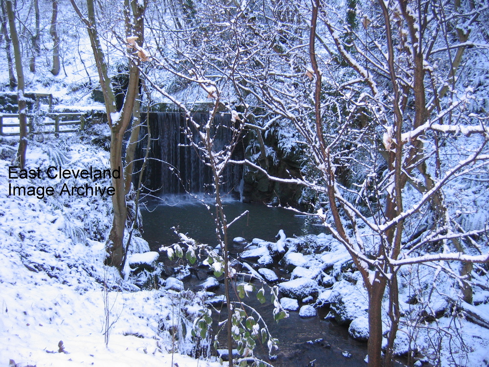
A delightful view of Loftus Dam BD (before the deluge!) in snow. Quite seasonal for this month! Richard Watson comments: “Walked through the wood post deluge (first time for 30 years) and was so shocked to see the damage caused — the photograph above is how I remember the waterfall.”
Image courtesy of Eric Johnson, thanks to Richard Watson for the update.
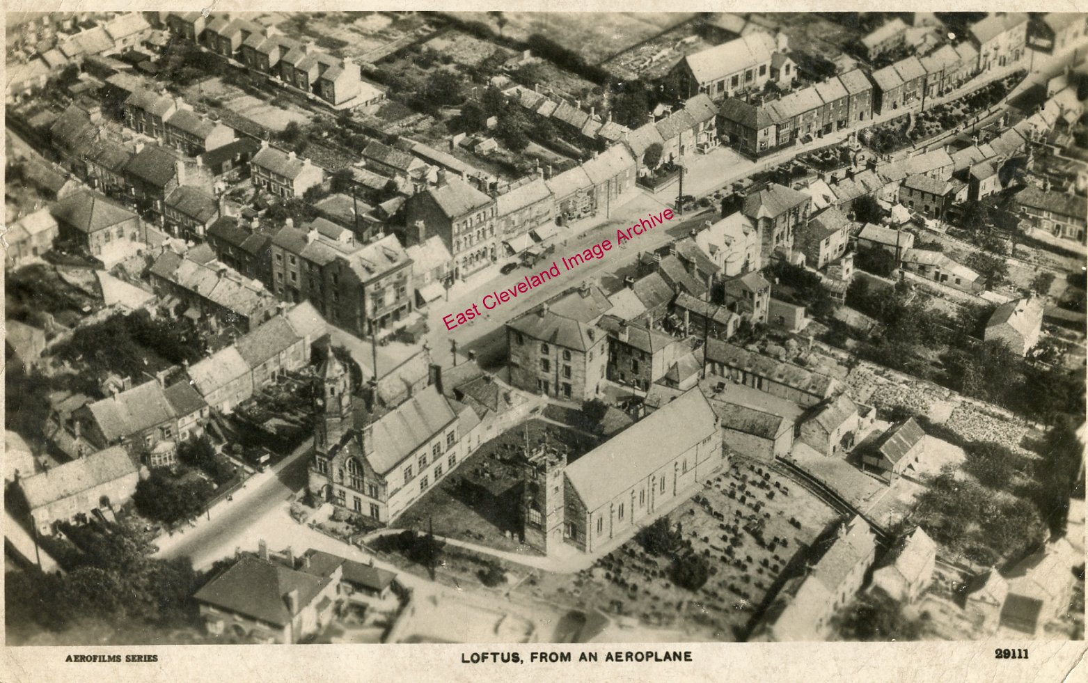
A view of Loftus in 1929. The High Street runs diagonally from the bottom left corner, through the Market Place, to the top right. The amount of detail in the picture is noteworthy; it is fascinating to compare it to Google Earth’s view of the same area. Many of the buildings still stand today. But dating this photograph which was taken after the erection of the War Memorial, but prior to the demolition of the houses on High Side behind the memorial were demolished. David Richardson tells us: ”This is one of several aerial views of Loftus produced as postcards from a flyover in 1929.”
Image courtesy of Carolyn Richards and many thanks to David Richardson for the dating update.
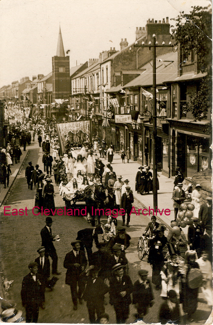
One of several images of the Coronation Parade to celebrate the Coronation of King George V in 1911. In this view the parade is viewed as it moves up Zetland Road to the Market Place. This view point must have been popular with photographers as we have many scenes of Loftus events from a similar perspective. Possibly taken from the upper floor of the Odd Fellow’s Hall.
Recent Comments