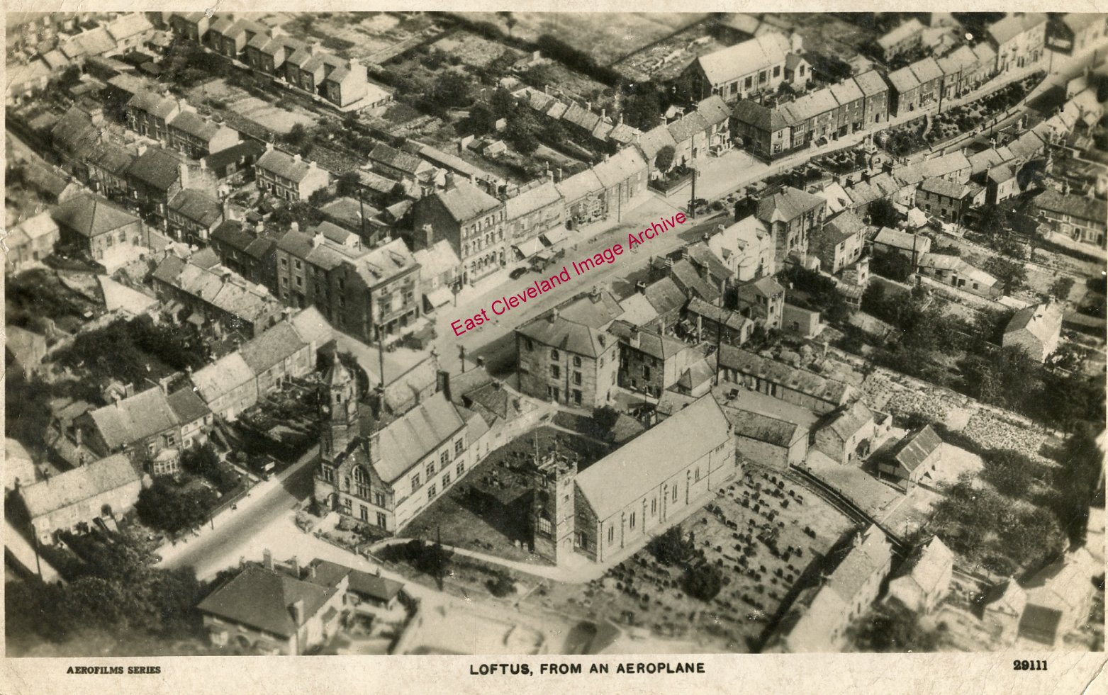
A view of Loftus in 1929. The High Street runs diagonally from the bottom left corner, through the Market Place, to the top right. The amount of detail in the picture is noteworthy; it is fascinating to compare it to Google Earth’s view of the same area. Many of the buildings still stand today. But dating this photograph which was taken after the erection of the War Memorial, but prior to the demolition of the houses on High Side behind the memorial were demolished. David Richardson tells us: ”This is one of several aerial views of Loftus produced as postcards from a flyover in 1929.”
Image courtesy of Carolyn Richards and many thanks to David Richardson for the dating update.
Recent Comments