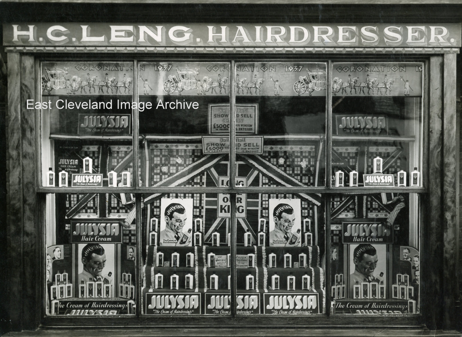
Thanks to Mrs. S. Dohring for this photograph of her uncle’s shop window, dressed for the coronation of king George VI in 1937. The shop was at 32, Zetland Road, Loftus.
Image courtesy of Mrs. Shirley Dohring.
|
|
||
|
Thanks to Mrs. S. Dohring for this photograph of her uncle’s shop window, dressed for the coronation of king George VI in 1937. The shop was at 32, Zetland Road, Loftus. Image courtesy of Mrs. Shirley Dohring. 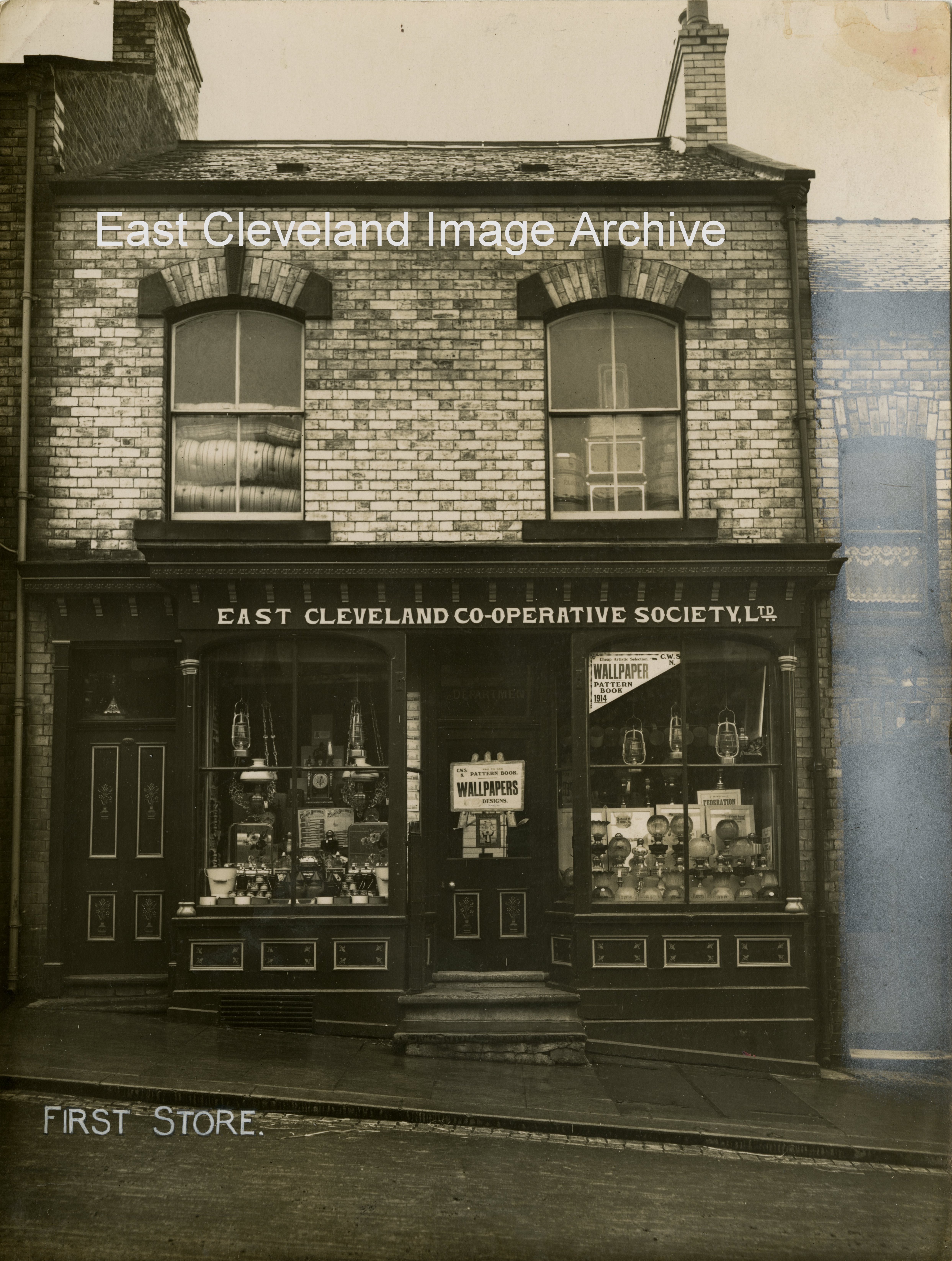 The first Co-op Shop in Loftus was situated on Zetland Road, this before the ’emporium’ on West Road. It obviously specialised in hardware items, based on the wallpaper posters and the hurricane lamps, etc., handing in the windows. Image courtesy of Loftus Town Crier. 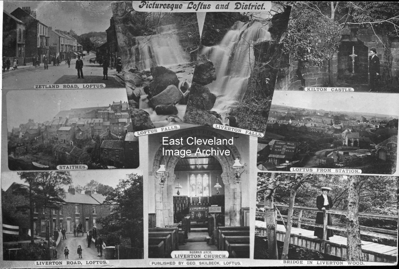 What a lovely Skilbeck postcard with a photomontage of the Loftus area; many of the individual images can be found on site. Image courtesy of Joyce Dobson. 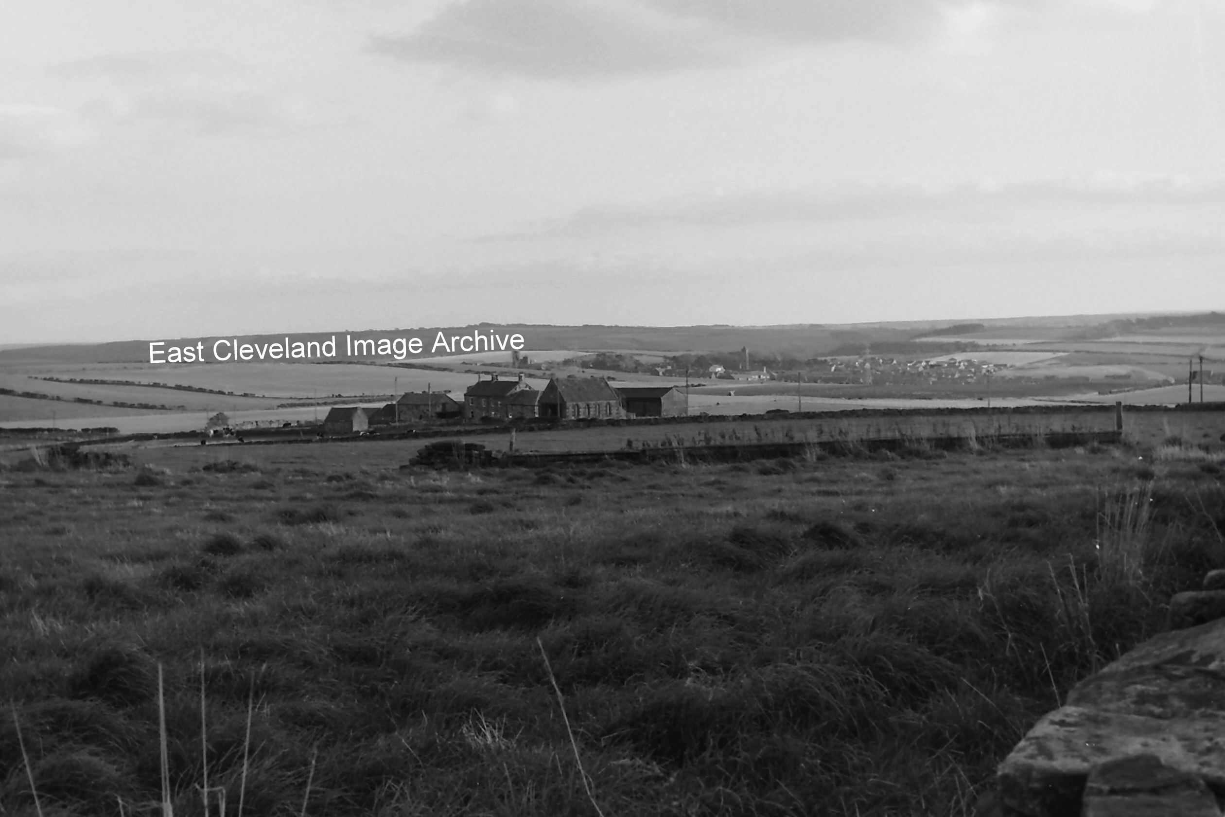 Looking over to Upton Cottages and Street house Farm, in the background the Church and village of Easington is clearly visible. Interestingly enough the area in the foreground is where the Saxon Princess excavations were conducted Image and updates courtesy of Eric Johnson. 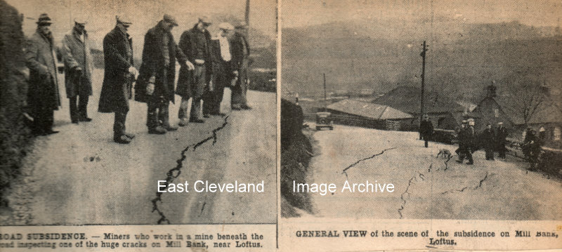 Miners who work in a mine beneath the road inspecting one of the huge cracks on Mill Bank, 2nd of March 1937. Images are from our cuttings file (in the main from the Evening Gazette). 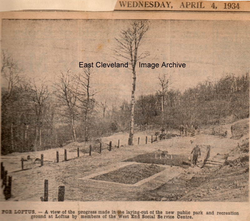 A piece of land on Mill Bank was let for a nominal fee by the Marquis of Zetland and the park was made by 80 volunteers from the Loftus West Road Social Centre, one of the schemes for relieving the monotony of the unemployed, transforming 3 acres of wooded land into a beauty spot, the park and children’s recreation ground is hoped to have swings, a sand pit and other attractions. Images are from our cuttings file (in the main from the Evening Gazette), thanks to Maurice Dower for the update. 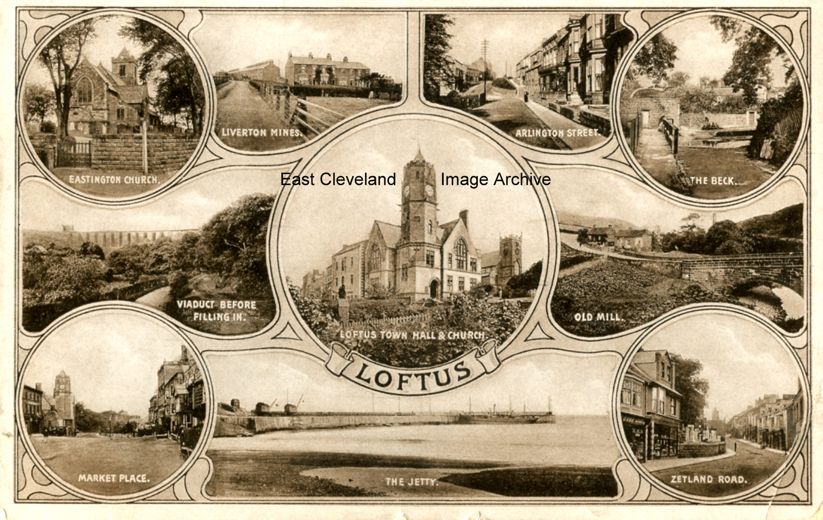 There is a similar card to this on site already and I had to look closely to make sure that it wasn’t the same. Some of the images on this one are different from those on the other. Image (from a postcard posted in 1913) courtesy of Tina Dowey.
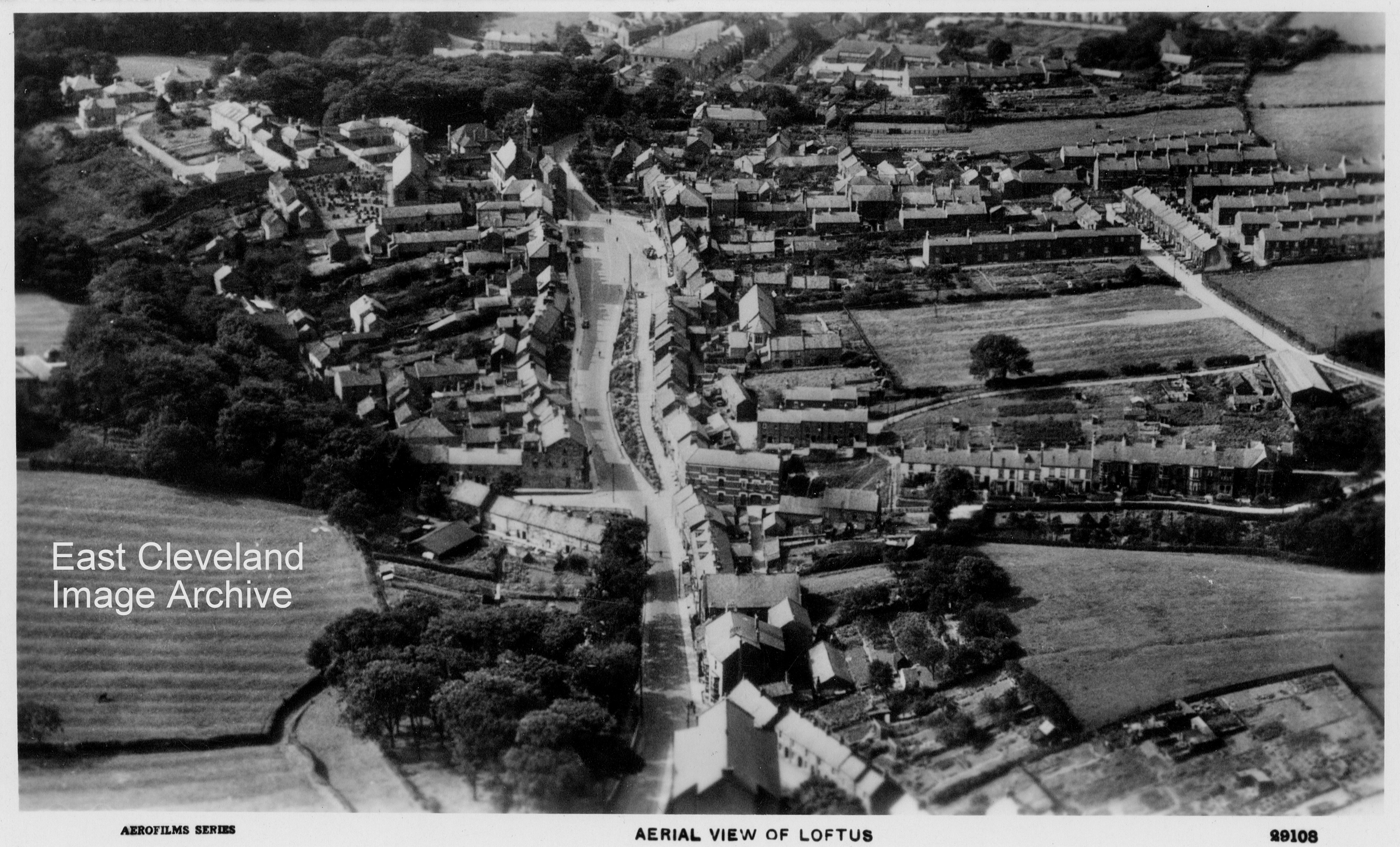
Taken from the east, in the foreground is the roof of the Chapel then along Arlington Street, we see on the right the road to Spring Head and on the left Dam End, the road widens at the Market Place. The road on the right of the photo is the road that leads up to Micklow lane. A lovely clear postcard view believed to have been sold by Ford’s in the early 1960’s, although unsure of date of production. However Norman Patton points out: ”I suspect that the church in the foreground is the Newton Memorial Chapel which was damaged beyond repair in the bombing of 1941 and demolished. It also appears that the beautiful and large Methodist Chapel near to the Arlington Hotel had not been built when this photograph was taken and yet I remember attending in my earliest days (early 40s)!! There is an obelisk at the east end of the market square which I don’t remember seeing in my life and I am not convinced that the War Memorial is in the picture. I don’t know how many of these observations are accurate but given the number of what appear to be motor vehicles on the road, I am guessing about 1920………don’t forget the aeroplane!?” Richard Watson comments: ”Would concur with Norman’s observations — the houses now opposite the recreation ground on Micklow Lane also are absent — the 20′s would seem a good guess.”
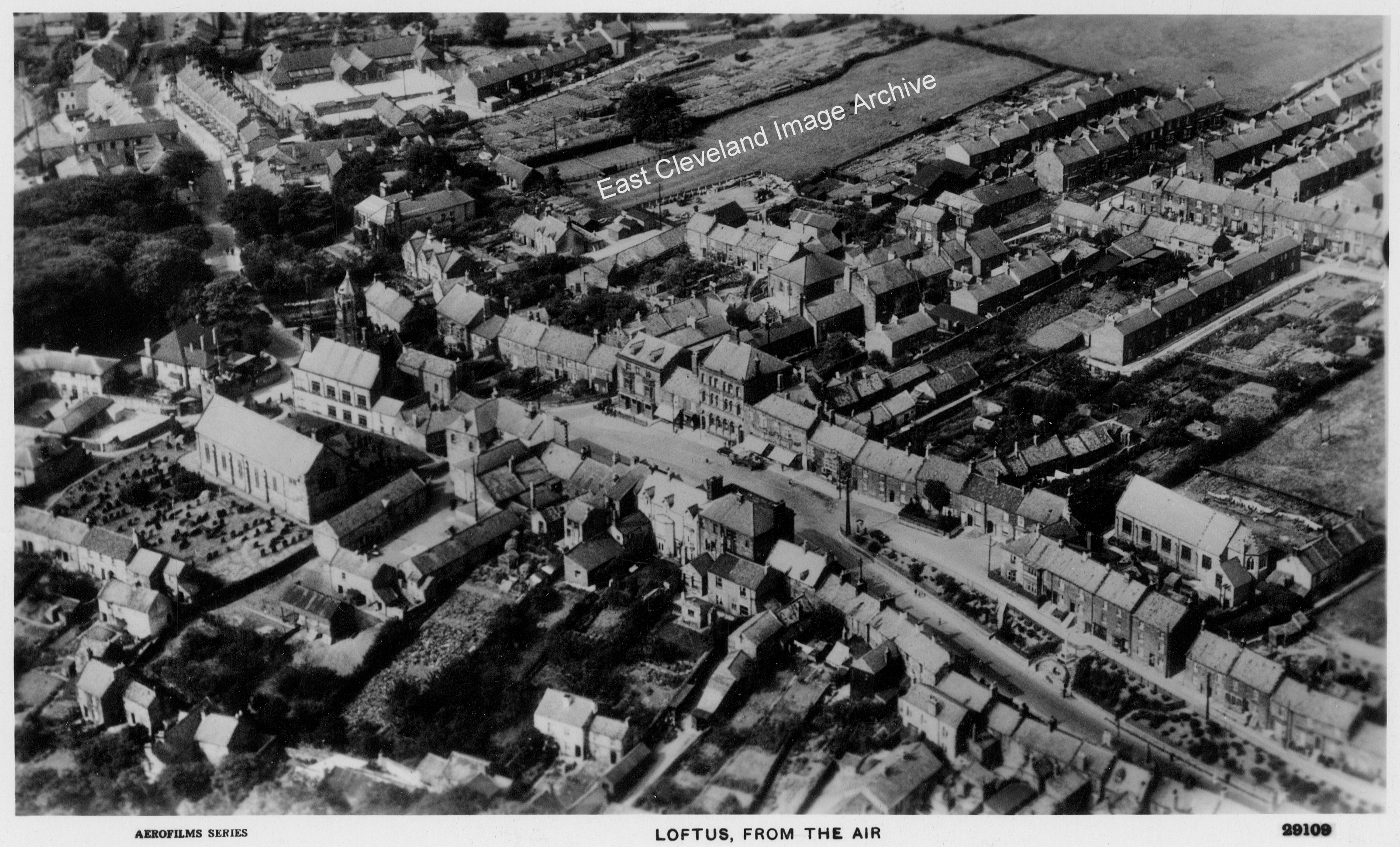
Another lovely aerial view showing a different part of Loftus, any places you recognise? 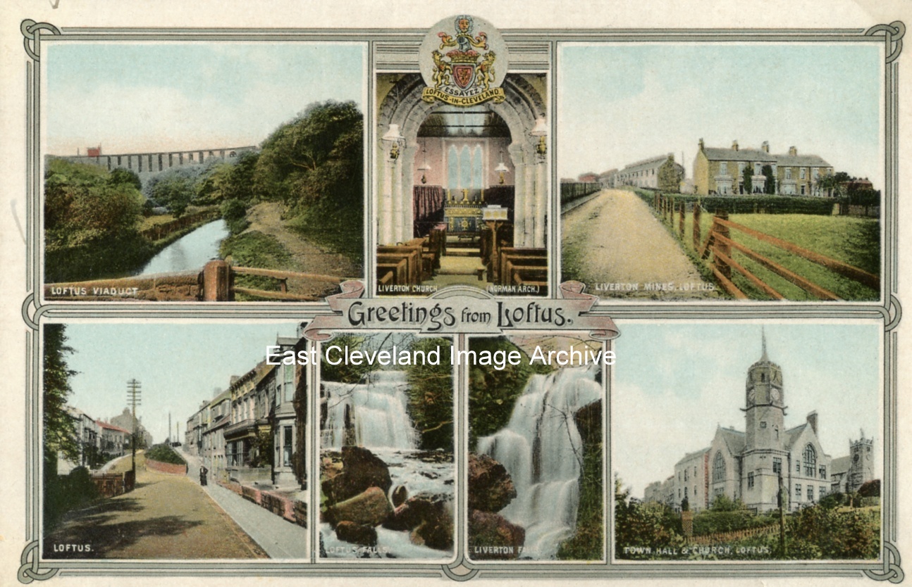 This collection of views of Loftus and district was produced by Skilbeck’s Printing, Bookbinding and Stationery Works, Loftus. The Liverton Mines picture, top right, threw me at first. It’s a view up the main road with Cliff Terrace on the right, long before the other houses on Liverton Road were built. Image courtesy of Beryl Morris and John G. Hannah. |
||
Recent Comments