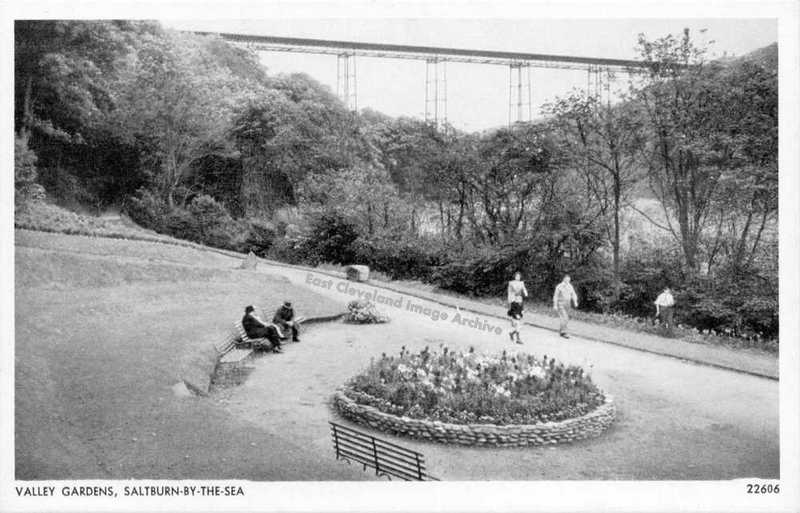
This view of the Valley Gardens shows clearly the Halfpenny Bridge in the background, but of more interest is the flower bed in the foreground which is where I believe there used to be a bandstand, although I can remember a fishpond and fountain. Callum Duff tells us: ”Saltburns bandstand was demolished by a bomb in 1940 and I was led to believe that the crater left by the explosion was made into a pond. I have film of this location from 1963 and there is fountain and fishpond on the site. This fountain used to be located below the Italian Gardens, next to the Chalybeate Spring and can be seen in many early photographs. The base of the fountain still remains and the outline of the later pond, now filled in. The fountain & pond were restored in the 1990′s but quickly succumbed to vandalism mainly due to the loss of the resident gardener, some years before. This image was presumably taken between 1945 and 1962?”
Image courtesy of Maurice Grayson and thanks to Callum Duff for the update.
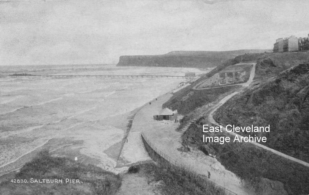
This early postcard view of Saltburn shows a varied collection of buildings along the shore before you can make out the Ship Inn and beyond. Callum Duff assists with dating with this detail: ”This photograph was taken sometime between 1920 – 1935. According to English Heritage the beach chalets were built between 1920 and 1929, a period which also encapsulates the building of The Beach Cafe (now Vista Mar). In 1935 the Spa Pavilion was extended adding the concrete apron of front windows which survive today.”
Image courtesy of Maurice Grayson and thanks again to Callum for the additional information.
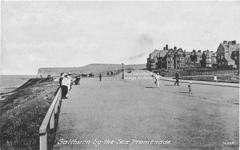
The Archive believed this was possibly late 1920s/1930s view of Huntcliffe and the top promenade at Saltburn; but what was missing were many of the present day seaward facing buildings. Callum Duff has come to our aid, explaining: ”All the seaward facing building and structures between Hazelgrove and the west side of the Cliff Lift were built between 1918 and 1939 as part of a government scheme to ease unemployment. They included; footpath improvements, railings, rose arbours, the rock garden, Jack’s Castle, Public Toilets, the large pillared shelter known locally as ‘The White Elephant’ the sunken shelter adjacent to it and a concrete pond which has since been filled in. The beach chalets, shelters and the bandstand may also have been part of this employment scheme, together with the widening of the pathway from the foot of Hazelgrove to the beach.”
Image courtesy of Maurice Grayson and many thanks to Callum Duff for dating this image.
A quiet day at Saltburn, sometime in the 1960’s. A sunny day, but with few visitors.Michael Shields has advised: “The fishing boat was Nelly owned by John Middleton who was a full time fisherman.”
Image courtesy of Maurice Grayson; thanks to Michael Shields for the update.
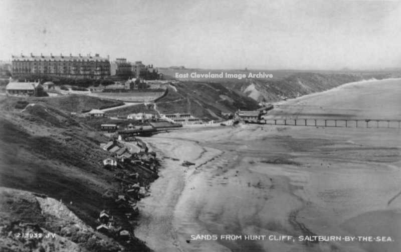
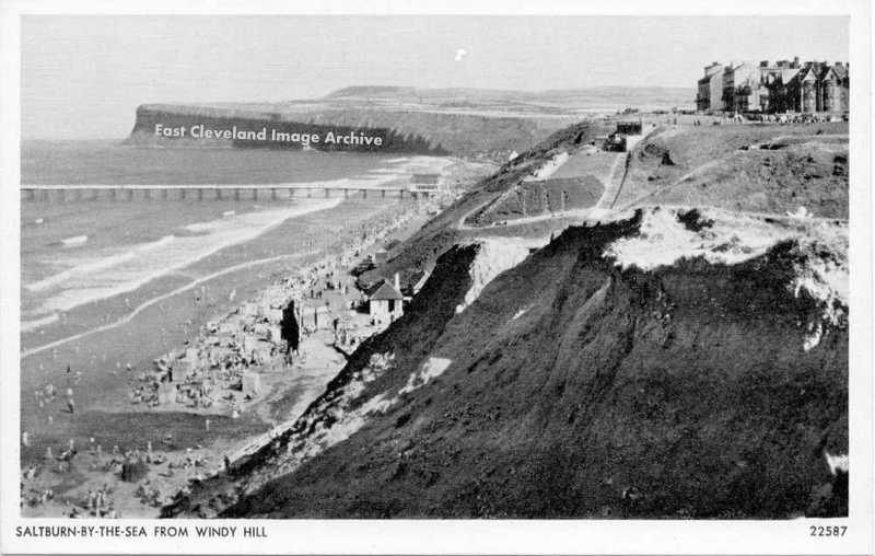
”Saltburn-By-The-Sea from Windy Hill” states the caption of this postcard. From the look of coastal erosion on the cliff a very unsafe place to set up a camera.
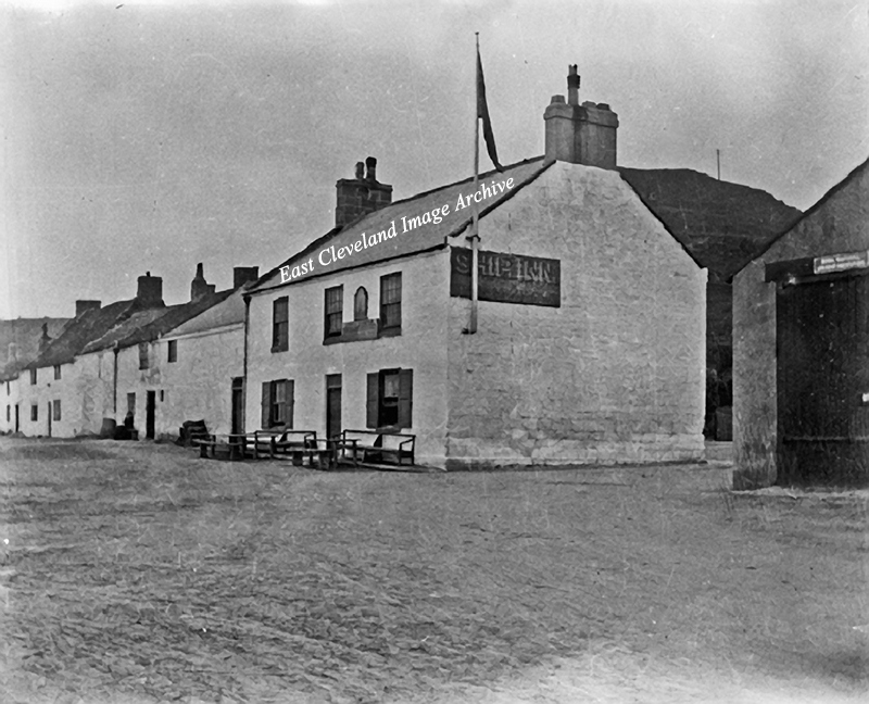
This glass plate image of The Ship Inn in Old Saltburn obviously predates the improvements to the Brotton road. Callum Duff advises us: ”The building to the right is actually the Lifeboat House, demolished after the auction of Saltburn’s last lifeboat in 1924 (The Mary Batger) and also to allow the road to be widened.” To the right of the Lifeboat House was another row of cottages which included a further two public houses: the Dolphin Inn, the Nimrod Inn; two gin shops and a shop. The cottages extending to the left of the view beyond the Ship Inn are much more extensive than today. This probably means the image is pre 1924, unless we can be advised otherwise?
Image courtesy of Geoff Patton; many thanks to Callum Duff for updating our information and datings.
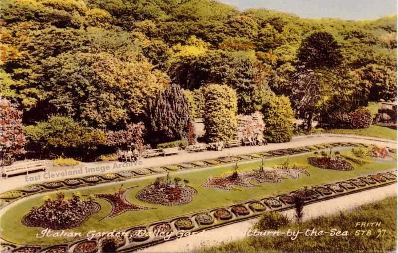
The Italian Gardens Saltburn, in immaculate condition. These ‘pleasure’ gardens were first laid out in the 1860s by the founders of modern Saltburn; the Pease family.
From a Frith Postcard courtesy of Maurice Grayson.
An early tinted postcard of Cat Nab, with the farm and mill buildings in the foreground. The hay stacks with their thatched conical covers are seen at the bottom left; a once common sight on farms.
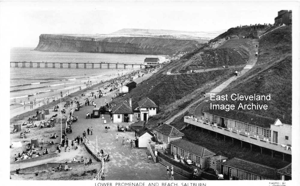
The development of the Hazelgrove area can be clearly seen by comparing this photograph with Hazelgrove no1. Most obvious being the number of chalets , sadly all gone now! Juliet Lonie remembers: “My grandma had the end chalet on the upper row. I enjoyed many a summer holiday there during the day. On rainy days we took the shutters off, sat in the chalet, played cards and watched the sea. Very happy memories.”
Postcard courtesy of Maurice Grayson, thanks to Juliet Lonie for that update.

Recent Comments