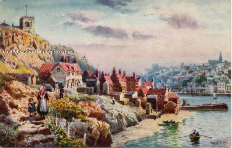
A colourful postcard from about 1900; A fisherwoman and child walk along the path from Tate Hill. This was a notorious place for cliff falls; several houses have been lost over the years in this area.
Image courtesy Ken Johnson.
|
|
||
|
A colourful postcard from about 1900; A fisherwoman and child walk along the path from Tate Hill. This was a notorious place for cliff falls; several houses have been lost over the years in this area. Image courtesy Ken Johnson. 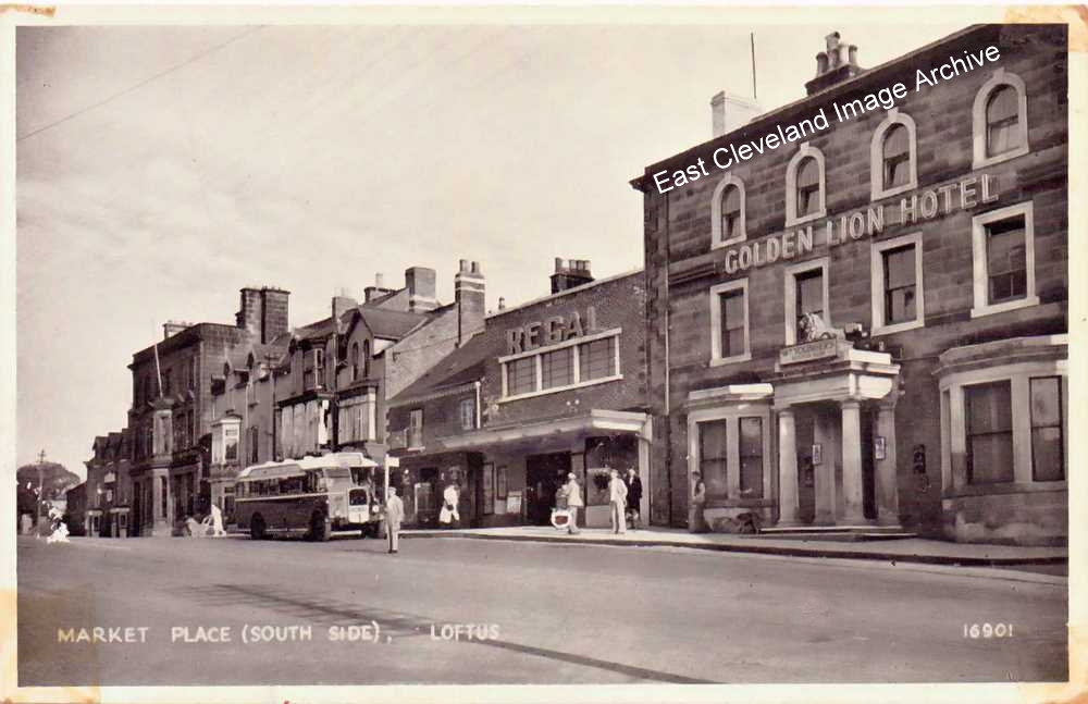 This postcard image (from a Salmon card) dates from just before the Second World War. The newly opened Regal Cinema stands next to the Golden Lion Hotel, with it’s lion statue gazing down on the market place. The lion’s replacement is a poor copy of the original. The bus experts will tell us about the United service make and model standing at the bus stop. 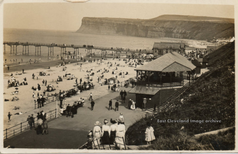 An early twentieth Century postcard view of Saltburn lower promenade. The beach, pier, and promenade are busy on a glorious summers day. The two-storied structure in the foreground, appears to have an open viewing platform, so we asked: ”Does anyone have any information as to it’s purpose? Callum Duff has told us: ”The two-storied structure on Saltburn’s lower promenade was built as a shelter but also served as covered viewing area for theatre productions and Pierrot shows which took place on the promenade opposite. A makeshift stage was set up (later made more permanent with an iron legged structure behind) and the two ramps either side of this served as ‘stage left’ and ‘stage right’. For shows comprising many parts but few cast, the area behind the stage was probably used for quick costume changes. Popularity in these shows declined with the advent of TV and the permanent stage was destroyed in the great storm of 1953 and never replaced. A building of similar design to the base of this structure survives as Saltburn Surf School and there are what look like original steps at the back of the building.” Callum also advises: ”As an addendum to my previous post, I have been informed that the current Surf School is housed in the ground floor section of the original building. The upper cast iron floor was removed around 1960, either due to deterioration of the structure or because Victorian architecture was deemed to be unfashionable. The steps were truncated to the rear to prevent anyone climbing on a roof that now had no safety railings. In my youth this former shelter was used to store deckchairs and other beach equipment for hire. It also looked rather sorry for itself until it was rescued by Nick Noble and his Surf School.” Image courtesy Ken Johnson and many thanks to Callum Duff for the updates. 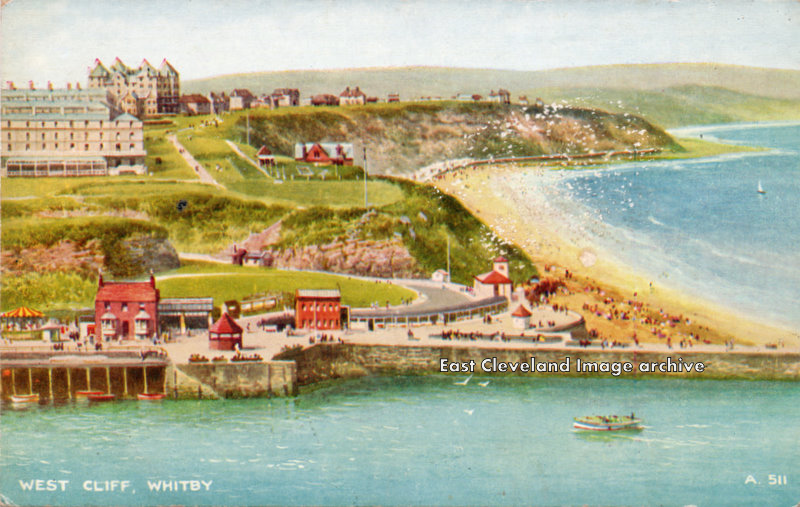 This coloured postcard is undated, but some clues can be observed. Above Khyber Pass, Captain Cooks Statue is absent. Can you tell us when it was erected? Also instead of a road past the pavillion, and Royal Crescent there is a footpath. On Pier Road, there is a roundabout instead of buildings. can any viewers give us an approximate date please. Image courtesy Ken Johnson. 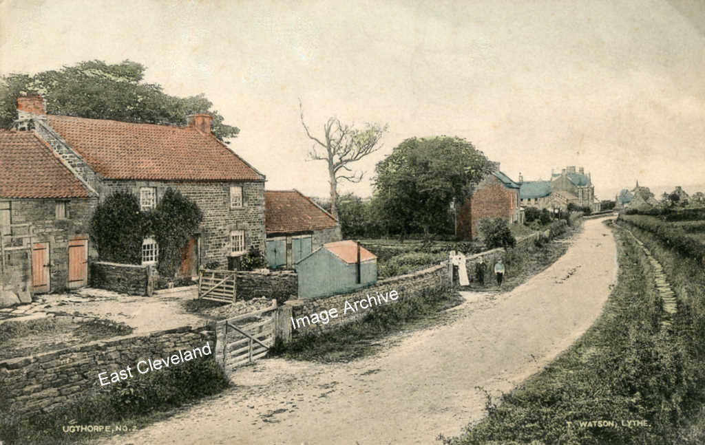 A delightful view of the west end of Ugthorpe, from a Tom Watson postcard, dated 1904. John Gallon tells the Archive: “Looking east, Pump Farm in the foreground, the “Pump” is over the wall behind the open farmyard gate, I was told that when I was a toddler I almost fell down the well looking for a lost kitten very soon after it was filled in (someone must have cared about me!!! Rose Cottage is in the middle distance (red brick). The “tin” hut in the centre was known as the Postman’s Hut where the postman would sort the post before delivering, it was wood lined inside and later used as a coal shed for the farm. As I write this I am sat, indoors, very close to where the dead tree is standing.” Image courtesy of Beryl Morris, thanks to John Gallon for the detail and updates. 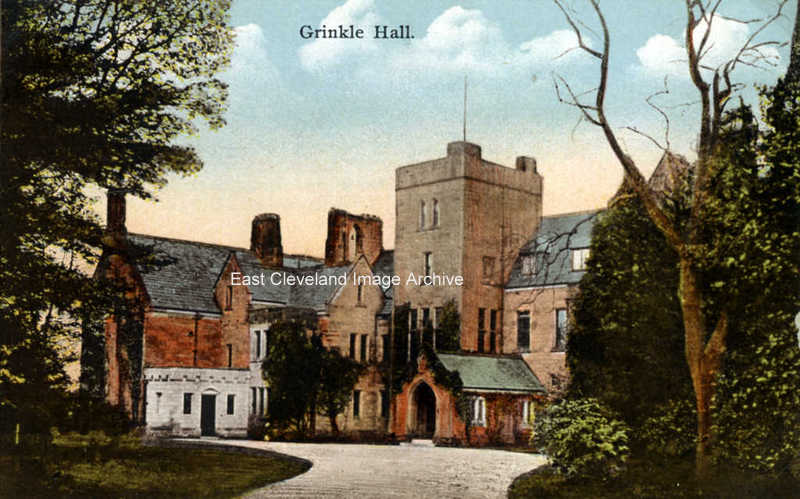 Another excllent postcard view of Grinkle Park from 1904. Part of a series of postcards kindly loaned by Beryl Morris. Image courtesy of Beryl Morris. 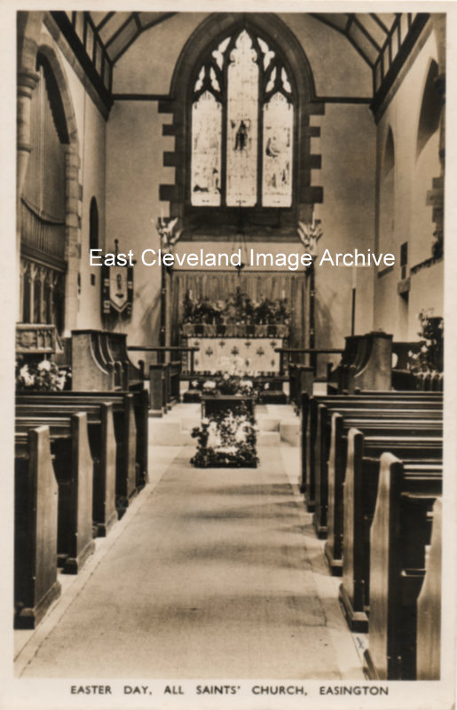 Easington church again, all dressed up ready for the Easter service. Image courtesy of Mrs Lilian Waton. 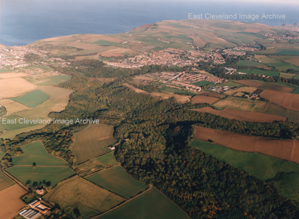 An aerial view of Loftus taken as part of the works to rectify the slippage on Loftus bank, Image courtesy of Keith Ferry. 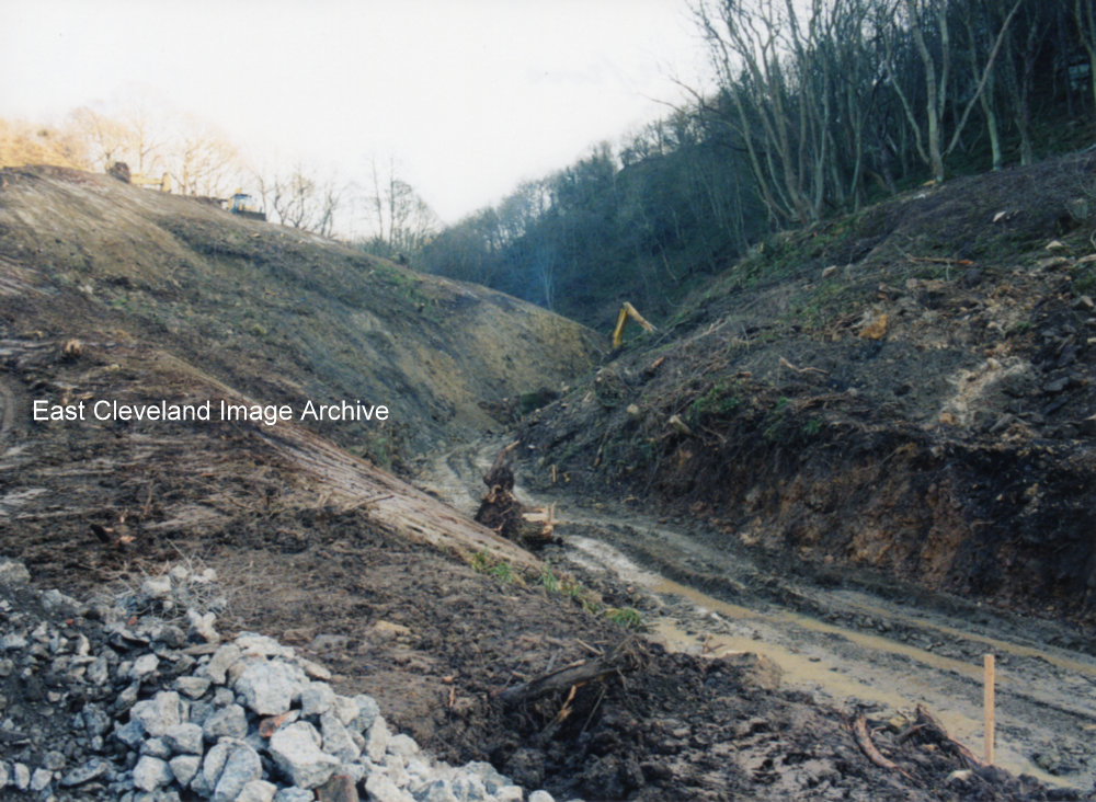 After specialist work by rock climbers on the steep cliff face of the narrows, work begins on removing 20,000 tons of unstable ground. And then replacing it with 200,000 tons of fill, using excavated materials from the Skelton and Brotton Bypass then under construction. This occupied the rest of 1999, at first weight restrictions and traffic lights were used to ease traffic flow. But when the bank closed, a 15 mile diversion was in force, via the A171 road over the North York moors. 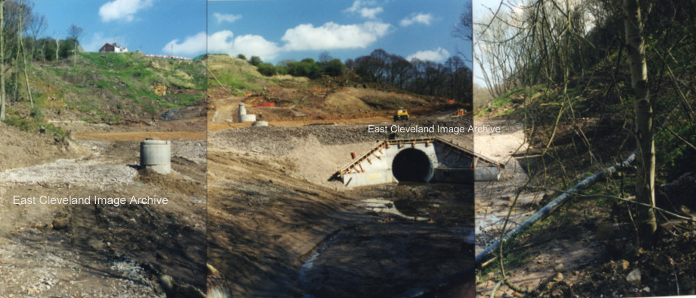 Loftus Bank; this montage of photographs shows the construction of the culvert to channel Whitecliffe Beck past the Landslip. It was 173 metres long, with a tunnel for the sewer 140 metres long. At the top of the bank the existing road was removed and replaced, with a retaining wall 65 metres long and 4 metres high being constructed. It was one of the biggest engineering projects ever undertaken by Redcar and Cleveland Council. During the works, Road traffic was routed onto the North York Moors A171 road. A 15 mile detour to Teesside, at a cost of £3,000,000. The road finally opened to controversy on September 29th 2000, some nineteen months after the first slip. Image and detail courtesy Keith Ferry. |
||
Recent Comments