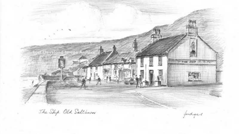
This delightful pencil sketch postcard from Judges clearly shows the additional buildings which were once to be seen beyond the Ship Inn.
Image courtesy of Maurice Grayson.
|
|
||
|
This delightful pencil sketch postcard from Judges clearly shows the additional buildings which were once to be seen beyond the Ship Inn. Image courtesy of Maurice Grayson. 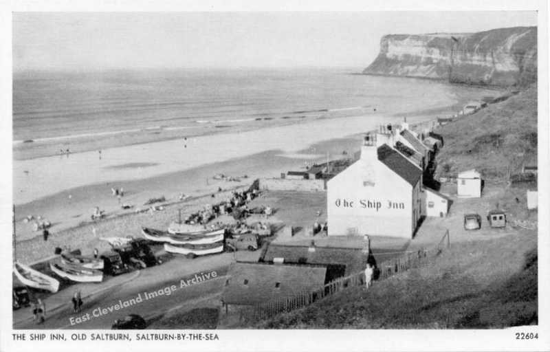 An early 20th century view of the Ship Inn, with an array of fishing cobles pulled up along side the road. The former Rocket House and Mortuary are both clearly visible, as is a footpath up along the seaward side of Cat Nab from where this postcard view was obviously taken. Nicholas Millington believes : ”Looking at those cars I’d say 1934?”. Callum Duff has advised us: ”Both this postcard and the one below are most likely to be post World War II. The once-fashionable bathing machines were retired in the early 20th Century and were lined up between The Ship Inn and Cat Nab, across the road from the mortuary and rocket brigade where they were either used for storage or by courting couples! They had all been removed by the end of the war and there is no sign of them in either of these postcards. A book by Major J. Fairfax Blakeborough called ‘The Story & Tradition of Old Saltburn’s Ship Inn’ was published in 1948 and uses the postcard above as one of its illustrations so I assume that the photograph was taken around that year.” Image courtesy of Maurice Grayson, thanks to Nicholas Millington and Callum Duff for the updates on a possible date. 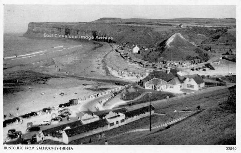 That is the title on the bottom of this postcard view – the old Bank cafe is clearly visible in the foreground – with a funfair in the area now the boat parking. There are more houses beyond the Ship Inn, possibly dating from the late 1930s, we believed. Callum Duff advises: ”Both this postcard and the one above are most likely to be post WW2. The once-fashionable bathing machines were retired in the early 20th Century and were lined up between The Ship Inn and Cat Nab, across the road from the mortuary and rocket brigade where they were either used for storage or by courting couples! They had all been removed by the end of the war and there is no sign of them in either of these postcards. A book by Major J.Fairfax Blakeborough called ‘The Story & Tradition of Old Saltburn’s Ship Inn’ was published in 1948 and uses the postcard above as one of its illustrations so I assume that the photograph was taken around that year.” Image courtesy of Maurice Grayson and many thanks to Callum Duff for the update. 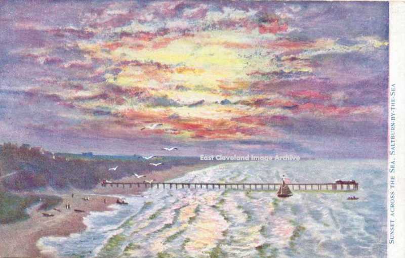 This artistic postcard view of Saltburn sands looking westward at the sunset is undated so we had no idea of the age, but Callum Duff advises: ”Judging by the uniformity of the pier legs this image was produced before the schooner SS Ovenbeg breached the pier on the 7th May 1924. The pier was shortened from its original length of 1500 ft in 1875 after heavy seas destroyed the pier head and landing stage. It re-opened in 1877 and the pier head bandstand was added in 1885. The image isn’t clear but it looks like the bandstand is there and possibly the original octagonal pier buildings. If so I would say that you can date this card sometime between 1885 and 1890. Otherwise between 1890 and 1924.” Image courtesy of Maurice Grayson and thanks to Callum Duff for the updating.  This view of what we know to have been the Towers private school. This postcard view is believed to have been taken from the Halfpenny Bridge and moist likely the Gatekeeper’s Lodgehouse on the eastern side of the valley. Image courtesy of Maurice Grayson.  This view over the Ship Inn clearly shows the Rocket House and Mortuary, prior to the improvements to the Brotton road which required demolition of the Rocket House. We asked: can anybody suggest a date for this postcard view? Callum Duff rescues us again: ”Improvements to the Brotton Road necessitated the demolition of the Lifeboat house as the former office of the Rocket Brigade can still be seen in this photo, next to the mortuary. The Alexandra Hotel has been painted white and the old bathing machines have disappeared so this photograph is definitely post World War II. Coupled with a white weatherboarded pier building with glass screens, I would date this postcard around 1960.” Image courtesy of Maurice Grayson and thanks to Callum Duff for the information and dating. 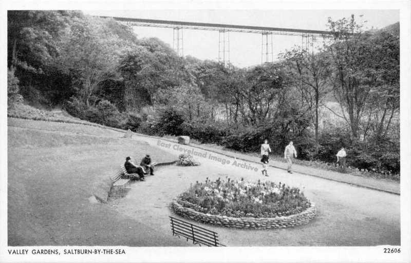 This view of the Valley Gardens shows clearly the Halfpenny Bridge in the background, but of more interest is the flower bed in the foreground which is where I believe there used to be a bandstand, although I can remember a fishpond and fountain. Callum Duff tells us: ”Saltburns bandstand was demolished by a bomb in 1940 and I was led to believe that the crater left by the explosion was made into a pond. I have film of this location from 1963 and there is fountain and fishpond on the site. This fountain used to be located below the Italian Gardens, next to the Chalybeate Spring and can be seen in many early photographs. The base of the fountain still remains and the outline of the later pond, now filled in. The fountain & pond were restored in the 1990′s but quickly succumbed to vandalism mainly due to the loss of the resident gardener, some years before. This image was presumably taken between 1945 and 1962?” Image courtesy of Maurice Grayson and thanks to Callum Duff for the update.  This early postcard view of Saltburn shows a varied collection of buildings along the shore before you can make out the Ship Inn and beyond. Callum Duff assists with dating with this detail: ”This photograph was taken sometime between 1920 – 1935. According to English Heritage the beach chalets were built between 1920 and 1929, a period which also encapsulates the building of The Beach Cafe (now Vista Mar). In 1935 the Spa Pavilion was extended adding the concrete apron of front windows which survive today.” Image courtesy of Maurice Grayson and thanks again to Callum for the additional information. 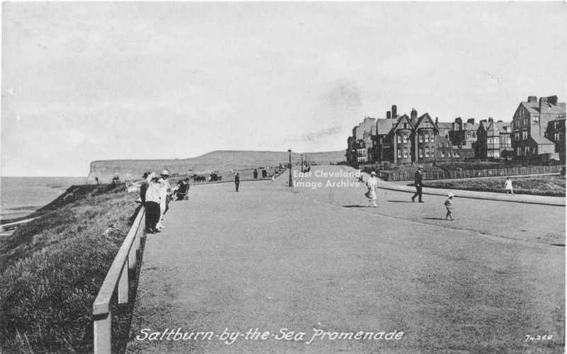 The Archive believed this was possibly late 1920s/1930s view of Huntcliffe and the top promenade at Saltburn; but what was missing were many of the present day seaward facing buildings. Callum Duff has come to our aid, explaining: ”All the seaward facing building and structures between Hazelgrove and the west side of the Cliff Lift were built between 1918 and 1939 as part of a government scheme to ease unemployment. They included; footpath improvements, railings, rose arbours, the rock garden, Jack’s Castle, Public Toilets, the large pillared shelter known locally as ‘The White Elephant’ the sunken shelter adjacent to it and a concrete pond which has since been filled in. The beach chalets, shelters and the bandstand may also have been part of this employment scheme, together with the widening of the pathway from the foot of Hazelgrove to the beach.” Image courtesy of Maurice Grayson and many thanks to Callum Duff for dating this image. 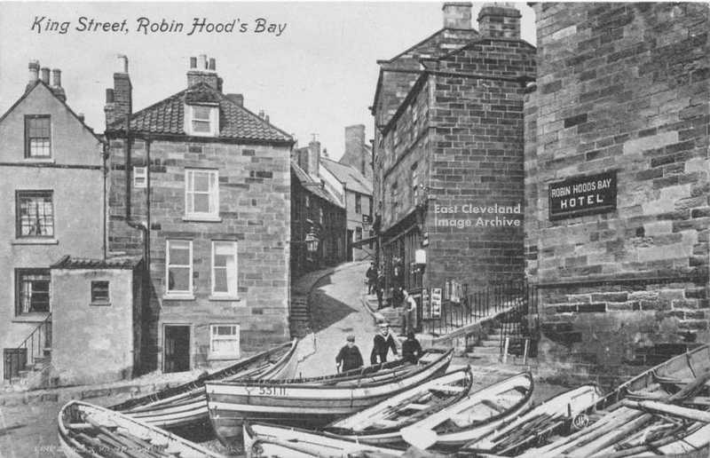 A large part of King Street, collapsed into the sea in the 18th century. This postcard is from around 1900, showing some of the fishing cobles, an important part of the economy of the village. Image courtesy of Maurice Grayson. |
||
Recent Comments