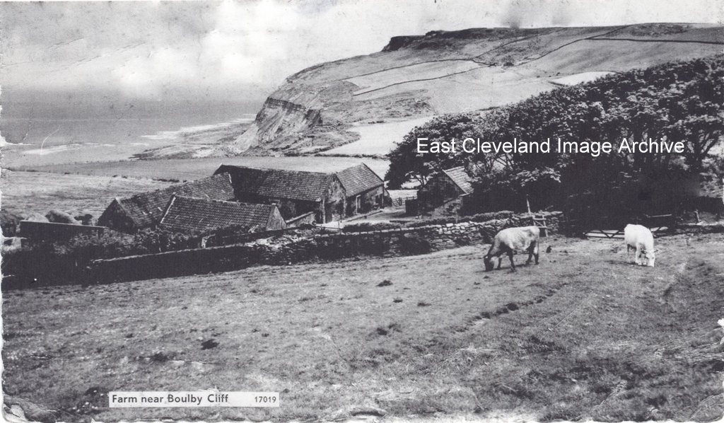
The postcard caption says ’Farm near Boulby Cliff’, it is confirmed as Hummersea Farm; but is there anything else significant?
Anne Cammidge tells us: ”The photograph shows the old cow byre buildings of Hummersea Farm. The building to the right was where the grain was kept and the flour grinder. The main farmhouse is set in the hill behind the trees. My mother Annie Hart was born and brought up here with sisters, Elsie, Ada, Mary, Hilda and brother Tommy Hart who eventually bought the farm from Lord Zetland. Uncle Tommy retired in the mid 1980’s when he moved to Easington.”
Holly Enticknap has the following memories: ”We converted the cow byre into our home, and called it The Barns. I’ll always remember there was a bottle stuck to the wall in the cow bier, about 20feet up! We never did figure out why it was there as there was no way to reach that height without ladders?”.
Image courtesy of Josie Etches, thanks to Anne Cammidge and Holly Enticknap for the updates.
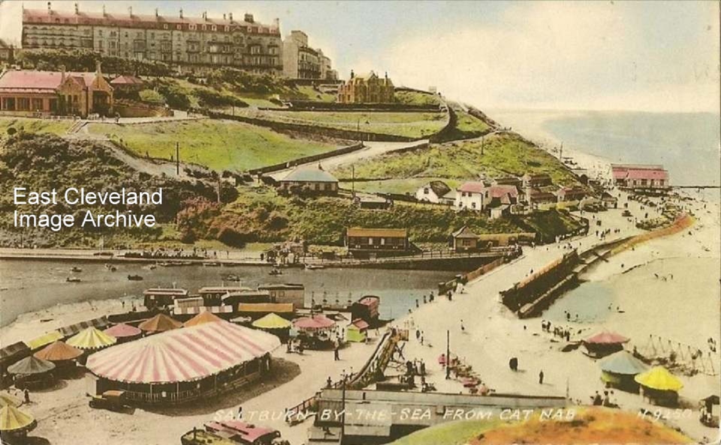
A lovely photograph of Saltburn taken from Cat Nab, from a Valentine’s postcard. As the postcard has not been used a possible date is still to be attributed.
Image courtesy of the Julie Tyrka and Joan Jemson.
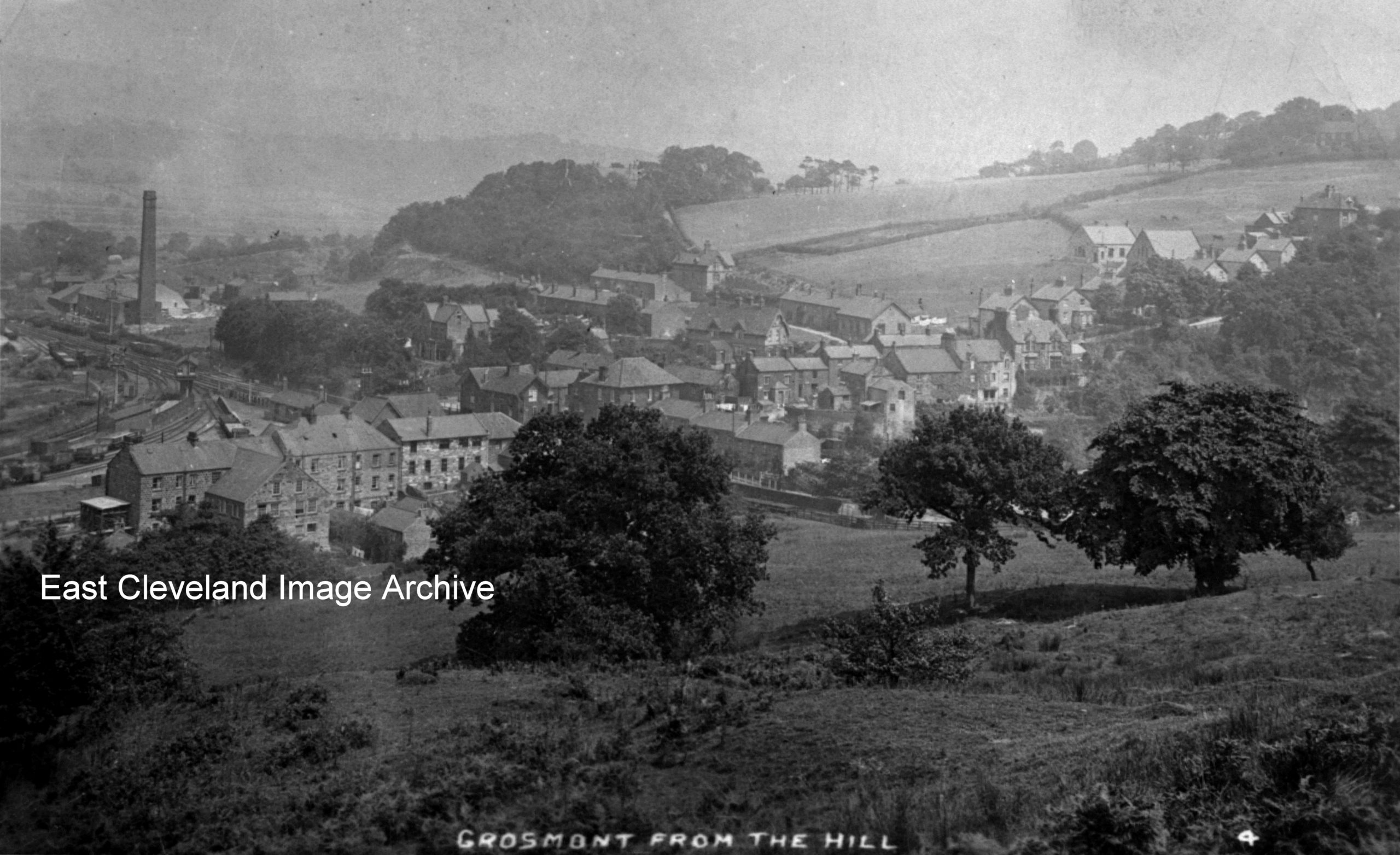
That is what the caption on this image says; I don’t think it looks much like this today. Russell Pigott tells us: ”I would say about the turn of the 20th century,there is fresh ballast on a siding which looks like it went into the ironworks that seem to be demolished and also the style of railway wagons in the picture.” Richard Coates comments: “I’m sure that I know the place the picture was taken. The rail lines that pass the chimney run to Whitby, if you look through the gap between the second and third bush you can just make out the line that runs to Pickering now owned by the NYMR. The view has changed slightly but not much.”
Image courtesy of Cleveland ironstone mining museum, thanks to Russell Pigott and Richard Coates for the updates.
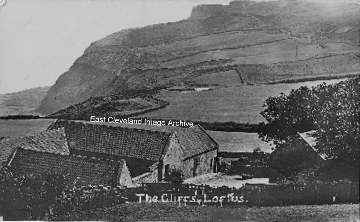
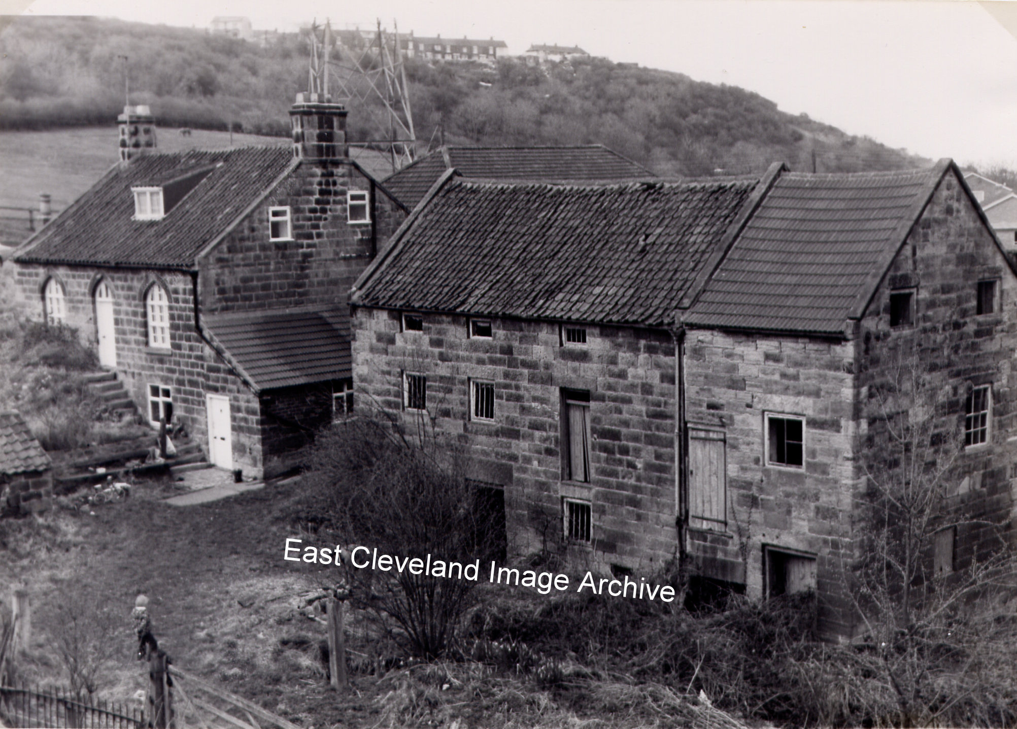
A different view of Hummersea Farm we see today, now much changed with a larger range of dwelling houses. In the distance beyond Snilah ponds is The Warren.
Holly Enticknap tells us: ”We lived in the barn on the right hand side, we converted it into our house, it took eight years to complete!”
Image courtesy of Louise Withnell and thanks to Holly Enticknap for the update.
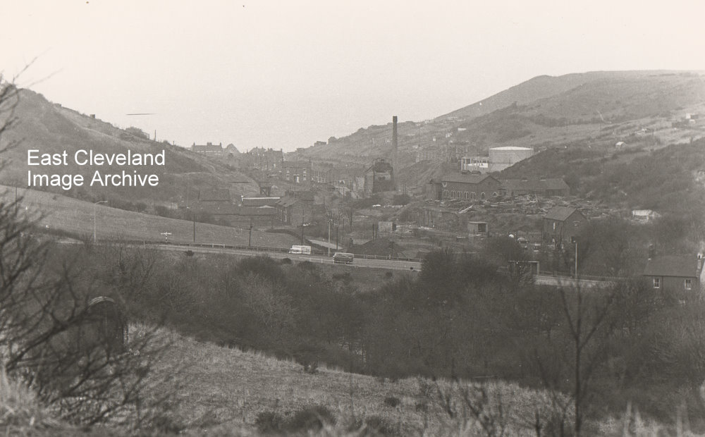
This photograph; taken from the former zig zag line against the railway embankment across the valley shows how Skinningrove was built in the valley with the gas works, gasometers and the mine buildings showing on the right hand side.
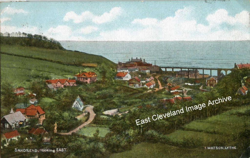
This is a view that we don’t normally see as we drive through Sandsend; the card was posted in December, 1904.Thanks to Peter Appleton for pointing out that the original caption for the image was incorrect: “This isn’t “looking east”. The coastline here runs approximately east-west. This view is looking approximately north-west.”
Image courtesy of Beryl Morris, thanks to Peter Appleton for the update.
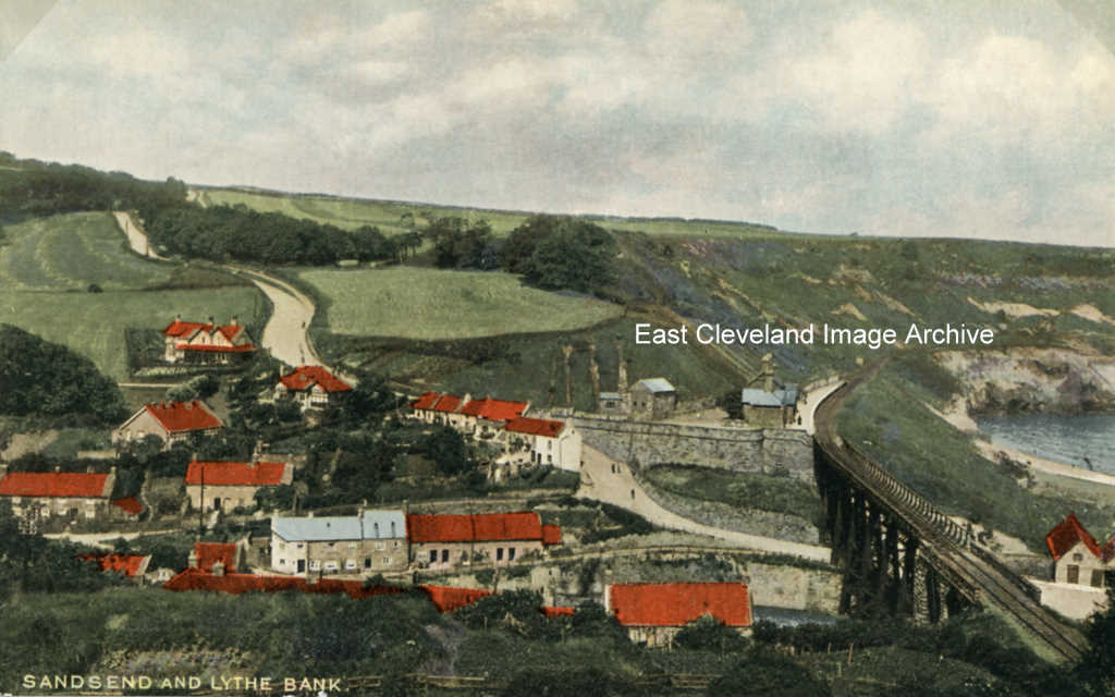
This view of Sandsend and Lythe bank is from a postcard, post marked with the date of 7th June, 1919.Perhaps from a holiday post World War I and all its horrors.
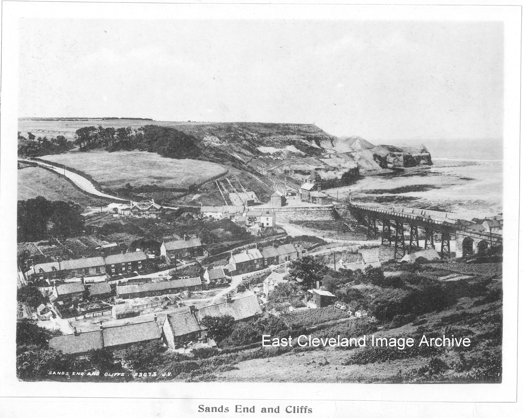
A view of Sandsend, entitled “Sand’s End and the Cliffs”; the railway station and its environs look remarkably tidy! The image is from a published “Views of Whitby & District”, undated but obviously early 20th century. The image also is also in ”Photographic View Album of Whitby”. (photographed and printed by Valentine & Sons Ltd., Dundee).
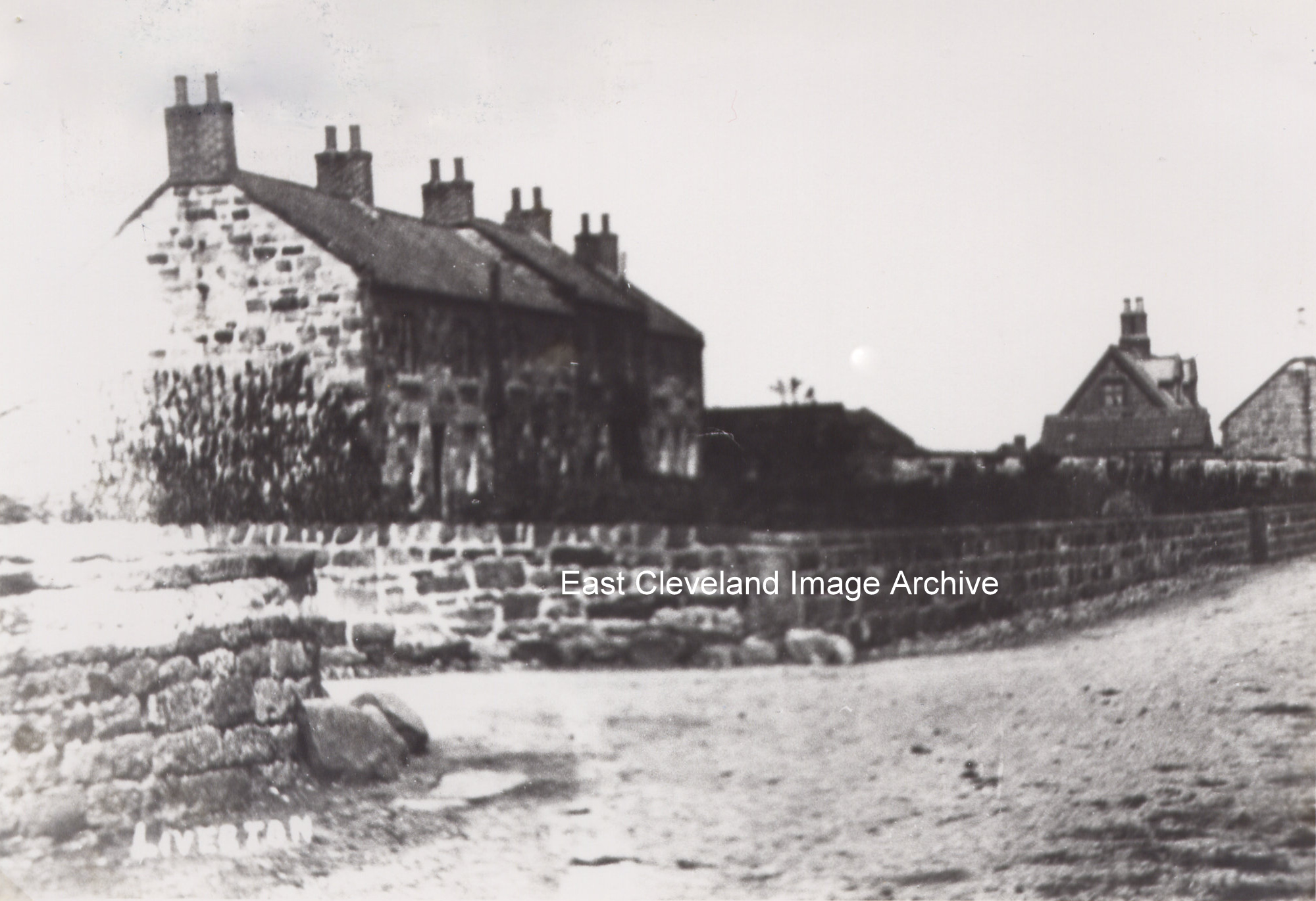
Somewhere different; I don’t think we have another photograph of Liverton or of these cottages which I always knew as Petch’s Cottages am I right? As Jill Gale tells us: ” This is at the corner of Moorsholm Lane with main road. Village hall to far right of picture.” Bill Watkinson tells us: ”I and my family lived in the last one next to Moorsholm Lane from 1968 when we bought it for £2500 and they were known as 4 Petch’s Row then. My Mum and Dad sold up in about 1984 when a motorcyclist was killed in the side garden. The second house in the row was lived in by Mrs Harrison and young Jim her son who worked at the Shrubberies. The house behind the village hall was lived in by a lady with Parkinson’s disease where I used to go to get our Sunday chicken.”
Image courtesy of the Pem Holliday Collection and thanks to Jill Gale and Bill Watkinson for the updates.
Recent Comments