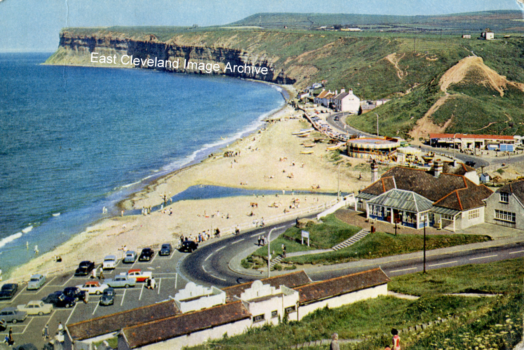
The caption that is printed on the reverse of this postcard reads: ”Old Saltburn, Yorkshire. At the foot of the valley through which Skelton Beck reaches the sea, Old Saltburn’s few cottages are so close to the breakers that spray beats on the windows. The headland of Huntcliff to the south forms a fine background.” David Richardson commented: “This may have been taken in the 1950’s.”
Image courtesy of Tina Dowey, from a postcard that was published by J. Arthur Dixon, Ltd; thanks to David Richardson for the update.
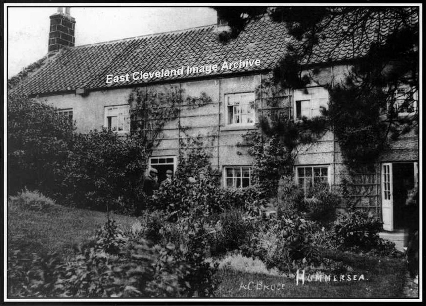
This image (from an A. C. Bruce postcard) featured in a Loftus Town Crier calendar with the commentary of: “Farm house and buildings at Hummersea. This farm is situated between North Terrace and the Coast Guard cottages. The farm was a place to rest for a lot of people who had climbed up from the beach.” The Archive asked: “Where were the coast guard’s cottages? Does anybody recognise the two people in the doorway?”
Eric Johnson advised: “Of interest in the photograph, are the upstairs windows, they are of the ’Yorkshire’ sash type; in which as can be seen in three of them, the lower left hand panes open ”sideways” by sliding to the right. unlike normal sash windows with the upper panes sliding up and down. I think the coastguard cottages are now known as Warren Cottages towards the alum quarry.”
Image courtesy of Loftus Town Crier, many thanks to Eric Johnson for the update.
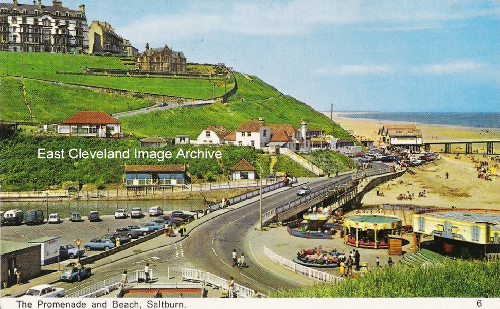
A photograph contemporary with that in ”Saltburn, A Renaissance”, only taken from Cat Nab. This shows the roundabouts where the boat park is now; I think this dates into the 1960’s. Tony Auffret tells us: ”I think this was still there in 1960. The “amusement” on the far right was a “waltzer”. There were “swing boats” behind along the edge with the beach.” Callum Duff has a dating update: ”Although Skelton Beck was used for boating before 1962, the ‘official’ council-run boating lake with sluice gates to regulate the depth of the beck, segregated areas for larger and smaller boats and the marking out of car parking spaces and the toilet block was laid out in 1962. The reason I know this is that I have a copy of the 1961 centenary film (where there is no boating lake visible) and a copy of a 1963 film of Saltburn where the boating appears to be well-established and very popular. This postcard image was taken between 1962 (when the boating lake was completed) and 1974 (no postcards images of Saltburn were produced between 1974 and 1978). The Waltzers remained on this site until 1978 and the rest of the rides and buildings had been removed by 1983.” Rick Avern enquired: “Does anyone know who owned these rides in the 1960’s.” Alan Collins advised: “My mother worked in the cafe and beach shop, owned by the family who also owned the little fairground. To the right of the bog waltzer was a rifle range with metal targets that were knocked over with the .22 rifles. The family who owned the fairground, beach shop and cafe lived in the farm house, on the other side of a little wooden bridge, behind where this photograph was taken. The family also owned the shop (behind where you can see a small brick cemented paddling pool behind white wooden railings, which was also dismantled in the early 1950’s). It sold sweets, ice cream, postcards, and the usual stuff – but my mother persuaded the owners to serve hot food.”
Image courtesy of Jean Dean; many thanks to Callum Duff, Tony Auffret, Rick Avern and Alan Collins for the updates.
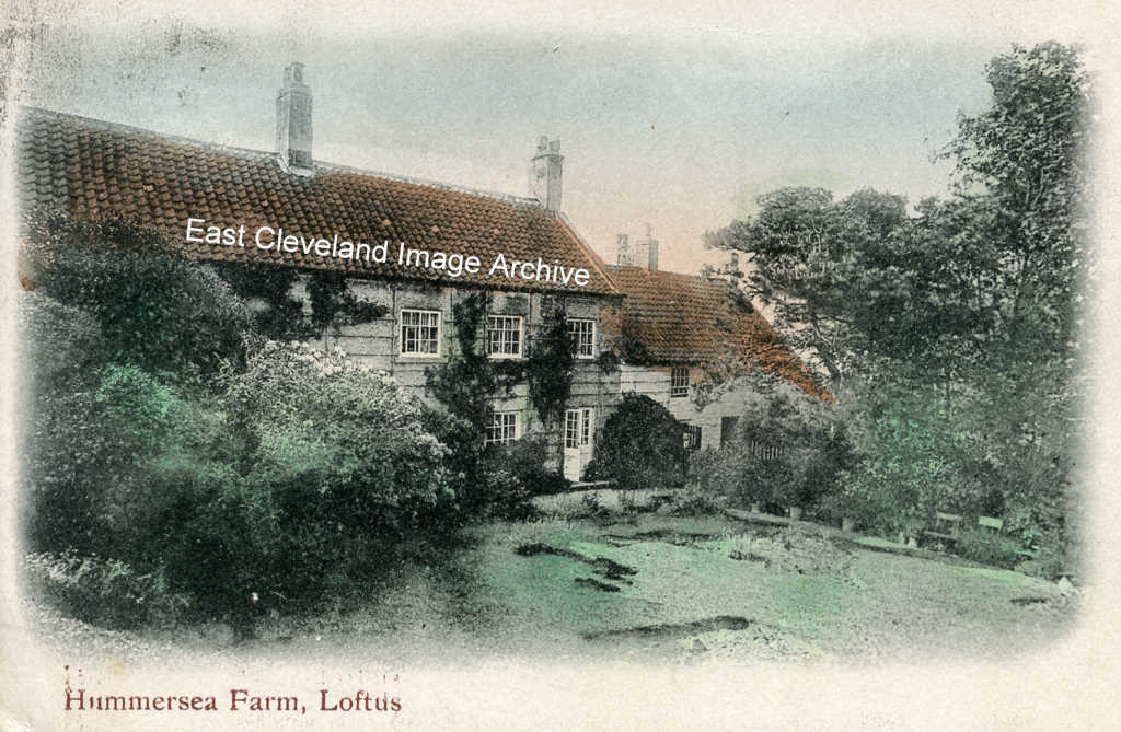
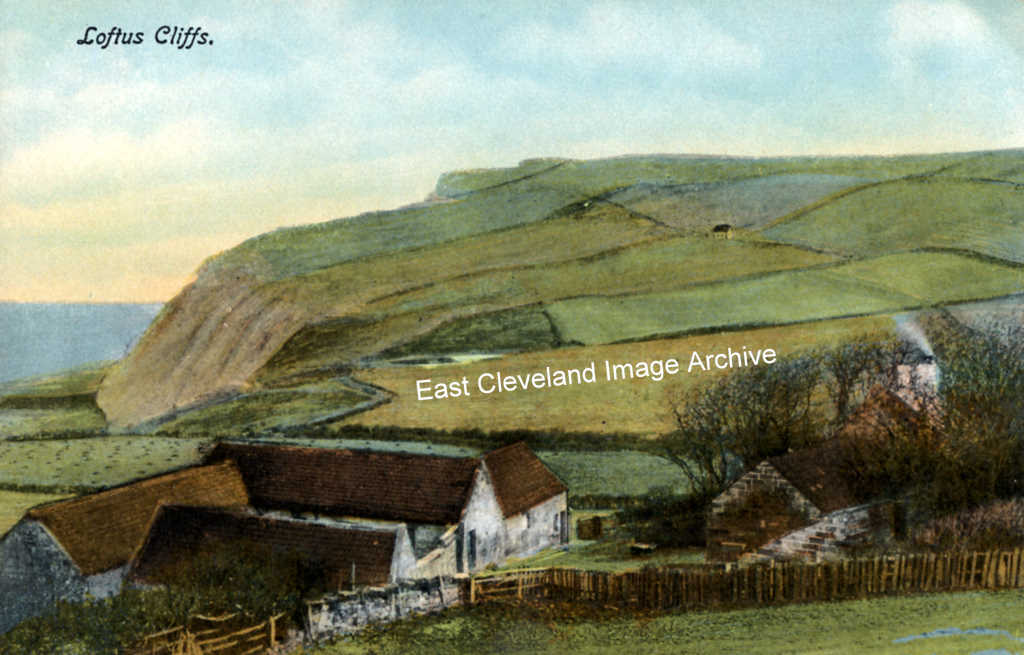
Another idyllic setting; this from a hand tinted postcard view of Hummersea Farm, today much altered and improved from this scene. Although the farm still remains secluded and peaceful.
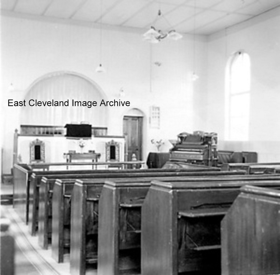
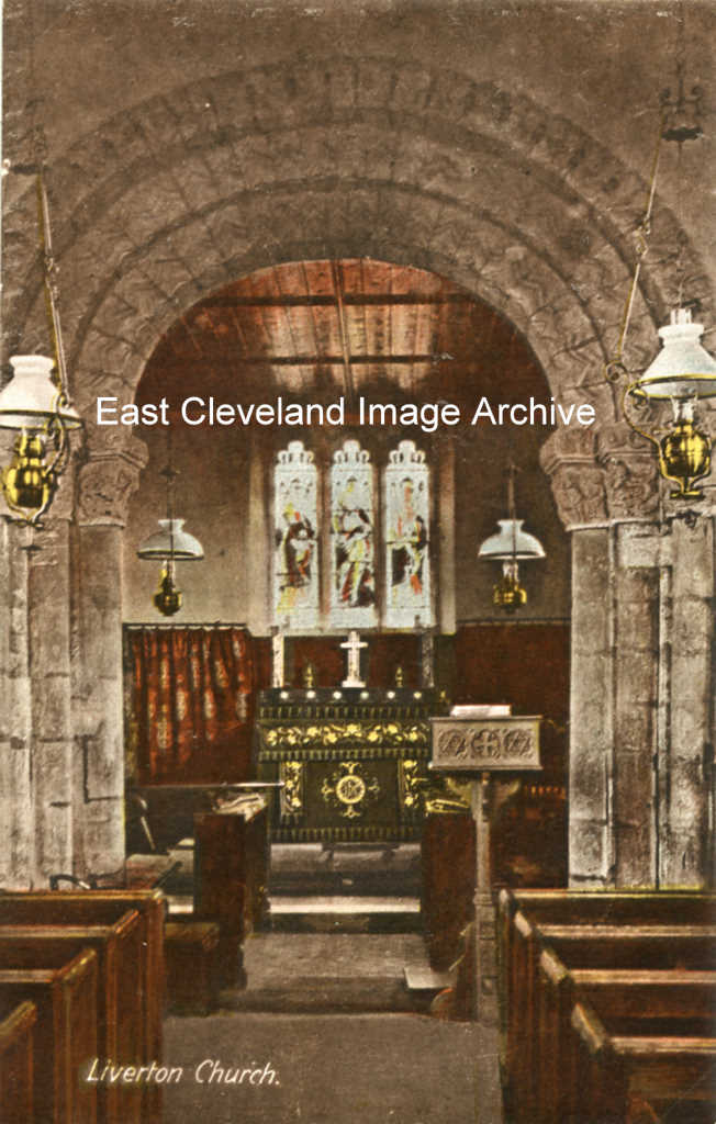
The image was donated by Iris Knight (nee George) Her father (Tom George)was lay preacher at the chapel and just for good measure, he must at the time been the tallest man in the village at 6 feet 4 inches tall as Iris recalls. Sheila Alderson tells us: ”I remember the Sunday School at the back, we went through the door on the right hand side. Before I left England my name was written on the outside window ledge across from the ’Hollywell’ (Sheila and Paul); I wonder if its still there….lovely memories of my childhood ….”Mel Stevens (Wobblywotnotz) commented: “I now own the chapel at Liverton Mines and was thrilled to find a picture of how it looked when it was still in use.”
Image courtesy of Iris Knight (nee George) via Ray Brown, also thanks to Sheila Alderson for the update.
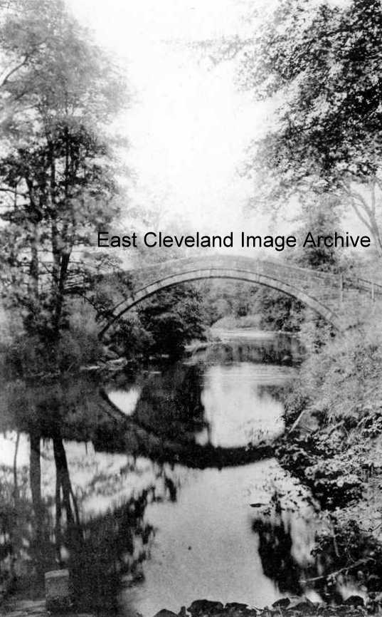
This photograph taken by Frank Meadow Sutcliffe; a perfect, timeless image. Taken from ”Photographic View Album of Whitby” – photographed and printed by Valentine & Sons Ltd., Dundee.
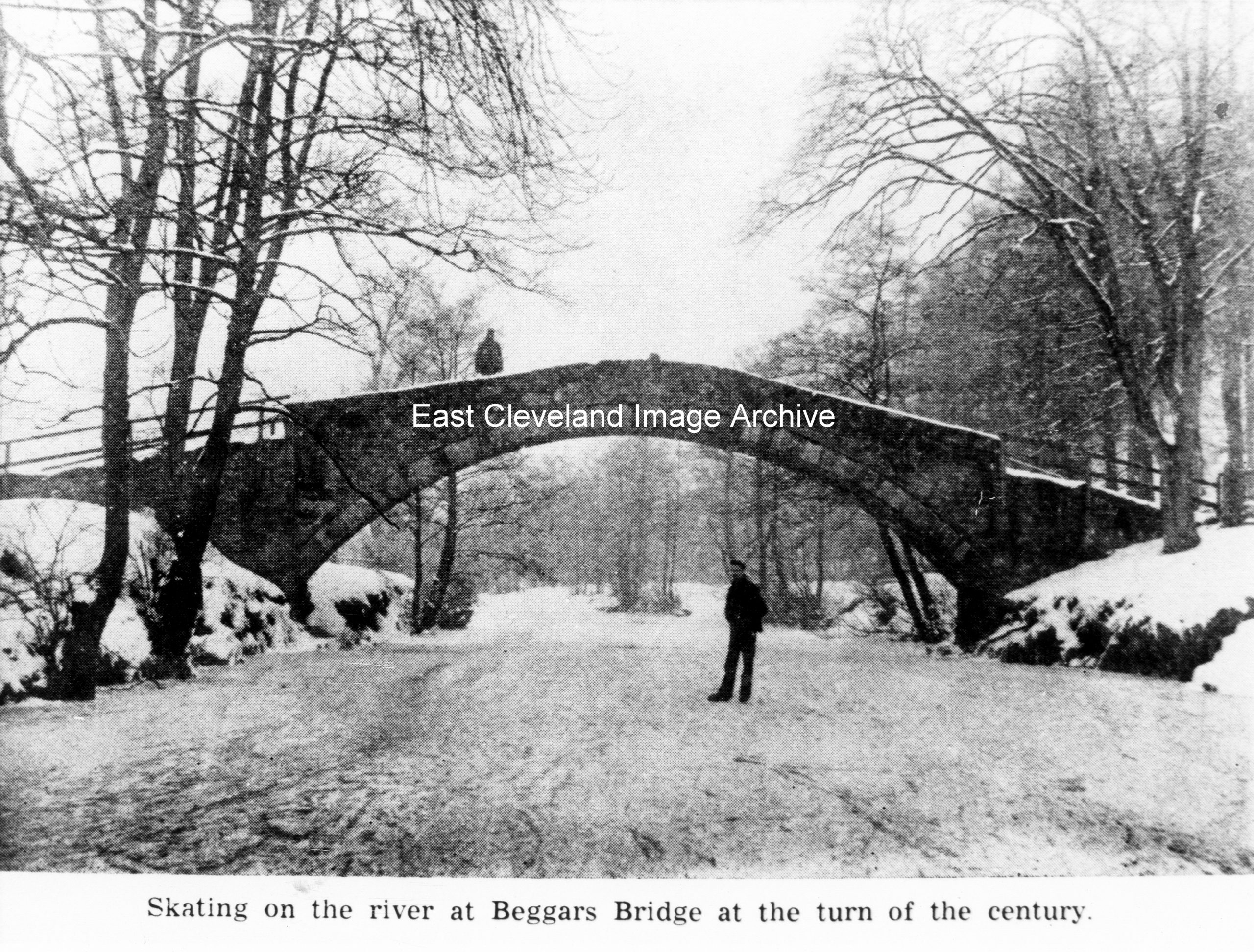
I think we all know the story of Beggar’s bridge, when a poor man loved a rich girl and went away to make his fortune to build the bridge. Well here it is in winter with the river so frozen that they could skate on it, image dates from c.1900. Was it frozen in the cold of last winter? Image courtesy of Cleveland Ironstone Mining Museum.
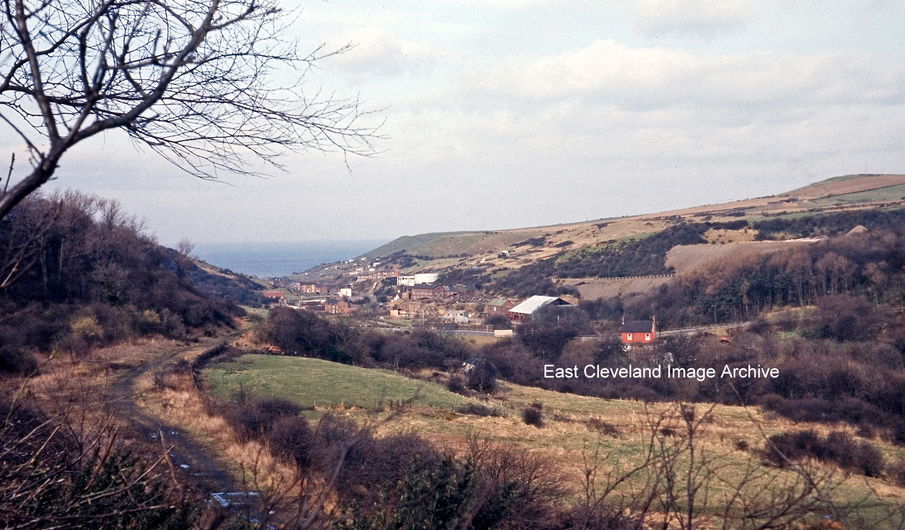
Raymond Brown tells us: ”This one is of Skinningrove Valley circa 1963. The old track bed of the line to Loftus/Whitby can be clearly seen with the track lifted from the BR closure (well before it was re-laid for CPL) and in the distance the pair of old Gas holders at Skinningrove. Note the lack of trees that now obscure this view.” The consensus of opinion is that this is the first junction of the zig-zag, with the ’tail’ of the first section coming off the photo at the bottom (originally to run under the viaduct, but after the viaduct was in-filled, stopping short just before the new embankment).
Image courtesy of Raymond Brown and thanks go to Colin Hart and Russ Pigott for the updates.
Recent Comments