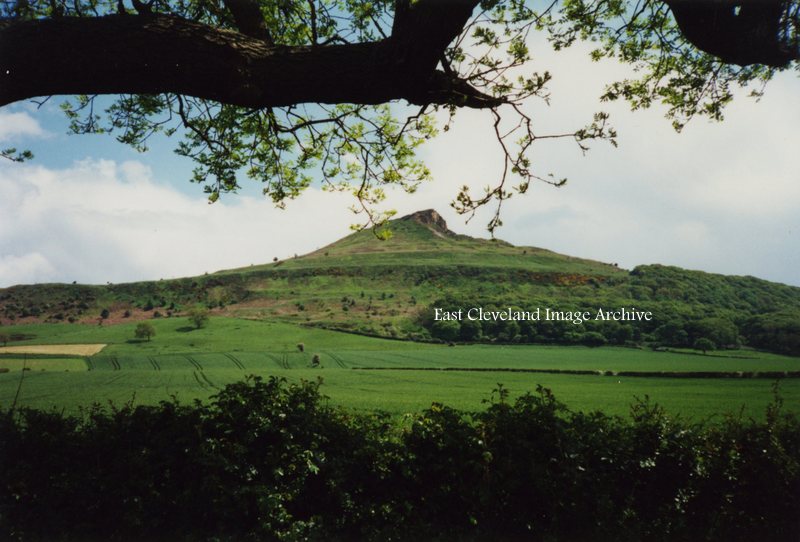
A familiar view to all who visit the area is this more modern image of Roseberry Topping; viewed from the lay-by/car parking are as one approaches Newton under Roseberry. At 1,049 feet (320 m), Roseberry Topping was traditionally thought to be the highest hill on the North York Moors however, the nearby Urra Moor is higher, at 1,490 feet (450 m). The top offers views of Captain Cook’s Monument on Easby Moor and the monument on Eston Nab. We are informed: “Until 1912 the summit resembled a sugarloaf, but a geological fault and possibly nearby alum and ironstone mining caused its collapse.”
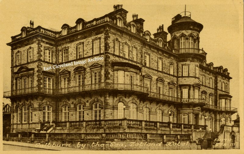
This Frith’s postcard view of what is today called The Zetland, is of the former Zetland Hotel; viewed from the entrance to the Valley Gardens on Glenside dates from the 1950s, externally little has changed today. The Hotel is no more and the building is now luxury apartments with stupendous views; although further developments have taken place to the rear of the building. Proposed as a luxury railway hotel by Henry Pease the founder of Saltburn, to promote the resort, it was built 1861 to 1863. Over the years the fortunes of the hotel and the resort declined and by the early 1970s the number of visitors to the town had dropped substantially. Many hotels struggled to survive and had to close. Eventually, the Zetland Hotel also closed in 1983 and was converted into apartments in 1989.
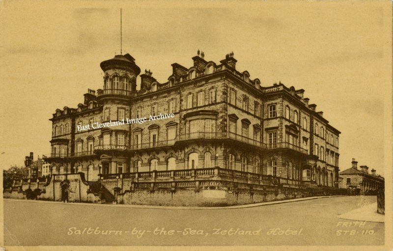
This Frith’s postcard view will be familiar to many travelling from the south and approaching Saltburn via the infamous Spa Bank! Dating from the 1950s, it is little changed today, the Hotel is no more, but the building is now luxury apartments with stupendous views. Proposed as a luxury railway hotel by Henry Pease the founder of Saltburn, to promote the resort, it was built 1861 to 1863. Over the years the fortunes of the hotel and the resort declined and by the early 1970s the number of visitors to the town had dropped substantially. Many hotels struggled to survive and had to close. Eventually, the Zetland Hotel also closed in 1983 and was converted into apartments in 1989. Today it is simply known as The Zetland.
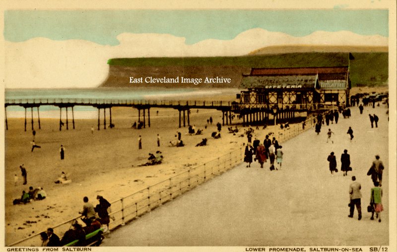
Another very dated view of the beach and promenade at Saltburn, this postcard views serves to remind us how dress styles have changed over the years. You dressed up to go to the beach; nowadays minimal clothing is the norm (and lashings of factor 50+ sun cream). John Keelty tells us: “My father used to take me and my twin brother, Peter to Saltburn and we used to ride up and down in the rail car from the beach to the promenade. When my father went for a pint in the Ship Inn, there was a big green hill, of grass were we used to play till he came out. Sometimes we used to share a bag of potato crisps if he was sat outside. There were lots of happy memories when we were young, in 1955. He used to take us once a year, to the seaside, and we always liked Saltburn; we got ice cream and used to walk along the pier.”
Image courtesy of Iris Place and thanks to John for that update.
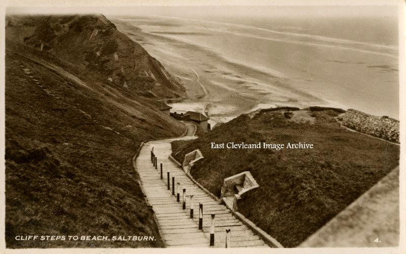
This Constance postcard view of the steps to Hazel Grove and the beach dates from pre 1950s, today the bank sides are considerably overgrown; in some cases more brambles than grass. I remember the council workmen cutting them, but alas times change.
Image courtesy of Iris Place and many thanks to Alan Collins for the update on possible dating of this image.
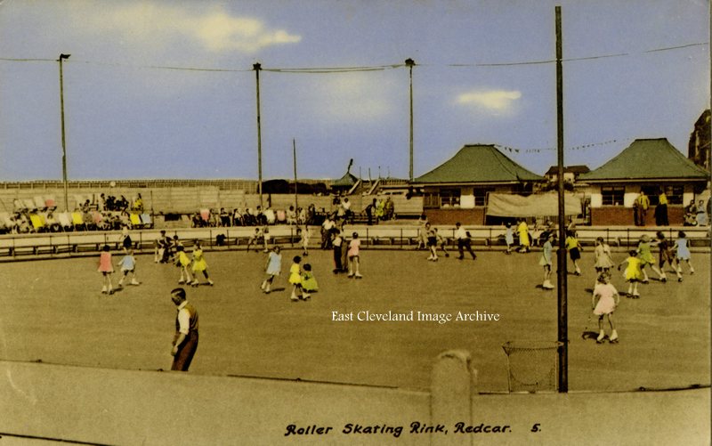
Yes it’s the skating rink at Redcar, pity it isn’t still there, but with ‘elf and safety’ now you would have to wear helmets, knee pads, elbow pads; too tired to skate by the time you had got ready. This postcard view from the late 1950s or early 1960s, shows plenty of use. Fred Brunskill tells us: ”The roller skating rink was on the site of the old outdoor swimming baths in the Coatham Enclosure and were built at a cost of £ 10,000 and opened in 1951 to commemorate the Festival of Britain.” Alan Franks tells us: “I remember it well, I used to go skating in the early to mid 1950s here as a lad. We used to skate as fast as we could round and round trying to impress the girls. It didn’t really work.”
Image courtesy of Iris Place and many thanks to Fred Brunskill, Alan Franks and Alan Collins for the updates.
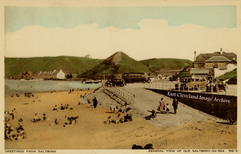
This late 1950s postcard view of Cat Nab and Old Saltburn was we presume taken from the pier. Note the style of dress; particularly the family walking up the slipway to the promenade. Mum in her best coat and dad in his raincoat; the small child is more appropriately dressed for a session on the beach.
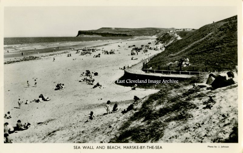
Marske beach is halfway on the long stretch of sand from Coatham to Huntcliff. Not as popular as Redcar or Saltburn, but still busy in this 1930s postcard image by J. Johnson (newsagent and photographer in Marske); it is little changed today. It is a pleasant beach, with boats pulled up to the slipway. No candy floss or ice cream stalls, nor bingo; just a lovely and unspoiled family beach.
We posted an image believing it to be of the Convalescent Home at Coatham; based on the ‘REDCAR’ heading to the ‘cropped’ postcard. This provoked many comments and we are grateful to Fred Brunskill, Dave Cusson, Mick Mavin, and Craig White; but our saviour was Carl Conway who correctly identified the building as the Felix Hotel, Felixstowe. Several of the comments were suggesting that it might be the cloisters of the Sir William Turner’s Grammar School.
To that end we havefound and posted in the space this early tinted postcard view of Sir William Turners, which shows the aforementioned cloisters. Many thanks for all who contributed and another mystery solved.
Image courtesy of Mike Holliday and other sources.
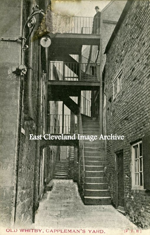
This J. T Ross postcard view of Cappleman’s Yard although not postmarked dates probably from the late 1890’s. Situated at 43/44 Church Street, Cappleman’s Yard is first listed in 1828 and later in 1899, changed its’ name to Stanley Place c.1909. A typical example of a Whitby yard with steps and landings crossing the narrow yards or alleys which adjoined Church Street in particular.

Recent Comments