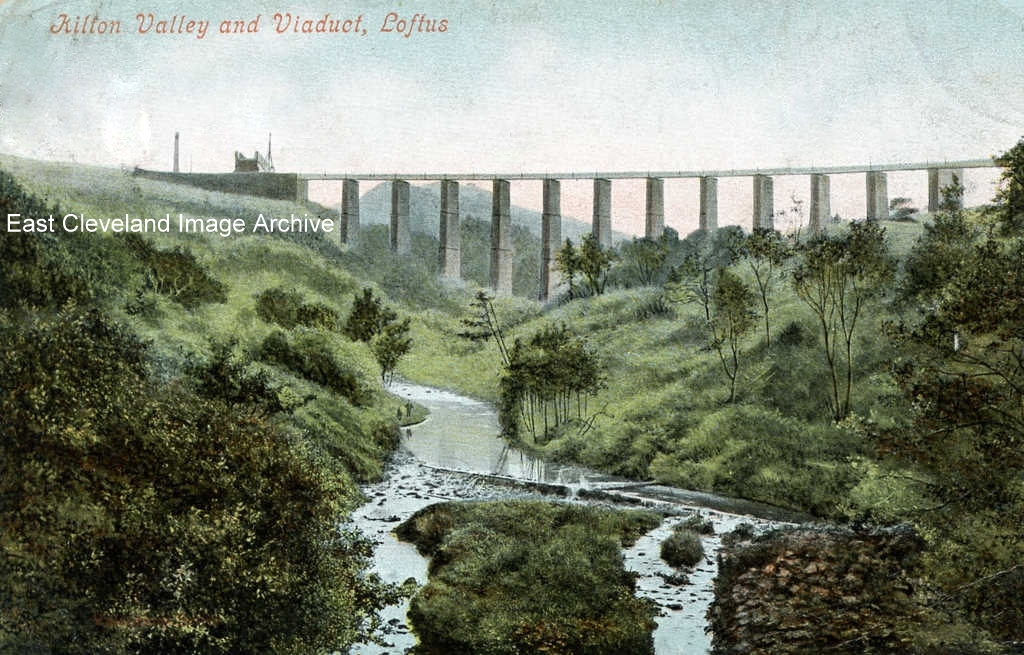
This postcard is a lovely example of early colour hand tinting to a black and white photograph and was produced by Cooke’s Fancy Bazaar in Loftus; the original was posted in Loftus on 30th July, 1905.
Image courtesy of John G. Hannah.
|
|
||
|
This postcard is a lovely example of early colour hand tinting to a black and white photograph and was produced by Cooke’s Fancy Bazaar in Loftus; the original was posted in Loftus on 30th July, 1905. Image courtesy of John G. Hannah. 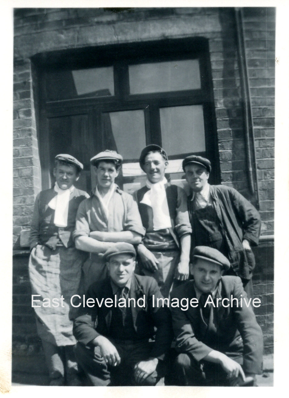 Skinningrove works, date unknown; Tom Codling had been identified as is standing on the left of this group. Eric Johnson advised: “I can recognize faces, but only name I can think of is Stan Bowman, kneeling on the right. has the photograph been taken outside the Talbots laboratory?” Can anybody else assist? Image courtesy of Mrs. J. Wilson, thanks to Eric Johnson for the update. 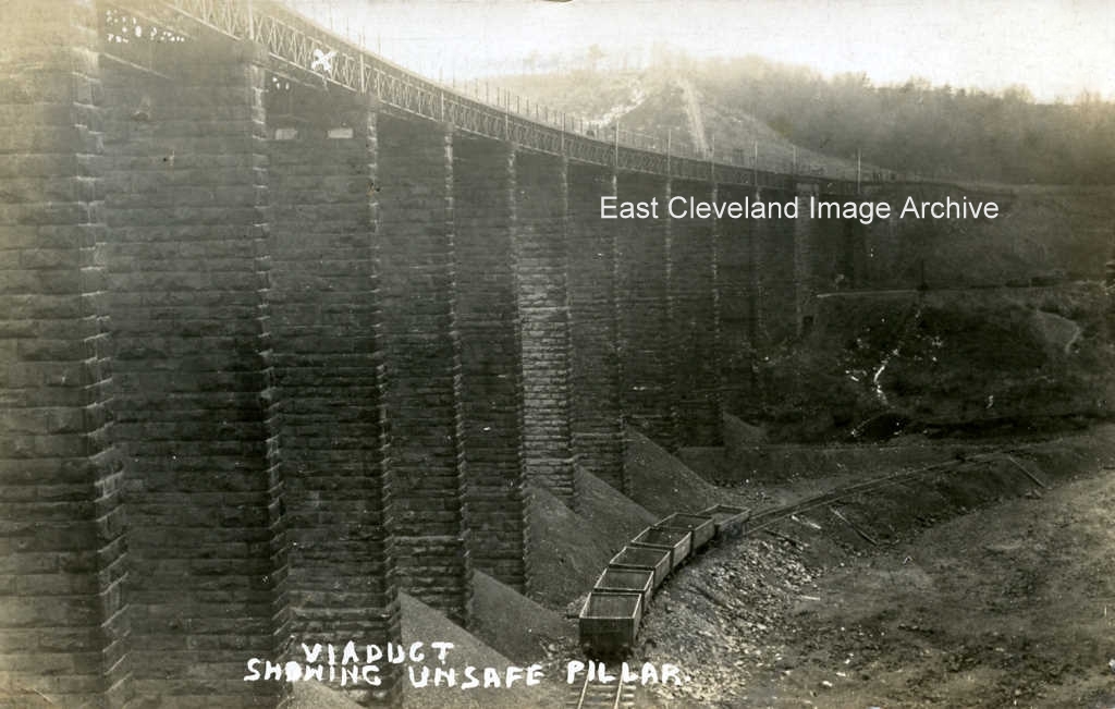 X marks the spot not of treasure, but of the unsafe pillar of the Loftus to Carlin How viaduct that caused it to be filled in with spoil from the mines. The condition of the pillar lead to the creation of the culvert to house the Kilton Beck and the infilling of the viaduct with iron stone mining waste to create the embankment we still see today. This image dates from 1911 and is from a T.C. Booth postcard. Simon Chapman tells us: ”Kilton Viaduct was infilled from 1907 to 1914 primarily so that ironstone could be worked from beneath it, particularly from the Carlin How mine. The picture was taken in 1911 when one pier cracked and train services were suspended for a fortnight in January 1911 while remedial action was taken.” During that fortnight “rail passengers were carried between Loftus and Skinningrove in Motor char-a bancs.” On consulting the postcard the sender comments ”The viaduct has been repaired and is now open for traffic.” Obviously this is an image from prior to the remedial action which Simon reports. Image courtesy of John G. Hannah and thank to Simon Chapman and Derick Pearson for the updates. 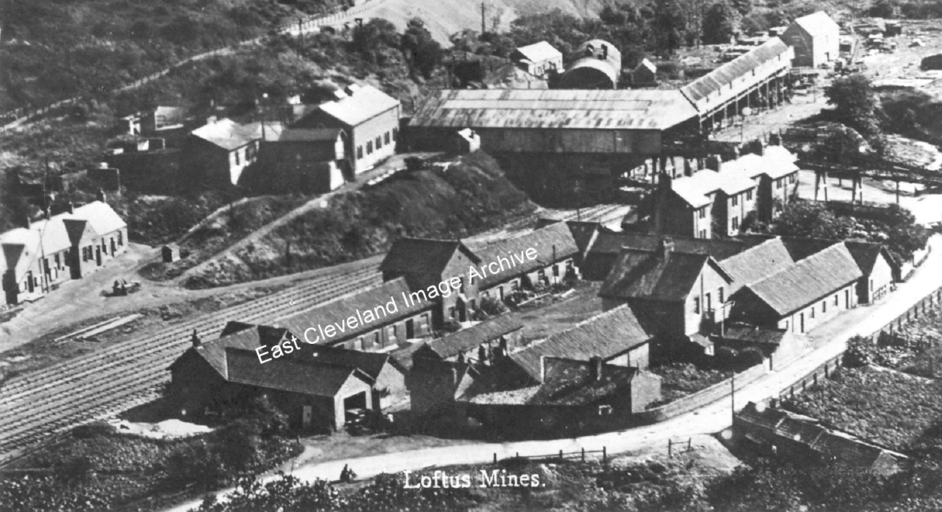 Skinningrove Mine, from Carlin How once again (this time captioned ”Loftus Mines”) the stables are centre foreground with Overmen’s Cottages behind them (lovingly named ”Hoss Muck Row” by the locals, for obvious reasons); behind that the picking belt and heapstead. Dating from c.1903 this view is much changed, in more recent times part of the remaining buildings have been converted to living accommodation and the renowned ‘Kaskane/Covell’s Bar’. 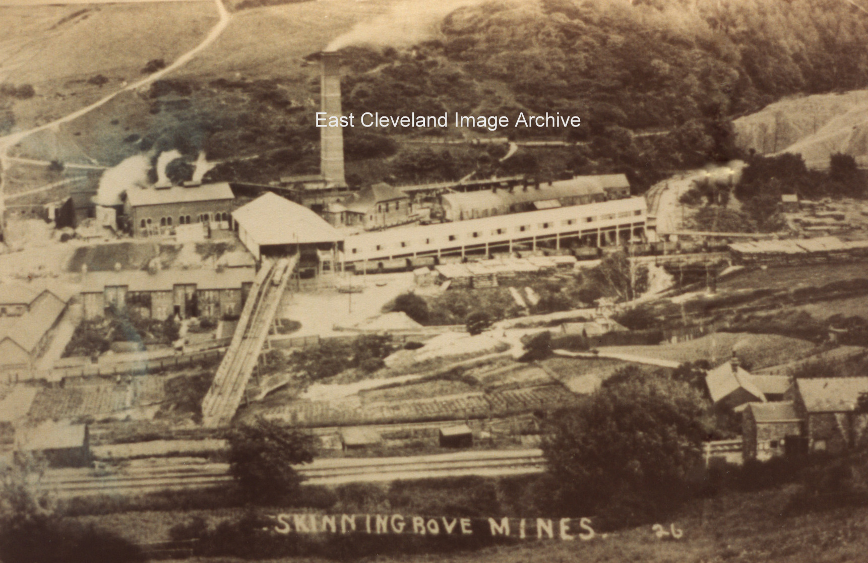 Another image of Skinningrove Mine, looking straight down onto it from Carlin How. The ”Zig-Zag” in the foreground with Duckhole just on the right. The stables left middle with Overmen’s Cottages next to them. Deepdale woods and the shale heap are right background. 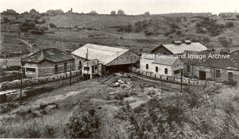 I’d never seen a view from this angle before and I’m still trying to get to grips with it. Carlin How in the background, with the ”Zig-Zag” cutting across the middle of the picture. The building directly in front is the loading shed where the iron ore was loaded into standard gauge wagons. I think I need help with this one please! The image was taken from the road which passes above Deepdale woods down to Skinningrove village. Peter Appleton asks: “Would the set of tubs leaving the image centre-right be using the north drift? Are the roofs and chimney stacks just to the left of the “E” of East, the Overmen’s Terrace cottages?“ Image courtesy of Joyce Dobson and Keith Bowers, thanks to Peter Appleton for the update. 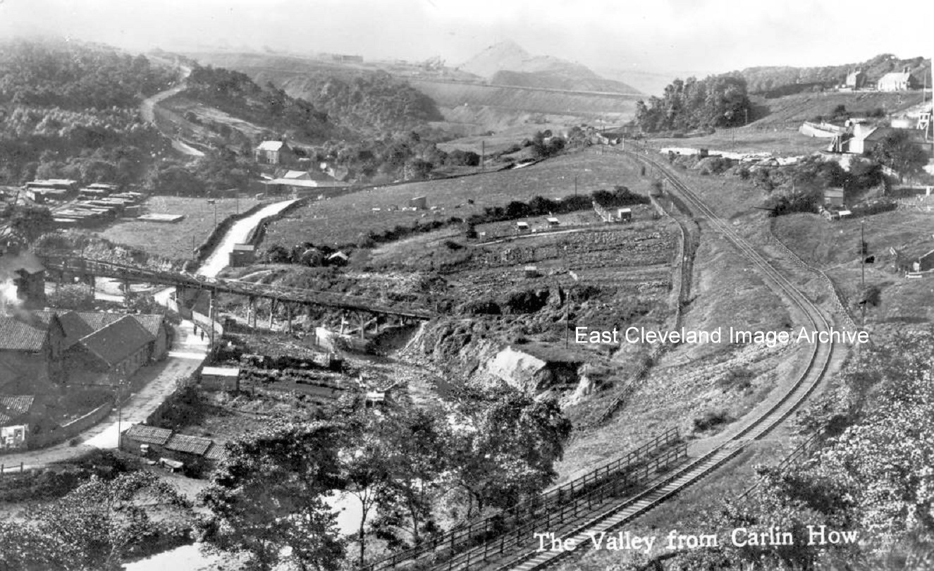 A good image of Skinningrove valley, post-1911 and pre WWI (no signs of the army camp on the field below the railway), showing just how busy this little valley was! The picture very obviously taken from Carlin How; on the left we have Skinningrove Mine, with the stables and just visible the Overmen’s Houses and on the right we have Duckhole Pit just coming into the picture. Kilton Mill takes the stage left of centre in the middle, the viaduct (now an embankment) away in the background and towering over it all in the haze is Liverton Mines shale heap. The sweep of rail track cutting through the image is the middle section of the ”Zig-Zag”. Image courtesy of the Pem Holliday Collection. 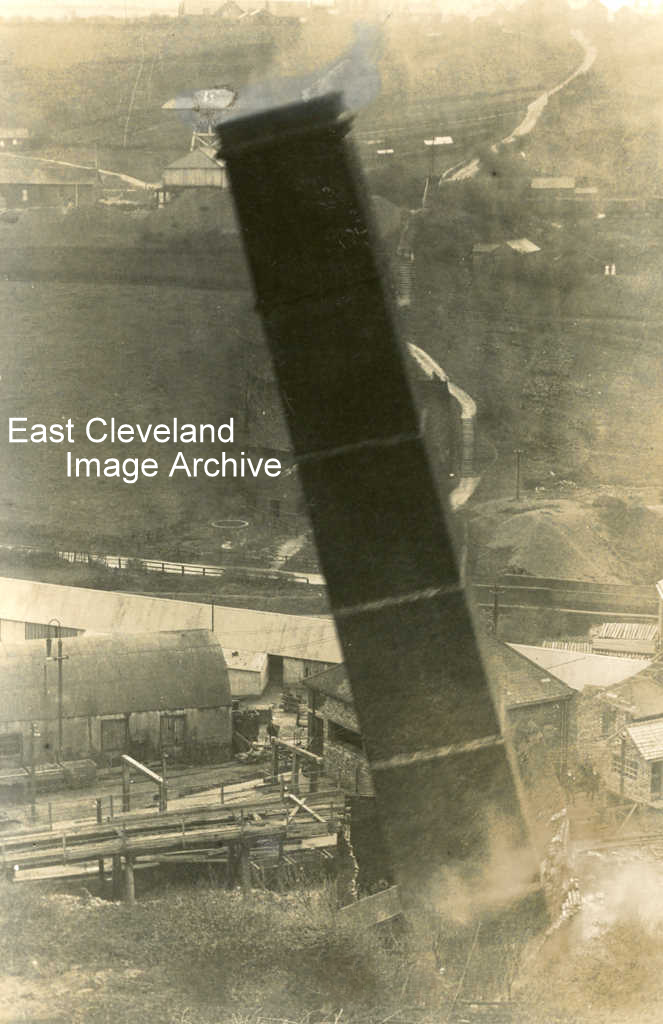 A close view of the chimney Loftus (Skinningrove) mine being felled in 1912. As it slowly falls, in the background can be seen the Staple shaft of “Duckhole” mine. The footpath linking from Carlin How (beside the former Wesleyan Chapel is also visible. Duckhole mine was eventually linked to Lumpsey mine at Brotton, and worked from that shaft. To the Image courtesy of Cleveland Ironstone Mining Museum. 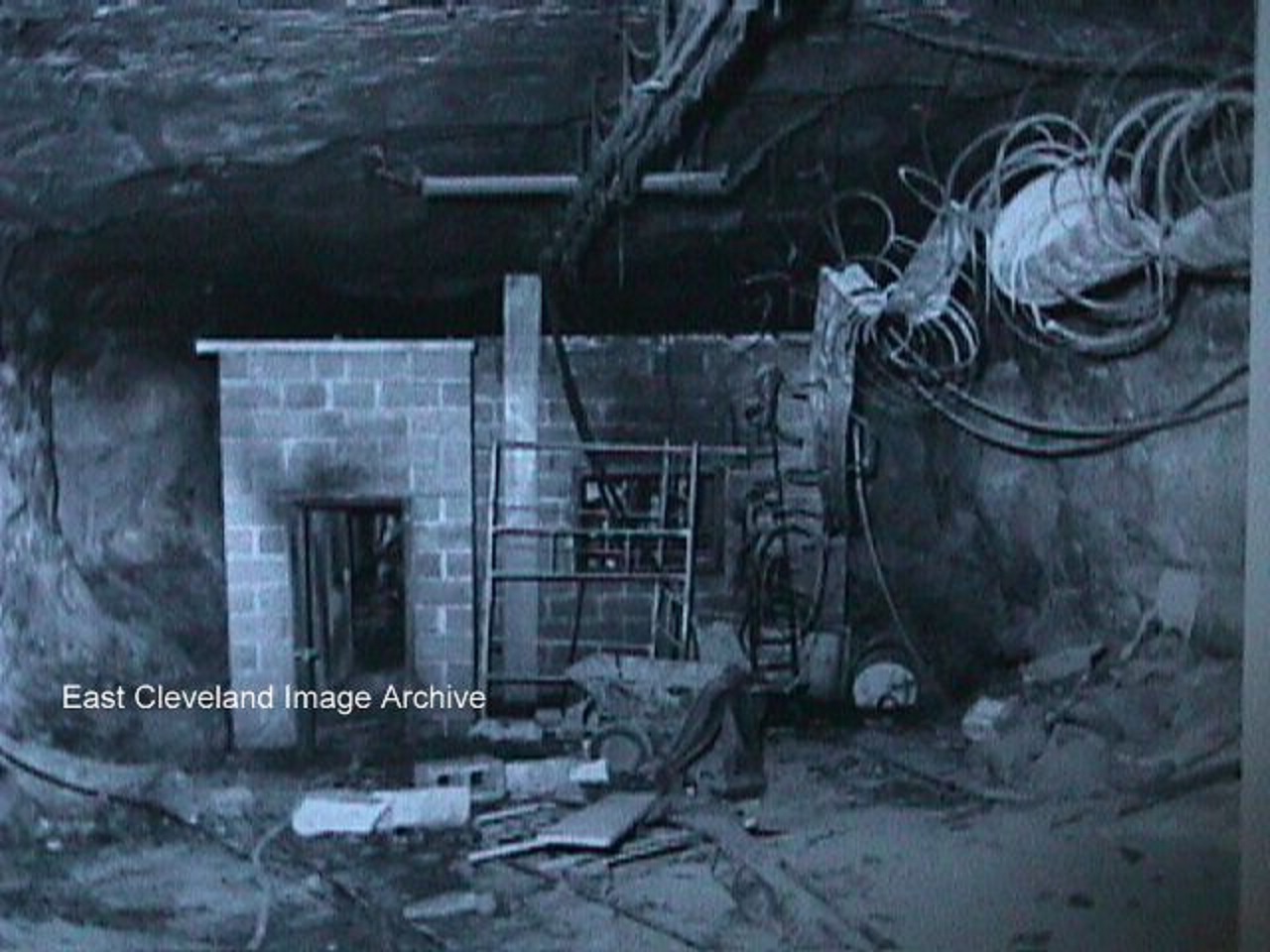 It doesn’t always go smoothly underground – I can imagine this caused considerable hazard underground, loads of toxic fumes, smoke and, worst of all, a lack of oxygen. Ian Benson recalls: “Remember having to go to site of fire with another miner to collect all the discharged fire extinguishers that the rescue team had used to put fire out and take to man shaft pit bottom to be sent out of mine for refilling. They must have used practically all the extinguishers down the mine. The fire I recall was around 1976. The photograph is just as I remember the scene”. Image courtesy of Alan M Franks and thanks to Ian Benson for that update. 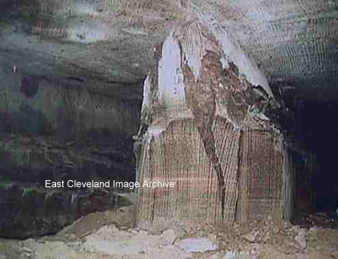 An example of the immense working pressures involved in potash mining and the instability of the crystal structures involved. Originally our Editor thought this pillar was part of the old Bord and Pillar workings, however Tim Coleman advised the Archive: “This pillar was located in the far south of the mine in a panel mined late 2001 and completed early 2002. The photograph has been clipped on the right hand side where my colleagues were standing”. Image courtesy of Alan M. Franks and information kindly supplied by Tim Coleman. He actually took this image when he was the Rock Mechanics Engineer at Boulby. |
||
Recent Comments