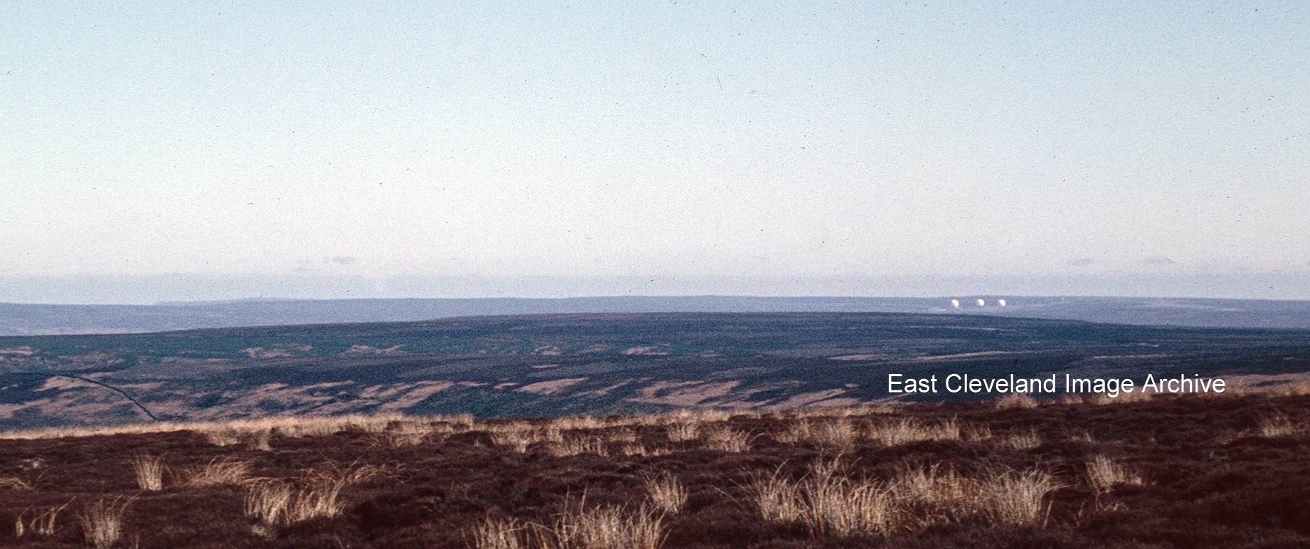
The original ‘Golf Balls’ at Fylingdales in the 1960s, now replaced by a pyramid object; the original ‘Golf Balls’ could be seen for miles across the moors, particularly from the north and west and often best viewed from the Guisborough to Whitby ‘moor’ road.
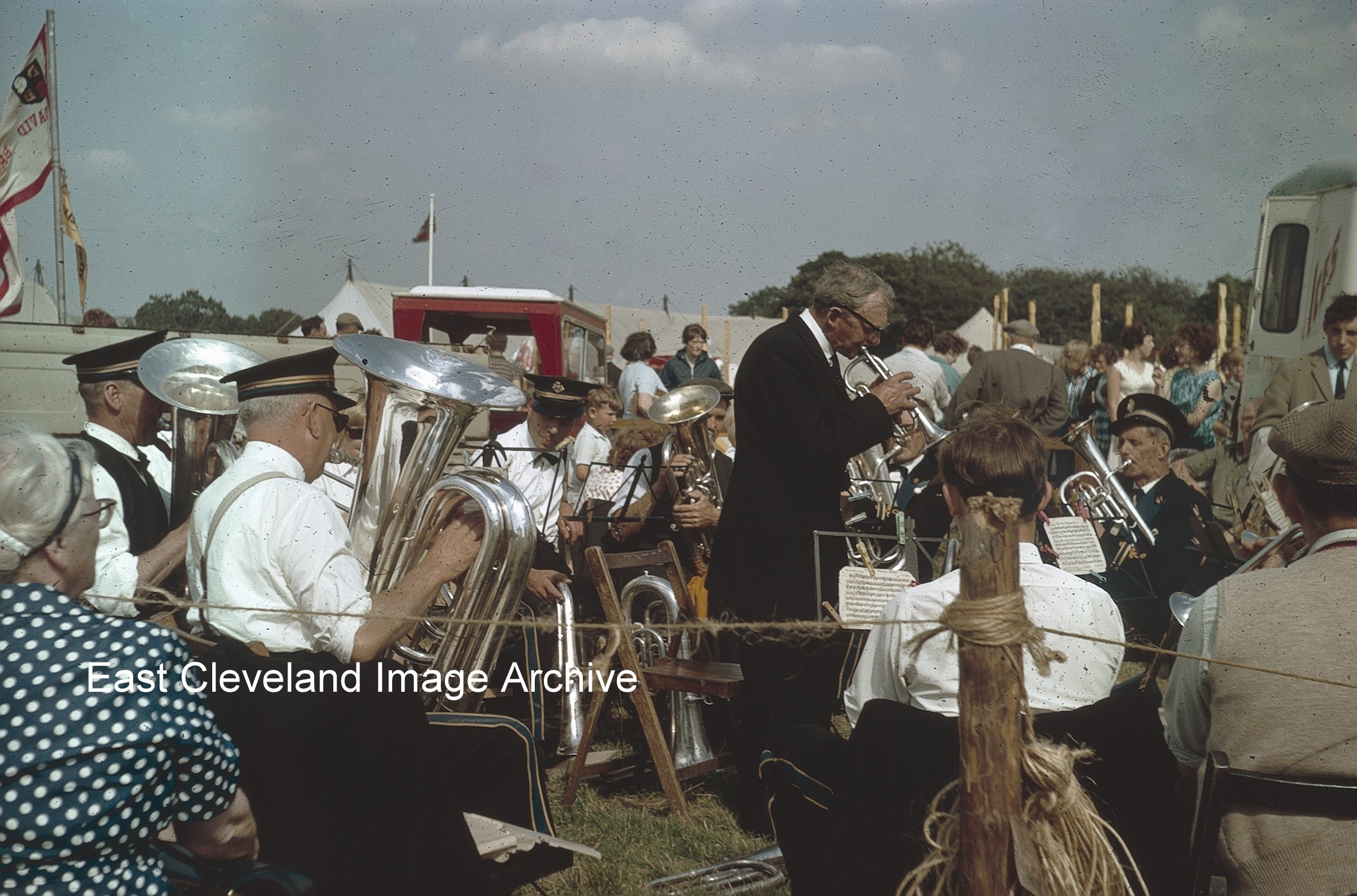
Stape Silver Band playing in the sunshine at Egton Show in the 1960s, one of the many attractions of the show; popular with all ages and weather permitting a fantastic day out for all ages.I would imagine the band would be feeling the sun’s rays later in the day!
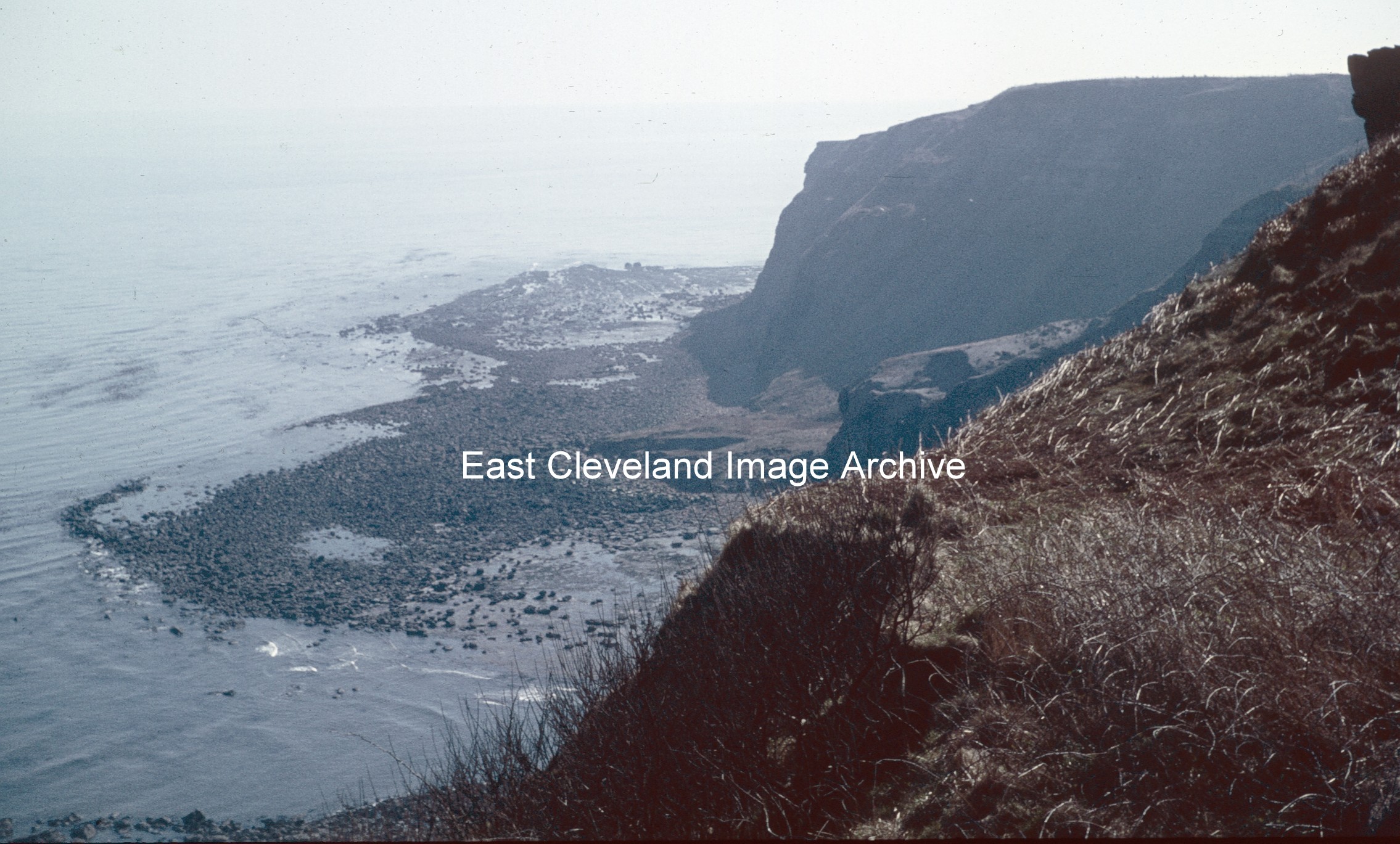
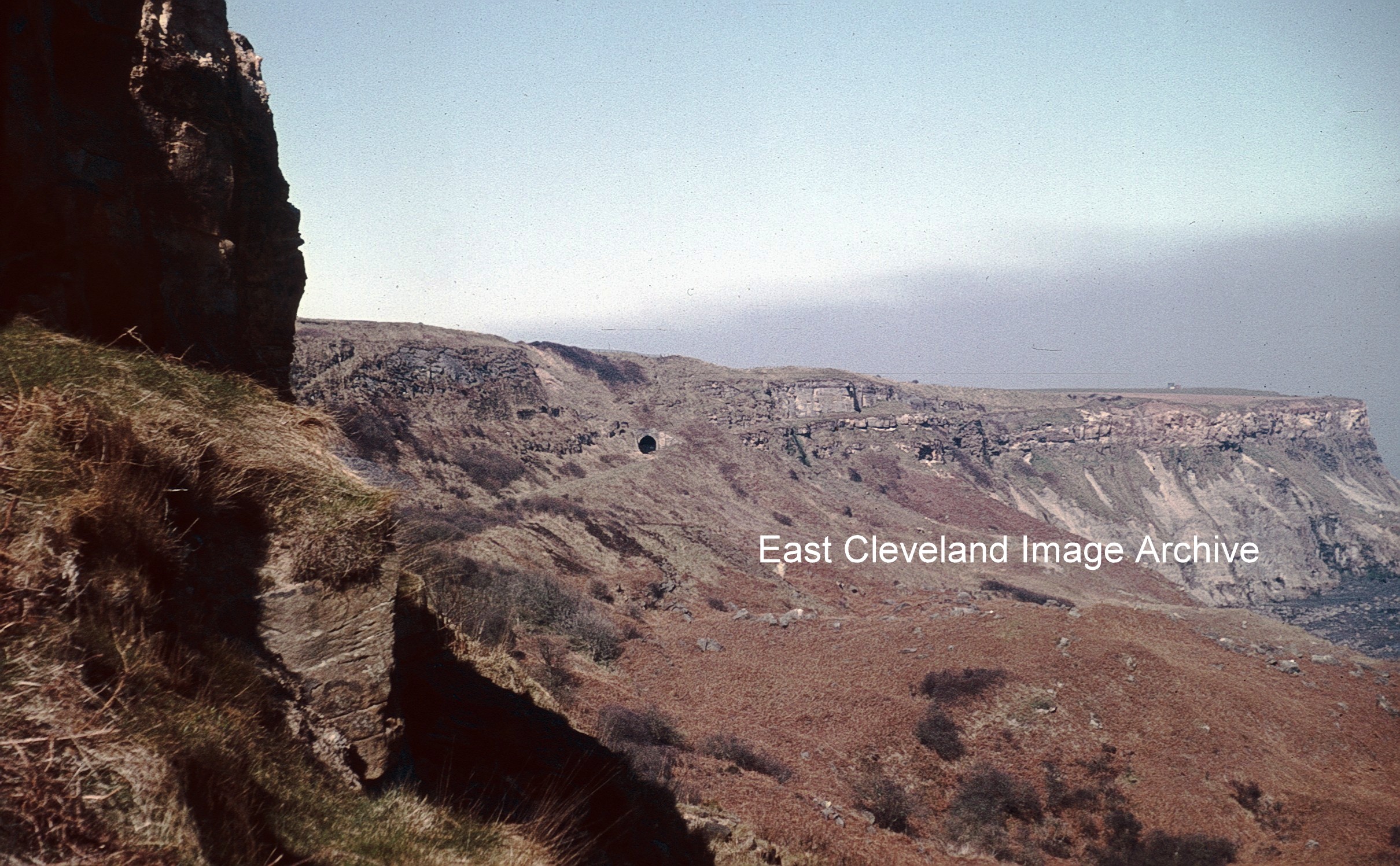
Now known to be Keldhowe Point and not Kettleness Point; as David Richardson advised: “It was taken on Ovalgate Cliffs and is looking east across Loop Wyke towards Tellgreen Hill and Keldhowe Point.” Peter Appleton commented: “This is an interesting view. Note the enormous debris field of boulders behind the words “East Cleveland”. These boulders are the legacy of the massive landslide of 17th December 1829 which destroyed the village of Kettleness and the alum works. Mercifully, it took the form of a “rotational slump” and nobody was killed or seriously injured. By mid-summer 1831, the alum works had been rebuilt at a higher level in the quarries and production had been resumed. The works would continue in operation until 1871, being one of the last two north-east Yorkshire works to close.”
Image courtesy of Robert Goundry; thanks to David Richardson and Peter Appleton for the updates.
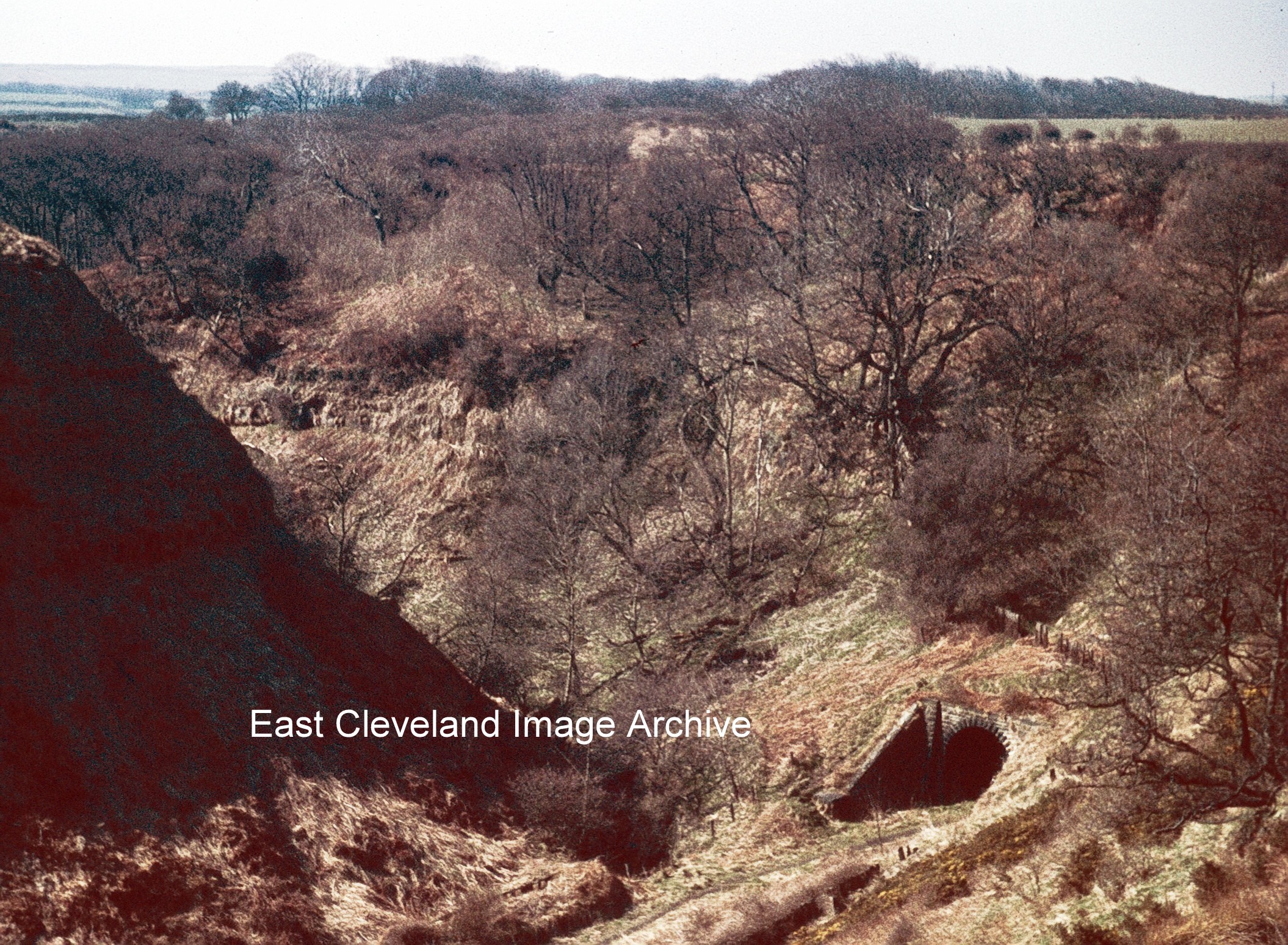
This view of the Kettleness tunnel shows the eastern end of the first of two tunnels close to Kettleness. The second tunnel cuts through a section of the cliff face further towards Sandsend. Taken in the 1960s with the tracks long gone, the area still attracts rail enthusiasts to view the old route and those keen to explore the old tunnels.
Sandsend tunnel minus railway tracks, this view dating from the 1960s is today remarkably unchanged. All the tunnels on this section of the line closed pre-Dr Beeching in the late 1950s are today ‘bricked up’ to prevent access. They do give an idea of the difficulties the Victorian builders had in developing the line as it hugged the coast from Whitby to Saltburn.This image and those following are part of a series of views taken by Robert Goundry in the early and late 1960s.
Image courtesy of Robert Goundry, thanks to Ronnie Bailey for highlighting our slip-up.
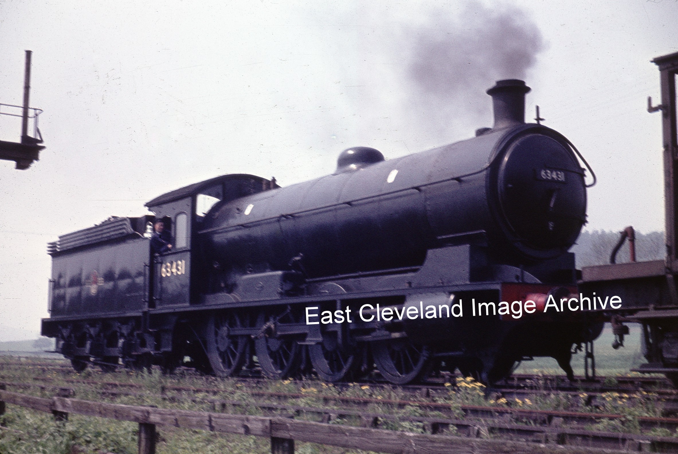
Locomotive 63431 also visited Boosbeck, possibly before or after crossing the Slapewath viaduct, as part of the Q6 range were specifically designed to handle the mineral traffic of the North Eastern Railway. This view of the locomotives gives a real impression of the size and potential power they possessed.
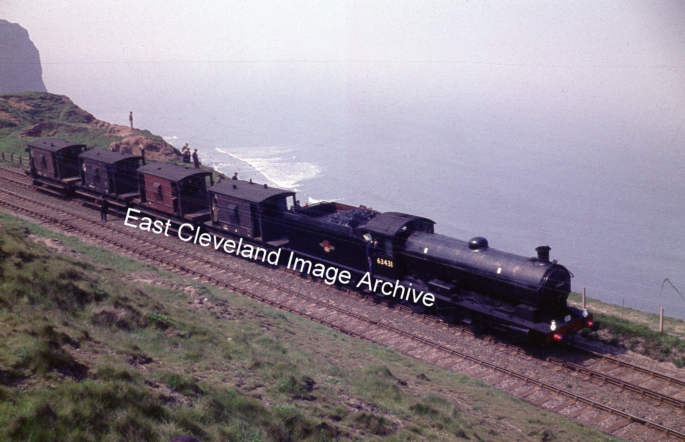
Locomotive 63431 on the track at Huntcliff, obviously the photographers are now appreciating the view! The driver obviously preferred to remain in the cab.
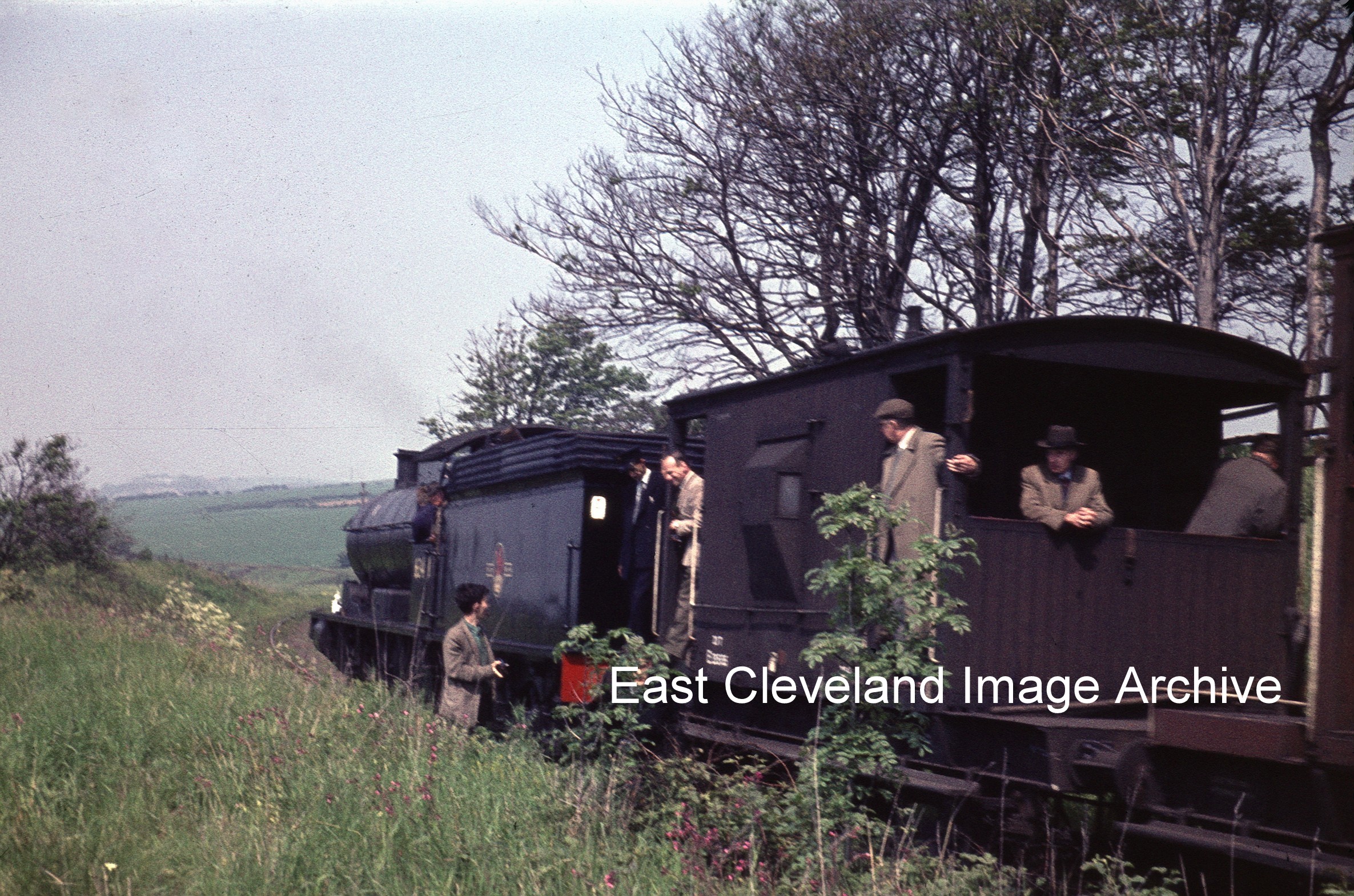
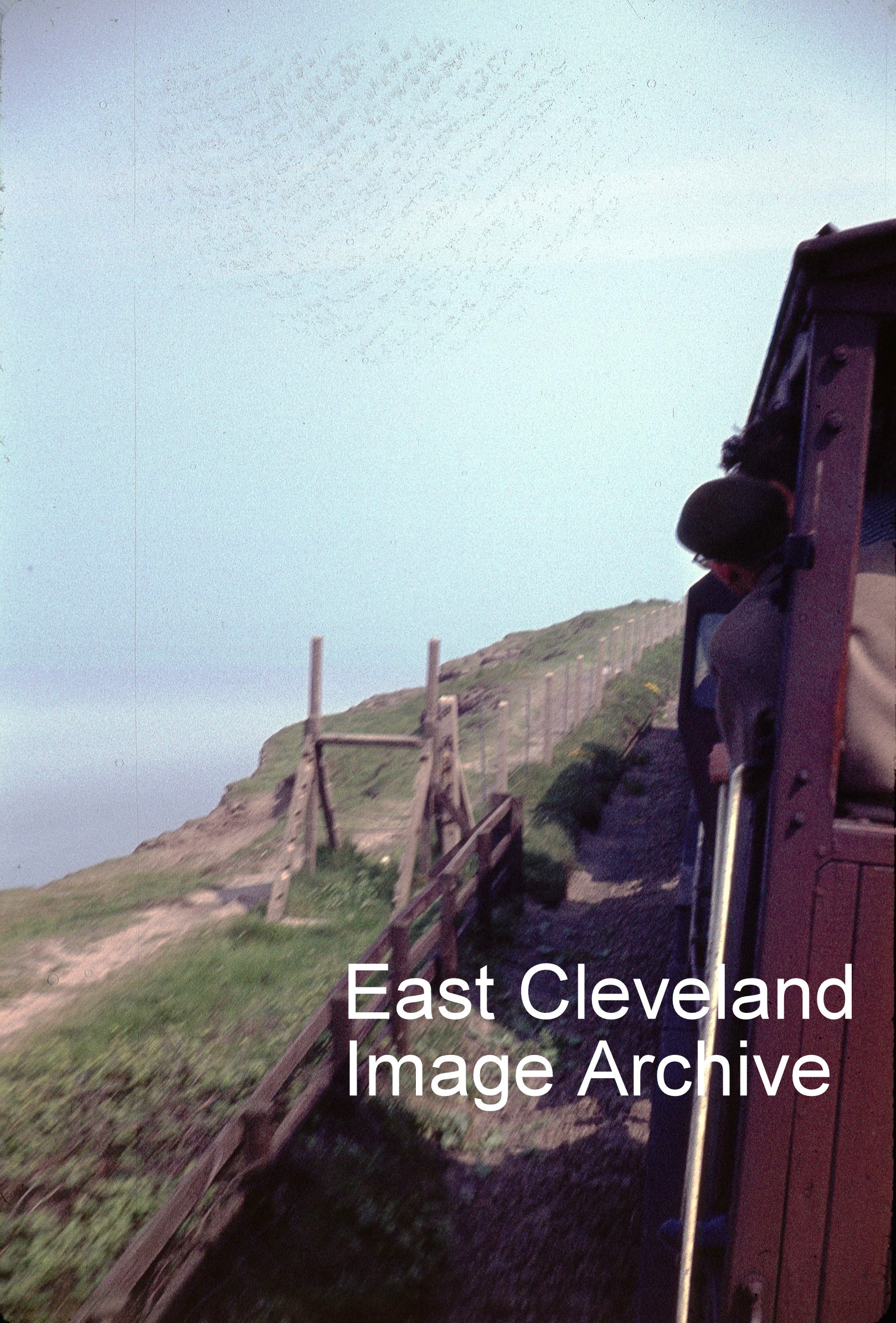
This image was taken from one of the brake vans which were part of the 63431 train as it passed around Huntcliff point, it gives a lasting impression of the closeness of the edge. Early locomotive drivers and passengers must have had a wonderful view!
Recent Comments