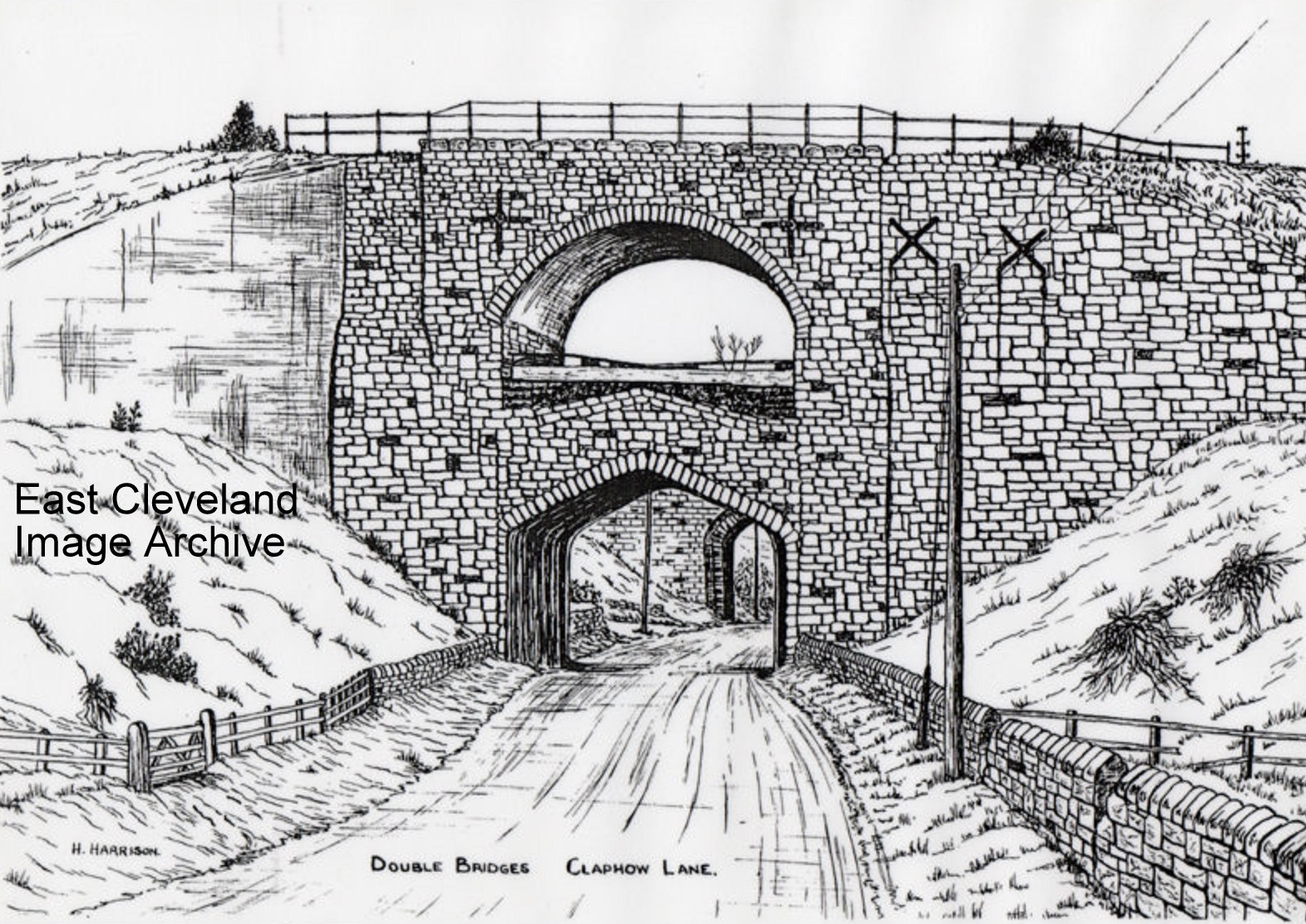
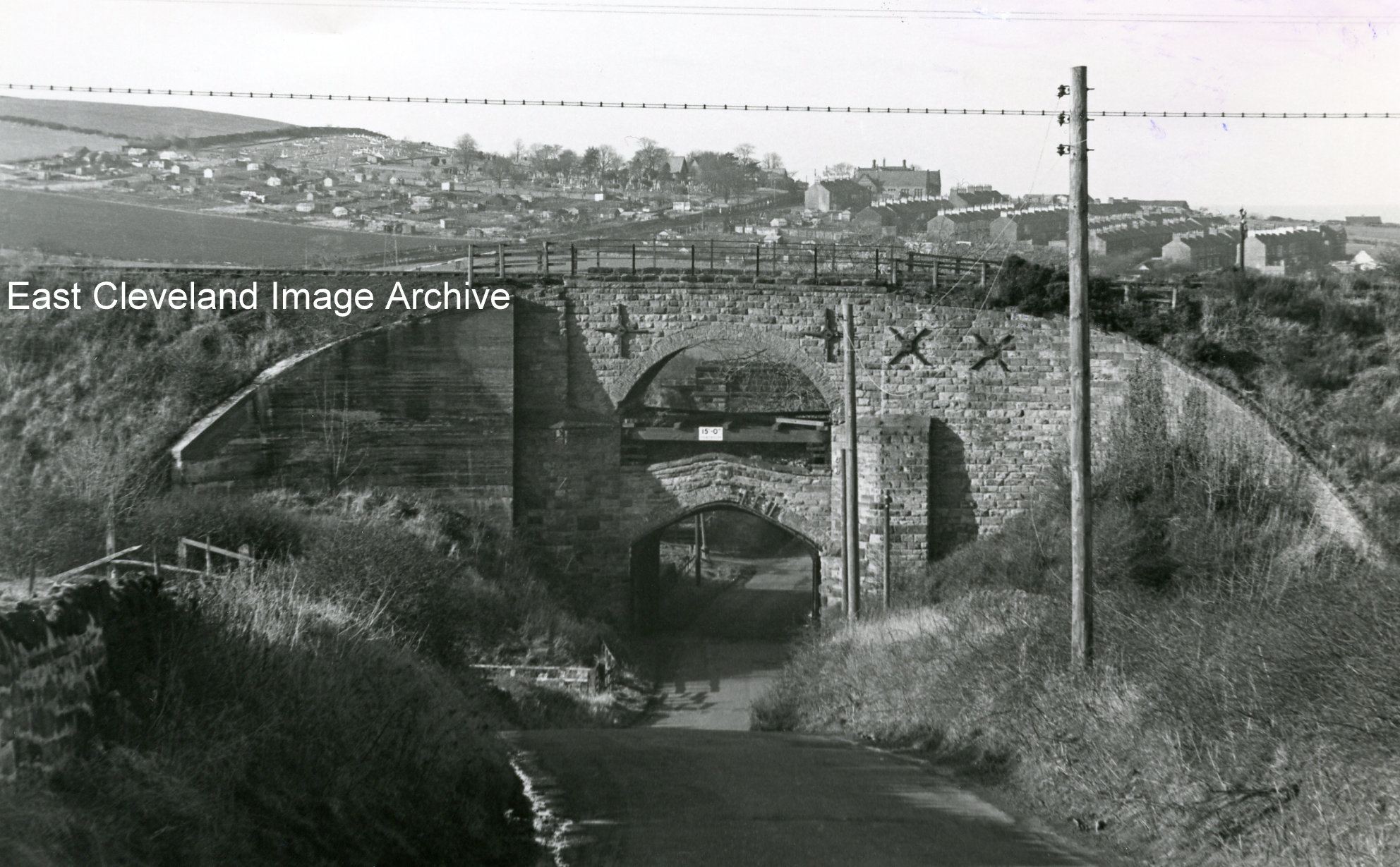
One of the two rail bridges at Claphow, Stanghow Road (the road connecting New Skelton directly to Lingdale). Due to mining subsidence the bridge was strengthen with the addition of a second arch inside the original arch. A buttress was added at the right hand side and four iron rods inserted through the parapet, whilst the left hand side was concreted.
Andrew Pearson tells us: ”Really good photograph, looks to be from around 1964 or maybe early 1965. The railway was part of the much missed coastal route down to Whitby and Scarborough from Middlesbrough which closed completely in May 1958 between Loftus and Whitby West Cliff, passenger trains continued to run to Loftus until 1960 and then only to Guisborough until 1964 when it too closed under what came to be known as the Beeching Axe, which was to devastate the UK rail network. By this time the only traffic across this bridge was the weekly goods (mostly coal), to Boosbeck public delivery siding, from the Brotton direction, which ended in September 1964 when the depot at Saltburn took over coal deliveries enabling this line to be closed altogether. The line from Guisborough meantime had been cut just before reaching Boosbeck and was used for the storage of redundant wagons for the last five years of its life. During the summer of 1965 all the rails and fittings were uplifted from Brotton junction to the Esk Valley line junction near Nunthorpe inclusive, and this bridge was subsequently removed during improvements to the Lingdale to Skelton road. The other bridge behind it in the picture, on the Priestcroft Junction to Skelton triangle line, is still there.”
Alastair MacKenzie adds: “I recall this too and think it was demolished in early 1970’s. Andrew is correct but doesn’t mention that the other leg of the triangle is still in use for the potash trains. This takes off at North Skelton and re-joins what would have been the triangle at Brotton. As a child living at Boosbeck, I recall seeing many iron-stone and passenger trains on this triangle. Often at night particularly if cold and frosty, the finished steel product trains to or from Skinningrove could be heard. The playing field behind our house at Wandhill, Boosbeck; looked onto the Boosbeck end of the triangle at Priestcroft. I never saw this personally but it is known that excursion trains from places like Leeds and Bradford, coming to Redcar and Saltburn, would run up to the triangle to be turned as the turntable at Saltburn was too small for loco’s like the V2. They would run up coupled in twos and threes to turn by reversing onto one or other leg.”
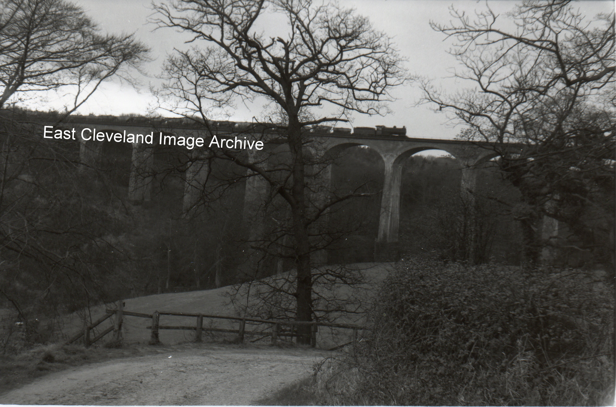
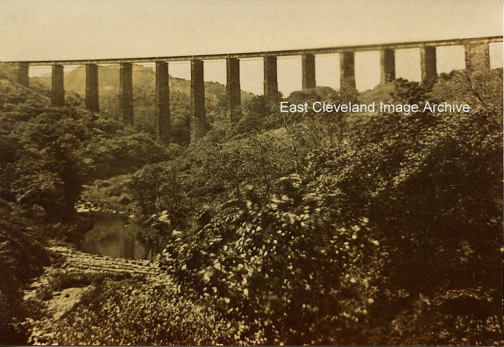
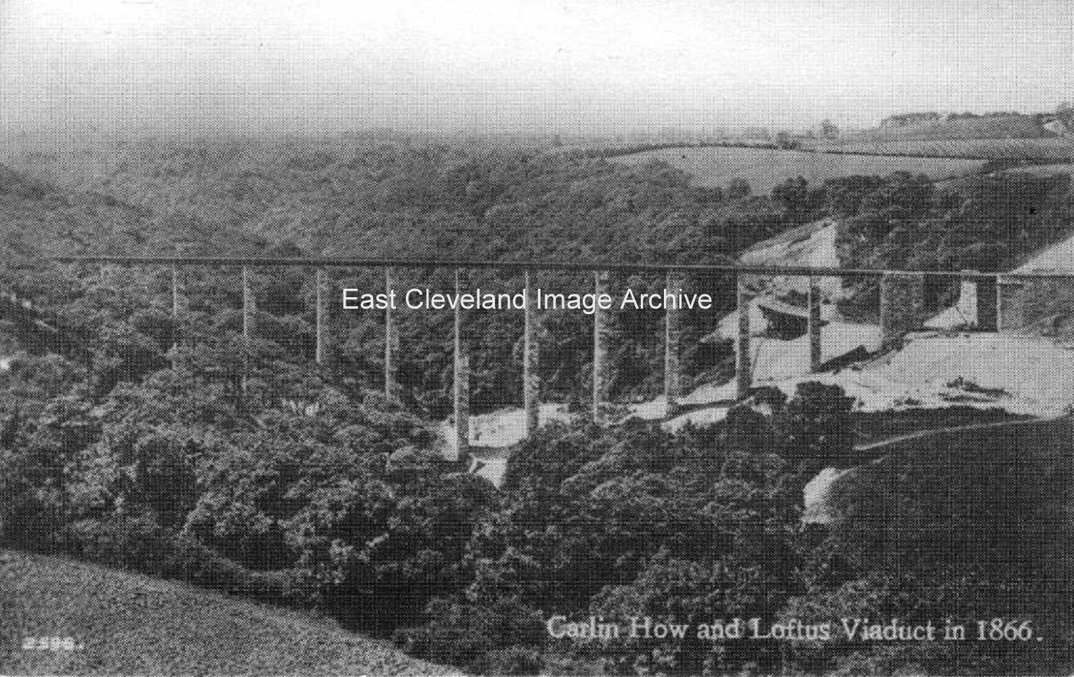
Andrew Pearson confirms this: “The other leg of the triangle is part of the Saltburn – Boulby line which is very much still with us and in regular use but singled throughout, where before it was double track from Saltburn Junction through Brotton to Carlin How and then single track on through to Whitby/Scarborough with passing places at Loftus, Staithes, Hinderwell, Kettleness, Whitby West Cliff then Robin Hood’s Bay, Ravenscar, Staintondale and Cloughton. Opened in 1872(goods) and 1875(passenger) as the ‘Saltburn Extension’ the line served ironstone mines at Longacres, Lumpsey and Brotton in their time as well as Skinningrove Works now also Boulby Potash (rebuilt 1974 from Carlin How with a new viaduct) and it occasionally even sees steam hauled specials the most recent of which ran as far as Carlin How and back on March 30 2013. Intermediate stations were North Skelton and Brotton. Passenger services between Saltburn and Brotton ended September 6 1957 and between Loftus/Brotton/Guisborough April 30 1960 but goods services continued thereafter as in my previous post as well as mineral workings Lingdale Pit until 1962, Kilton (1963) and North Skelton (1964).
The triangle was indeed used also for turning excursions particularly Redcar races specials, sometimes the whole train might have to go up to turn if siding space for the stock was not available on the day; I remember seeing empty passenger coaches crossing Saltburn bridge to do just that in the very early 60s when there was no longer a normal passenger service, not long before all that sort of traffic started to be discouraged by British Rail under Beeching, and far too many useful lines started to close down.”
Callum Duff asked: “I’m convinced that this bridge existed until around 1975 because I remember my Dad driving under it when I was a child and me being intrigued by such an unusual structure. Does anyone else know for sure when it was actually demolished?” Andrew responded with: “Not too sure as to the exact date but 1975 would be about right as it was definitely missing by 1976 when I happened to pass that way. As can be seen in the picture, the road was very much still a country lane and not suited to the ever increasing traffic even back in the 70s, never mind now when speeds are dangerously high so improvements were a priority on safety grounds. The bridge had been in a poor condition for a long time due to mining subsidence, it presented a bottleneck and once its rail function ended it would have had little further purpose.”
Image courtesy of Ted Morgan (via Eric Johnson), with information from Eric Johnson; also thanks to Andrew Pearson, Callum Duff and Alastair MacKenzie for the updates.
Recent Comments