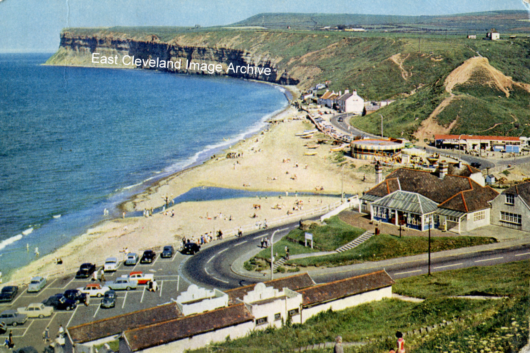
The caption that is printed on the reverse of this postcard reads: ”Old Saltburn, Yorkshire. At the foot of the valley through which Skelton Beck reaches the sea, Old Saltburn’s few cottages are so close to the breakers that spray beats on the windows. The headland of Huntcliff to the south forms a fine background.” David Richardson commented: “This may have been taken in the 1950’s.”
Image courtesy of Tina Dowey, from a postcard that was published by J. Arthur Dixon, Ltd; thanks to David Richardson for the update.
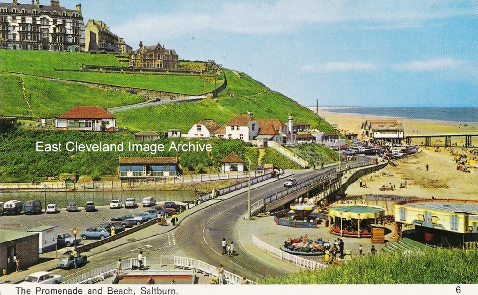
A photograph contemporary with that in ”Saltburn, A Renaissance”, only taken from Cat Nab. This shows the roundabouts where the boat park is now; I think this dates into the 1960’s. Tony Auffret tells us: ”I think this was still there in 1960. The “amusement” on the far right was a “waltzer”. There were “swing boats” behind along the edge with the beach.” Callum Duff has a dating update: ”Although Skelton Beck was used for boating before 1962, the ‘official’ council-run boating lake with sluice gates to regulate the depth of the beck, segregated areas for larger and smaller boats and the marking out of car parking spaces and the toilet block was laid out in 1962. The reason I know this is that I have a copy of the 1961 centenary film (where there is no boating lake visible) and a copy of a 1963 film of Saltburn where the boating appears to be well-established and very popular. This postcard image was taken between 1962 (when the boating lake was completed) and 1974 (no postcards images of Saltburn were produced between 1974 and 1978). The Waltzers remained on this site until 1978 and the rest of the rides and buildings had been removed by 1983.” Rick Avern enquired: “Does anyone know who owned these rides in the 1960’s.” Alan Collins advised: “My mother worked in the cafe and beach shop, owned by the family who also owned the little fairground. To the right of the bog waltzer was a rifle range with metal targets that were knocked over with the .22 rifles. The family who owned the fairground, beach shop and cafe lived in the farm house, on the other side of a little wooden bridge, behind where this photograph was taken. The family also owned the shop (behind where you can see a small brick cemented paddling pool behind white wooden railings, which was also dismantled in the early 1950’s). It sold sweets, ice cream, postcards, and the usual stuff – but my mother persuaded the owners to serve hot food.”
Image courtesy of Jean Dean; many thanks to Callum Duff, Tony Auffret, Rick Avern and Alan Collins for the updates.
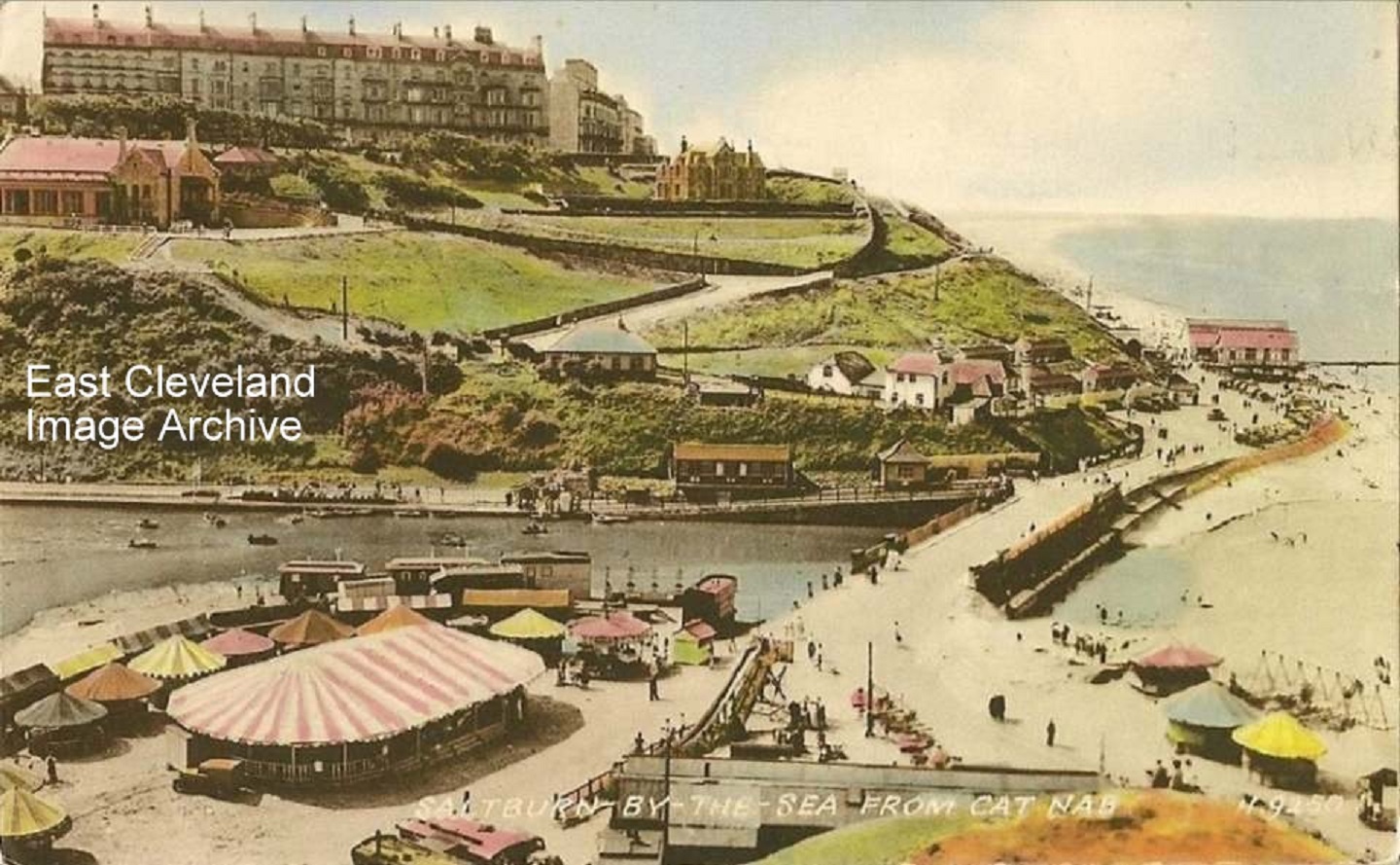
A lovely photograph of Saltburn taken from Cat Nab, from a Valentine’s postcard. As the postcard has not been used a possible date is still to be attributed.
Image courtesy of the Julie Tyrka and Joan Jemson.
A lovely walk along here by the miniature railway and into the gardens with the Halfpenny Bridge looking splendid in the background. Do you remember riding on the miniature railway? Callum Duff tells us: ”I used to work on the Miniature Railway in the late 1980′s and early 1990′s. You had to be made of strong stuff to cope with the change in temperature from one end of the valley to the other. After 3.00pm it was still nice and warm at the Italian Gardens end but as soon as you got over the bridge it was freezing! I remember a passenger asking me why I was wearing finger-less gloves in August. ‘Just wait until we get round that corner’ was my reply!”
Image courtesy of Julie Tyrka and many thanks to Callum for the insight working conditions on the railway.
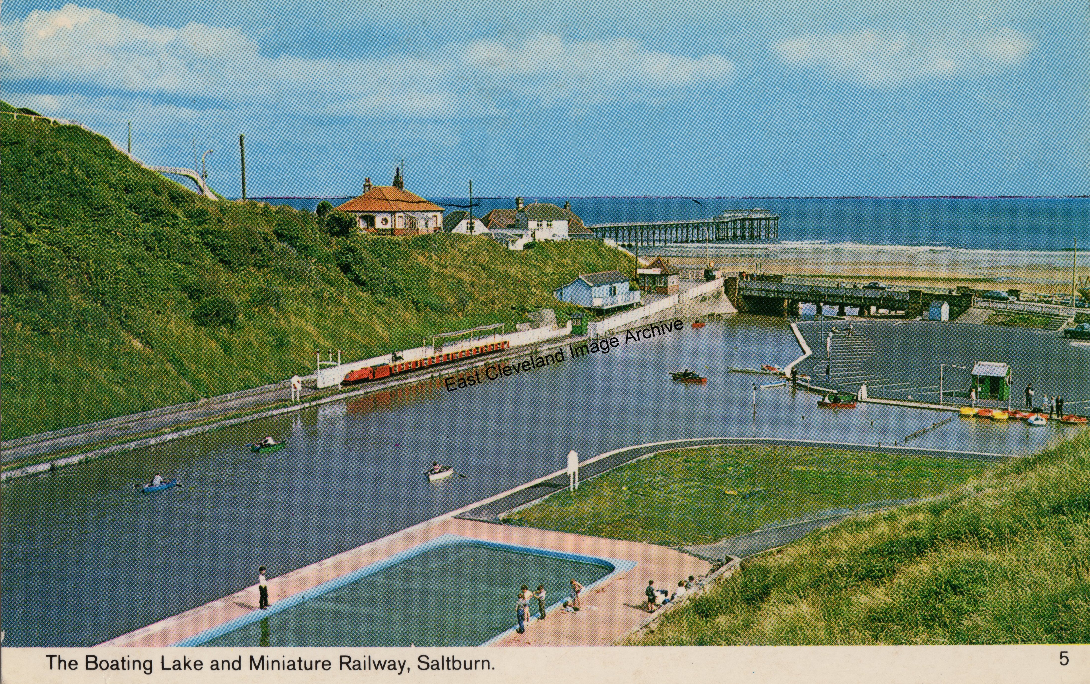
Here is a picture that shook the cobwebs, Saltburn with its paddling pool (no longer PC since the Health and Safety laws and litigative society), Miniature Railway running from the tourist hot spot and the beck as a useful facility instead of the state we have today. Notice that the miniature railway (15 inch gauge) with its rake of toast-rack carriages is still in its original Saltburn Motor Services livery of red with cream lining (although we are told that the original colour was green and this was the early Council livery called ’Dustcart Red’ and white!). The four carriages were built in the SMS garages in Saltburn and the train was driven by one of SMS’s regular drivers during the brief summer season. Following our request for a date to the image, Martyn Richardson told us: ”1973 I would say – I remember playing in the paddling pool, and also going on the “boating lake” – I can remember being brave if you went close to the edge of the little waterfall bit that ran over and under the road bridge. Good memories from this photo – didn’t the pier fall foul of the weather in 1974? – I can remember that and I was only seven at the time.”Bill Fletcher asked: “Very interesting picture but did you notice all of the ships near to the horizon and has anybody any memory of the bridge structure between 2 vertical poles about half-way up Saltburn bank and just visible here?”. However Callum Duff tells us: ”Saltburn’s boating lake was laid out after Saltburn’s Centenary celebrations in 1961, opening for the Summer season in 1962. Based on a slide I own from 1963, the paddling pool was constructed at this time. Looking at the photo above and the new-looking paving around the pool (it was still being laid in 1963) I would put the likely date for this card at 1966 or 67. I always think of the 1960′s as being Saltburn’s last decade as a popular resort with most if not all of its original attractions. unfortunately I grew up in Saltburn in the 1970′s when the opposite was true!”
Thanks to Martyn Richardson, Bill Fletcher and Callum Duff for those updates.
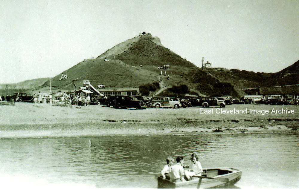
We think this image was taken in the 1950s. Do you remember this boating lake? It was known as just Saltburn boating Lake. What’s left of it now, is now the orange beck that runs through the Saltburn Gill and into the sea. Where the cars are is now the car park and public toilets and the little hut behind them is the beach cafe. I remember going to the kids paddling pool down there when I was little and my grandad telling me, that when he was younger the beck was a lot bigger and wider than it is now and it went under the road bridge too. It would be great to find out who it is in the boat? Callum Duff tells us: “The ‘Official’ Boating Lake (with a weir, defined shape and demarcation for age groups and vessels) was laid out in 1962 with the Paddling Pool being completed in 1963. Despite many fond memories of the boating lake, it had a very short lifespan. This is attributed to two main factors; the weir was built too high which caused the lake to flood the surround banks and the cost of maintenance was never recouped by usage. The Boating Lake finally went out of use in 1983 and the paddling pool was demolished in 1987. This photograph is earlier than 1962 although you have to wonder who transported this rather sturdy boat to the beck for the children to use?”
Image courtesy of Julie Tyrka and many thanks to Callum Duff for the update.
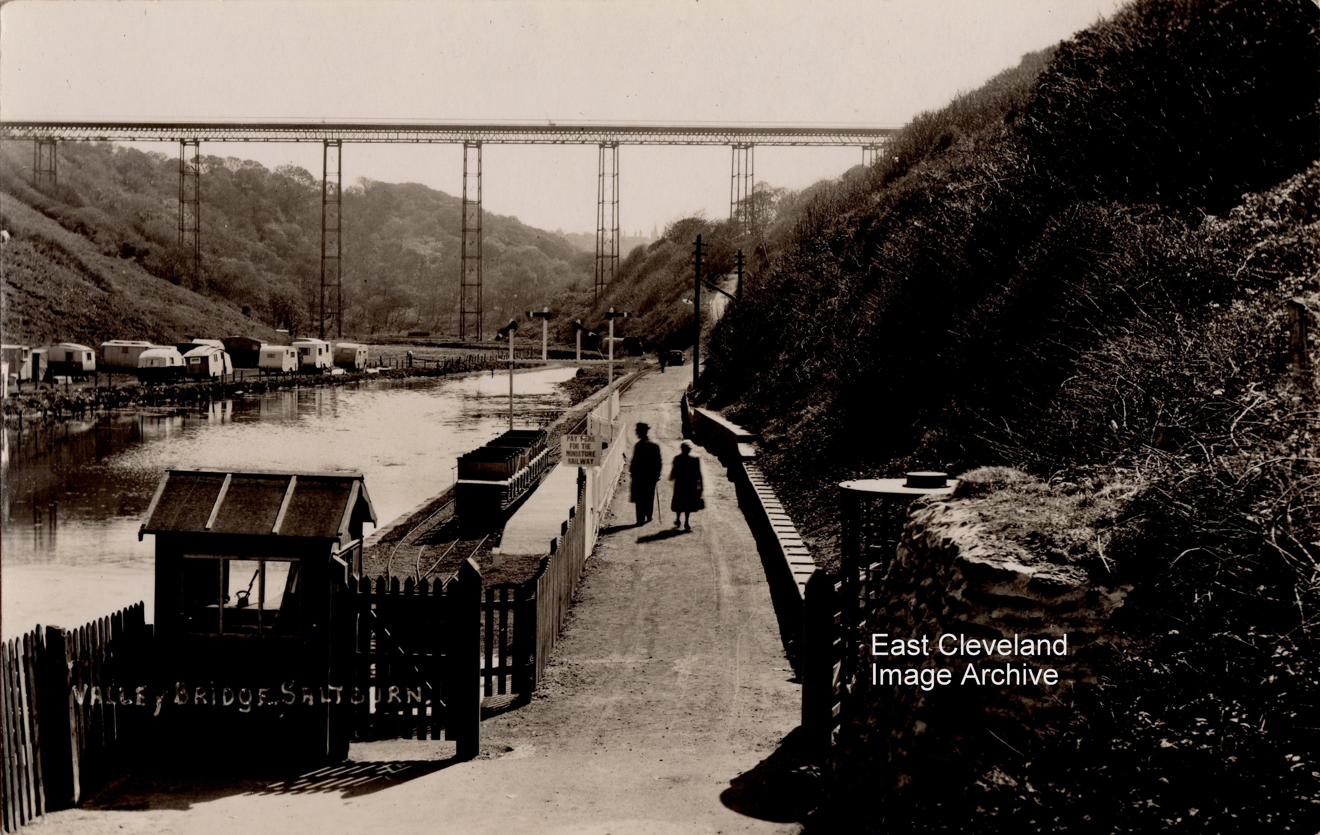
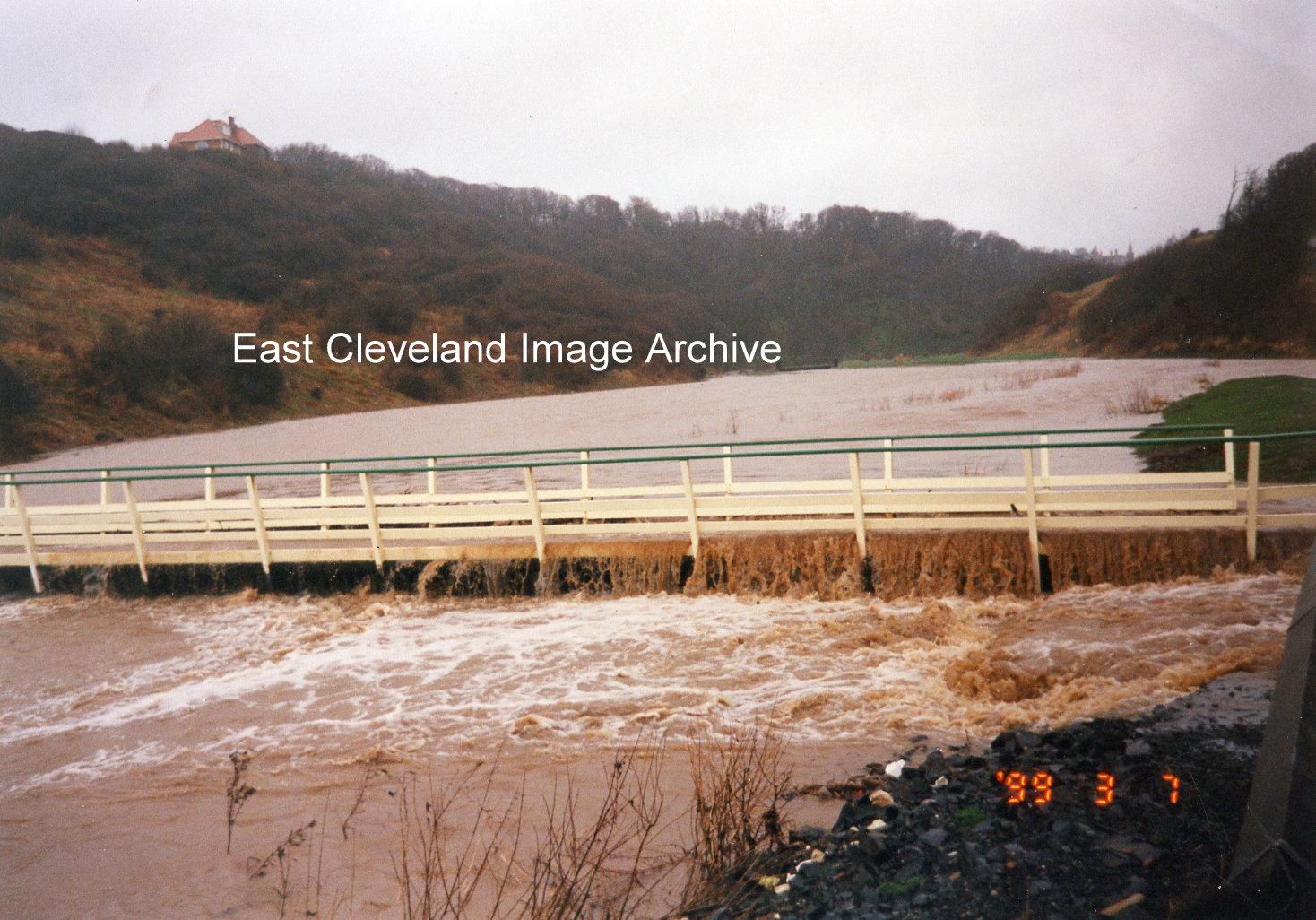
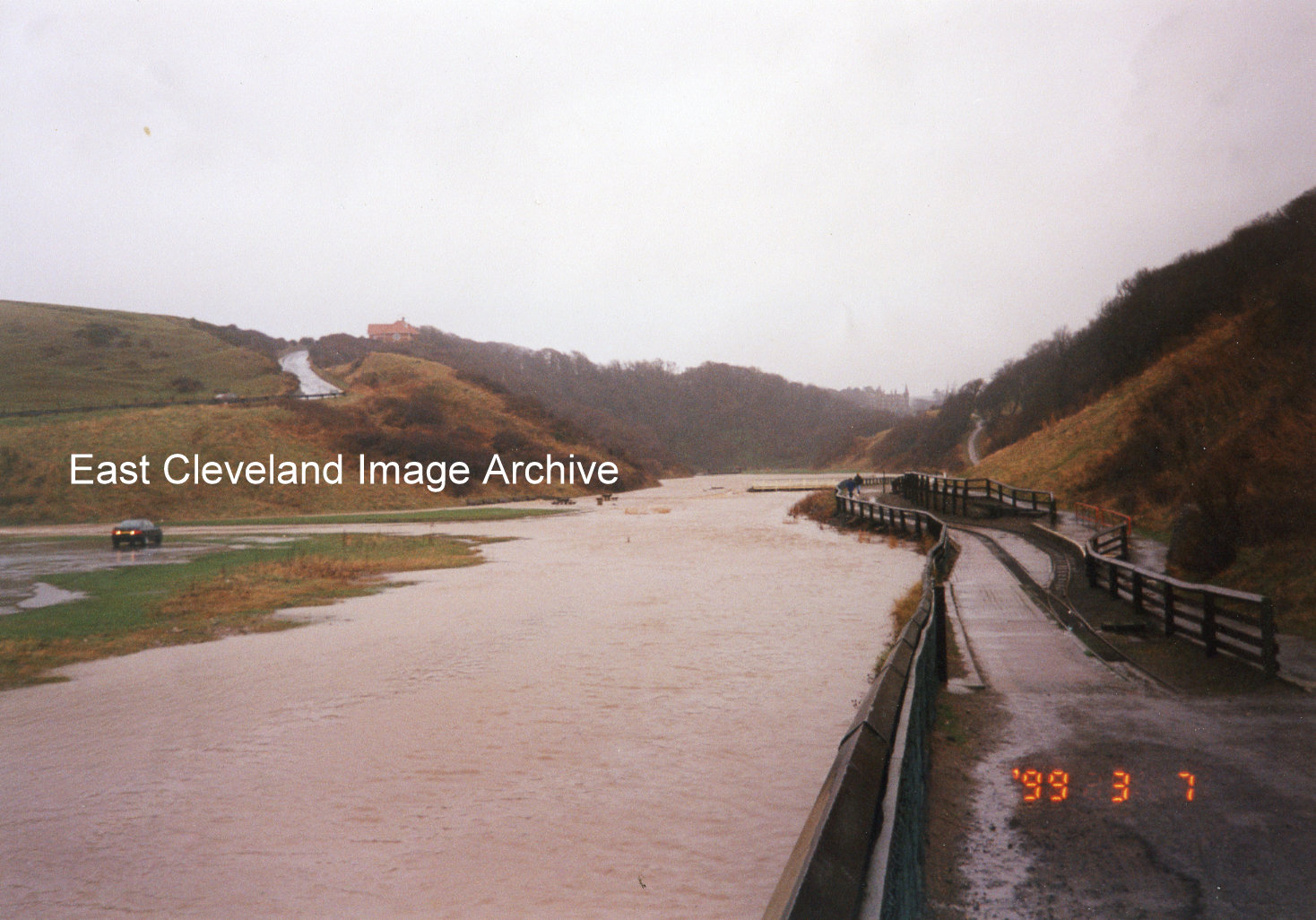
A bit further upstream, at the footbridge, the water flooded the field and filled the valley. The toll bridge keeper’s cottage for the old Ha’penny Bridge can be seen at the top of the bank on the left.
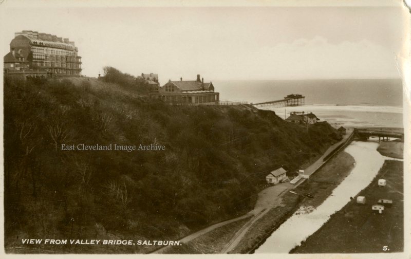
This image from the D Constance postcard series, taken from the Ha’penny Bridge (or Valley Bridge) in 1948, shows the original station of the Saltburn Miniature Railway – it was moved further towards the beach the year after this was taken. The footpath was in better condition than it is now! Notice the caravans where the picnic area is now. Image courtesy of Iris Place, Saltburn Miniature Railway and Jean Hall.
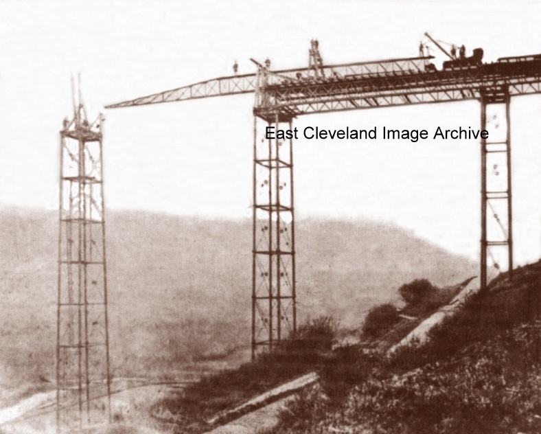
We have photographs of the halfpenny bridge being blown up but this is the first one I have seen of it being built in 1869. It was built by Gilks and Wilson, and was 126 feet high and 650 feet long. The tolls were: Pedestrians – half-penny. Bicycles and rider – one penny. Carriages – half-penny per wheel, passengers – one half-penny. (Information courtesy of Howard Wilson). Originally built to facilitate travel to Skelton Castle the bridge was unable to be used by motorised traffic and so in the later 20th century was use by walkers, cyclists, horse riders and horse drawn vehicles until it’s demise in December 1974.
Any more photographs of this bridge out there that you would like to share with us?
Recent Comments