|
|
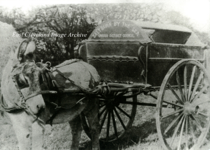
An early refuse cart for the Council, possibly dating from the 189os. I could not have carried a vast amount as the donkey appears quiet small. Can anybody assist with a possible date or even information?
Image courtesy of Joyce Dobson and Keith Bowers.
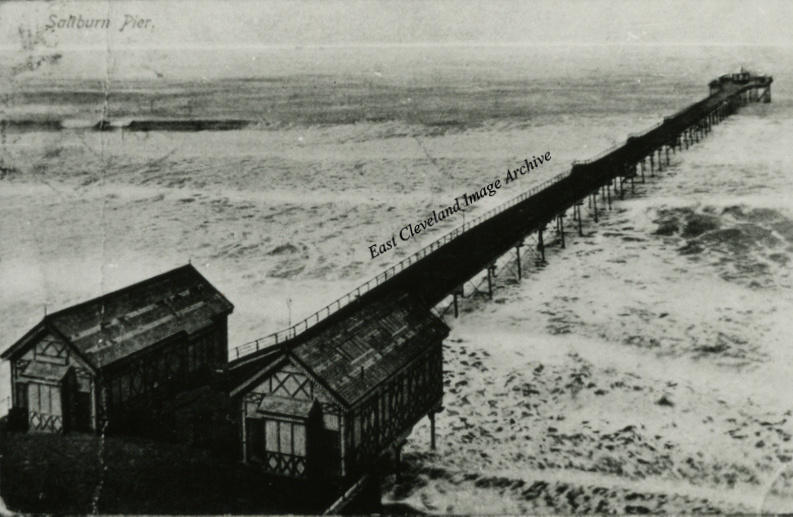
An early image of the pier complete with small building at the end. The sea looks a little tempestuous, hardly surprising that there is not a person in sight! Callum Duff tells us: ”The building at the end of the pier is a bandstand with protective wooden and glass screens inset from the pierhead railings. The bandstand survived until after World War II where presumably the fashion changed and it was removed as part of Saltburn Pier’s post war improvements.”
Image courtesy of Joyce Dobson & Keith Bowers and thanks to Callum Duff for the update.
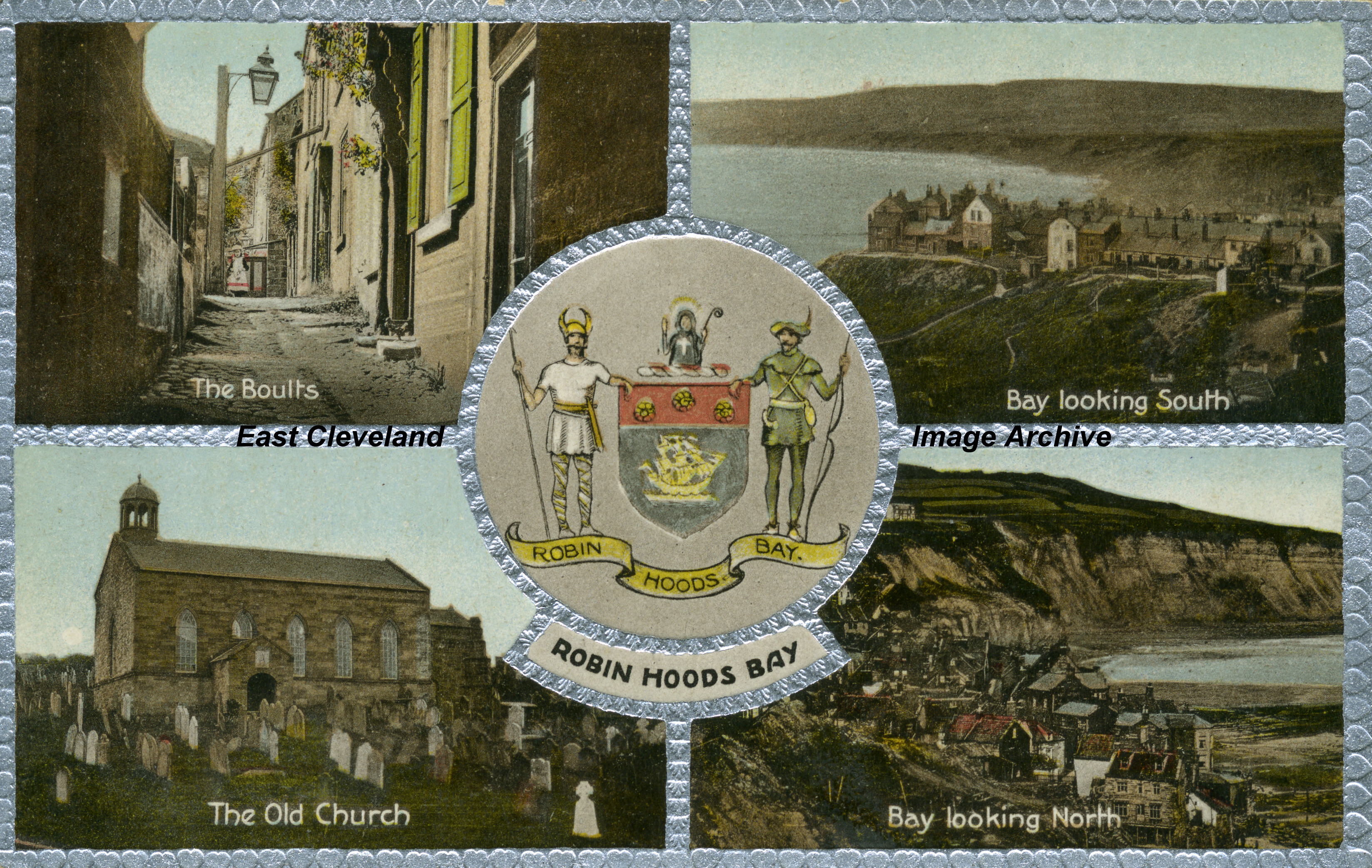
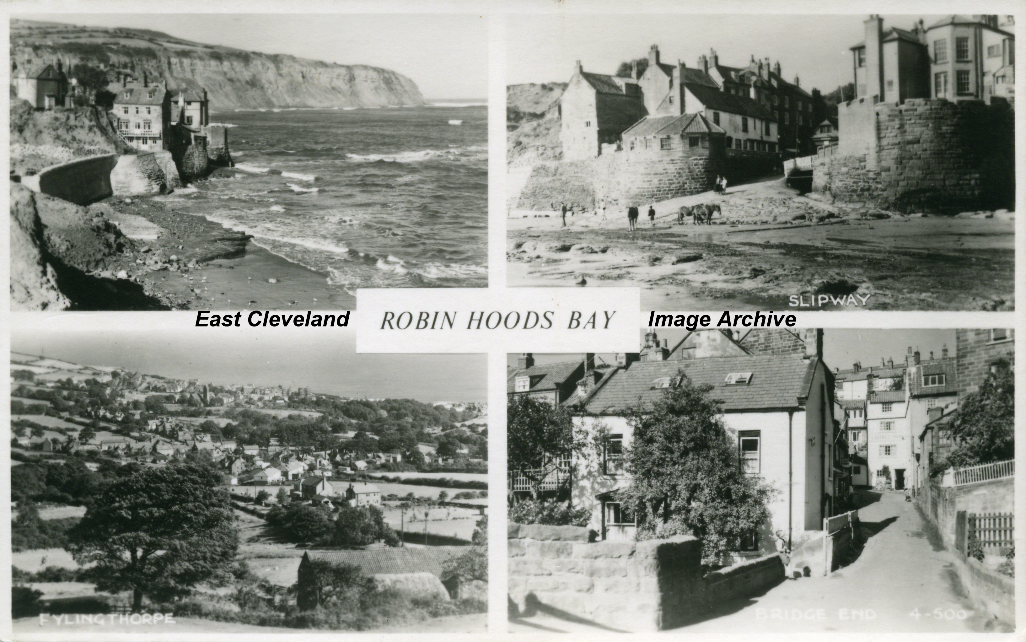
A “posh” post card with four separate views of Robin Hoods Bay with a central section bearing the coat of arms. Delightful coloured views of “Bay Town”.
Image courtesy of Joyce Dobson and Keith Bowers.
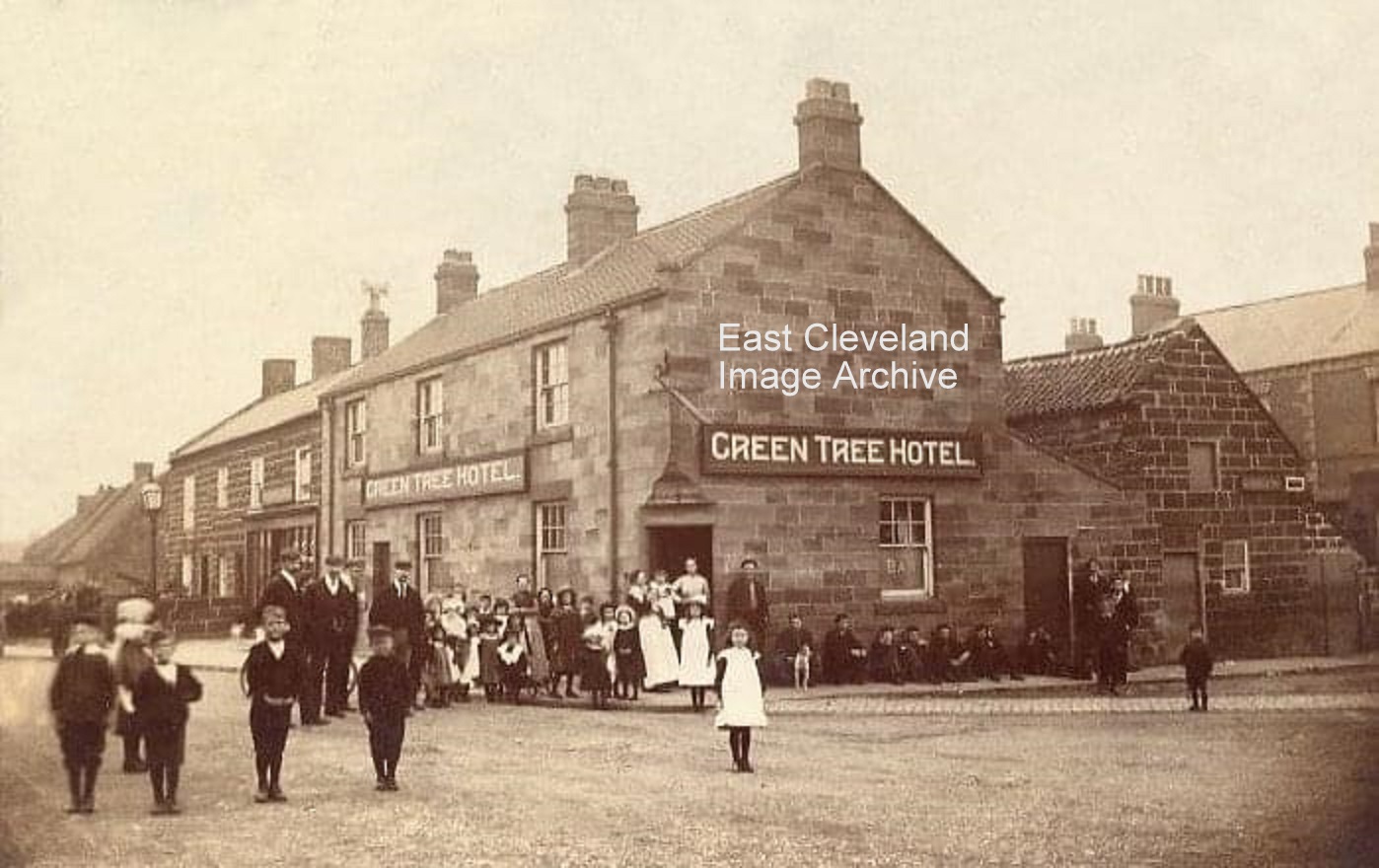
Quite a throng gathered outside the Green Tree! Half the school must have emptied as the word got around that a photographer was coming! Dating this image is simplified as the Archive is aware that the hotel had alterations between 1901 and 1906. Also interesting is the shop beyond the hotel, this building is now a private house and no sign of the large double fronted shop remain.
Image courtesy of John G. Hannah, thanks also to Nivard Ovington for his assistance in dating the alterations to the Green Tree.
This delightful multi postcard of Robin Hoods Bay shows a much quieter village than we can see today.
Image courtesy of Joyce Dobson and Keith Bowers.
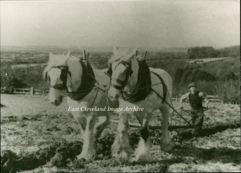
The Archive believed this to be possibly in the Esk Valley, but welcomed further details. Did you know the ploughman? William Castle has told us: ”In Gordon Clitheroe’s book ‘Ryedale’ he has this picture as Edgar Dowson ploughing near Hutton-le -Hole, probably just before the II World War. The Beck Isle Museum in Pickering (where Mr Clitheroe is Curator) also has this picture, possibly the original. Colin Grice has a further update: ”It is very likely just east of the road between Hutton-le-Hole and Keldholme – looking towards Kirkbymoorside (hidden). The Dowsons lived at Halfway House just up the road.”
Image courtesy of Joyce Dobson and Keith Bowers, thanks also to William Castle and Colin Grice for the updates.
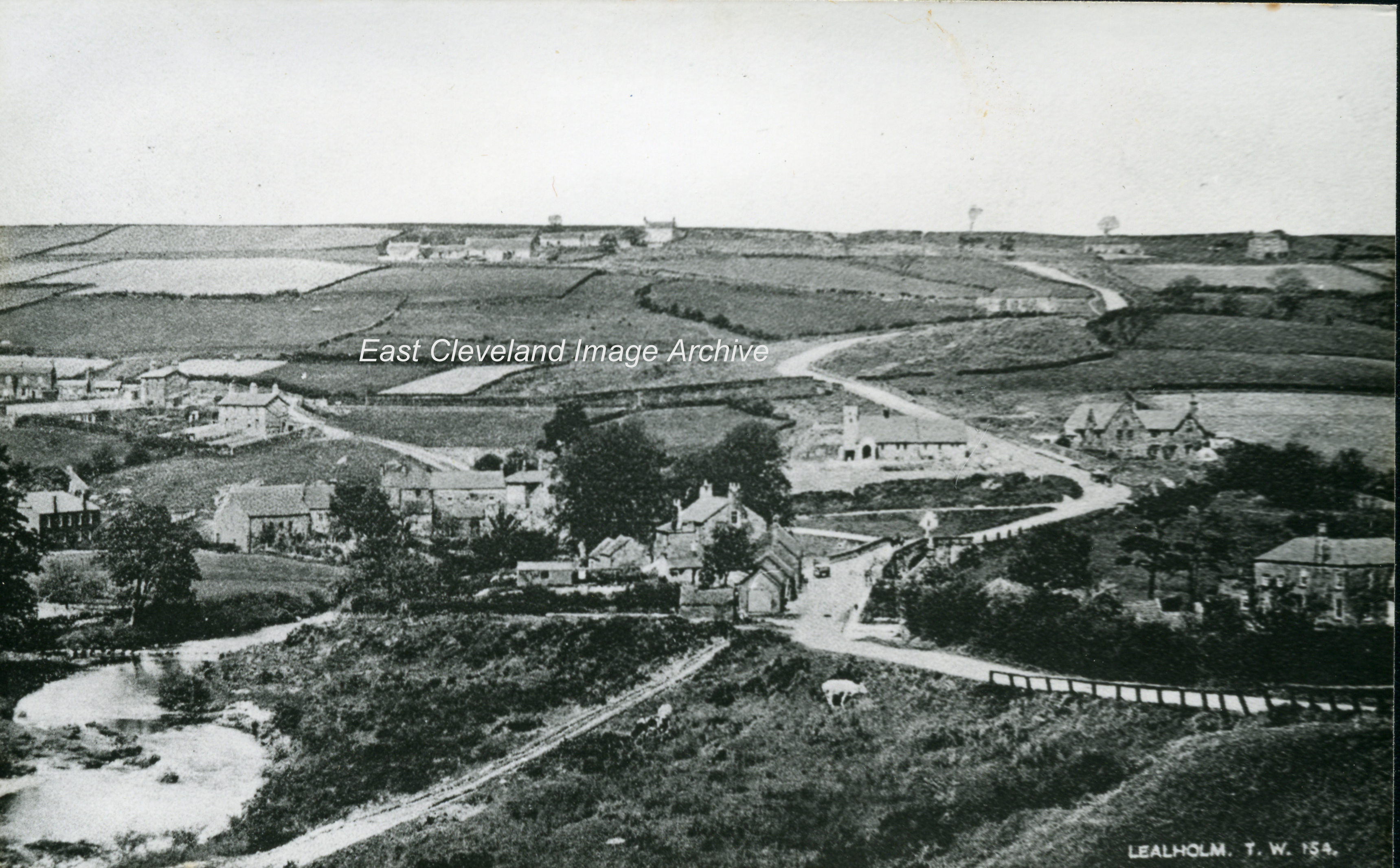
This view of Lealholm is from a Tom Watson of Lythe Postcard.
Image courtesy of Joyce Dobson and Keith Bowers.
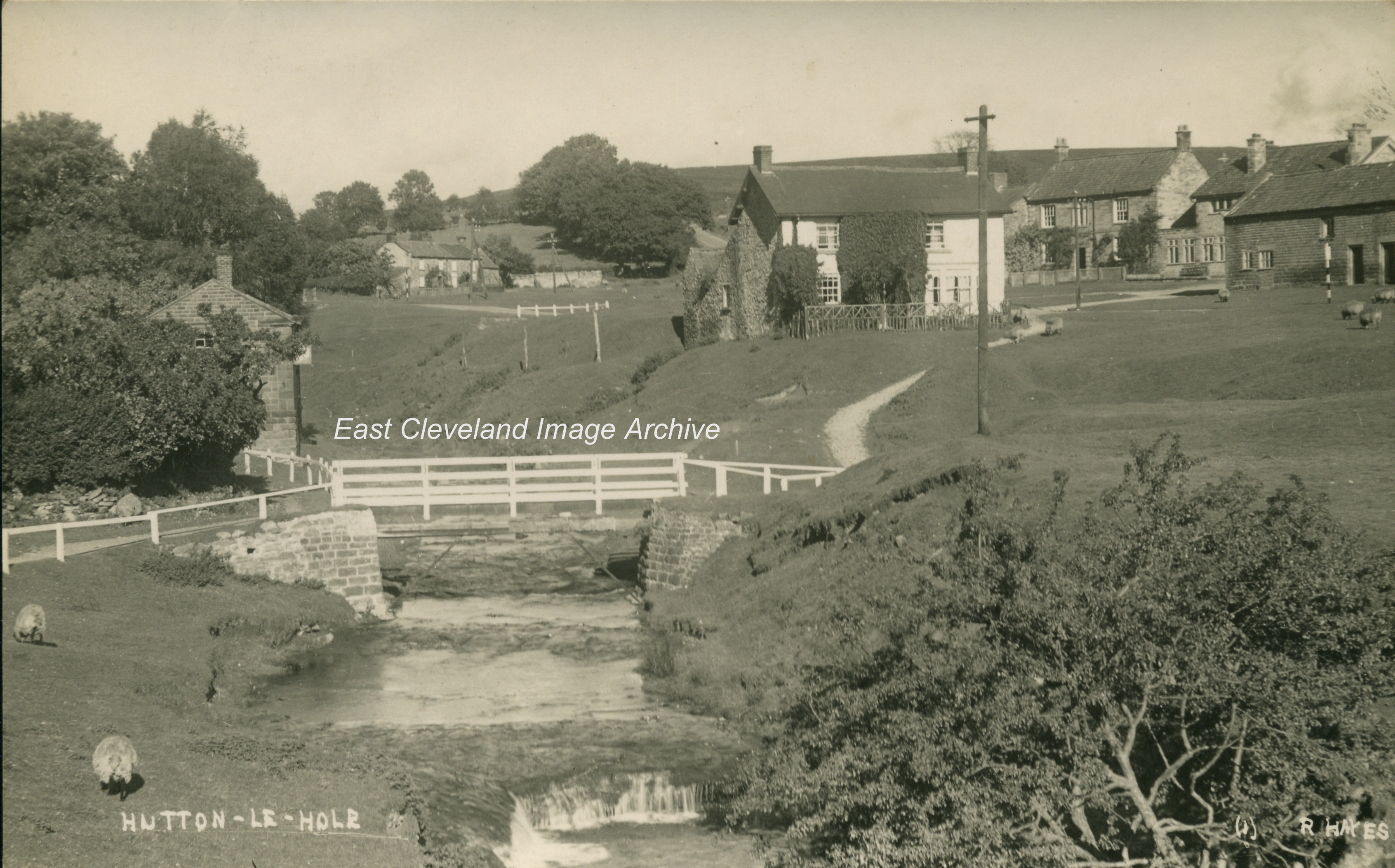
The familiar bridge over the stream which wends its way through this picturesque village. How many others have taken a snap of this bridge?
Image courtesy of Joyce Dobson and Keith Bowers.
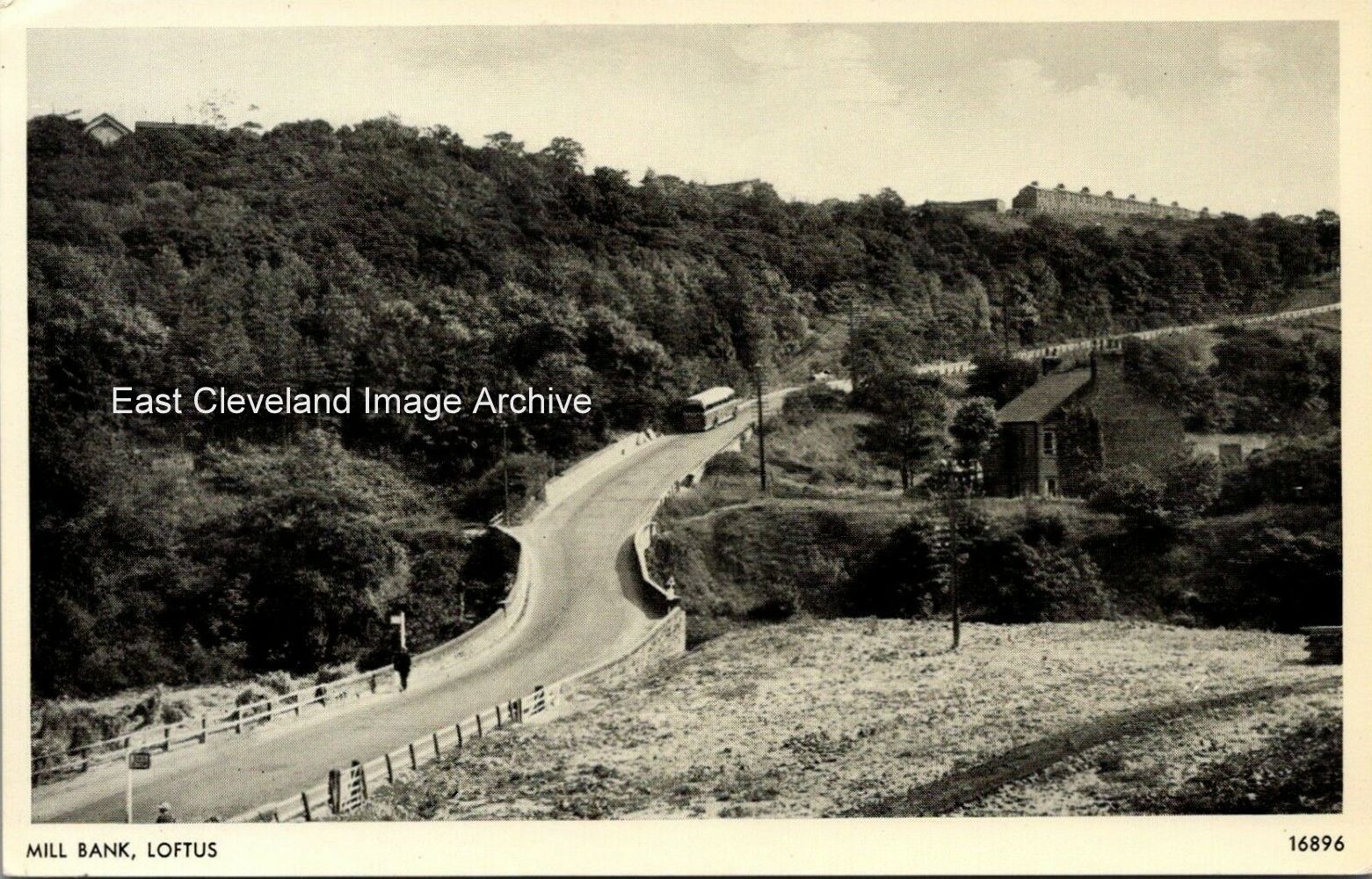
Another sunny day on Loftus Mill Bank. this view from a Salmon Series postcard shows a 1950s United bus on its way towards Loftus. Interesting you can still make out the bridge under the road which carried ironstone, etc., from the Whitecliff mine (to the right in this photograph) down to Skinningrove mine.
Image courtesy of John G. Hannah.
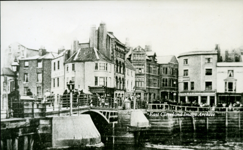
The old swing bridge at Whitby, prior to 1909. With the buildings on the left of the bridge known as ”Boots corner”; were demolished in a road widening scheme in 1975.
Image courtesy of Joyce Dobson and Keith Bowers.
|
|
Recent Comments