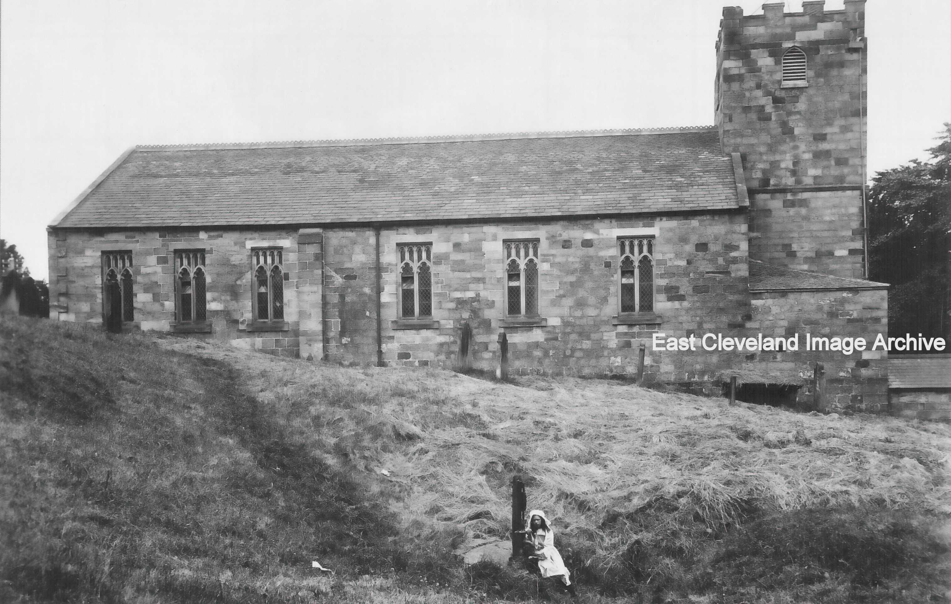
The church of St Hilda, Hinderwell. Largely rebuilt in the late 18th and
early 19th century. The young girl sits at St Hild’s Well; the primary source of fresh water in the village for many years.
Image (from a postcard) courtesy Maurice Grayson.
|
|
||
|
The church of St Hilda, Hinderwell. Largely rebuilt in the late 18th and 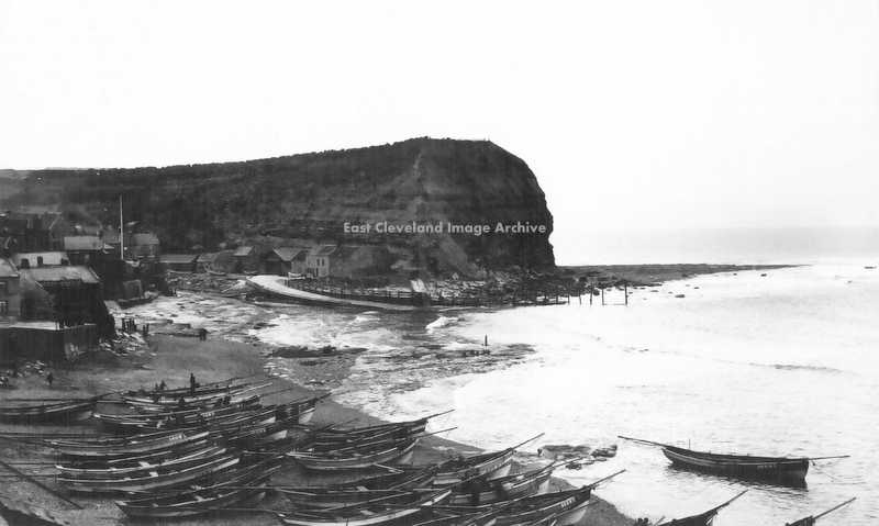 Staithes beach, with part of the once numerous fishing fleet of cobles. Hilary Rodwell comments: “We used to go to Staithes every year because my grandparents used to live there. I remember going out in Uncle Nelse’s coble. It was great fun and we looked forward to it every year. I too remember the loss of the Cod and Lobster. John Stott is my cousin.” Image courtesy of Maurice Grayson, thanks to Hilary Rodwell for the update. 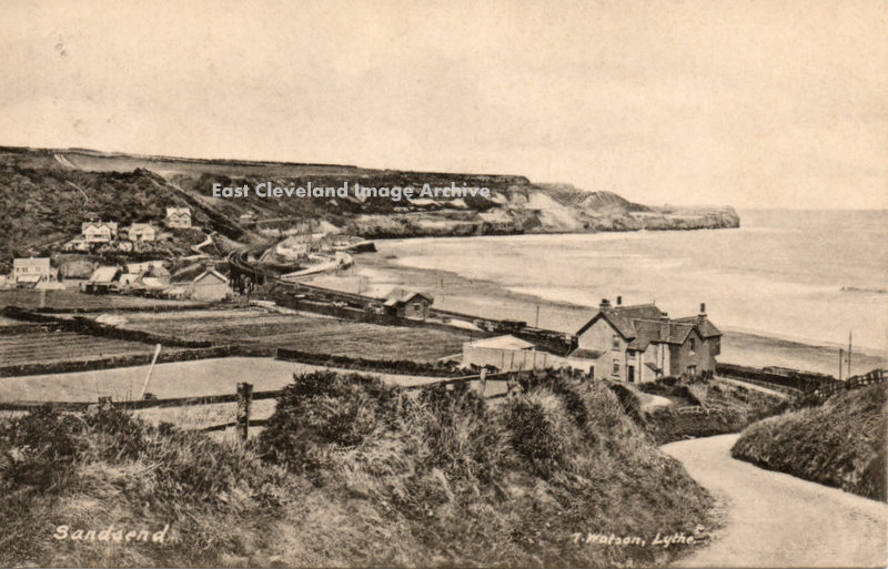 This is a view of East Row and Sandsend from the old road to Whitby; from a Tom Watson postcard. The new coast road constructed through boulder clay, is very prone to landslips. Even in more recent times the landward side has had to be “re-sculpted”. Image courtesy of Ken Johnson. 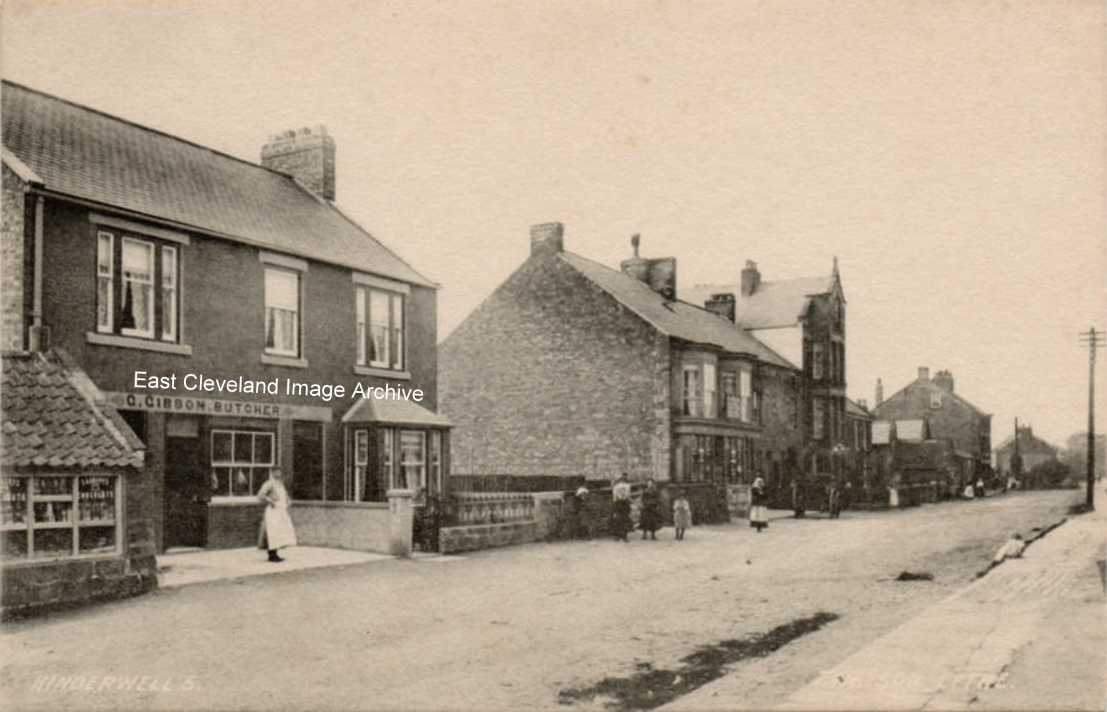 A Tom Watson of Lythe postcard view of of Hinderwell High Street; with Gibbon’s Butchers prominent, presumably Mr Gibbon is standing proudly in front of the shop? Tom Watson was a contemporary of F.M. Sutcliffe of Whitby; they both took many fine views of Whitby and district. 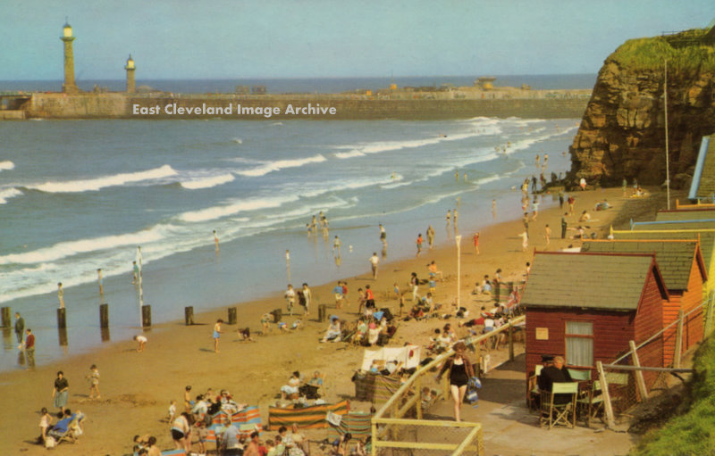 Not a cloud in the sky, a hot sunny day on the beach at Whitby, sometime in the 1960s. A summer scene, of which the older viewers have happy memories; even if they were not as ‘sunny’ as our memories tell us! Postcard courtesy Ken Johnson. 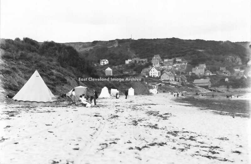 Runswick Bay Beach, in Edwardian times. With a variety of tents for ladies to change their beach wear in modesty. The larger seaside resorts had wheeled bathing huts which entered the sea, probably the difficulties of accessing the beach at Runswick led to this innovative method of ensuring the ladies privacy. Image courtesy of Maurice Grayson. 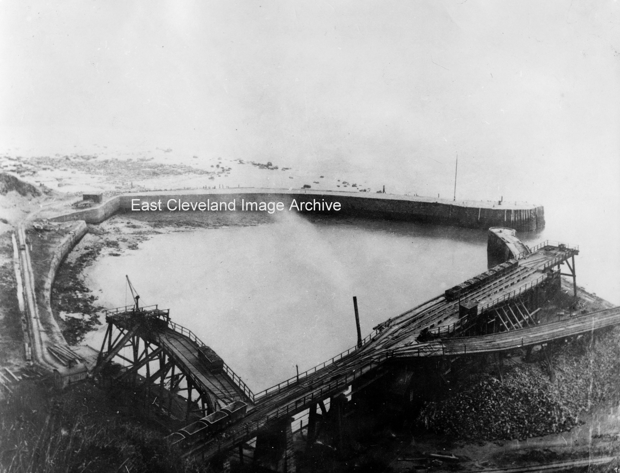 A lovely photograph of Port Mulgrave’s docks; when it actually was a port, built around 1856-57, it was a very busy place serving the surrounding mines. This shows the harbour prior to World War II, the disintegrating remains of Palmers ironstone loading staithes clearly visible; the seaward pier was blown up during the war. 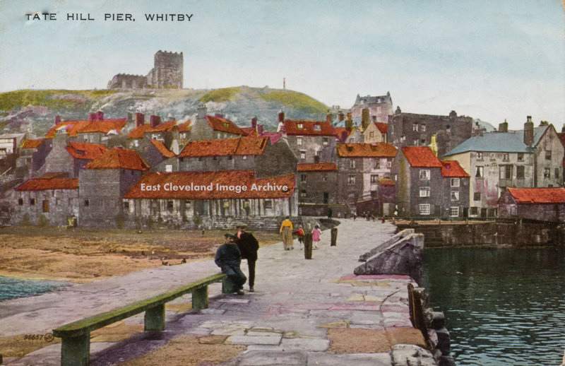 1926 is the date we have for this coloured postcard of Tate Hill Pier, the Lifeboat Station now occupies the right hand landward end of the pier, with the Duke of York Inn behind. At the top left is Henrietta Postcard courtesy Ken Johnson, thanks to David Richardson for the update. 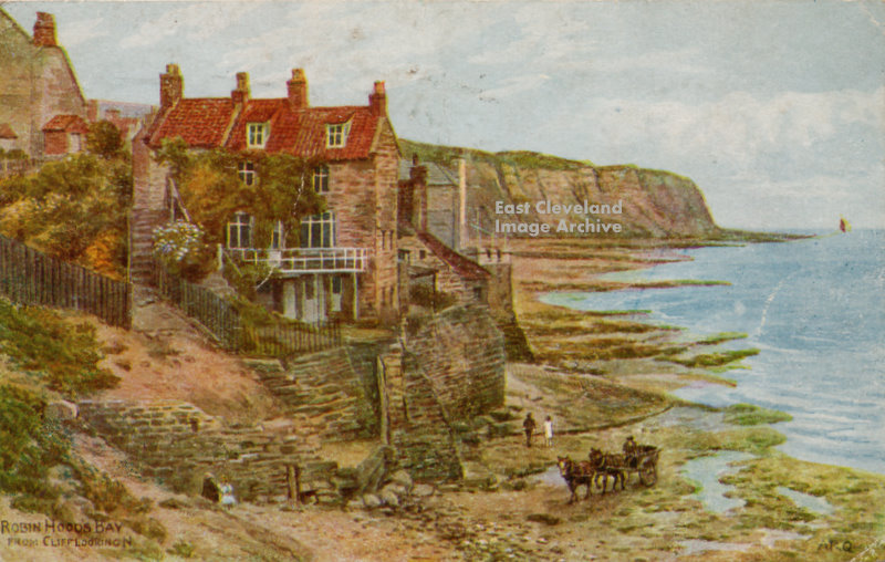 Robin Hoods Bay, Looking towards the landing slipway. Coloured postcard or painting, hard to say? The horses and cart suggest an early date, Possibly collecting kelp, as no fishing cobles are evident; date of card posting is 1947. Image courtesy Ken Johnson. 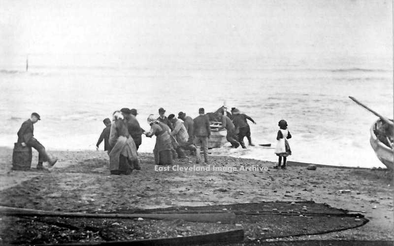 On the open beaches of the Yorkshire Coast, it was all members of the village to help with hauling the cobbles up the beach, when returning from fishing. Apart from the idle youth sitting down kicking at the sand and the girl who is too young. Location now confirmed as Staithes, the ladies bonnets suggest this. David Richardson confirms with: ”An early 1900′s image of Staithes beach, the old timber sticking out of the sea on the left of the image is very distinct in other photos of the time as is the cobble just off to the right.” Image courtesy Maurice Grayson and thanks to David Richardson for that confirmation of location. |
||
Recent Comments