A Yorkshire Post image of the River Esk in flood at Sleights. On 23rd July 1930 severe flooding affected Sleights following a cloud burst. Many villagers were marooned in their homes, surrounded by water as our postcard picture shows. These floods, the worst since the 1800’s affected the whole of the Esk valley. Obviously the Yorkshire Post had a photographer available at the right moment. Pity this poor householder!
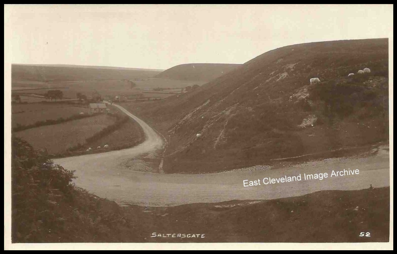
Although postmarked from 1952, it is likely this postcard view of Saltersgate and across what is known as Fylingdales moor is possibly pre 1940; not a lot to see apart from sheep! Graham Denison tells us: “You can see the Saltersgate Pub, bottom of the bank on the left. Legend says ‘The fire is never to be allowed to go out or the excise man who is supposedly buried underneath it will start haunting the neighbourhood’. Pub closed and boarded up, guess the fire’s out too!”. By 2019 even the pub has gone now!!
Image courtesy of John G. Hannah and thanks to Graham Denison for the update.
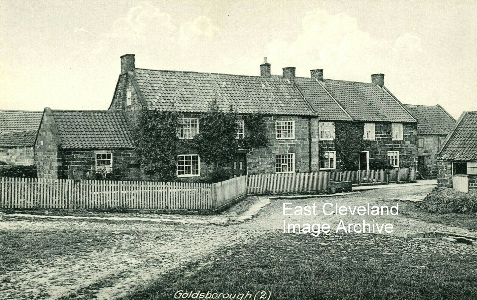
Goldsborough as a village is unknown to many; unless you are ‘brave’ enough to venture off the main coast road to Whitby (at what is known as Barnby crossroads). This view from a Tom Watson postcard dates from the ealry 1900s or possibly earlier. Beyond Goldsborough, heading towards the sea is the isolated hamlet of Kettleness. I said ‘brave enough’ as the road has interesting corners, narrow sections where meeting a farm vehicle and possibly trailer or speeding local/Post Office vehicle can cause a slight panic to unwary drivers. The final view is well worth the challenge. This view has not changed alot today, the road is now metalled but the farms seem as quiet. It even has a suitable ‘drink’ station, which has been noted for its culinary refreshments!
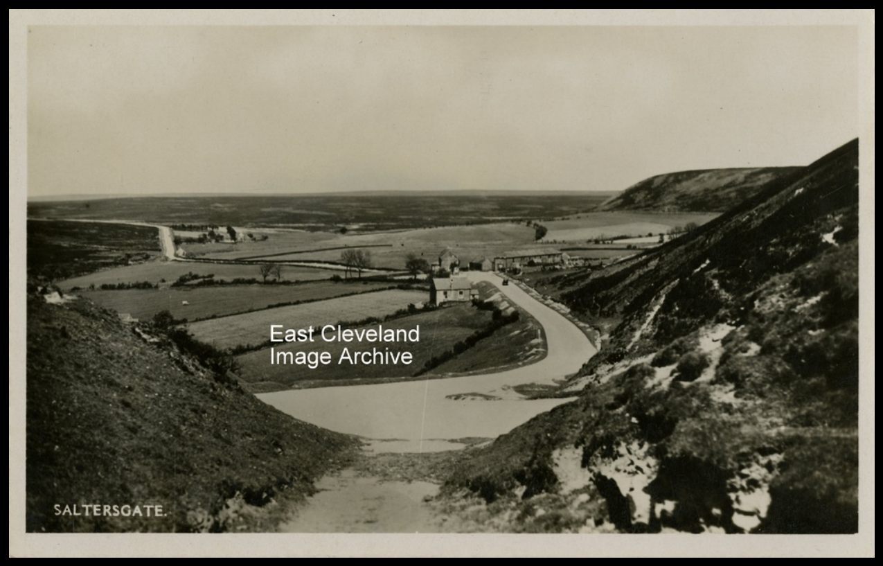
A view of Saltersgate looking north, in the days before the Fylingdales ‘golf balls’ or the more modern ‘pyramid’. The horse and cart approaching the notoriously steep hill would have been disturbed in modern times by the low-flying aircraft or the speed of modern day traffic. Image courtesy of John G. Hannah.
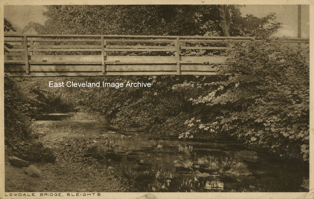
This final postcard, also produced by J. W. Tate is dated 1925 and posted to a lady in Barnsley. The bridge presumably featured in the families walks. Noel Barrett advises: ”I suspect that this is the original footbridge at the bottom of Lowdale Lane which crosses over the Iburndale/Littlebeck to the Cricket Field. There is now a concrete 1950’s footbridge in roughly the same position.”
Image courtesy of John G. Hannah and many thanks to Noel Barrett for the update.
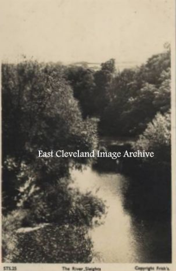
This Frith’s postcard view, apart from the title could be anywhere! A view of a river between trees is replicated in all parts of the country. Was this an example of how to extract money from tourist? Perhaps in memory of a happy visit to Sleights, who knows?
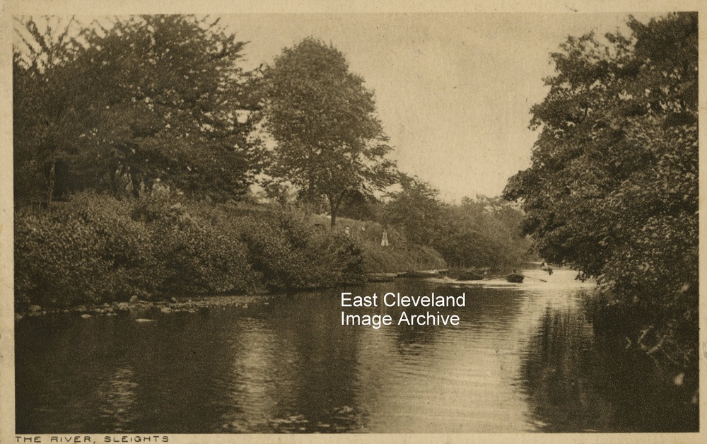
This postcard view (produced by J. W. Tate, Grocer, Sleights) has been written, but un-posted; dating based upon the final ’used’ card in this series, giving a date of 1925. Noel Barrett tells us: ”This is almost certainly a photograph of the boat landing at the River Gardens Tea Rooms and Garden Centre at Briggswath, near Sleights. The photograph looks downstream towards Ruswarp.”
Image courtesy of John G. Hannah and many thanks to Noel Barrett for the update.
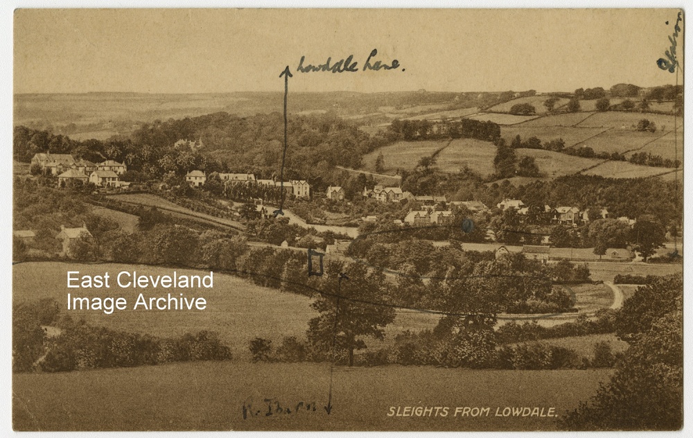
An unused (and unidentified) postcard view of Sleights from above Lowdale. The hand written annotations appear to correspond to the following two images of the Sleights area. Noel Barrett tells us: ”This photograph is taken from Battle Banks which lies just above Lowdale Hall, Sleights; in the middle ground is what is now Sleights Sports Field which became a sports field in the 1930’s. In the foreground to the right is Lowdale Farm and barn.” Malcolm Jones asks: “I would like to know the history behind the name Battle Banks at Sleights.” Whilst Chris Warman says: “Was battle bank some sort of settlement. Can’t find out much about it!”
Image courtesy of John G. Hannah and many thanks to Noel Barrett for identifying the viewpoint, also to Malcolm Jones and Chris Warman for the comments.

Recent Comments