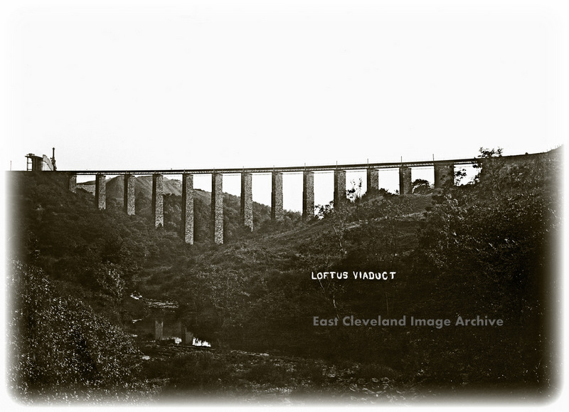
This view of Loftus or Kilton Viaduct was taken before 1913 and the filling in of the structure with shale from the mine. At the left of the viaduct the calcining kilns at the Liverton Mine can be seen, whilst in the very foreground the weir providing water to power Kilton Mill further down stream is also visible.
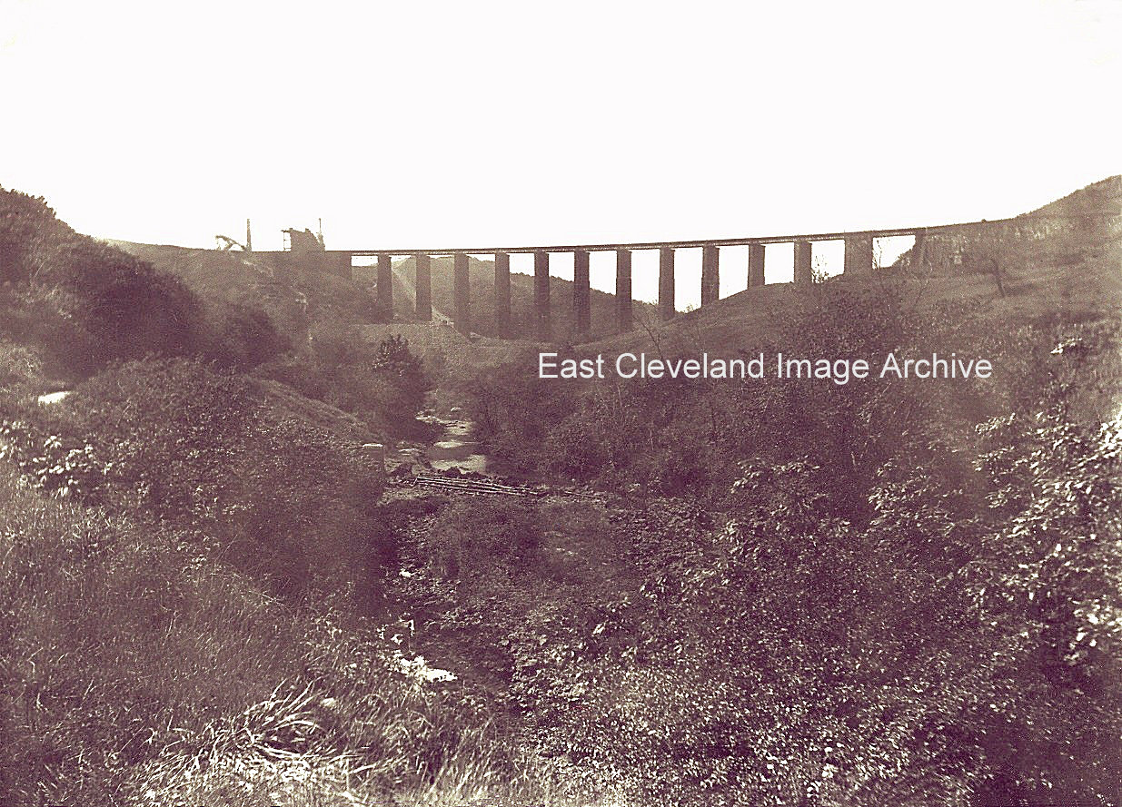
Looking towards the Kilton viaduct, from Mill Bank side. Interestingly in the middle of the image can be seen the ‘weir’ or ‘dam’ for the head race of Kilton Mill which is still situated on the other side of the road embankment further down stream from this point. The head race tunnel under the road was retained when the road was realigned in 1958; ensuring a supply of water to turn the mill wheel at Kilton Mill.
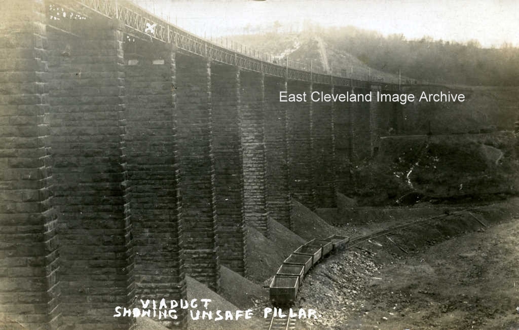
X marks the spot not of treasure, but of the unsafe pillar of the Loftus to Carlin How viaduct that caused it to be filled in with spoil from the mines. The condition of the pillar lead to the creation of the culvert to house the Kilton Beck and the infilling of the viaduct with iron stone mining waste to create the embankment we still see today. This image dates from 1911 and is from a T.C. Booth postcard. Simon Chapman tells us: ”Kilton Viaduct was infilled from 1907 to 1914 primarily so that ironstone could be worked from beneath it, particularly from the Carlin How mine. The picture was taken in 1911 when one pier cracked and train services were suspended for a fortnight in January 1911 while remedial action was taken.” During that fortnight “rail passengers were carried between Loftus and Skinningrove in Motor char-a bancs.” On consulting the postcard the sender comments ”The viaduct has been repaired and is now open for traffic.” Obviously this is an image from prior to the remedial action which Simon reports.
Image courtesy of John G. Hannah and thank to Simon Chapman and Derick Pearson for the updates.
An excerpt from a local paper describing the construction in 1913 of the culvert over Kilton beck prior to the conversion of Kilton Viaduct (also called Loftus Viaduct or Carlin How Viaduct – it depended where you lived!) to the embankment due to undermining of the central support structure by Loftus mine.
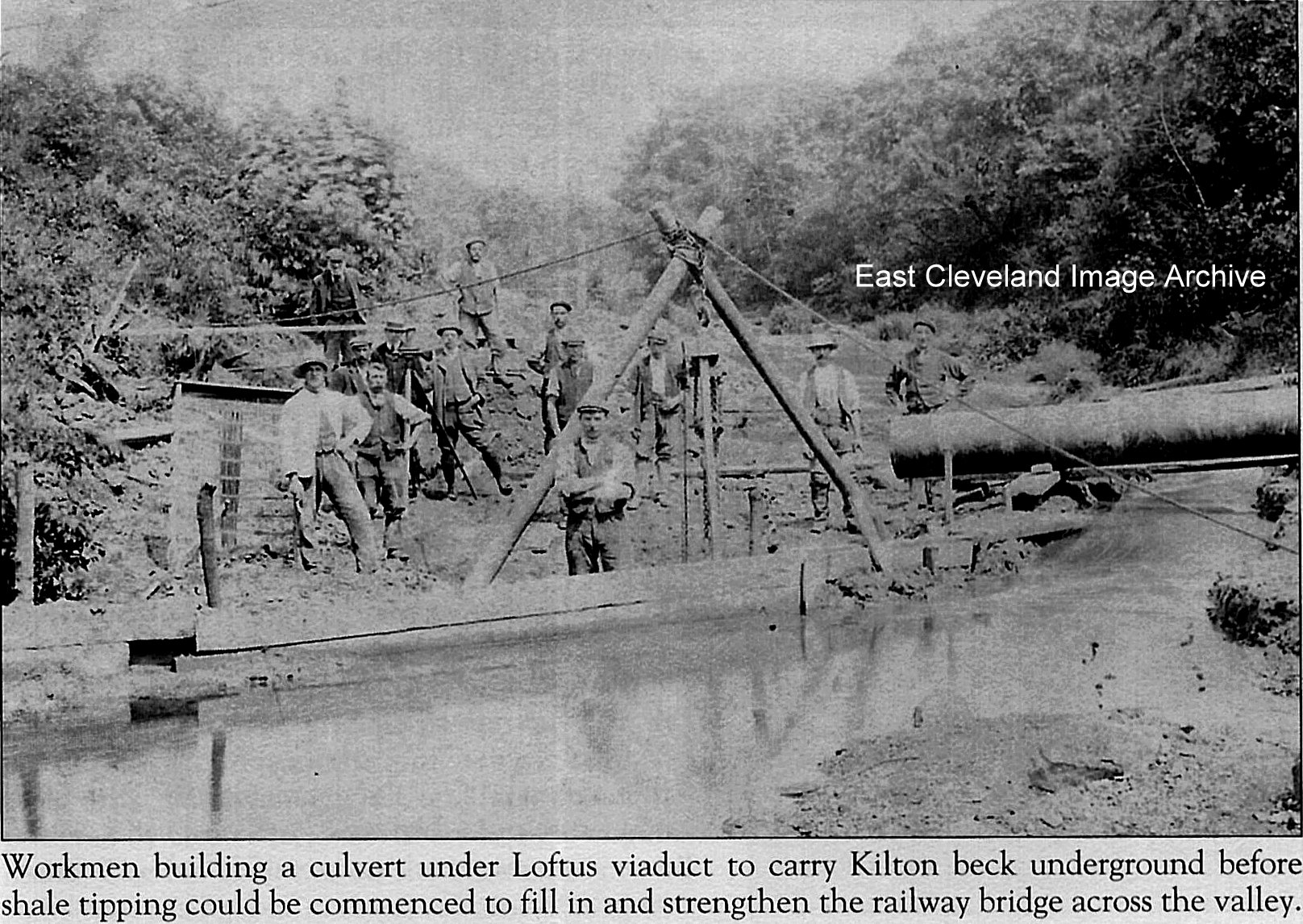
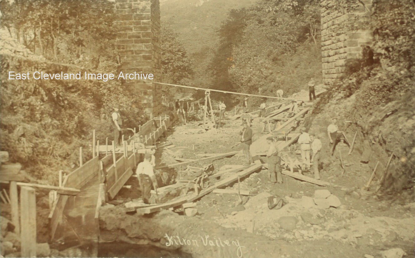
Around about 1911, part of Kilton Viaduct began to suffer from subsidence due to it being undermined by ironstone mining. It was decided to bury the viaduct in shale from the shale tips of the local ironstone mines. Creating an embankment and ensure future stability. Before they could do this it was necessary to culvert Kilton Beck. This image, taken from a postcard shows part of the culverting process; with wooden shuttering in place to make the culvert. Also visible is an aerial rope-way for carrying raw materials to the site.
Image courtesy of The Pem Holliday Collection, John G. Hannah (also on cd produced by Derick Pearson).
That is what the caption on the photograph says. The Archive asked: “What is happening there? David Richardson suggested: “I’d say this photo shows the works associated with the construction of the Kilton Beck Culvert before the Viaduct was filled in during 1913.” Eric Johnson assists with: “I believe this is the raw materials site; for constructing the culvert under Kilton Viaduct, prior to filling in with shale. The wide chute on the photograph has a large pile of material at the base, the top of the chute is widened to facilitate tipping of wagons, possibly from the zig zag line to Skinningrove. The smaller chute maybe for sending down wooden battens, to the work area; where there is a vertical steam boiler. Possibly to supply steam to a hauler engine for the narrow gauge railway running from the material pile on the left of the photograph. This is on a hopper wagon, some hoppers are alongside the rails, upside down. Stacks of wooden planks can be seen on the hillside near the cabins, with several saw benches for making the shuttering for the culvert arch.” Derick Pearson also offered: “The narrow chute reminds me of the type used to walk down to a work site when on a batter side, there is a man stood in it at the bottom. It could also have been a water chute to feed the boiler and of course be used for the concrete mixes.” This sums up the image satisfactorily.
Image courtesy of the Pem Holliday Collection, also thanks to David Richardson, Eric Johnson and Derick Pearson for resolving query as to when and why.
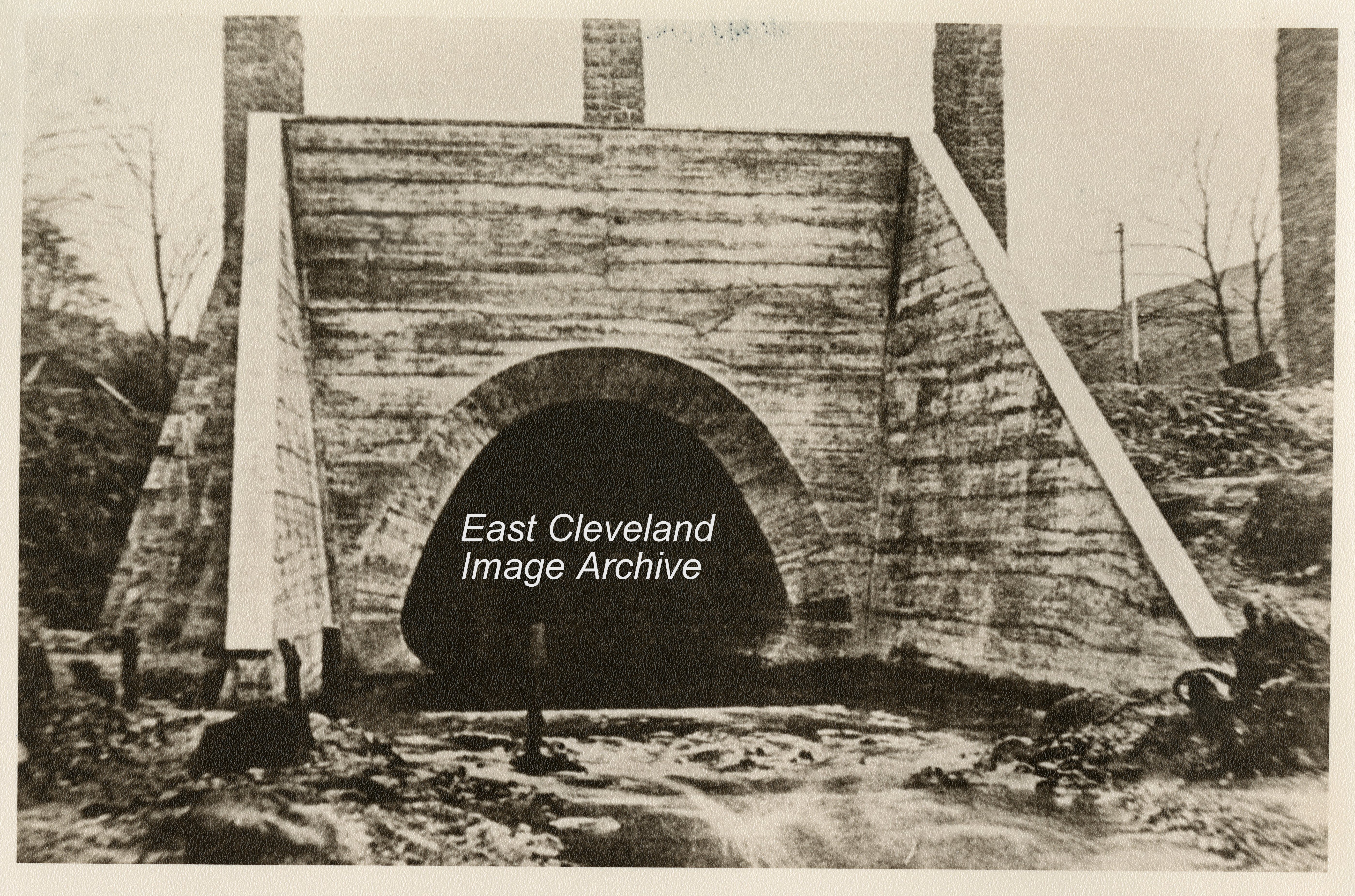
A photograph I have never seen before; visible are the arch legs of the Loftus to Carlin How viaduct in the background; and the culvert looks finished. This all prior to the infilling which took place 1907 to 1914.
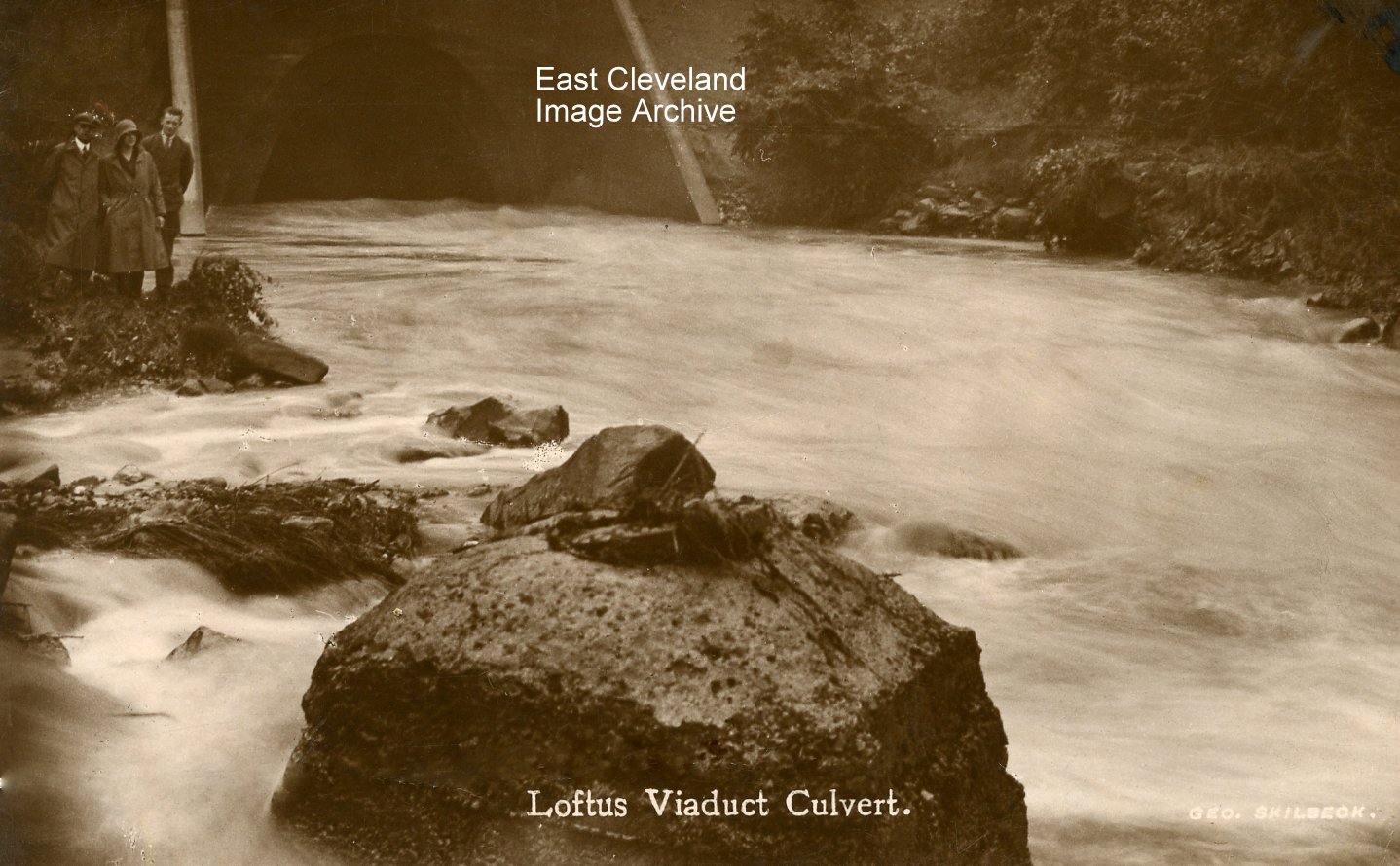
A peaceful image of the water as it flows under the viaduct and on to the sea at Skinningrove.Norman Patton commented: “In my lifetime, I cannot remember floods at Skinningrove in the days when the beck had this much water flowing. ie. prior to the construction of Scaling dam. Have I got this wrong?” Derick Pearson advised: “This photograph here however has the same three persons on it as another photograph (next image on the Archive), which was taken the same day about an hour later”. Despite the comments to the image, the Archive is aware that the beck at Skinningrove is not affected by any possible outflow from Scaling Dam, as this emerges at Staithes; the overflow from Lockwood Beck flows via Kilton Beck. The image is taken from a George Skilbeck postcard and dates from the 1940’s.
Many thanks to Kathleen Hicks for the Lockwood Beck information, also thanks to Derick Pearson and Norman Patton for their memories of the beck flooding.
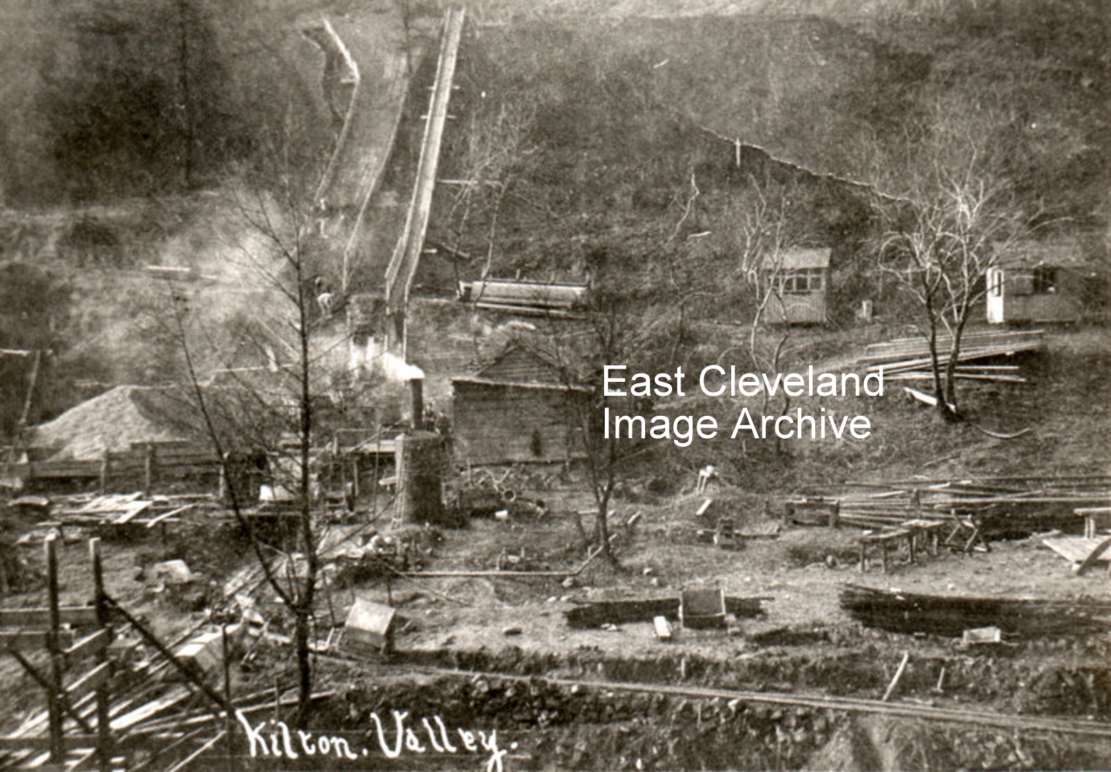
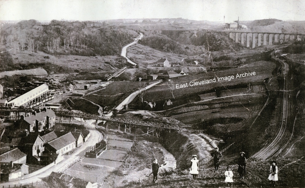
A panorama of Skinningrove valley. The mine is on the left, with Overmen’s cottages next to the trestle bridge which crosses the beck to the drift into the bottom of Loftus North mine, the shaft used to hoist ironstone to the works. On the left the white enclosure of the newly built picking belt (1907), for cleaning the ironstone can be seen. Towards Mill bank, the mine rail sidings cross the beck this was originally extended to the old Whitecliffe mine. Kilton Viaduct is yet to be filled in, with Liverton mine above it. and the rail zig zag skirts the right hand side down the valley.
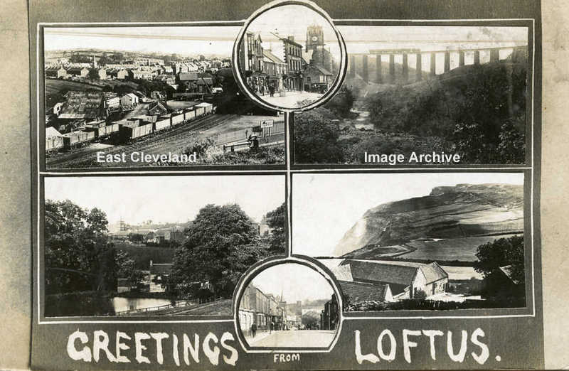
This T. C. Booth postcard presents a collection of views around Loftus; the railway station yard, the market place, Kilton viaduct, Hummersea farm, West Road and Loftus mill from the early 1900s.
Recent Comments