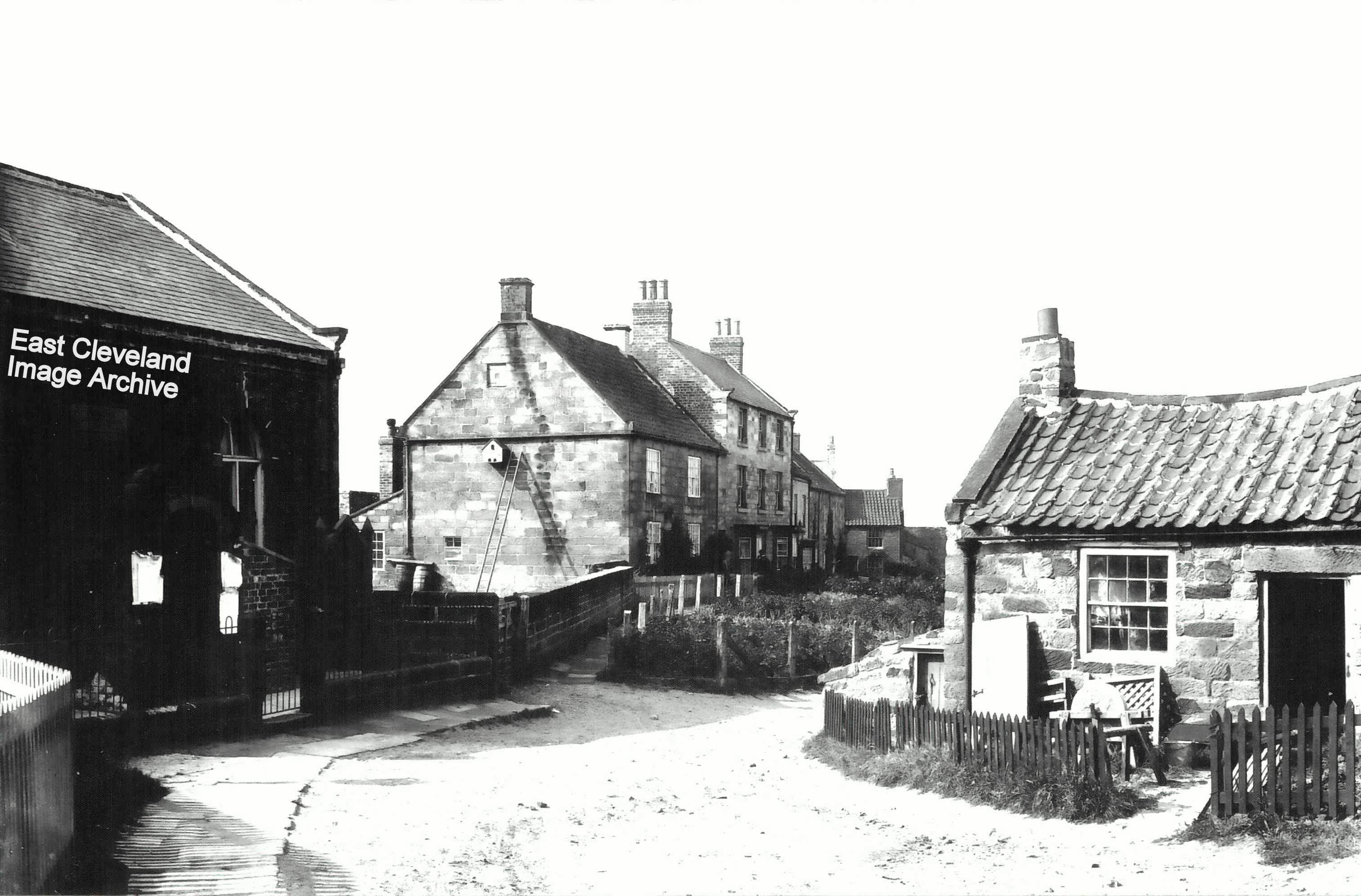
A quiet corner of Hinderwell, Porret Lane; the Primitive Methodist Chapel on the left, opened in 1858. The house in the centre of the image has a ladder leading to a nesting box on the wall, whilst the cottage on the right has a grinding wheel in the garden. Image courtesy Maurice Grayson.
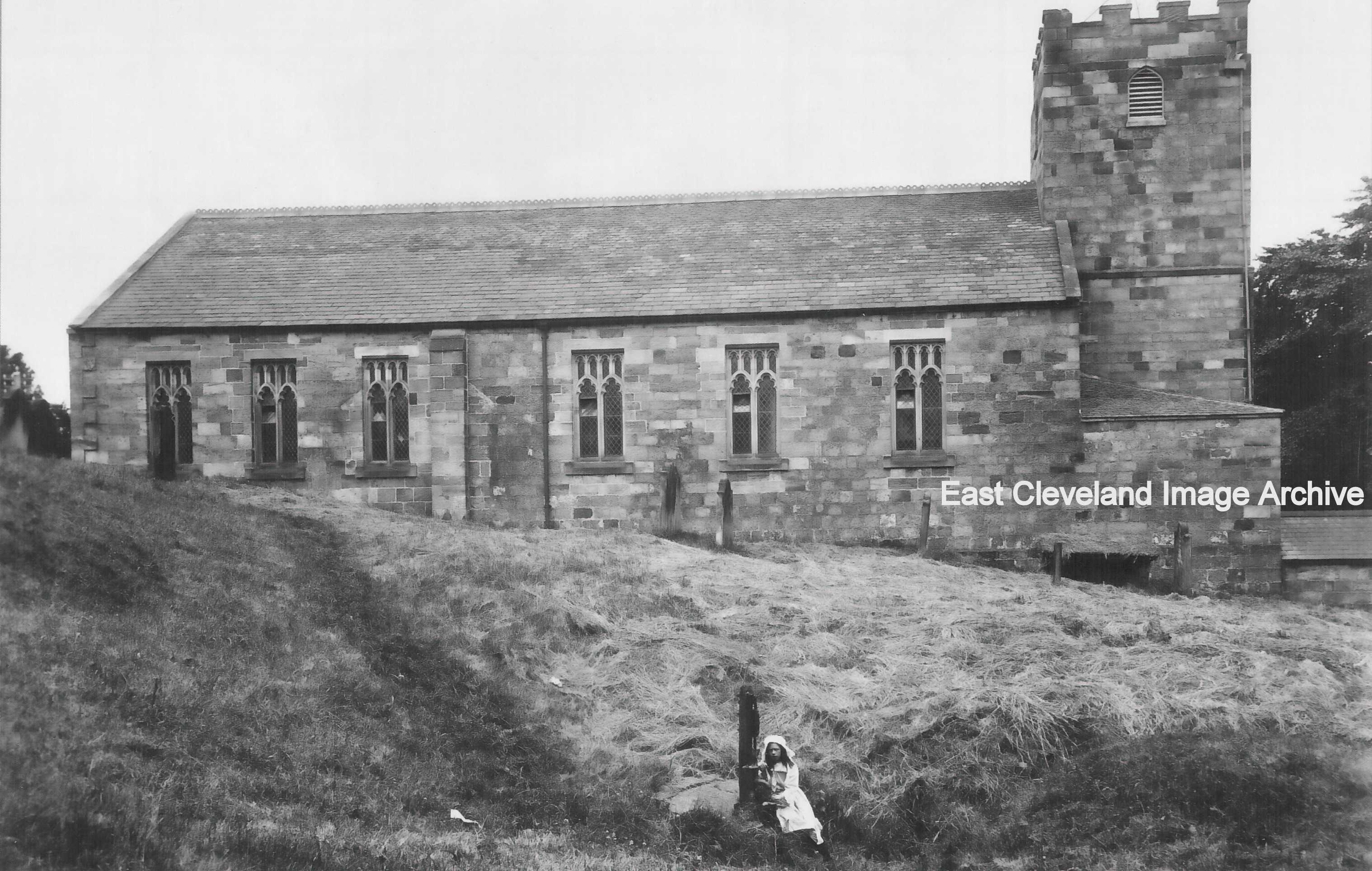
The church of St Hilda, Hinderwell. Largely rebuilt in the late 18th and early 19th century. The young girl sits at St Hild’s Well; the primary source of fresh water in the village for many years. Image (from a postcard) courtesy Maurice Grayson.
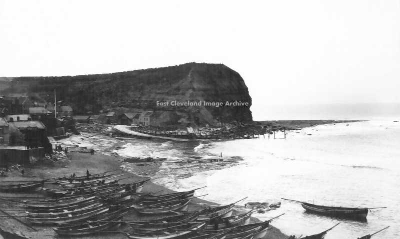
Staithes beach, with part of the once numerous fishing fleet of cobles. Hilary Rodwell comments: “We used to go to Staithes every year because my grandparents used to live there. I remember going out in Uncle Nelse’s coble. It was great fun and we looked forward to it every year. I too remember the loss of the Cod and Lobster. John Stott is my cousin.”
Image courtesy of Maurice Grayson, thanks to Hilary Rodwell for the update.
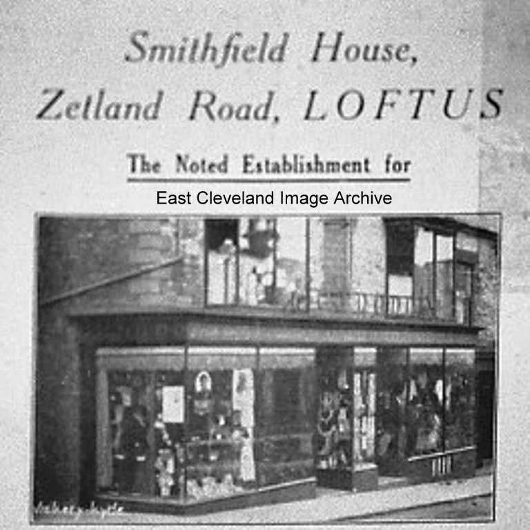
An early view of the end of Zetland Road, from an advertising poster, more recently known as ‘Tony Gallagher’s hairdressing salon’. Eric Johnson has advised: “Smithfield House became C. J. Dodds after moving from market place. Name was on cast iron sign above doorway.” We are unsure of date as yet, perhaps somebody out there can advise. Keith Bowers has assisted with: “Smithfield House were running a Summer Sale campaign in the Whitby Gazette July 1917.“
Image courtesy of Geoff Patton, thanks to Eric Johnson, Keith Bowers and Neil Graham for the updates.
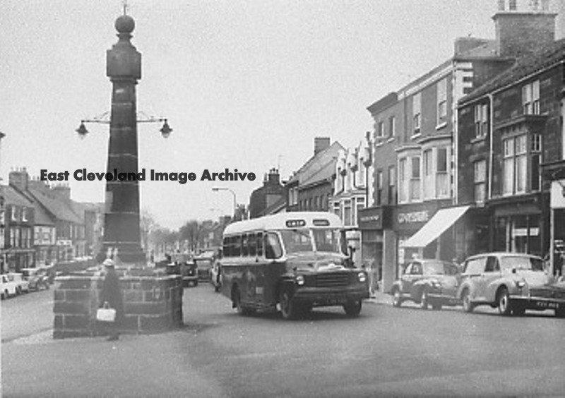
Guisborough Market Cross, long before the present traffic and pedestrian lights. No wide pavement and possibly about 1950. Having said we were unsure of a date, Rod Scase tells us: ”About 1960 by looking at the cars.”
Image courtesy of Geoff Patton and thanks to Rod Scase for the update.
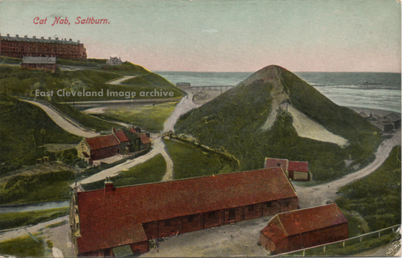
A tinted postcard of Cat Nab Saltburn, the farm and buildings prominent in the foreground, and in the distance, The Spa, and ”Teddy’s Nook,” Where King Edward the seventh was supposed to have stayed. The Pier appears to be at its full length on this card posted in1909. We are advised by Callum Duff: ”Regarding Teddy’s Nook (aka ‘The Cottage)’, Saltburn. I’m afraid that the stories relating to this building are mainly untrue. The name ‘Teddy’s Nook’ actually refers to a previous resident who collected teddy bears. When she wrote to her friends she would sign off as ‘Teddy’s Nook’ meaning the place populated by toy bears. Similarly the story about Teddy’s Nook which relates to two sisters owning a pet lion and exercising it on the beach is also steeped in legend. Most likely the ‘lion’ was a breed of dog previously unseen in this country. There are no photographs (press or otherwise) of wayward lions or royalty and in a town which grew simultaneously with the development of photography, there would be. These are just two of Saltburn’s ‘Tall Tales’ that have been embellished over the years despite there being no concrete proof of either. Unfortunately my attempts as a local historian to redress the balance will always be outweighed by the majority who prefer to believe the myth. I can’t see either story disappearing anytime soon!” He also advises: ”Just an amendment to your information, the pier seen here is the shortened version of 1250 feet. The original pier was 1500 feet long but had a short lifespan lasting from its opening in 1869 to the demise of the pierhead and landing stage in a storm in 1875.” Katharine Broome adds: “There is another story about Teddy’s Nook told by my mother – a German spy lived there during World War I. He was said to send morse code messages to German ships off-shore. My mother lived in one of the early houses in Exeter Street. At that time, there were fields behind the house. By co-incidence, we stayed in the same house, for a short time in World War II after our own in Victoria Road was destroyed by a bomb in 1942.”
Image courtesy of Ken Johnson and thanks to Callum Duff and Katharine Broome for the updates.
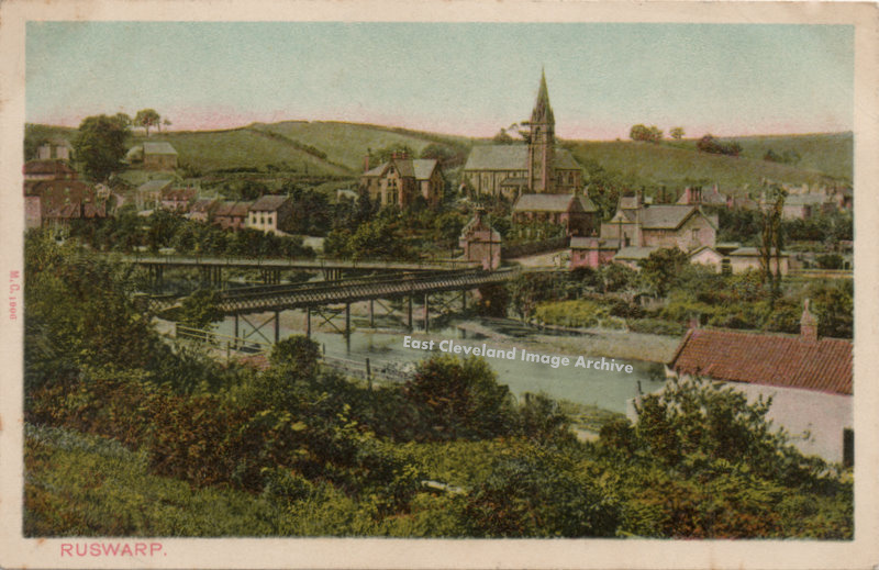
Another tinted view of Ruswarp and the bridges across the River Esk. with the former Ruswarp mill to the left of the image. The postcard appears to have been produced before the mill burned down in 1911.
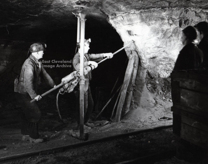
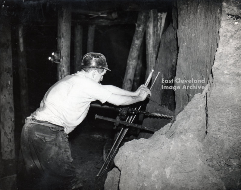
Giving a good view of a miner using a hand ratchet drill, drilling holes ready for the charges by the shotfirer. David Richardson tells us: ”An excellent photograph of a miner in the process of drilling a hole using a Blackett Hutton Hand Rotary Drill and while Hardy Pick Ratchet Drills were used they are operated much differently to the Blackett Huttons.”
Image courtesy of George Pearson and thanks to David Richardson for that update.
Recent Comments